- ~ Home
- Camino Finisterre
- Day Two, Negreira to Olveiroa
Jump to Camino Finisterre and Muxía Stages
Day Two on the Camino Finisterre
~ Negreira to Olveiroa, 33.6 Kilometers (20.88 Miles)
Disclosure: the PilgrimageTraveler.com is an associate of Booking.com, Roamless, and Amazon. As associates of these merchants, we earn from qualifying purchases from our links.
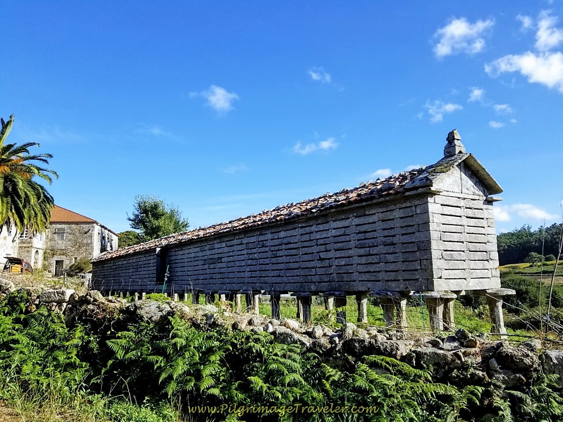
Day two on the Camino to Finisterre is a strenuous one with two significant climbs. However it is a joyous day, filled with many open and high views of the Galician countryside, more enchanted forests, many old stone hórreos, and lovely stone cafés and albergues to tempt you to linger longer.
"I believe that all of life is an unfolding journey and we never fully 'arrive' in this lifetime, but commit to always beginning again and to always being surprised by God. Pilgrimage offers us the opportunity to encounter the stranger within ourselves, to journey to places which make us feel uncomfortable in the service of breaking something free inside of us. The pilgrim's path matters in this world where we are encouraged to hold onto and accumulate comforts at any cost."
~ Christine Valters Paintner
🙋♀️ Why Trust Us at the Pilgrimage Traveler?
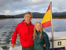
We’re not a travel agency ~ we’re fellow pilgrims! (See About Us)
We've trekked Pilgrimage Routes Across Europe since 2014!
💬 We’ve:
- Gotten lost so you don’t have to. 😉
- Followed waymarks in the glowing sunlight, the pouring rain and by moonlight. ☀️🌧️🌙
- Slept in albergues, hostels & casa rurals. Ate and drank in cafés along the way. 🛌 😴
- Created comprehensive and downloadable GPS maps and eBook Guides, full of must-have information based on real pilgrimage travels. 🧭 🗺️
- Shared our complete journeys, step by step to help YOU plan your ultimate pilgrimage and walk with your own Heart and Soul. 💙✨
Every detail is from our own experiences. Just fellow pilgrims sharing the Way. We have added a touch of spirituality, heartfelt insights and practical guidance from the road ~ offering a genuine connection to the spirit of pilgrimage. Tap into the wisdom of seasoned pilgrims!
Ultreia and Safe Pilgrimage Travels, Caminante! 💫 💚 🤍
Maps and Stats of Day Two on the Camino Finisterre
Here is our Google map, created from our uploaded GPS tracks. I have placed accommodations, cafés and supermarkets on the map for your ease of planning. There are sufficient cafés along the route, but if you plan to go all the way to Olveiroa and to cook your dinner you will need to carry your groceries, because there is no grocery store to speak of in Olveiroa.
Do not confuse Olveiroa with the town of Olveira, to the north!
The distance, as you can see, on day two of the Camino Finisterre, is almost 34 kilometers, a healthy 21-mile day, according to my GPS. This is a full day of walking, taking us 8.5 hours to complete, with breaks, so come prepared!
Bring back-up food for your day, stocking up in the grocery stores in Negreira. The café bars may not be spaced properly to accommodate you when hunger hits! Food, indeed, keeps a pilgrim happy and energetic. I do not advise you to diet on this this stage!
Also on the day's route you will notice two orange alternative routes. The long one is A Picota route, that has similar elevation changes, but is one kilometer longer. The reason to go this way is for a variation if you have done this route several times. This alternative is well-marked with green arrows and concrete mojónes.
The second shorter orange route, following the bike route, is a wonderful alternative to avoid the Monte Aro climb, a difference of about 50 meters (160 feet). However, taking this way will also miss the striking views at the Mirador de Monte Aro. Your choice.
As you can see from our elevation profile below, day two is more strenuous and difficult than day one. There is a long, 11 kilometer hill climb to start off your day from Negreira and another climb from about 22-26 kilometers into the day.
There is 892 meters of accumulated elevation gain for the day, almost 3000 feet! If this day doesn't tire you out, you are a machine.
As you can see on our Google map above, there are many opportunities to shorten your day and make your Camino to Fisterra a four day adventure.
👣 Camino Finisterre and Muxía eBook Guide
Our Downloadable Camino Finisterre eBook Guide in PDF Format contains all the valuable information from our web pages, for comfortable reading offline and without ads on your personal device. Don't carry a hard copy guide book to increase your pack weight. Use our digital guides on your next Camino instead!
Our ebook guide is packed with frequently updated information, because a digital format is more nimble than hard-copy publishing. Our eBook Guide is unique because we also entertain and immerse you with our story!
📲 Instant download. 💸 Money-back guarantee. 🔄 Free updates for 1 year.
We cover the entire circular route to both Finisterre and Muxía so you can choose to go to either or both! Click here for your copy or BUY NOW!
Jump to Camino Finisterre and Muxía Stages
Photo-Rich Travelogue of Day Two, Camino to Finisterre
The four compadres set out after our glorious buffet breakfast, included in our night's stay at the Hostal La Mezquita. It was a wonderful buffet with ham, cheese, bread, fruit and yogurt. We could even have it starting at 7:30 which was wonderful as well.
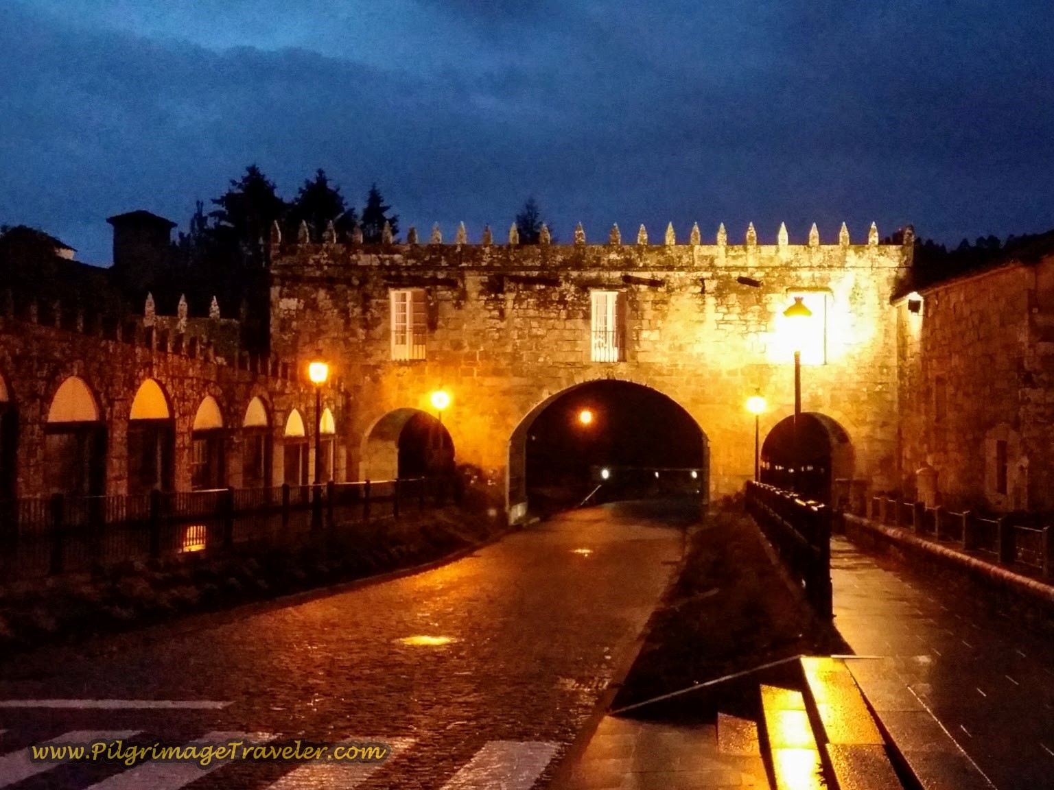
As we set out, we were all a bit somber. We knew it was going to be a long day, starting out with the long hill climb. First, we walked down the hill from the hotel, walking through the gate of the Pazo do Cotón, shown below. This is how it looked the year I left alone just before daybreak. (See day one for daylight photos.)
After walking through the gate, you cross a river. Note the river trail to the right, the Ruta Dos Tres Pazos. Keep going straight along the road.
After a total of about 1/2 kilometer from the hotel, we turned left onto the DP-5602, below. The real climbing begins here. I took this shot looking back at Rich and Steve on the Way.
 The Long Climb Begins on the DP-5602
After a few hundred meters, or so, the Way turns right at this 68.85 kilometer marker. It is important to note, that this is where you would turn left if you are looking for the municipal albergue in Negreira.
 Right Turn at the 68.85 Kilometer Marker
Our morning was misty, and threatening to rain, but we did have the immediate reward of open views of the river valley and Negreira below.
 View of Negreira and Barcala River Valley Below
A brief 150 meters onward, turn right and climb some more towards the Igrexa de San Xián de Negreira. Below is a photo of Rob, trudging upward. He requested silence on our walk this morning, and we all obliged to walk into our own worlds that morning and do as Christine Valters-Paintner suggests.
This is a quaint little church on the outskirts of Negreira and it was worth a pause to contemplate the meaning of our walk through life.
After passing the church, you are led towards this inviting pathway, below.
 Camino de Fisterra on Inviting Road
After a total of 400 meters on this road, the Way turns into the forest.
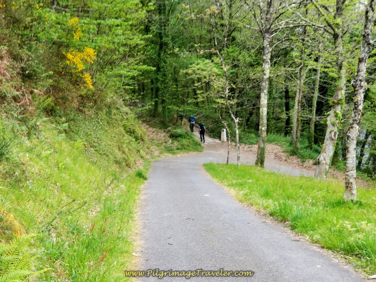 Left Turn Into the Forest
As we walked on together, in silence, the enchanting forest took on a different perspective. I really began to notice it, and notice my tendency not to notice enough of the wonders along the Way.
The forest walk lasts for about 1.2 kilometers, when it meets the DP-5603 and turns left, below. Snuggle up to this road, because almost the entire Finisterre Way on day two either walks upon it, or essentially follows its path.
 Meet-Up-with the DP-5603 and Turn Left
For this stretch, you only walk on the road for 700 meters. There is an improved pilgrims path along the side of the highway, on which to stay safe.
700 meters onward, leave the DP-5603, turning right at this intersection. There is a café just before this intersection, if you need it.
 Leave the DP-5603, Turning Right Here
The steepest part of the climb is in this first 3.0 kilometer from Negreira, so by the time you arrive in the next hamlet of Zas, it levels out for a bit of reprieve. Pass by what appears to be an unused country church, the Capela de San Mamede de Zas after approximately 3.2 kilometers into the day.
After winding through Zas for 450 meters, we soon were diverted into the woods on a path at the 65 kilometer waymark.
 Winding Through Zas
 Divert Into the Forest at 65 Kilometer Marker
It had started to drizzle, when the path ended after about 1.1 kilometers. Then it turns to the right at a farmer's field, shown below, where it intersects with a dirt lane.
 Right Turn Onto Dirt Lane at Farmer's Field
 Drizzling While Farmer Harvests
This wide and open farmer's lane shown above, soon re-enters the forest and gives way to more pleasant paths.
 Return to the Forest on Day Two, Camiño Fisterra
 Rain Gear on Pilgrims
 Pass 63.9 Kilometer Marker
It is over 2.0 kilometers when you walk out of this forest section and come to the next tiny town of Rapote and this fountain with potable water and rest area. My GPS recorded about 7.0 kilometers walked at this area.
 Fountain and Rest Area in Rapote
A few meters onward after the rest area we turned left in town, then a right at the next Y-intersection, then an almost immediate left again when the pavement ended, shown below, to enter a forested path once again.
 Path in Rapote Leads to Forest Again
 Pavers Line the Improved Forest Path
 Walk Through More Verdant Forest
After about 1.3 kilometers, past Rapote we entered the next town of A Pena and passed by the Albergue and Cafetería Alto da Pena, shown below. After only 8.3 kilometers into the day, and looking at the long stair climb to get up there, we decided to push on to Vilaserío before taking a break on day two of our Finisterre Way.
We talked to some other pilgrimage travelers, later, who highly recommended this place, stating that the bunks rooms have only four to a room.
 Pass by the Albergue Cafetería Alto da Pena
Immediately after this sign, pass by another private albergue, the Albergue Rectoral San Mamede da Pena that also gets good reviews. It also has a beer garden with food and coffee.
The albergue is just after the town church, the San Mamede da Pena, with its dedication plaque. A few meters after passing the church, the Camino turns left at a cruceiro. As we walked on the paved lane, and looked back over our left shoulders, we could get a clear view of the church and the albergues, high on the hill.
After a total of about 600 meters onward from the albergue, come to the intersection with the DP-5603 and turn right. Fortunately, the walk is a brief 1/2 kilometer before turning to the right again. However, there is a short diversion to the right, under a bridge, for a few meters, before returning to the DP-5603.
Just after the right turn, the Way turns to the left, towards the next town of Vilaserío. It is a full kilometer of walking on a forest path, descending to cross a small stream on a footbridge, then ascending back up to join the familiar DP-5603, below, turning to the right.
 Rejoin the DP-5603 on Day Two of the Camino Finisterre
You must walk a full 2.0 kilometers on this road, sharing it with many tractors in this farming country. Fortunately, once again there is an improved, gravel path along the side of the road to keep you safe. You will finish the final 1/2 kilometer of climbing for the morning on the pavement.
You will know you are finally at the top when the windmills appear high on the ridge to your left! Breathe, relax and enjoy the downhill to come. You have made it! The top is at 11 kilometers total, about 1/3 of the day completed.
Pass by the sign for the town of Vilaserío along the DP-5603, and just beyond it the Camino turns to the left, shown below, to enter the town proper.
 Turn Left Toward Vilaserío on Day Two of the Way to Finisterre
It is a short, pleasant walk through the forest for 1/4 kilometer, when you make a right turn into the town, and come to the restaurant and bar, the Restaurante O Rureiro.
There are three albergues in this small town, the Albergue Casa Vella, meters off the Camino to the south (not pictured), the Albergue and Pensión O Rueiro, just down the hill from the bar pictured below, and the municipal and donativo Albergue de Peregrinos de Vilaserío farther down the highway. There is also a casa rural, the Villa Rica House, along the main highway before the municipal albergue.
We did stop and have a café con leche and pastries at the O Rureiro and broke our walk in silence. After 12.8 kilometers, it was nice to chat again, and take a load off our feet!
 Restaurante O Rueiro in Vilaserío
It is a few meters down the hill, past the above albergue, when the Camino meets up with the DP-5603 once again and turns to the left. The countryside is absolutely gorgeous through here. In less than 1/2 kilometer, you walk past the municipal albergue remodeled from an old schoolhouse.
 Left Turn Onto DP-5603 in Vilaserío
Walk a full 1.8 kilometers on the road once again, then turn right onto a side road toward the next hamlet of Cornadó. While this tiny town has no services, it does have vending machines shortly after the turn, on the left side of the road. You can get snacks, drinks and coffee.
There is also a fountain in the center of town by the bus stop, a short 200 meters down the road, to fill your water bottles if needed.
 Fonte do Cornadó
Turn left by the fountain, and after a few meters, pick up a long, gravel road through the countryside, passing windmills along the way.
 Long Gravel Road Through the Countryside
You have walked on this long gravel road for a bit more than a full kilometer, when coming to an intersection with the DP-5604. The Camino goes to the right here.
 Right Turn at Intersection with the DP-5604
Stay on this road for 1/3 kilometer on a nice walker's lane, show below. Then turn left onto another long gravel lane at the 53.1 kilometer marker and a sign for the Casa Pepa. The Casa Pepa is a good 5.0 kilometers away in Santa Mariña. In the photo below, you can see the turn to the left in the distance, just before the stand of trees after approximately 16.2 kilometers into the day.
 Walkers Lane on the DP-5604
From the turn at the 53.1 kilometer marker it is a long 3.4 kilometers to the next town of As Maroñas on day two of the Finisterre Way, mostly on gravel lanes.
 Rich and Elle at the 51.9 Kilometer Marker
 The Way Turns to Pavement
 Cross a Stream Before As Maroñas
When you come to the intersection, below, in As Maroñas, after about 19.6 kilometers, many signs greet you, because surprisingly while there are no services here, there are a lot in the next town of Santa Mariña, about 1.1 kilometer ahead. Turn left as directed.
 Left Turn Here in As Maroñas
 Walking Through As Maroñas
 The 1.1 Kilometer Road to Santa Mariña
Next, we reached the cruceiro in the center of Santa Mariña, shown below. The Camino Finisterre goes to the right, but to reach the Casa Pepa one must go left a few more meters. Our friends Steve and Rob, at a total of 22 kilometers for the day, were going to stay here at the albergue. The Casa Pepa is a private albergue and it also has a very nice café.
Rich and I were going on to Olveiroa, so we had a cup of café con leche with them, before heading onward. Our plan was to meet up again in a few days in Muxía.
 Cruceiro in the Center of Santa Mariña
Reluctantly, we continued onward without our friends. As we left town we noticed a very nice picnic area, where one could have a picnic. It is just less than 1/2 kilometer from the center of town, to the AC-400 where there are lots more services.
There are two more café/bars, a panaderia (bakery) and the municipal Albergue de Peregrinos de Santa Mariña, +34 981 852 897, shown below. The sun was coming out and there were many pilgrims hanging out here as we walked by.
 Albergue de Peregrinos de Santa Mariña
After turning left, or westward onto the AC-400, it is not quite 1/2 kilometer on this road, before the Camino turns to the right onto a quiet secondary road towards the next tiny town of Gueima. It is almost two kilometers from the turn off the AC-400 to Gueima, climbing steadily along the way.
 Walkers Path Along the AC-400
 The Quiet Secondary Road to Gueima
 Walking Through the Tiny Town of Gueima
After the town of Gueima, the Camino heads toward the next small town of Vilar do Castro, 700 meters onward. There are no services here, but it is distinctive in that walking to this town begins the next very steep climb of the day, after about 24.25 kilometers into an already long day.
 Pilgrim Begins the Climb Towards Vilar de Castro
While the Camino has been climbing steadily since Santa Mariña, it now takes a turn for the steeper, which shouldn't be that bad, having gained 100 meters (328 feet) over about three kilometers, but after a long day's walk, I had difficulty convincing my legs!
After the 700 meters from Gueima, take a sharp turn to the right at the 45.146 kilometer waymark, in Vilar de Castro, and continue on a nicer, flat road for a while that leaves town, shown below.
 Flat Road Leaves Vilar de Castro
OR, you could take the alternative route to A Picota, and turn left in Vilar de Castro, at the 45.146 kilometer marker, and towards the Hotel Casa Jurjo or the Casa Albergue Picota in this town.
The southern, alternative route through A Picota avoids the steep hill climb described below, and shown on the map above in orange, and it adds about one kilometer to the route. However, it can be another option to shorten the day. (At this juncture you are about 9.2 kilometers from Olveiroa but with the steep hill climb ahead.) The Picota route, however, has a climb of its own, even a bit higher than the standard route, it is just more gradual and on easier pavement.
On the alternative route, 200 meters after the turn in Vilar de Castro, go right to join the main road, all the way into A Picota, about 4.7 kilometers. Come to an intersection with the DP-3404 in the main square. The Hotel Casa Jurjo and the Casa Albergue Picota are located at the intersection. Turn right onto the DP-3404 and head north for 3.3 kilometers until the main route joins the DP-3404 to walk across the river into Olveiroa (8.0 kilometers total).
Otherwise, along the main route, after turning right in Vilar de Castro and after 800 meters more, take a left turn at the next T-intersection. You are now heading towards the high point of day two on the Camiño Fisterra ~ Monte Aro and the final steep push.
Just when I thought the road could go no higher, I spied this dirt road to the left with people on it! Could this be the Camino??
 Is That the Camino??
And the answer is: Yes it is! 300 meters onward from the last turn, the Camino takes a left onto this final steep dirt pitch.
In actuality, you could continue straight along the paved road and avoid this climb, because the Camino joins the alternative route not quite two kilometers later. Consult the northernmost orange route on the interactive map. If you choose this viable option, you will miss the fabulous viewpoint, and shorten the route by almost 1/2 kilometer. Once upon a time, this was the official route.
Just continue straight and down the hill. After about 130 meters, stay left at the Y-intersection. For the next 1.5 kilometers, just follow the well-marked bike route! It’s that easy.
Back on the official route, 400 meters after the grueling climb, there is a nice resting and viewing platform, shown below. This is a wonderful place with stupendous views of the countryside and the Fervenza Reservoir.
We lingered a bit here, but not very long. One hundred meters onward, the road turns left to point the pilgrimage traveler to the next obstacle. Another climb??
Mercifully, the answer this time is: No, the Camino turns right. Take heart, because it is all downhill from here to Olveiroa.
 Mercifully the Camino Turns to the Right Here
It is a lovely and not-too-steep, 1.4 kilometer stroll from the high point of the day, into the next town of Lago. The views of Fervenza Reservoir abound.
It is a long, straight road for one kilometer from the top, turning left near Lago, below.
 Left Turn Towards Lago
If you need a break and refreshments, there is the Casa Xalleiro waiting for you at the bottom of the hill. There is also the Albergue Monte Aro if you have had enough walking for the day! In Lago, you have completed about a 27.2 kilometer walk from Negreira.
 Casa Xalleiro in Lago
Lago is a very small town, and after another 1/2 kilometer walk you turn left at this bus stop/bench area. Rich and I stopped and had a picnic here. I needed something to get me through the next five kilometers to Olveiroa.
It is at this juncture where the alternative bike route joins the official route.
 Bus Stop Picnic Area in Lago
About 400 meters on down the road from the bus stop, and towards the next town of Corzón, take a right hand turn.
Continuing on the route, it is 2.7 kilometers from the bus stop to Corzón as the Camino winds around the country roads, following the clear waymarks. The road seemed to never end.
 The Road to Corzón
 Waymarks on the Road to Corzón
 Walk by the Church in Corzón
In the town of Corzón, across from the church is the Compartmento Corzón, +34 606 81 71 46, a place where you can camp with your own tent, or rent one of theirs. They also have a restaurant with pilgrim's meals.
After Corzón, it is another kilometer to the next town of Ponte Olveira. There is not much here, but there is the nice-looking old stone building that houses the Albergue Ponte Olveira.
Past the albergue, the Camino turns right to pick up the DP-3404 for the final two kilometers into Olveiroa! This is where the alternative route from A Picota and the main route join at the DP-3404.
Cross the Río Xallas. Is that a hill ahead walking into Olveiroa? Argh! This final stretch on a busy highway I felt was bad enough without a hill on the final push. I was so tired! I dislike greater than 30k days, and I doubt I will ever do this long day two on the Camino Finisterre again!
After a few more meters beyond the top of the hill above, finally we came to the sign announcing the historical center of Olveiroa. You can barely make out the black letters on the distant wall of the photo below. I guess I was more interested in photographing the sheep!
 Left Turn Into Historical Center at Olveiroa Sign
I must say, I like Olveiroa, and the many hórreos that surround this town. I will miss staying here in the future if I walk through, making four shorter stages. To see gorgeous photos of the town hórreos lit up in the early morning, see our day three.
Just 300 meters after the turn into the main part of town, we came to our accommodation for the night, the Casa Loncho, shown below.
There is also a municipal albergue, the Albergue de Peregrinos de Olveiroa, just north of the main road, and three more privadas (privates), the Albergue As Pías and the Albergue - Restaurante Casa Manola, along the Camino itself and the Albergue Santa Lucía - Olveiroa, also just steps to the north.
Olveiroa is a pinch-point with few albergues, so we had reserved a room at the Casa Loncho, a wonderful pilgrim refuge. The place is full of choices for the night, from lovely rooms to the standard dormitory, called the Albergue Hórreo.
Plus, the most wonderful of all, the main dining/reception area served food and beverages from 6:30 a.m. to 10 p.m., whenever anyone wanted it - a pilgrim's dream! Because of this, the cafeteria is always a bustling place.
In addition to all this loveliness, they had a little grocerette that had things like chips, Oreos, nuts and fruit for sale to stash in your pack for the next day. I have to admit that I had two packages of Oreos when I arrived. I was so happy to see something familiar for the first time in weeks. Not much of a pilgrim, at this moment, I confess, but I was still happy, on this day two of my Camino Finisterre!
Lounging outside on the balcony of our room, I felt truly blessed on this day. We splurged on a double room instead of the dormitory (which didn't smell too lovely on this particular day) and despite the Saturday night partying noise, we slept very well. After walking 33 kilometers, I think I would have slept through a hurricane.
After our wonderful evening meal, which we had quite early by Spanish standards at 6:00 p.m, the Menú del Día (menu of the day), consisting of breaded and fried chicken filets, french fries and Caldo Gallego (local vegetable soup) and copious amounts of wine, we went to bed with full bellies and contented hearts. The caldo never tasted so good! - cabbage, potatoes and a salty chicken broth to replenish our electrolytes!
Jump to Camino Finisterre and Muxía Stages
Reflections on Day Two of the Camino Finisterre
We started out with our good friends on this day, in silence, contemplating our own pilgrimage. We journeyed on for 22 kilometers together, later chatting and being our usual selves. This felt different than our prior Camino days, but it was a necessary and welcome change. Having to leave them behind after 2/3rds into our day felt much more unusual, as we had come such a long way together.
The physical effort that it took, walking our final 10 kilometers, kept us in a different place. It kept us distracted from true reflection perhaps. We missed our friends and yet it felt freeing to have a conversation solely with one another. We looked forward to meeting up with them again in Muxía.
The symbolic nature of the journey on the Camino, versus our journey through life brings constant parallels to mind. This unfolding journey, as the beginning quote describes, reminds us that the Way is always full of surprises, twists and turns that are out of our control. The Way is constantly changing before our eyes as we learn more and more about ourselves and our responses to this sacred path.
Salutation
May your own day two on the Camino Finisterre be a learning experience for you. May you also find more insight into yourself, encountering the stranger within, when you walk the Finisterre Way. Ultreia!
Camino Finisterre and Muxía Stages
Please Consider Showing Your Support
Many readers contact me, Elle, to thank me for all the time and care that I have spent creating this informative website. If you have been truly blessed by my efforts, have not purchased an eBook, yet wish to contribute, I am exeedingly grateful. Thank you!
Search This Website:
🙋♀️ Why Trust Us at the Pilgrimage Traveler?

We’re not a travel agency ~ we’re fellow pilgrims! (See About Us)
We've trekked Pilgrimage Routes Across Europe since 2014!
💬 We’ve:
- Gotten lost so you don’t have to. 😉
- Followed waymarks in the glowing sunlight, the pouring rain and by moonlight. ☀️🌧️🌙
- Slept in albergues, hostels & casa rurals. Ate and drank in cafés along the way. 🛌 😴
- Created comprehensive and downloadable GPS maps and eBook Guides, full of must-have information based on real pilgrimage travels. 🧭 🗺️
- Shared our complete journeys, step by step to help YOU plan your ultimate pilgrimage and walk with your own Heart and Soul. 💙✨
Every detail is from our own experiences. Just fellow pilgrims sharing the Way. We have added a touch of spirituality, heartfelt insights and practical guidance from the road ~ offering a genuine connection to the spirit of pilgrimage. Tap into the wisdom of seasoned pilgrims!
Ultreia and Safe Pilgrimage Travels, Caminante! 💫 💚 🤍
Follow Me on Pinterest:
Find the Pilgrimage Traveler on Facebook:
Like / Share this page on Facebook:
Shroud Yourself in Mystery, along the Via de Francesco!
Walk in the Footsteps of St. Francis, and Connect Deeply with the Saint and to Nature in the Marvelous Italian Countryside!
Need suggestions on what to pack for your next pilgrimage? Click Here or on the photo below!
Find the Best Hotel Deals Using This Tool!
Carbon Trekking Poles ~ My Favorites!
Carbon fiber construction (not aluminum) in a trekking pole makes them ultra lightweight. We like the Z-Pole style from Black Diamond so we can hide our poles in our pack from potential thieves before getting to our albergue! There are many to choose from! (See more of our gear recommendations! )
Gregory BackPack ~ My Favorite Brand
Do not forget your quick-dry microfiber towel!







Your Opinion Matters! Comments
Have you had a similar experience, have some advice to give, or have something else you'd like to share? We would love to hear from you! Please leave us a comment in the box below.