- ~ Home
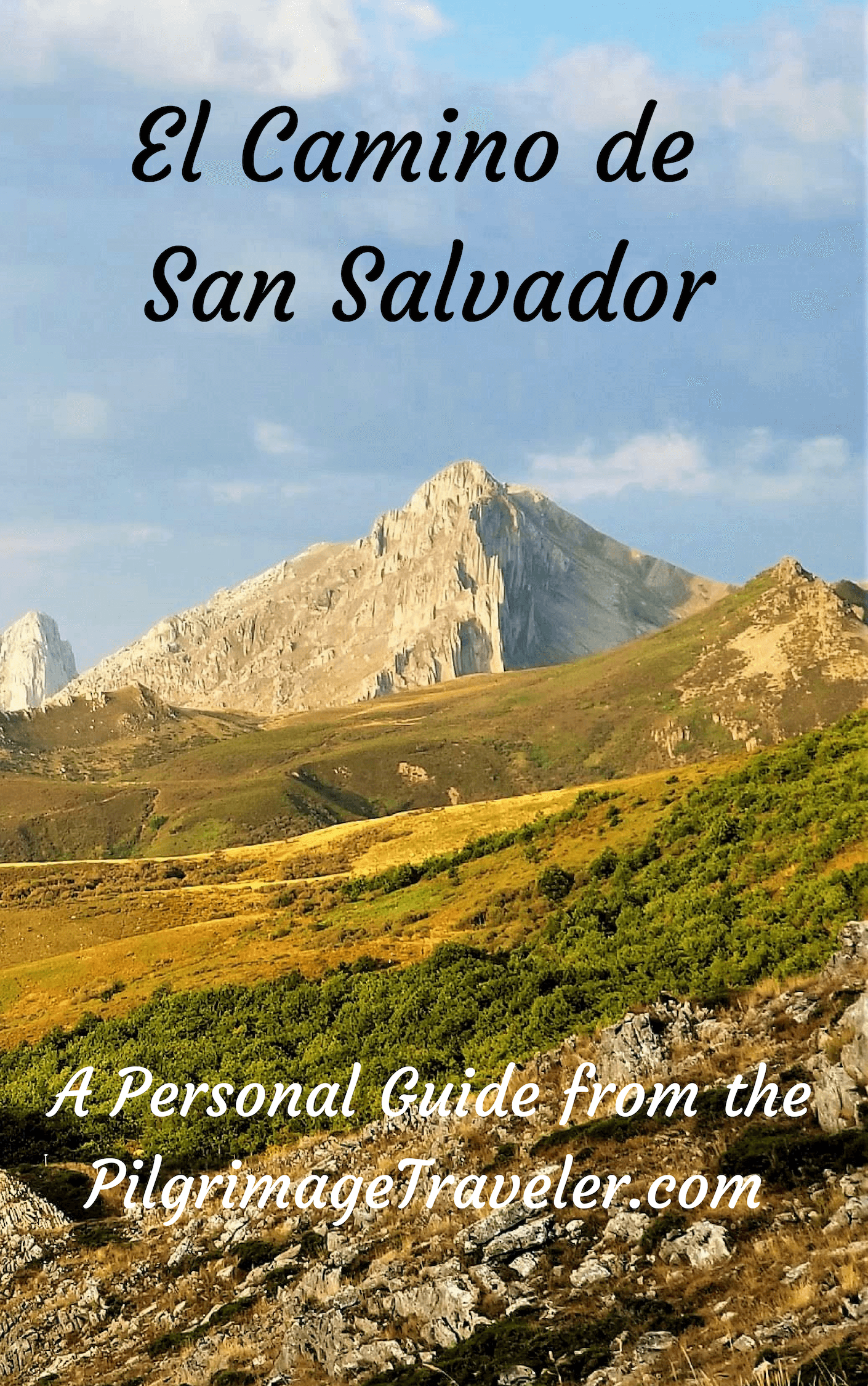
- ~ Camino de San Salvador (The Way of the Savior)
- Day One, Leon to La Robla
Jump to Camino de San Salvador Stages
Day One on the Camino de San Salvador, León to La Robla, 26.2 Kilometers (16.3 Miles)
Day one on the Camino de San Salvador is a walk northward out of León, leaving the Camino Francés far behind as it heads for the Cantabrian mountains of Asturias. This day follows the path of the Río Bernesga, steadily gaining elevation throughout the day on its journey to La Robla.
"We may run, walk or stumble,... but let us never lose sight of the reason for the journey, or miss a chance to see a rainbow on the way." ~ Gloria Gaither
🙋♀️ Why Trust Us at the Pilgrimage Traveler?

We’re not a travel agency ~ we’re fellow pilgrims! (See About Us)
We've trekked Pilgrimage Routes Across Europe since 2014!
💬 We’ve:
- Gotten lost so you don’t have to. 😉
- Followed waymarks in the glowing sunlight, the pouring rain and by moonlight. ☀️🌧️🌙
- Slept in albergues, hostels & casa rurals. Ate and drank in cafés along the way. 🛌 😴
- Created comprehensive and downloadable GPS maps and eBook Guides, full of must-have information based on real pilgrimage travels. 🧭 🗺️
- Shared our complete journeys, step by step to help YOU plan your ultimate pilgrimage and walk with your own Heart and Soul. 💙✨
Every detail is from our own experiences. Just fellow pilgrims sharing the Way. We have added a touch of spirituality, heartfelt insights and practical guidance from the road ~ offering a genuine connection to the spirit of pilgrimage. Tap into the wisdom of seasoned pilgrims!
Ultreia and Safe Pilgrimage Travels, Caminante! 💫 💚 🤍
Maps and Stats of Day One on the Camino de San Salvador
Here is our google map, created from our upload GPS tracks. I have placed accommodations and cafés on the map so you can plan your day. I have included alternative routes, in red, that are described farther below.
As you can see from the elevation profile of day one on the Camino San Salvador, it is essentially a long steady climb, with a few extra elevation bumps in the middle. The total elevation gain is 600 meters, with a loss of 468. It is a good warm-up for what is to come.
We did not feel the day was all that strenuous, however, if you are starting late, or wish to stop sooner, there is an albergue about two-thirds of the way through this stage after about 17 kilometers, in the town of Cabanillas.
There are two short, but significant climbs that will get your heart beating, as you can see.

👣 Camino de San Salvador EBook Guide
Walk smarter with our ad-free, beautifully formatted and downloadable Camino de San Salvador eBook Guide in PDF Format ~ perfect for offline use in the mountainous and remote areas along the Way. Includes daily stage details, alternative routes and stunning photos! Our eBook Guide is unique because we also entertain and immerse you with our story!
Don't carry a hard copy guide book to increase your pack weight. Use our digital guide on your mobile device on your next Camino instead! Now, you can walk with clarity and confidence in the Cantabrian mountains.
📲 Instant download. 💸 Money-back guarantee. 🔄 Free updates for 1 year.
👉 Click here for more information, or BUY NOW.
Jump to Camino de San Salvador Stages
Photo-Rich Travelogue for Day One on the Camino de San Salvador
In the early morning hours, we set off from our Hotel Crisol Quindós, towards the Plaza San Marcos and the pilgrims statue.
In late September, the sun only rises by 0800, and few people were in the streets. My husband Rich was very happy, after our breakfast of giant croissants and cups of café con leche. The Cafetería Peregrino is just across from the plaza. It is most conveniently located for the start of a pilgrim's journey!
 Rich at the Cafetería Peregrino
Upon arriving at the pilgrims statue, (see intro), walk eastward across the plaza, in front of the San Marcos church, against the French Way pilgrim traffic until you come to the first street, the Avenida los Peregrinos (Pilgrim's Avenue). Across the street you will see the first concrete waymark, below.
 First San Salvador Concrete Waymark
There may be yellow arrows directing you to turn left by the concrete waymark and onto the Avenida Los Peregrinos. There IS a wooden waymark around the corner, on the opposite side of the street from the concrete one.
After about 260 meters come to a large parking garage, and just beyond, is the first large roundabout with an airplane in the center, shown below. When you see the airplane you are ensured that you are heading in the right direction.
Prior to this roundabout with the airplane, there may not be a lot of arrows or waymarks, so it is significant to find this place as a reassurance you are heading in the right direction. After the roundabout, more wooden signs appear that will also reassure you.

Walk around the roundabout to the west and after crossing the street you can immediately see a stairway on your left, leading down to the Río Bernesga, and a lovely alternative river path to walk along, instead of the street. The Camino along the street is actually a bit shorter than the riverwalk.
You can see this riverwalk from the Avenida los Peregrinos almost at all times, at least initially, if you choose to walk here. You would only need to be astute when the Camino leaves the Avenida Los Peregrinos, to turn right, or eastward onto the Calle Unicef after about 2.3 kilometers on the riverwalk.
Or, if you despise pavement and don't need a café, you can choose to continue along this winding and less direct path for an additional 5.0 kilometers, for a total of about 7.5 kilometers, joining the main route on the north side of the town of Carbajal de la Legua. This extended route will only add about a few extra hundred meters to your total. Check the map above to see the route in red.
Back on the pleasant Avenida los Peregrinos, it is important to note, on the northeast side of the airplane roundabout is a large supermarket called the Mercadona where you can supply your pack for the day, a necessary task, if you have not already done so, although it may not open until 9:00 a.m. See the map above for its location.
Here is a photo that depicts the proximity of the riverwalk to the Camino on the Avenida Los Peregrinos, in the beginning of the day.

Continue through the Parque del Bernesga along the colorful, paved sidewalk and after about one kilometer from the airplane, you come to the second roundabout, below, and continue straight through and northward, shown in the next photo. There are now plentiful yellow arrows and signs and the running track is pleasant to walk upon.
 Second Roundabout on the Avenida Los Peregrinos
 Running Track Joins the Camino
1.2 kilometers later, about 2.6 kilometers from the start at the pilgrim statue, you approach the third roundabout, where you leave the Avenida Los Peregrinos, and where the yellow arrows on the pavement direct you to the right and onto the Calle Unicef. This is a beautiful residential area with lots of new homes.
 Third Roundabout, Turn Right onto the Calle Unicef
Instead, if you walk to the third roundabout on the Bernesga riverwalk that I've pictured below, you have a choice of the dirt track to the far left, or the pavement to your right. Sometimes the choice is side-by-side, first photo, and sometimes not, next photo.
 Paved Section of Bernesga Riverwalk
 Unpaved Section of Bernesga Riverwalk
Often the dirt tracks are hard gravel and it helps if it is muddy or raining, however your best choice in the case of mud is to stick to the pavement, either on the riverwalk or up on the Avenida Los Peregrinos. As noted above, if you wish to join the Camino at the third roundabout, after about 2.3 kilometers, look for a set of stairs to your right, leading you up and to a paved path back to the Avenida. This is the first possible crossover back to the official Camino that you can see on the map above.
Back on the official route, after only 350 meters on the Calle Unicef, come to a T-intersection and turn left onto the LE-5504, the highway, Carretera de Carbajal.
 Leaving León on the Carretera de Carbajal
Within 1.1 kilometers, come to a Cepsol station, with a Carrefour market at another large roundabout, not shown. Follow the waymarks to continue to the left and through the roundabout.
After another 1/2 kilometer, continuing on the Carretera, walking northward, you pick up a bike path, and after 4.4 kilometers for the day, pass by a huge sports complex on your left, the Olímpico de León, below. 400 meters after this giant white building, pass the León city limits sign. You may notice a golf course on your left and high fencing to contain golf balls along the road through here.
 Pass the Olímpico de León, Day One, Camino San Salvador
360 meters later, enter the city limits of the next town of Carbajal de la Legua.
 Entering the City of Carbajal de la Legua
Just shy of 5.0 kilometers for the day, along the official route, you will encounter this intersection, below, with the Calle Once de Marzo. This is where the second possible crossover from the Bernesga riverwalk joins the official Camino, see this description just below.
 Intersection Where Bernesga Riverwalk joins the Official Route in Carbajal de la Legua
Jump to Camino de San Salvador Stages
If you choose to take the Bernesga riverwalk past the first crossover, you will pass the obvious white Olympic sports complex and the golf course on your right along the next 2.55 kilometers. Below is a photo of the path that follows along the golf course. You can see the high fence that prevents any crossover back to the official route through this section.
 Path Follows the Fence Line Along the Golf Course
The Bernesga Riverwalk leaves the proximity of the golf course and picks up this gravel lane, through a pastoral area. You may see horses through this area, or evidence of them!
 Gravel Lane Through Pastoral Area
You will know you are approaching the second crossover, when you see the structure of the highway bridge ahead, pictured next.
 Highway Bridge Ahead
The gravel lane soon intersects with the Calle Once de Marzo at a roundabout, where a right turn will take you back to the LE-5504 and the official route, after 1/2 kilometer.
You can actually stay straight through the roundabout, picking up another gravel lane on the other side, to continue on this alternative Bernesga River route for another 3.0 kilometers if you so desire, joining the official route on the north edge of town.
However, if you wish to stop at a café in Carbajal, after about 1.4 kilometers, you can take the second lane to the right to get back to the main road and the official Camino after a short jaunt of 200 meters. This would be the third opportunity for a crossover. Turn left and the Bar Central is another 1/2 kilometer north.
Or, you can continue on the full 3.0 kilometers, by taking the gravel lane for 2.6 kilometers, until coming to an intersection with a paved road at another bridge on the left and a soccer field on the right. Turn right onto this road, and a few meters later, an immediate turn to the left, to pick up a narrow paved road, the Calle la Vallina, for the final 400 meters. Make sure you continue to follow the river and not cross it. The Calle la Vallina takes a bend to the right and joins the Camino a few meters later, at the north side of town.
Back on the official route, from the intersection with the Calle Once de Marzo, just past the golf course, the Camino de San Salvador continues to walk northward through the urban area of Carbajal de la Legua for the next 2.1 kilometers, along the LE-5504, photo below.

The road becomes more narrow as it heads north through town. You will encounter many old adobe homes along this seemingly never-ending stretch through town and this concrete waymark.

After about 6.7 kilometers, we stopped into the Café Central that was open at 9:20 in the morning, near the center of the urban area, that may be your only opportunity for a café until La Seca, about 12 kilometers farther down the road.
After about 7.4 kilometers, the longest of the Bernesga river routes join the main route, from the west. A few meters after their joining, pass a pilgrim's fountain.
Soon, after another 400 meters, the homes cease and the road becomes dirt. I have good news and bad news! The pavement finally ends for about the next 8.7 kilometers, however, here is where the first significant hill climb begins.
 City Limits of Carbajal de la Legua, Road Becomes Dirt
Jump to Camino de San Salvador Stages
Just as the road starts to really steepen after about 1/2 kilometer on the gravel road, you will pass the Fuente de Valle, or Valley Fountain, not pictured, which was dry when we passed and is “no potable” or nonpotable water.
 Climb Begins to Steepen and Ascends this Hill
After about 9.6 kilometers we crested the first hill, where a sign pointed to a trail off to the left, announcing the “Mirador de Bernesga,” or the Beresga Viewpoint. The trail leading to the viewpoint looked too far off route, so we walked on by. We were already experiencing views over our left shoulder of the river valley below. And there are more to come!
At the top, we met up with two Spanish pilgrims who had already logged 1000 kilometers, starting on the coast east of Madrid, and were walking for 38 days! They were planning to continue on the San Salvador to Oviedo, then on to Santiago via the Primitivo. What an industrious journey!
As we descended from the top of the hill, the Camino stayed to the left, dropping into a more forested and cooler area, shown below. There are plenty of waymarks to guide you, where the side roads turn off.
 Dropping Down First Hill
After 10.9 kilometers, you will come to the bottom of the hill, round a bend and cross the Arroyo Valdecastro, running low in September.
The pilgrimage traveler is following a nice, wide roadway, that is open and could be quite hot in the summertime.
 Big Bend Before Entering the Cool Forest
After taking the large bend, the Way heads up the next small hill. You will see two signs as you climb this hill, “Punta de Regreso” or the Point of Return and the “Ruta de los Miradores” or the Viewpoints Route. And indeed, there are many viewpoints over the Bernesga River Valley below.
As you climb, the nice wide road becomes more of a goat path, with lots of mountain bike tracks and into a wonderful holly forest. This forest is dense and shady.
After 11.3 kilometers, you pass by a beautiful old holly tree, with a bench and a chair. You can have a rest here if you need it.
In fact, underneath many large trees along the way, there are benches, if you want to rest in the shade! Often with a shrine next to it as well.
 Pilgrim Rest Stop in the Holly Forest
The Camino de San Salvador is mostly upsy-downsy through here on day one. The holly forest is oh-so-lovely and moss-covered, with the occasional yellow arrows painted on them.
After about 11.75 kilometers, the trail goes steeply up and to the right. You get glimpses of interspersing views of the verdant Bernesga river valley to your left, denoted by the ribbon of green trees.
Top out for the second time after 12.2 kilometers at the Mirador de Bernesga.
 Top of the Mirador de Bernesga
Then the forest opens as the trail descends once more, shown below, and the Way ahead becomes clear ~ up the next hill!
 River Valley Below and the Way Ahead
First you walk by a sign for a fountain, a few meters off Camino to your left, called the Fuente de Villalbura. I have no idea if the fountain is functional, but the path was so overgrown I had no desire to investigate! After a few more meters, walk by the ruins of Villalbura.
 Ruins of Villalbura Just Past the Fuente de Villalbura
After about 12.8 kilometers, you cross a muddy wash, the Arroyo de Villalbura, and turn right and up the hill.
 Right Turn Up the Hill on Day One of the Camino San Salvador
 Turn Sharply to Right and Up Hill
The short steep climb becomes apparent once you start up. Below is a photo of the steep climb ahead, where the view opens up.

While it appears that you must climb to the tippy top, the Way turns off the left, before this is so.
 Turn Left, Avoiding Rugged Top
However, the climb continues, after the turn shown above.
 More Climbing!
After 13.3 kilometers, you come to a pseudo-top with a nice cluster of trees to stop in the shade and rest if needed. Still ahead are visible power lines, and the pilgrimage traveler must keep climbing on day one of the Camino de San Salvador.
 Tree Shelter at Pseudo-Top
After 13.5 kilometers, reach the actual top and turn left to go downhill. You don't have to go all the way to the top that you can see ahead. Just when you think you are not at the top, a Camino sign directs you to go down to the left, and descend on steep, loose and gravelly dirt.
 Left Turn Here Ends Climbing
Jump to Camino de San Salvador Stages
 Continue the Descent
About 200 meters into the descent and after the turn, you will see a very steep hill descent ahead, on a goat track. This fortunately, is not the way, but you will turn to the right to go around it. This goat trail turned out to be a mountain biking thrill-ride shortcut!
More of the actual foot trail comes into view ahead, shown below. It is now a flatter walk ahead.
 The Trail Bends Ahead
 High View of River Valley
Pass by another fountain after 15 kilometers, the Fuente de Pelayo, with a picnic area, not pictured. There is also a pilgrim’s station, a box on a stand, where you can write your reflections if you desire.
After about 15.7 kilometers, you join the power line, now directly overhead, and then the road turns sharply to the left and starts to descend once again.
 Road Flattens Before Next Town of Cabanillas
This steep descent heads westward towards the next town of Cabanillas, then it bends to the north, flattens out, see above photo, and suddenly you come out into town, shown in the photo below. I was grateful because I was hurting a bit, was quite hungry and ready for a break on day one of the Camino de San Salvador.
You have come 16.5 kilometers, when you reach the Camino Real and a row of houses, shown here.
 Entering Cabanillas

After walking by the church, the Capillo del Santo Cristo, shown above, after 16.8 kilometers, you come to a nice shady plaza with a fountain and a rest area, if you desire to take a break here and refresh your water supply as well.

There is also the municipal albergue 120 meters to the right of the plaza, see the bright pink sign for it, below, that you will see on the north side of the plaza. It is the municipal Albergue de Peregrinos de Cabanillas, with only four places, (Tel. +34 659 38 70 40, Mari Flor or +34 657 47 37 49 Toño). You must call ahead if you plan to stay here and bring your own food.
 Sign to Albergue Municipal de Cabanillas
There is no café in town, but we were pleasantly surprised to find lovely vending machines at the albergue, for coffee and substantial snacks, including sandwiches that may even be sufficient for your dinner. We took a break here and visited the quaint Iglesia de San Justo, adjacent to the albergue.
 Albergue de Peregrinos de Cabanillas
Jump to Camino de San Salvador Stages
Then it was back on the Camino. After the plaza in Cabanillas, the Way first takes a left turn at the albergue sign, crosses a drainage ditch, then takes an immediate hard right turn northward after the ditch. The intersection is shown in the photo below. It then picks up a dirt road that is well-marked. Here you continue to follow the river and you can hear it and see it. It's quite pleasant.
 Right Turn After Ditch in Cabanillas
A local left her mark on this section. Most likely the crochet work will be gone before too long, but it was a nice addition when we walked through!
 Northward Past Cabanillas
After 18.2 kilometers there is another pilgrim's station with a notebook and some first aid supplies, where you can leave your thoughts and sign in. We did not want to disturb the two pilgrims there, so we kept walking through on day one of our Camino de San Salvador.
 Leave Your Reflections Here
And then it's onward through the forest towards the next town of La Seca de Alba.

After about 18.9 kilometers, you come to the information board by the bridge, that leads you across the river and into the town and a sign for the bar. If you decide to go here, the Bar Marisa in La Seca is about 400 meters off-Camino.
 Information Board in La Seca
 Bridge to La Seca
We talked to a pilgrim who walked this whole way, off-Camino, only to discover it was closed. You can roll the dice if you want, or call first, to make sure they are open. We were happy to drink the café con leche and Aquarius from the vending machine at the albergue in Cabanillas, and eat from our pack! Almost a kilometer out of my way, is not my idea of a wise choice!
The Way climbs after the bridge in La Seca, on a very loose gravel trail, shown below. This was harder to negotiate than I expected. About 500 meters from the bridge, stay left at this intersection.
 Climb After La Seca
After not quite 20 kilometers, pass by a shrine that says "The Savior is Born."
 The Savior is Born Shrine
You have entered a nice and shady forest, walking along the river on paths.
 Delicious Wooded Path
 Path Joins the Río Bernesga
The nice forested path abruptly ends at this intersection, after about 20.5 kilometers, below, which the pilgrimage traveler crosses over, to join the Calle Real towards the next town of Cascantes de Alba.
From this point forward, the final 5.7 kilometers of the day will be on asphalt, unless you take a longer diversion, described below.
 Join the Calle Real to Walk Toward Cascantes
Only about 200 meters later, after about 20.7 kilometers total, you enter into Cascantes.
 Entering Cascantes de Alba
Walking through Cascantes you will pass many quaint brick and stone buildings, like below. When you reach the center of town, you will see a Camino waymark on a fountain under the awning, also pictured below. This is fresh, potable water.
 Potable Water Fountain by the Cascantes Church
This fountain is by the backside of the town church. You have to walk around to the front, if you wish to see it. It was closed when we walked by.
 Iglesia de Cascantes de Alba
Just beyond the church is the city fountain with three big spouts, not pictured. It may not be safe to drink, as the sign declares. It's sanitation is not guarenteed.
There are no services in Cascantes, not even a bar.
You continue on after Cascantes, walking on a paved road, which is very quiet. After 21.5 kilometers, you will come to a decision point, which is tricky to find. In the past, the directions were painted boldly on the pavement in yellow on the sidewalk, shown on the photo below. Now, the paint has all but faded (you may be able to see traces of it like we did, on the photo farther below, or perhaps someone will refresh it in the future.)

Now, you have to rely on finding this sign, below, that is very difficult to spot and hidden in the trees. It says, “La Robla por Llanos de Alba, 6 km de Tierra,” or La Robla through Llanos de Alba, 6 km by land, and is pointing to the left.
The sign pointing straight ahead says, “La Robla por la Ermita Celada, 5 km de Asfalto” or La Robla by the Ermita Celada, 5 km by road.
 Signpost at Decision Point in Cascantes
The path “Por Llanos de Alba,” turns left here, has less asphalt, is a full kilometer more and avoids walking through the center of La Robla. You may be able to see the yellow paint on the concrete wall in the next photo, that says, “Por Llanos de Alba.” This is the turn.
 The Way "Por Llanos de Alba"
But this route also walks through industrial and power station areas on the west side of town that are not beautiful, ending at the municipal albergue on the north side. It may be your best choice if your destination is the albergue.
Don’t believe that this longer route has no asphalt at all, and is on beautiful paths. It is initially, but it definitely still goes through industrial and urban areas as well.
Plus, in order to see the historic Ermita de Celada, you must walk mostly on the asphalt, the shorter five kilometers. For us, the first time, the shorter way, "Por la Ermita Celada," to see the Ermita was a no-brainer, however we have now walked the Llanos de Alba route as well.
Jump to Camino de San Salvador Stages
Por Llanos de Alba Route Description
This route is initially on a nice shady lane, for about the first 1/2 kilometer, below. Then it becomes very exposed to the sunlight, for the rest of the route.
 Initial Shady Lane Por Llanos de Alba
At the first intersection, after not quite 600 meters total, stay to the right, continuing on the dirt lane. This track is pleasant but without shade.
 Next, Open Dirt Lane
Continuing straight at the next intersection, after 1.2 kilometers total, the Way becomes more of a tractor lane for the next 1/2 kilometer.
 Straight Ahead onto Tractor Lane
After 1.7 kilometers total, turn to the left, and onto a wider, gravel lane. 100 meters later, walk under a railroad bridge.
 Approaching Railroad Bridge on Gravel Lane
Continue on this lane as it takes a strong bend to the right (north) and after 2.4 kilometers, comes to a T-intersection. Make a left turn. Stay on this lane for another 1/2 kilometer, until you come to another railroad bridge, below.
 Stay Right at 2nd Railroad Bridge
Instead of walking under it, turn right at the bridge. You are now approaching the power plant and electrical substation of La Robla, and you will soon see smokestacks, cooling towers, and electrical towers. Come to a T-intersection and turn left, joining the asphalt.
 La Robla Electrical Substation
Continue on the asphalt another 250 meters and approach yet another railroad bridge. Just before the bridge, again, take a right turn onto a dirt lane. Follow this dirt lane for 1/2 kilometer, rounding the electrical towers on your right and with the railroad tracks on your left.
After 4.2 kilometers total, at the next T-intersection, by another railroad bridge on your left, turn right onto another gravel lane. Immediately cross a small stream, coming to another T-intersection. Turn left and onto the pavement once again. Stay on the pavement for only 200 meters and turn right onto another long gravel lane, below.
 Gravel Lane Towards Llanos de Alba
This gravel lane continues, as it pulls farther away from the railroad tracks, and enters the eastern edge of Llanos de Alba, and buildings on either side of the lane. The lane turns to asphalt a few meters before intersecting with the CL-626 at a large roundabout, below, after just shy of 5.0 kilometers on this diversion.
 Join the CL-626 at Large Roundabout
Cross over the CL-626 on the crosswalk and turn right. A few meters later, pass the exit sign for Llanos de Alba, cross the Bernesga River and enter the city limits of La Robla, see below. In a few more meters you will come to another large roundabout. Look to your left and see the bright yellow ramp that takes you up and over the intersection, seen on the far left of the photo below. Take this ramp.
 Entering La Robla, and Yellow Pedestrian Bridge
After exiting the ramp, take a sharp, 180 degree left turn, to pick up a northward asphalt path that parallels the road you just crossed, the N-630.
 Parallel Asphalt Path Along the N-630
Follow the asphalt path for 300 meters, past the exiting La Robla sign, until it takes a bend to the right. Pass a nice park, the Parque de la Huerva, and the Albergue Municipal de La Robla (+34 659 093 647) with 16 places, is less than 100 meters away! We have never stayed here, as it is a bit tight for our level of comfort. It is the usual, basic municipal albergue, with a nice kitchen.
 Entrance to Albergue de Peregrinos de La Robla
This route, Por Llanos de Alba may not be the best if you are staying in town, because you need to pass the albergue, walking a few meters more until the intersection with the main street, the Calle Mayor. Then you need to take a right turn and back track southward, into the center of town.
Make your own judgment on which route to take, after viewing the photos and information of this route, and the next, below!
Jump to Camino de San Salvador Stages
Por la Ermita Celada Route Description
After about one kilometer from the decision point, the quiet paved road joins the LE-4514, at a major intersection, with a brief side path to the left. Take this diversion off the highway for a few meters, then you must walk along it, as you pass the welcome to the municipality of La Robla sign, shown below. This sign is after approximately 22.8 kilometers into the day.
 Entering the Municipality of La Robla
This is a very busy road. A casual path along the side of the shoulder has been created by pilgrims, below, but it is rough and full of stones and not consistent - sometimes behind a guard rail and sometimes not! The cars are moving along the highway very fast, so be careful through here!
 Casual Pilgrim’s Path Along the LE-4514
As you walk, in the distance you will be able to see large smokestacks ahead. Soon you approach a giant white building on your left. This is an important landmark, the Endaki Tecnocast S.L, a chemical molding plant. The building says "Nordcasting" on it.
 Approaching the White Industrial Building of Endaki Tecnocast
Just before the end of the never-ending white industrial building, the left shoulder widens and a gravel road begins, pictured below. This is where the Camino de San Salvador leaves the highway to the left, but takes a gravel road that runs parallel to it. This intersection is after about 23.6 kilometers into the day.
 Leave Highway at End of White Building
The turn is extremely easy to miss. I enhanced the photo to brighten up the shady area, where the waymark is hidden below the trees. While you could continue on the road, it is imperative you find this path if you wish to see the historic pilgrim's church, the Ermita de Celada, from the front side and to read its history on the placards there. Otherwise you will only see the rear view from the road, if you know where to look.
Sadly, we missed the side road and totally walked right by the Ermita the first time through, as I was expecting signs directing the pilgrimage traveler to it! I didn't even realize we had missed the side, parallel road and didn’t realize I could see it from the paved road, albeit the rear view!
The Ermita is essentially right under the smokestacks of the power plant and the electrical station. If you missed the road, keep looking to your left, just before the big bend in the highway, before entering town. It is after approximately 24.2 kilometers.
After finding the turn, walk along the gravel track for about 2/3 kilometer, devoid of any shade, and passing picnic tables and resting benches along the way. Arrive at the Ermita de Celada, pictured below.
 Ermita de Celada, La Robla
I guess the Ermita is never open now, which is a shame. The oldest segment of the hermitage is the pointed Gothic arch, from the 14th century, and the rest of the building is from the 17th and 18th centuries. To read more of its history, click on the link above.
There is a non-functioning fountain just past the Ermita.
I had read about a hand impression, where pilgrims traditionally place their hand in the print, located on the entrance gate to the Ermita, that you will pass through next and pictured below.
I didn’t realize the pilgrim’s gate and the hand impression are modern concoctions from 2014, but the meaning of the print is very nice: “Place your hand on mine and may the kindness and love that you harbor inside permeate this place.”
 Handprint on the Gate of the Ermita
After walking through the gate, above, the side road joins the main road, where the sign telling you that you are entering the city limits of La Robla is straight ahead. There is now a sidewalk to keep you safe along the busy road.
 Welcome to La Robla
Walk under the road way bridge of the N-630 which you can see ahead. Turn left at the next intersection onto the Calle Ramón y Cajal, following the yellow arrows. This road leads you into the city.
 Inviting Tree-Lined Calle Ramón y Cajal
Within several hundred meters, come to and pass under some sort of industrial use overpass, with the letters S.A.N.V.L on it, shown in the picture below. Here is where industry merges with the city.
 Walk Under Industrial Use Overpass
Take the crosswalk to the right side of the street and follow the arrows on the sidewalk towards the blue pedestrian bridge that takes you up and over the highway, pictured below.
 Follow Arrows to Pedestrian Walkway Over Street
The town of La Robla is an aging industrial town, a bit beaten-up-looking. Walking through the industrial park on the southside of town didn't edify this place, and the town itself does not do much more to improve your impression of it.
Once across the highway on the blue pedestrian bridge, take a right turn and you are walking on the main street into the heart of La Robla on day one of the Camino de San Salvador. Pass a water fountain and a café.
 Main Street Through La Robla
Across the street from the pedestrian bridge turn, on the corner, is the first possible accommodation, the Apartamentos Turísticos Buenavista, (+34 652 84 54 65). This apartment for four people is economical if there are that many in your group.
About half-way through town, next you come to the economical Hostal Ordóñez de Celis, (+34 652 921 630), on the right. This is where we ended up staying, instead of the albergue on the extreme north end of town.

Finally, on the north side of town, you will come to a pole that has yellow arrows pointing to the left and an A in yellow! If you look to the left, you will see this sign, below, announcing the albergue. There is a café, the yellow building down this alley, and the albergue is next.
This is how the albergue appeared in the early morning light, the next day.

Instead we returned to the Hostal Ordóñez de Celis, (+34 652 921 630). For 40 Euro, we got a comfortable apartment with a kitchenette, a central kitchen down the hall with an espresso machine and a washing machine that the proprietress let us use for no additional charge. We were able to cook our dinner and boil eggs for our breakfast. It was oldish, but clean and comfortable.
Also in town, a few steps off the main road is the Pensión Mundo Bar Yosumar, (+34 987 570 733), the Posada La Milana and La Bogadera, (+34 609 96 27 92). We have also stayed at the Pensión Mundo and the owners are helpful and friendly. They serve an early breakfast at the bar for pilgrims as well.
There are lots of restaurants and cafés in town, when you find the main plaza to the west of the main road, and also grocery stores if your preference is to cook. La Robla has all the services that you should need.
Reflections on Day One of our Camino de San Salvador
Our day was without incident, and easy enough. I had experienced some twinges in my left knee, but all-in-all it was not worrisome at this time. So far, so good!
We took many breaks, took it slower than on Caminos in the past, and met a group of Spanish pilgrims with whom we would keep pace in the coming days. I was happy and enjoying the scenery. We were back on the pilgrimage road, once again. What could go wrong?
Salutation
May your own day one on the Camino de San Salvador be filled with reasons to pause and ponder your own journey. May you catch every view, every rainbow and keep on stumbling onward, however that looks for you! Ultreia!
Camino de San Salvador Stages:


 on the high point called the Alto de Los Romeros (High Point of the Pilgrims).")


Please Consider Showing Your Support
Many readers contact me, Elle, to thank me for all the time and care that I have spent creating this informative website. If you have been truly blessed by my efforts, have not purchased an eBook, yet wish to contribute, I am exeedingly grateful. Thank you!
Search This Website:
The Pilgrimage Traveler Digital Guides
Our Guides Help You:
~ Know what to expect each day!
~ Locate historic sites along the Way!
~ Know where you are in your journey!
~ Discover a quote from the sages, for your daily reflection on the journey!
Click on a Photo Below to Get Your Copy.
A most popular alternative on the Central Route of the Camino Portugués!👇

The Portuguese Routes are rapidly gaining in popularity, especially the section from Lisbon! Plan to walk this one soon, before it is no longer a quiet experience!👇

Our most popular Portuguese guide! 👇

The most historic of the Portuguese Caminos ~ not to be missed!👇

The spiritual adventure of a lifetime, following in the footsteps of St. Teresa of Ávila!👇

The amazing mountain route alternative, the Camino Sanabrés, from Granja de Moreruela on the Vía de la Plata!👇

The most incredible mountain scenery on this camino from Leon to Oviedo!👇
The shortest of the caminos, but not easy!👇

The very first, Original Way from Oviedo to Santiago!👇

The pilgrimage to the "End of the World" ~ The perfect add-on to your camino!👇

All Banners, Amazon, Roamless and Booking.com links on this website are affiliate links. As an associate of these companies, the Pilgrimage Traveler website will earn from qualifying purchases when you click on these links. We have used and love all of our product recommendations and believe you will too! We sincerely thank you!

🙋♀️ Why Trust Us at the Pilgrimage Traveler?
We’re not a travel agency ~ we’re fellow pilgrims! (See About Us)
We've trekked Pilgrimage Routes Across Europe since 2014!
💬 We’ve:
- Gotten lost so you don’t have to. 😉
- Followed waymarks in the glowing sunlight, the pouring rain and by moonlight. ☀️🌧️🌙
- Slept in albergues, hostels & casa rurals. Ate and drank in cafés along the way. 🛌 😴
- Created comprehensive and downloadable GPS maps and eBook Guides, full of must-have information based on real pilgrimage travels. 🧭 🗺️
- Shared our complete journeys, step by step to help YOU plan your ultimate pilgrimage and walk with your own Heart and Soul. 💙✨
Every detail is from our own experiences. Just fellow pilgrims sharing the Way. We have added a touch of spirituality, heartfelt insights and practical guidance from the road ~ offering a genuine connection to the spirit of pilgrimage. Tap into the wisdom of seasoned pilgrims!
Ultreia and Safe Pilgrimage Travels, Caminante! 💫 💚 🤍
Follow Me on Pinterest:
Find the Pilgrimage Traveler on Facebook:
Shroud Yourself in Mystery, along the Via de Francesco!


Walk in the Footsteps of St. Francis, and Connect Deeply with the Saint and to Nature in the Marvelous Italian Countryside!
Need suggestions on what to pack for your next pilgrimage? Click Here or on the photo below!

Carbon Trekking Poles ~ My Favorites!

Carbon fiber construction (not aluminum) in a trekking pole makes them ultra lightweight. We like the Z-Pole style from Black Diamond so we can hide our poles in our pack from potential thieves before getting to our albergue! There are many to choose from! (See more of our gear recommendations! )
Gregory BackPack ~ My Favorite Brand


Do not forget your quick-dry microfiber towel!