- ~ Home
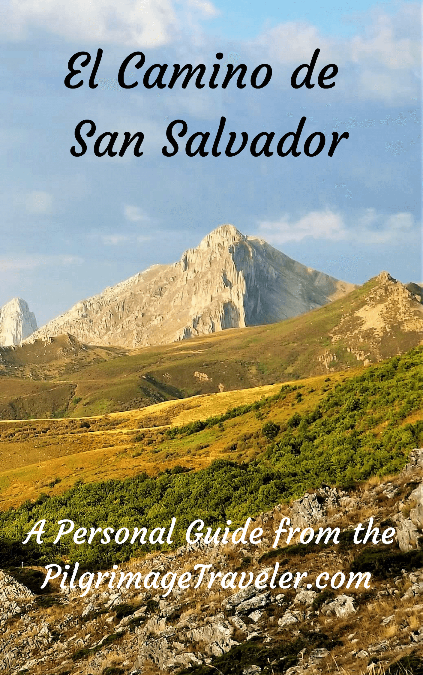
- ~ Camino de San Salvador (The Way of the Savior)
- Day Two, La Robla to Poladura de la Tercia
Jump to Camino de San Salvador Stages
Day Two on the Camino de San Salvador, La Robla to Poladura de la Tercia, 22.9 Kilometers (14.23 Miles)
By the end of day two on the Camino de San Salvador, the Way takes the pilgrimage traveler into the heart of the Cantabrian mountains, leaving civilization behind. The scenery and the difficulty that you have been waiting for, finally arrives!
"Whatever course you have chosen for yourself, it will not be a chore but an adventure if you bring to it a sense of the glory of striving. . . if your sights are set far above the merely secure and mediocre."~ David Sarnoff, Russian-Born American Entrepreneur
🙋♀️ Why Trust Us at the Pilgrimage Traveler?

We’re not a travel agency ~ we’re fellow pilgrims! (See About Us)
We've trekked Pilgrimage Routes Across Europe since 2014!
💬 We’ve:
- Gotten lost so you don’t have to. 😉
- Followed waymarks in the glowing sunlight, the pouring rain and by moonlight. ☀️🌧️🌙
- Slept in albergues, hostels & casa rurals. Ate and drank in cafés along the way. 🛌 😴
- Created comprehensive and downloadable GPS maps and eBook Guides, full of must-have information based on real pilgrimage travels. 🧭 🗺️
- Shared our complete journeys, step by step to help YOU plan your ultimate pilgrimage and walk with your own Heart and Soul. 💙✨
Every detail is from our own experiences. Just fellow pilgrims sharing the Way. We have added a touch of spirituality, heartfelt insights and practical guidance from the road ~ offering a genuine connection to the spirit of pilgrimage. Tap into the wisdom of seasoned pilgrims!
Ultreia and Safe Pilgrimage Travels, Caminante! 💫 💚 🤍
Maps and Stats of Day Two on the Camino de San Salvador
Here is our Google map of the day, created from our uploaded GPS tracks. I have included the services on the map, so you can plan your day. There are not a lot of services along this route, so planning is a must!
If you are stopping at the albergue in Buiza for the night, you must get your groceries in La Pola de Gordón. There is one small café in Buiza for the locals, noted on the map, however the hours it is open are erratic.
The same is true if you plan to make it all the way to the albergue Poladura de la Tercia. You will either need to get your groceries in La Pola de Gordón, or call ahead for a meal at the only place for food, the Posada de Embrujo, next to the albergue. This restaurant is within the Casa Rural, right next to the albergue. Be advised that the full-course dinner here costs 15 euros per person! Breakfast is an additional 3 euros, for a total of 18 euros per person, just for meals. Plus it is closed on Mondays.
Be prepared to eat from your pack, regardless. This is the Camino de San Salvador, and you never know! We had actually made a reservation for the night and for dinner, the day before, so they did know we were coming. If you want food at the restaurant in the Posada, a reservation is mandatory.
Important note: The grocery store in La Pola de Gordón is the last one all the way through to Campomanes, on day three or four, so you will have to carry at least two days worth of food if your plan is to cook in the Poladura de la Tercia and Pajares albergues!
The day essentially consists of one long climb to the high point called the Alto de las Las Forcadas de San Antón at 1463 meters in altitude. The climb is unnoticeable until the final three kilometers or so, when the steepness quickly increases as you climb up and out of Buiza. All told it is about a 500 meter climb (1600 feet). It is a day filled with glorious views that will reward your efforts!

👣 Camino de San Salvador EBook Guide
Walk smarter with our ad-free, beautifully formatted and downloadable Camino de San Salvador eBook Guide in PDF Format ~ perfect for offline use in the mountainous and remote areas along the Way. Includes daily stage details, alternative routes and stunning photos! Our eBook Guide is unique because we also entertain and immerse you with our story!
Don't carry a hard copy guide book to increase your pack weight. Use our digital guide on your mobile device on your next Camino instead! Now, you can walk with clarity and confidence in the Cantabrian mountains.
📲 Instant download. 💸 Money-back guarantee. 🔄 Free updates for 1 year.
👉 Click here for more information, or BUY NOW.
Jump to Camino de San Salvador Stages
Photo-Rich Travelogue for Day Two on the Camino de San Salvador
Our day started out just after dawn, on a cool and very crisp September morning, walking northward on the main road of La Robla, the Calle Mayor. There is a nice sidewalk here, so you will be safe as you walk along.
There will not be much stirring in the early hours, so hopefully you secured your breakfast the night before. We were able to prepare hard boiled eggs in our kitchenette in the Hostal Ordóñez de Celis the night before and have bread and coffee with it.
If you are staying in the Pensión Mundo and Bar Yosumar (+34 987 570 733), they serve breakfast for pilgrim's at 07:30 which is also extremely convenient.
Almost immediately after the albergue turnoff, walking along, pass the sign for entering the town of Alcedo de Alba. Pass by rows of buildings on the way north.
 Leaving La Robla in the Early Morning
When the homes end, the Camino quickly joins the Río Bernesga once again as it walks you northward. The railroad also follows the path of the river and accompanies you on the right, in an elevated road bed, through this section, below.
 Parallel Paths of the Bernesga River and the RailRoad
After about 900 meters, you come to this aqueduct, shown below, built in 1795 and more recently restored. There is a nice plaque describing how a famous 19th century Spaniard politician wrote about this particular place in his diary.

After only 300 meters more along the river, after about 1.2 kilometers, a historic bridge greets you, called the Puente de Alba. This bridge is part of a local castle. Here I am, posing in front of it.

After the bridge, the Calle Mayor takes a strong bend to the left (west) and away from the railroad tracks, continuing toward the next town of Puente de Alba.
 Walking Toward the Next Town of Puente de Alba
350 meters onward, the Calle Mayor joins the N-630 at the 118 kilometer marker, shown below. There is a fountain in town, if you need to fill your water bottles, not pictured.
 The Calle Mayor Joins the N-630
Next, walk through town on a nice parallel roadway just to the right of the N-630, see photo below.
 Leaving Puente de Alba on Parallel Roadway
After 350 short meters on the national highway, and after passing the sign telling you that you are leaving Puente de Alba, the Camino de San Salvador takes a right turn up a hill, and onto the Calle Real at this waymark.
For the first time on this Camino, we are now seeing real mountains!
 Right Turn Onto Calle Real at Waymark
Immediately the road takes a bend to the right and crosses over the same railroad that the Camino has been following for a time.
 Cross Railroad Tracks
This quiet tree-lined road takes you into the next village of Peredilla, after about 2.5 kilometers. There are no services here in this small town.
 Rural Road to Peredilla
Jump to Camino de San Salvador Stages
After about 3.25 kilometers into day two on the Camino San Salvador, after walking through Peredilla, the Camino leaves the pavement, taking a left hand turn, shown in the photo below.
 Left Turn Here Onto Path
This dirt tractor lane heads for a tunnel that passes under the N-630 and joins the railroad.
 Walk Under N-630 Toward the Railroad
The tractor lane follows the railroad tracks for 850 meters.
 Follow Railroad Tracks
After approximately 4.2 kilometers, there was a clearing ahead, with the sunlight brightly lighting up a steeple. It was the Ermita de Buen Suceso, and it was inviting in the brilliant morning light. There are picnic tables here, if you find yourself in need of a break when you arrive.
 Ermita de Buen Suceso
Little is known about the origin of the hermitage, which has been cited in documents as early as the tenth century. The existence of numerous Jacobean shells in its decoration, link the temple with the Camino de San Salvador. According to an inscription on the keystone, this particular building was first built in 1766.
The image of "Our Lady of Good Success" represents the Immaculate Virgin and has a large number of devotees throughout the region, who celebrate a great pilgrimage on the first Sunday of September, with a large local festival. It would be interesting to stumble upon if you land here at that time!

Jump to Camino de San Salvador Stages
It is at the Ermita where the Camino joins the N-630 once again, but only briefly. There is a restaurant here, across the street from the hermitage, if you are in need of a break.
There is another fountain, also, beside the Ermita, labeled as “potable,” right along the highway. Very shortly after the fountain, the Camino takes a left turn onto a side road, shown in the photo below, and towards the next town of Nocedo de Gordón.
 Left Turn Here Off the N-630
 Cross Railroad Tracks Again
You do not walk into Nocedo de Gordón but turn right at this building, below, after only 400 meters from the turn and after 4.85 kilometers.
 Right Turn Here in Nocedo de Gordón
Thus begins an off-pavement trail system for approximately two kilometers. You are continuing to follow the path of the River Bernesga, now on your right.
This river valley road is a nice and easy gravel road. Enjoy the flat walk while you can! They are few and far between on the San Salvador!
First cross under this overpass, shown below, then follow the road into shady woods running along the river.
 Off-Road Section Begins
Along this gravel road, Rich would stop frequently to pick and eat blackberries. He just loves them and while I do too, I found myself waiting constantly for him to eat and catch up!
 Rich Stops to Pick Blackberries
After about 6.5 kilometers, on day two of the Camino de San Salvador, a trail turns off the road up and to the left. Take this trail.

The trail walks over a footbridge that crosses a small arroyo.
 Cross Footbridge Over Arroyo
Our lovely trail ends just beyond the footbridge and comes out onto a paved road at a water treatment facility. The Camino turns right, then bends to the left and through this tunnel, shown below. A hill awaits you on the pavement on the other side of the tunnel.
 Join Paved Road at Tunnel
Here is my husband Rich, making his way up the hill by the electric substation. The railroad tracks are visible once again on your right with the River Bernesga just farther east. This is not the most beautiful section on day two on the the Camino San Salvador!
 Walk Up Hill By Electric Substation
At the top of the long, hot hill, a water fountain and a shady picnic grove awaits you, if you need a break at this point in your day after about 7.2 kilometers. It is only 1/2 kilometer onward to the next town of La Pola de Gordón from here.

Join the train tracks, and follow them on the parallel road into La Pola de Gordón.
 The Next Town of La Pola de Gordón Awaits Ahead
Follow the long bend in the road to the left and come to an information board when you enter town. Right after the information board, the Camino takes a right turn onto the Calle Villarín and takes you toward the heart of town.
First, follow the arrows to this walkway that leads you down the stairs to cross under the train tracks.
 Stairs Leading Down to Cross Under the Railroad Tracks in La Pola de Gordón
Coming up on the other side of the tracks, take a right turn and come immediately to a T-intersection. There is a bar and a fountain on the corner here. If you turn to the left, a few meters onward is the Hotel Restaurante Bicis & Vacas (+34 696 27 41 66), a few steps off the Camino.
Turn to the right to stay on the Camino and cross the Río Bernesga on a bridge after 8 kilometers.
 Cross the Bridge Over the Río Bernesga
As you continue straight after the bridge, there are two bars in the next block. We had a nice break at one of them.
At the end of the block the Camino turns left onto the Calle La Constitutión, and walks through the center of town, passing a supermarket and the town church and clock tower, pictured below.
Along this same street, but to the right are more possible accommodations in town, the Alojamiento Cuatro Estaciones and the Pensión 15 de Mayo (+34 619 44 40 00). And finally, the Hostal Fontañán is on your left, after about another 200 meters from the clock tower.

If you were to turn left, immediately after the bridge, there are two apartment accommodations in town, run by the Alojamientos Alfabernesga, the Aguasblancas and the La Plata. They are economical if you have a group of 2-5.
It is only 200 meters through town on the Calle La Constitutión before you see this side path, shown in the photo below, immediately after the Hostal Fontañán, where the Camino turns off the highway after about 8.5 kilometers into day two. Initially this roadway is just below the main highway, following the Camino de San Salvador sign.
 Leaving La Pola de Gordón on a Footpath
Jump to Camino de San Salvador Stages
The Camino continues on this gravel roadway.
 Gravel Roadway Skirts a Cliff
The path drops down to and walks along the Bernesga River, and takes the pilgrimage traveler under this bridge that contains the railroad tracks. On the other side, bend right, then left and a few meters later, come out onto the pavement, where you need to turn to the right. This is not well-marked. It is only about 1/2 kilometer on this path from the turnoff in town.
 Cross Under Railroad Tracks by the River
Join the LE-473, just downhill from a plaza where there is a gas station on the road, off Camino about 150 meters to your right. This gas station may be your last chance for a cup of coffee or a snack, before the end of the day in Poladura de la Tercia. There are no services after this!
After you turn left onto the LE-473, you head northwest toward the next hamlet of Beberino. There is not much of a shoulder along this highway, so exercise caution!
 Entering the Next Town of Beberino
After 1/2 kilometer, arrive in the center of Beberino, after 9.6 kilometers, with the church on your right and a pilgrim's fountain on your left, where you can replenish your water supply if needed.

After walking through Beberino, about 1.0 kilometer from the church along the LE-473 and after about 10.7 kilometers into day two on the Camino de San Salvador, come to this intersection below. Turn right here onto the CV-103-1 towards Buiza.
 Take Road to Right Towards Buiza
If you were to stay on the LE473, after 450 meters, off Camino, you would encounter the Pensión Restaurante Rabocan, (+34 640 70 66 21), yet another possible accommodation along the Way.
Snuggle up to the CV-103-1 as you will be on it for about 2.4 kilometers from this turn, along the CV-103-1, steadily climbing, more significantly now, until you reach Buiza. It is a quiet road without a lot of traffic, but there are big bends in the road as it climbs, so stay alert at all times, because there is no shoulder to walk upon.
After about 1.3 kilometers from the turn, pass by the historic Ermita Virgen del Valle.
 Pass the 16th Century Ermita Virgen del Valle
After about 12.7 kilometers into day two on the Camino San Salvador, come to a wolf on the ridge above! When you see him you know you are getting close to Buiza. He fooled us for a moment, then we realized he didn't move! Perhaps he is a protector of pilgrims?
 Buiza Town Guardian
After approximately 13.2 kilometers, come to the sign for the city limits of Buiza, at the foot of the mountain, shown below. The town is a really, really quiet place!
 Entering Buiza Town Limits
Barely 100 meters onward, at 13.3 kilometers, look for the brightly colored flags ahead, which marks the park and the Albergue de Peregrinos de Buiza, (+34 987 597 031 - call ahead to let them know you are coming, to get the keys)

The albergue is a lovely and clean place, with a nice kitchen for cooking. We stopped here in the shade for a bite of lunch from our pack.
Despite what information you may have about a café bar here in Buiza, the locals confirmed that there are no reliable hours when it is open. You may get lucky when you arrive, but it is best to come prepared if you are planning to stay the night.
The hospitalera immediately saw us sitting outside, and came from somewhere, inviting us inside. We explained we were only here for a break, but did make ourselves a cup of refreshing tea with water heated in the albergue and from our own tea bags in our pack. At less than 14 kilometers into our day two, we wanted to journey on farther on the Camino de San Salvador.
 Clean and Friendly Albergue with 12 Beds
Just beyond the albergue there is another information board and some ruins.
After about 350 meters from the albergue, come to this intersection with a water fountain, shown below. Fill your water bottles if you need water, as this will be your last opportunity before the final destination in Poladura de la Tercia, more than eight kilometers away. It is nothing but mountain trails and climbing from here to Poladura!
Turn left at the fountain and then an immediate right at the split rail fence and onto the Calle las Sierras.

Go only 50 meters and see the yellow arrows directing you to turn left again, shown in the photo below. At this turn, if you were to go straight, and by the town church, you would encounter a second possibility for accommodation, the Buiza Rural. Book ahead if you'd like to stay here instead of the albergue. It may have a 2-night minimum.
 Turn Left and Continue Ascending on Travesia
Jump to Camino de San Salvador Stages
Continue on this street as it bends and climbs steeply out of town, a gorgeous and quaint little place. At the last house in town, a Spanish homeowner saw Rich pulling a plum out of an untended tree. He asked him if he likes plums and invites us to his house to pick more. He wanted to fill our packs with plums! We took quite a bit, thanked the man and walked onward. Plums, ripe off the tree in Spain, are delicious and sweet!
While the Camino begins its climb in town, the real climb begins after you leave it. As you leave town, the road soon turns to gravel.
Just past the last buildings, this sheltered pilgrim’s rest stop is available, below. It would be a good respite from the hot sun if you need a break.
 Pilgrim's Sheltered Rest Stop
300 meters after the Camino becomes a dirt track, you make a right hand turn at this sign below and onto a gravel road.
 Right Turn Towards Oviedo
In yet another 300 meters, turn left from the gravel road and onto this path, below. The Camino de San Salvador, on day two starts to really climb steeply now.
 Rich Climbing Out of Buiza
As you continue your climb, many lovely views open up of Buiza in the valley below and behind you, just as tall mountains appear ahead before you.

This bright little pink flower, shown below, brightened our path, growing close to the ground because of the harshness of the weather. It is a bulb-grower whose flower comes first, in August, then the leaves come later. It is called Colchicum Montanum or August Crocus, in English and Merendera Montaña in Spanish. We saw these as well, all along the Camino Primitivo!
 Tiny August Crocus Brightens the Way

After about another one-and-a-quarter kilometers, come to this bend in the trail, where the rock formations become more dramatic. Welcome to the Forcadas de San Antón, the name of these rock formations. Take heart, because at this point you are less than one kilometer from the "alto" or the top!

 Yellow Arrows Painted on Rocks
 Negotiating Rocky Terrain on Old Roman Road
The Camino through here was once the old Roman road from Legio (León) to Llugo de Llanera (Asturias) according to a Spanish journalist Xurde Morán. You can most certainly see remnants of the road! It is a step back in time, for sure.

When the square summit top of Chanza Peak comes into view, you are almost there!

And suddenly, before you is the mojón (cairn) you have been waiting for! The Alto de las Forcadas de San Antón.

After 16.4 kilometers and at 1463 meters you finally reach the top. It is only 3.1 kilometers from the albergue in Buiza to the top of your climb on day two of the Camino de San Salvador. However, it will feel like you have come farther!
 Elle at the Alto de las Forcadas de San Antón
We spent some time on the summit, having a picnic and enjoying the view after the long day's effort.
Jump to Camino de San Salvador Stages
Here is a photo of the descent to the Valle de la Tercia on the other side. You still have about 6.5 kilometers to Poladura de la Tercia from here, about a 1.5 hour's walk.
Ignore the signpost to the right, to the top of a local peak, but head straight as the waymark directs.
 The Descent on the Other Side Towards the Tercia Valley
Notice the sign in the distance that you will pass that points to “Rodiezmo.” This is your direction for now, but this town is not your destination.
 A Bit of Shade Along the Way
About 600 meters beyond the summit top, come to the first water control station, shown in the photo below. Stay to the right.
 Straight On at the First Water Hut
Continue your descent into a luscious and cool pine forest.
 Descend Farther Through Pine Forest
Come to the top of a ridge where you can see the trail ahead as it traverses the mountain called the Barrancón, shown in the photo below.

From this lofty vantage point, you can also see your choice of the two routes ahead, the normal, high route, and the lower route on the gravel road, see photo below.
 The Two Routes From Above
Apparently, if the weather is horrible or too snowy on the high ridge, instead of turning left at the second water station, below, you can go straight and through the narrow gorge of the Arroyo Barranquillo, and to the Holy Queen's Cross (Cruz de Salve) marker. This option is only 650 meters longer, and rejoins the main route after only about two kilometers. See the above map for this alternative, in red, and its description, farther below.
After about 17.7 kilometers into day two on the Camino de San Salvador, about 650 meters beyond the first water control station, come to the second one. Leave the gravel road here and turn left onto a more rugged goat trail.

Pictured below is the large cairn and waymark that is hard to miss, that indicates the turn. If you happen to stay on the road, you will easily see the cairn just above you, to get you back onto the route. You shouldn't miss this prominent pile of rocks and can climb back up to it!
 The High, Rugged Road on the Barrancón
There are also two yellow signs here, not pictured, one points to the high road and says “Poladura 4.5 km” and the other points to the low road, and says, “Rodiezmo 2.7 km.” Again, if you choose the lower route you are not going to Rodiezmo, but will follow the San Salvador waymarks and join the Poladura route 2.0 kilometers later.
The scenery is quite dramatic through here, so I would take the high road, if at all possible! However, I found the lower route to be quite enjoyable and dramatic as well, but in a different way. See the lower route description and photos, farther below.
The next photos show the progression of the dramatic climb on the upper route. There are many goat tracks through here, but just stay on the most prominent one.

As you climb, you can see the lower route from above, for a surprisingly long time. Below is a photo that Rich took of me on the lower route, from the upper one.
 The Lower Route from the Upper Route
Here I am in the photo below, at the turning point that affords the pilgrimage traveler a dramatic view over the Barranquillo arroyo cut. At the bottom of this cut is the alternative, low route.
This point is after 18.3 kilometers into day two on the Camino de San Salvador, or 550 meters from the second water control station when you come to the top of this second lookout.

From this high point, there is a dramatic descent into the Valle de la Tercia. You still have not quite five kilometers left to go to Poladura de la Tercia.

But first, drop down into and cross this high meadow to the next viewpoint.
 Across a High Meadow
After about 18.6 kilometers, we stopped briefly at the top of this final high viewpoint. The yellow shell metal markers through here were created by a group of Camino de San Salvador enthusiasts, including Ender, who according to the Confraternity of St, James, welded and painted these signs himself! Thank-you Ender!
 Rich Stops for an Adjustment
As we continued our descent, with the Carba Mountain on our right shoulder, views of the Tercia valley open up, and the town of Rodiezmo is seen directly to the north, shown in the photo below. Rodiezmo is not your next destination.


As the trail descends steeply, it switchbacks and heads in a more northwestern direction. The views of the valley from here are quite dramatic! (That road you see below running left/right, is the lower route.)
 Trail Switchbacks Below, and Rodiezmo Seen in the Tercia Valley
You can see how our Camino trail stays high and hugs the hillside, skirting along it, instead of dropping right away into the valley toward Rodiezmo.
 Rich Walking Toward the Tercia Valley
Continue your descending traverse of the Barrancón mountain. You can see the gravel road below you, up ahead, in the photo below, where the lower route from the Barranquillo gorge will eventually join up with the high route.

The trail meets the gray gravel road, and takes a left turn, not quite 1/2 kilometer after the final high viewpoint, and after about 19.0 kilometers into day two on the Camino de San Salvador. Less than four kilometers left in the day!
This road is also where the winter route alternative joins the main route.
Jump to Camino de San Salvador Stages
The Lower Route for Inclement Weather
The lower route, as I stated before, is also quite stunning, as the gravel road goes through the Barranquillo gorge, following the arroyo’s cut. It starts out flat and easy, below, and gradually descends into the cut, for a loss of about 100 meters (330 feet) over the first 1.3 kilometers. This is definitely the easier route.
You can just make out Rich in the photo below, a small red dot, ascending above the bushes, on the official route above. Just like he could see me from above, I could see him climbing higher on the ridge above me.
 Easy Gravel Road
The gorge begins essentially at the water control station shown in the photo, next, after about 750 meters.
 The Gorge Beckons
As you round a bend, the cut becomes more dramatic.
 Gorge Walls Rising Up
And as you exit the gorge, below, about 350 meters later, the road meanders through the remaining rock formations.
 Meandering Road
At the final significant rock outcropping on this route, after about 1.25 kilometers, you will come to the Holy Queen’s Cross, the Cruz de Salve, below. You can see the cross at a distance, but it is much smaller than I expected.
 Cruz de Salve - Holy Queen's Cross
A few meters beyond the cross, and after rounding a bend around it, stay left at the Y-intersection. The lane now begins to gradually climb, turning left at this small drainage bridge, below, after about 1.3 kilometers on the lower route.
 Left Turn at Bridge
The alternative route continues to climb for the next 1/2 kilometer, gaining about 50 meters (160 feet), on a rough multi-track lane, until joining the brand-new gravel one, pictured below.
Once you reach this new gravel lane, the juncture of the two routes is just ahead. It is about 1.91 kilometers on this route, in total.
 Final Stretch on New Gravel Road
After the two routes converge, with just shy of four kilometers remaining, the final section is on an open and hot road towards Poladura de la Tercia, but the amazing views of the valley continue.
 Hot, Open Road to Poladura de la Tercia
And then finally, as the road continues to descend, the next hamlet of San Martín de la Tercia becomes distinguishable.

 The Road to San Martín de la Tercia
 Paddock Fence Line in the Valley
The dirt road takes you by a small cemetery on the outskirts of town, and then becomes paved as it enters the small village, after 21.4 kilometers total.
 Entering San Martín de la Tercia
After walking into the heart of town, first turning left at a large Camino mural on a building, and just before crossing over an arroyo, suddenly, you are directed to turn to the left again and walk up a hill on a dirt road, leaving town.
Something didn't feel right to me! I checked my compass and we were heading in a southwesterly direction! This couldn't be right!
I checked Google maps and indeed, we were heading in what appeared to me to be the wrong direction and away from Poladura. So, after walking about 250 meters on this dirt road, pictured below, we turned around and retraced our steps to town. This is where I turned off my GPS, thinking I was recording an incorrect route.
 Uphill Leaving San Martín de la Tercia
As it turned out, of course, this was the correct route, and if we had walked just another 300 meters or so, a full 1/2 kilometer later, the Camino turns to the right and continues from there.
However, since we were staying at the Posada de Embrujo, I just followed the paved road from San Martín to the Posada as Google maps directed me. This turns out to be the shorter route from San Martín, by a full 300 meters, just not the official Camino de San Salvador.
So intuitively, I was right, even though I was wrong in finding the actual Camino. You can see the actual Camino route on our Google map above, and the shorter route through town to the east, which shows up on the map as a loop. I guess I just did not want to walk up that hot, open dirt road!
Indeed the paved road from San Martín was flat and more shady, so I can't say I regretted taking this way! Here is the sign when you enter the town of about 10 houses!
 Entering Poladura de la Tercia
A few meters after entering town, we turned left to see the entrance gate of the Posada El Embrujo.

And immediately beside the Posada, on a terrace above, is the Albergue de Peregrinos de Poladura de la Tercia, (+34 639 354 776), with 14 places. You can take the stairs up the terrace, or walk up the road to it.
If you are coming in the official way, you will be walking down the hill, and see this view of the albergue in the photo below. There is a kitchen in the albergue, so if you brought your own food, you can cook it here. The Posada may have a small collection of artisan products or a few groceries for sale, as has been reported in the past, but I wouldn’t count on it! It’s safest to bring your own food if you are not getting dinner at the Posada.

I have no idea why the Camino planners chose to walk you up a hill out of San Martín, then down a hill through the fields to the albergue! It felt like it was only to avoid a few meters on the asphalt. So be it. Choose your own way!
If you choose the official route, after the left turn from San Martín, walk about ½ kilometer uphill until you see these two concrete buildings, below. Leave the road and turn right towards the buildings.
 Leave Road, Turn Right at Concrete Buildings
A few meters later, descend through the meadow and cross an arroyo on this footbridge.
 Drop Down, Cross Arroyo on Footbridge
Ascend from the arroyo on the other side, and come to a T-intersection with a gravel lane after about 130 meters. Turn right and enter into Poladura de la Tercia by the fountain and the albergue, shown above.
The Posada El Embrujo, which literally means the Inn of the Witches Spell, is a very comfortable bed and breakfast, a real treat in the mountains. However, you will pay a price. It is 52 euros/night for a single/double room, with breakfast for an additional 3 euros and 15 euros per person for dinner.
We did indeed have a lovely dinner, but if you are on a budget, don't choose this place! We were lazy and took the splurge.
If you stay at the Posada El Embrujo, you must make a reservation, including dinner if you want it. Your only option to stay here, and not have dinner, would be to bring in food that you can eat cold. There is no kitchen of any type that you can use. You could bring food and cook it in the albergue I suppose.
You can have dinner here if you stay in the albergue, but you must have a reservation before hand! And remember it is closed on Mondays!
There is a lovely fountain across the street from the albergue, and all eight or so pilgrims, chatted and soaked our feet and lower legs in the cold water! There was only one English-speaking pilgrim from Australia, who did not join us, because the conversation was essentially in Spanish! My brain hurt when we finally left.
Reflections on Day Two of our Camino de San Salvador
Because the day is "short" at 22.9 kilometers, I handled the altitude changes without difficulty. Coming from Colorado, and having many years of climbing under my belt, the 1600 foot elevation change, while I certainly felt it, my heart, lungs and legs were up to the challenge.
Many staging systems will have you stop at Buiza but at less than 14k, this just didn't make sense to us. However, as you will see in the next very difficult stage, it may be your best option. Read on, and choose wisely!
So far I was at my best game.
Salutation
May your own day two on the Camino de San Salvador fulfill your need for adventure and the glory of striving, as the opening quote suggests. To climb this stage to the Alto Forcadas, your sights will most certainly be set far above the merely secure and mediocre! Ultreia!
Camino de San Salvador Stages:


 on the high point called the Alto de Los Romeros (High Point of the Pilgrims).")


Please Consider Showing Your Support
Many readers contact me, Elle, to thank me for all the time and care that I have spent creating this informative website. If you have been truly blessed by my efforts, have not purchased an eBook, yet wish to contribute, I am exeedingly grateful. Thank you!
Search This Website:
The Pilgrimage Traveler Digital Guides
Our Guides Help You:
~ Know what to expect each day!
~ Locate historic sites along the Way!
~ Know where you are in your journey!
~ Discover a quote from the sages, for your daily reflection on the journey!
Click on a Photo Below to Get Your Copy.
A most popular alternative on the Central Route of the Camino Portugués!👇

The Portuguese Routes are rapidly gaining in popularity, especially the section from Lisbon! Plan to walk this one soon, before it is no longer a quiet experience!👇

Our most popular Portuguese guide! 👇

The most historic of the Portuguese Caminos ~ not to be missed!👇

The spiritual adventure of a lifetime, following in the footsteps of St. Teresa of Ávila!👇

The amazing mountain route alternative, the Camino Sanabrés, from Granja de Moreruela on the Vía de la Plata!👇

The most incredible mountain scenery on this camino from Leon to Oviedo!👇
The shortest of the caminos, but not easy!👇

The very first, Original Way from Oviedo to Santiago!👇

The pilgrimage to the "End of the World" ~ The perfect add-on to your camino!👇

All Banners, Amazon, Roamless and Booking.com links on this website are affiliate links. As an associate of these companies, the Pilgrimage Traveler website will earn from qualifying purchases when you click on these links. We have used and love all of our product recommendations and believe you will too! We sincerely thank you!
🙋♀️ Why Trust Us at the Pilgrimage Traveler?
We’re not a travel agency ~ we’re fellow pilgrims! (See About Us)
We've trekked Pilgrimage Routes Across Europe since 2014!
💬 We’ve:
- Gotten lost so you don’t have to. 😉
- Followed waymarks in the glowing sunlight, the pouring rain and by moonlight. ☀️🌧️🌙
- Slept in albergues, hostels & casa rurals. Ate and drank in cafés along the way. 🛌 😴
- Created comprehensive and downloadable GPS maps and eBook Guides, full of must-have information based on real pilgrimage travels. 🧭 🗺️
- Shared our complete journeys, step by step to help YOU plan your ultimate pilgrimage and walk with your own Heart and Soul. 💙✨
Every detail is from our own experiences. Just fellow pilgrims sharing the Way. We have added a touch of spirituality, heartfelt insights and practical guidance from the road ~ offering a genuine connection to the spirit of pilgrimage. Tap into the wisdom of seasoned pilgrims!
Ultreia and Safe Pilgrimage Travels, Caminante! 💫 💚 🤍
Follow Me on Pinterest:
Find the Pilgrimage Traveler on Facebook:
Shroud Yourself in Mystery, along the Via de Francesco!


Walk in the Footsteps of St. Francis, and Connect Deeply with the Saint and to Nature in the Marvelous Italian Countryside!
Need suggestions on what to pack for your next pilgrimage? Click Here or on the photo below!

Find the Best Hotel Deals Using This Tool!
Carbon Trekking Poles ~ My Favorites!

Carbon fiber construction (not aluminum) in a trekking pole makes them ultra lightweight. We like the Z-Pole style from Black Diamond so we can hide our poles in our pack from potential thieves before getting to our albergue! There are many to choose from! (See more of our gear recommendations! )
Gregory BackPack ~ My Favorite Brand


Do not forget your quick-dry microfiber towel!