- ~ Home
- Variante Espiritual Introduction
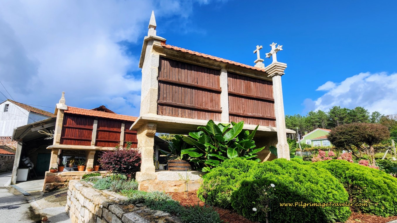
- Day Three on the Variante Espiritual from Barrantes to Vilanova de Arousa
Jump to Camino Portugués Stages
Day Three on the Variante Espiritual from Barrantes to Vilanova de Arousa
~ 17.5 Kilometers (10.9 Miles)
Day three on the Variante Espiritual from Barrantes to Vilanova de Arousa follows three rivers, in the first third and the last third of this day. First, the small Rego da Armenteira, continuing down from Armenteria, then the larger Río Umía from the Ribadumia region to Ponte Arnelas, and finally, the expansive Ría de Arousa estuary that feels and behaves more like the sea. I do love the river walks and this riverfront mileage totals almost nine full kilometers.
🙋♀️ Why Trust Us at the Pilgrimage Traveler?

We’re not a travel agency ~ we’re fellow pilgrims! (See About Us)
We've trekked Pilgrimage Routes Across Europe since 2014!
💬 We’ve:
- Gotten lost so you don’t have to. 😉
- Followed waymarks in the glowing sunlight, the pouring rain and by moonlight. ☀️🌧️🌙
- Slept in albergues, hostels & casa rurals. Ate and drank in cafés along the way. 🛌 😴
- Created comprehensive and downloadable GPS maps and eBook Guides, full of must-have information based on real pilgrimage travels. 🧭 🗺️
- Shared our complete journeys, step by step to help YOU plan your ultimate pilgrimage and walk with your own Heart and Soul. 💙✨
Every detail is from our own experiences. Just fellow pilgrims sharing the Way. We have added a touch of spirituality, heartfelt insights and practical guidance from the road ~ offering a genuine connection to the spirit of pilgrimage. Tap into the wisdom of seasoned pilgrims!
Ultreia and Safe Pilgrimage Travels, Caminante! 💫 💚 🤍
"What is the use trying to describe the flowing of a river at any one moment, and then at the next moment, and then at the next, and the next, and the next? You wear out. You say ‘There is a great river and it flows through this land, and we have named it History’.” ~ Ursula K. Le Guin, American writer (1929-2018)
Bodies of water are breathing, living places and as you move along them, tap into their energy for encouragement, fluidity and strength. Allow their vastness to conspire to create a space for reflection and introspection. You will not go away empty.
Maps and Stats, Variante Espiritual from Barrantes to Vilanova de Arousa
Here is our interactive Google map of the day's walk, with services and places of interest included.
The first 5.9 kilometers of the day's walk begins along the River Armenteira on flat paths through lush vineyards and fields, followed by the majority of the way along the River Umía. After leaving the river in Ponte Arnelas, the middle nine kilometers consist of several climbs, up and through both towns and wooded rural areas, mostly on paved roads. Finally, the last three kilometers are a flat again, joining the sea for a walk along the shoreline walkways until reaching the coastal town of Vilanova de Arousa, the culmination of the overland journey.
The biggest climb in the middle of the profile looks ominous compared to the flat land, but it is not strenuous, only gaining 80 meters (262 feet) over 1.5 kilometers.

👣 Camino Portugués eBook Guides


Enjoy all the valuable info from our web pages ~ offline, ad-free, and beautifully formatted, including our photos. Why carry a heavy guidebook when you can use a nimble digital version on your device?
Our guides are frequently updated and uniquely entertaining, as we share our own Camino story along the way.
📲 Instant download. 💸 Money-back guarantee. 🔄 Free updates for 1 year.
Buy only what you need ~ or grab all four for less than the price of three (>40% savings). Click here for more information or BUY NOW at only 17.85!
Jump to Camino Portugués Stages
Photo-Rich Travelogue, Variante Espiritual from Barrantes to Vilanova de Arousa
We started out the day, from the Hospedaje Rústico and Restaurante Os Castaños where we stayed, which is located to the right of this highway pictured below (see the end of day two for a photo), the VG-4.2, and crossed the street to the little brown tourist information hut shown. I shot this photo on the prior day, when the sun was fully shining.
 Cross EP-9305 by the Restaurante Os Castaños
However, the day of the actual walk, the sky was mixed, with definitely a chance for rain. Contending with rain is always part of a Galician pilgrimage, but this semi-rainy day was perfect. Just enough drizzle to keep you fresh and cool, but not enough to soak or depress you. Plus the photos have a moodier look, that increased the mystical quality of this day.
Take a left turn in front of the kiosk, and walk around it. After a few meters, you will immediately see the path pictured below, that continues along the Rego da Armenteira.
 Continue Rego da Armenteira Riverwalk
The riverwalk is a very pleasant walk, a perfect way to start a Camino day. Along this riverwalk the pilgrimage traveler will encounter many little boggy and tributary crossings on quaint wooden bridges. This is the first one for the day.
 Cross Wooden Footbridge, Variante Espiritual from Barrantes to Vilanova de Arousa
About 125 meters after starting the riverwalk, the Variante Espiritual crosses a small paved road, takes a hard left, then a bend to the right to follow the path of the VG-4.2 highway.
You can hear the highway before you see it, but eventually you will see it! The path follows closely to the VG-4.2 for about 1/2 kilometer.
 Path Runs Adjacent to the VG-4.2
When the path and the river turn eastward and away from the highway, it joins the Umía River and its riverwalk, known locally as the Ruta do Río Umía. This juncture is at approximately 1.2 kilometers total and it is at this picnic area shown next. The Umía River is much wider and deeper than the Armenteria river.
Make your way through the tunnel overpass of the EP-9506 to follow the path of the river.
 Join the Umía Riverwalk
Once in awhile Rich asks to take a photo of me, and I take the offer. While I did not plan this rainy day ensemble, I do find myself smiling when I look at this photo. I was definitely more pulled together with this look than usual!
 Rainy Day River Fashionista!
We moved quietly and contentedly for the next two kilometers along the Umía riverwalk, enjoying the serenity and lush beauty of the flowing river and the adjacent vineyards. The rain was on again, off again.


And then, I turned around to check on Rich and there was Rich's rainy day fashion statement. In all fairness, the rain was a bit heavier in this photo, and he had to put up his hood.
 Rich's Rainy Day Fashion Statement
We did see quite a few birds through this river area, including egrets, so keep your eyes open if you like to birdwatch. Their chirping and playfulness greatly added to the ambiance of the day!
As we were approaching the next town of Ribadumia, the terrain opened and we could see buildings ahead on the Variante Espiritual from Barrantes to Vilanova de Arousa.
 Clearing Ahead, Before Ribadumia
We could also see a very nice-looking restaurant across the river, the Náutico Coffee&Beer. Because we had such a substantial breakfast at the Os Castaños, we smiled as we walked by.
This section of the riverwalk ends with this walkway, seen below, at an intersection with the EP-9501. The Peto de Ánimas de Santa Baia de Ribadumia church can be seen ahead across from the highway, but it is off-Camino.
 Approaching the EP-9501
After walking up the ramp, the Camino turns left onto the highway, and crosses the river on this bridge. You can clearly see the path that continues on the other side of the river.
 Cross the Umía River on the EP-9501 Bridge
There are two bars if you need them, just beyond the bridge, including access to the one mentioned above.
After crossing the bridge, you will come to this information area and entry point for the riverwalk. It is clearly marked as the Ruta do Río Umía, where it continues along the west bank of the river. You are 3.2 kilometers into the day at this point.
 Ruta do Río Umía Continues along the West Bank of the River
Descend from the roadway level on a ramp, through more lush vineyards and back down to the river.
 Continue the Umía Riverwalk on the West Bank on the Variante Espiritual from Barrantes to Vilanova de Arousa
The Way looks similar to the prior section; full of lush greenery and vineyards.
 Peaceful Beauty Continues
As you move along this basically flat 2.5 kilometer section of riverwalk, it will change, with open areas and views of towns on your left shoulder, as well as lovely forested areas, like below. There are many places with benches to stop for a picnic along this section, if you desire.

After about 5.7 kilometers for the day's total, you will arrive at this picnic area, with an open, sandy area behind it.
 Near the EP-9501 at Picnic Area
Jump to Camino Portugués Stages
After passing the picnic area, stay on the path to the right of the EP-9501 where it intersects with the PO-300 running overhead on a bridge.
The Variante takes a right hand turn, joining the AP-300 but underneath it onto a catwalk under the Santa Marta bridge. You will continue onward as both the catwalk and the highway overhead cross the Umía River.
After crossing the river, the catwalk descends back to a path along the river towards the next town of Ponte Arnelas.
Walk along this path about another quarter kilometer, until coming to a T-intersection with a paved road, the Rúa Ponte Arnelas. This intersection is by the Roman bridge, the Ponte dos Padriños (Bridge of Two Godfathers), which is on your left. The Variante takes a left turn onto the paved road to cross this bridge. Thus ends the wonderful Río Umía riverwalk.
The bridge is not so beautiful in and of itself, but it is the legends surrounding how it got its name that make it so intriguing. Clicking on the link above explains the legend of the Godfathers. This folklore is unique indeed and makes the location come alive.
The town of Ponte Arnelas is also known for its Capela de Santa Marta. This darling little chapel is at the end of the Roman bridge, where it intersects with the main road through town and the Variante turns to the left.
There is a festival in Ponte Arnelas honoring Santa Marta every 19th of July. The cultural and spiritual heritage here in this town is strong and the medieval architecture surrounding the chapel is stunning. If you click on the chapel link you will see photos of how charming it is!
After the chapel, not quite 300 meters later you are through town arriving at a large roundabout with a Repsol gas station on the southwest corner, see photo below. The town has restaurants and the Hostal O Legado de Ramira (+346 16 57 68 73) if you wish to stay the night.
However, instead of taking the historic route through town, if you prefer to skip it, see our direct shortcut in red on the map above, where you can go straight on the EP-9501 instead of taking the catwalk under the PO-300 bridge. You will need to make your own decision here, whether or not to take the longer and interesting diversion into town.
The shortcut route arrives at the same roundabout shown below, after only 180 meters after joining the EP-9501. The official route arrives from the east or from the right side of the photo, at this roundabout. After coming to the roundabout, head straight towards the Repsol station if you are on the official route (or left if you came from the shortcut route as the photo depicts).
 Roundabout West of Ponte Arnelas
Continue a few meters until you come to a Y-intersection, staying to the left to join the EP-9703. A few more meters later, come to the 2nd roundabout, shown below. There are what looks like sculptures of a fife and drum group in the center.
At the roundabout, continue straight through on the EP-9703. The climbing for the day begins! One-half kilometer later, we encountered the Bar Casa Chicha. Yes, after almost half-way, a coffee break was in order, at about 7.58 kilometers total on the Espiritual Variante from Barrantes to Vilanova de Arousa.
 Bar Casa Chicha
Another few meters onward and there is a second bar, pictured next. As you can see this is a major highway, but there are sidewalks and shoulders to keep the pilgrimage traveler safe.
 Bar O Moucho Peregrino
400 meters after the Bar O Moucho Peregrino, a left turn is ahead, onto the Aldea Río Pequeño.
 Left Turn Onto Aldea Río Pequeño
Shortly after the turn, the quaint little Capela de San Pedro de Mouzos greets you. You may wish to pause here, get a stamp and reflect on your journey.

As you continue onward past the Capela de San Pedro de Mouzos, a few steps later the Variante Espiritual takes a left turn onto the side path pictured below, very briefly, barely a quarter of a kilometer. There is a historic washing fountain at the turn, not pictured.
 Brief Side Path
Return to the Aldea Río Pequeño at a cruceiro, and continue walking through the village of the same name, Río Pequeño.
 Walking Through Río Pequeño
Not quite 1/2 kilometer later, turn right onto the street pictured below, and toward the Cruceiro Río Pequeño, which you can see in the distance in the photo. It is in this area that you may notice that you are beginning the biggest climb for the day, after about 9.0 kilometers total on the Variante Espiritual from Barrantes to Vilanova de Arousa.
 Right Turn Towards Cruceiro Río Pequeño
After another 1/2 kilometer you will come to a T-intersection, where you will turn to the left in the town of A Igrexa. You will pass a restaurant on the left, after the turn and continue on this attractive street, lined with flowers and vineyards.
 Next Through A Igrexa
You can see the next turn to the right in the photo above. Not even 50 meters after the turn, the Way leads you to the right onto a dirt road and into the forest.
Now you are fully aware of the climb ahead. In this photo below, you are almost to the altitude top of the day, but not quite.

Continue on the dirt road after the forest opens up to more vineyards. Cross the EP-9005 highway and continue climbing on the casual farm road. When you reach the top shown in the photo below, it is the altitude top of the day at about 10.4 kilometers.
 Cross EP-9005, Altitude Top Ahead
Soon after reaching the top, the farm road joins this secondary paved road and walks past the Don Olegario Bodega. Indeed, we are deep in the heart of wine country!
 Don Olegario Wine Estate
Follow the high walls of the wine estate about 300 more meters, before a bend in the road leads you back into the cool pine and eucalyptus forest.
 Back into the Pine and Eucalyptus Forest
Is that the seacoast ahead? Yes it is, however there is still some distance left to attain it. The forest ends at the bridge over the VG-4.3 which you can see ahead in the photo below, and yields to rural villages.
 First Glimpses of the Seacoast
250 meters after the bridge, the way turns left at a crossroads by the bus stop in an area that Google only identifies as "Igrexa."
175 meters later, a right turn at the town cross, and between these two yellow homes is necessary, towards the next destination of the Igrexa de San Miguel.
 Right Turn Towards the Igrexa de San Miguel
The church which you pass in about another 200 meters, is on your left at a large parking lot with giant trees, but a few meters off the roadway. We did not take the detour to see it, but continued onward picking up the Rúa Igrexa on the other side and past this attractive home, one of many on this rural road.
 Along the Rúa Igrexa
600 meters after the church, come to this intersection with the PO-549, cross over straight forward and past the Plenoil station. There are several bars to the left at this intersection if you need a break.
 Cross the PO-549 at Gas Station, Variante Espiritual from Barrantes to Vilanova de Arousa
Also to the left at this intersection is the Alte Frankfurt (+34 986 55 41 65), an economical accommodation.
After the Plenoil gas station, you continue straight onwards through the rural areas, shown below, for another one-half kilometer.

Jump to Camino Portugués Stages
Come to the San Roque do Monte town sign. After entering this next village, a few meters later turn to the left by a large park with a children's playground, not pictured. You could have a nice break here also, if your preference is to eat from your pack.
Walk up the hill about 100 meters and come to the Plaza of the Capela de San Roque do Monte, shown below. The church itself is hidden in the trees on the left side of the photo. Take a right turn into the plaza, pass a donkey sculpture ahead, and continue straight, heading toward the church cross on the other side.
 Arrive at the Capela de San Roque do Monte Plaza
Pick up the narrow lane on the other side, shown below.
 Continue Onward Through San Roque do Monte
Walk about 1/4 kilometer on this narrow lane, coming to a crossroads. Turn to the left. The seacoast is a straight shot from here, about 3/4 kilometer away. You can feel it and smell it before you can see it.

And then, the seacoast welcomes you and wraps you into its embrace. Yes, this seacoast is full of flowing energy! Breathe in its strength for completing your pilgrimage journey.
At 14.5 kilometers total, arrive at the waterfront on the beach called the Praia do Castelete. Notice the bridge before you, that leads to the island of Arousa. The island is not your destination.

The beach pathway stays inland, but you can spend as much time as you want, meandering down by the water. You can't get lost, if you just follow the coastline for the next three kilometers into Vilanova de Arousa.
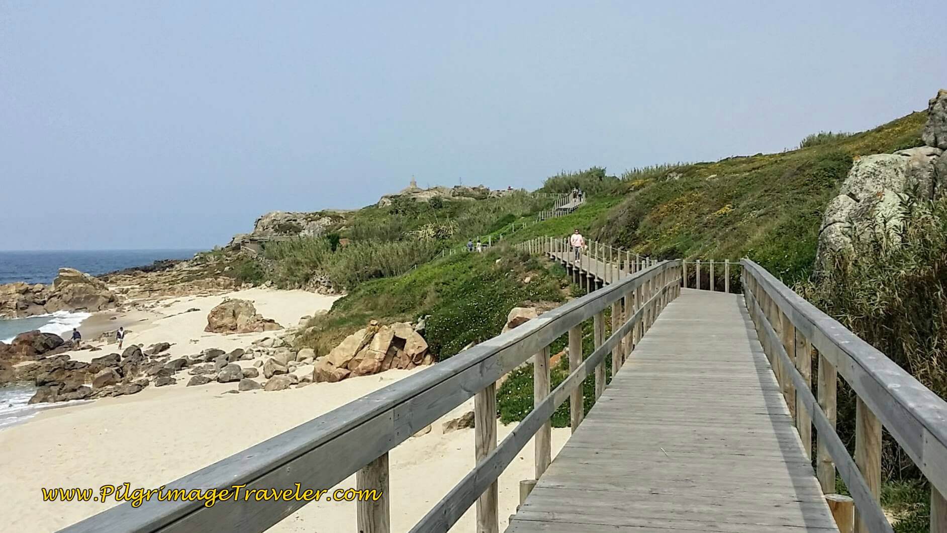
 Seacoast Path Next to the Beach
The beach path walks under the highway bridge that you have had in your sights on the Variante Espiritual from Barrantes to Vilanova de Arousa.
 Walk Under PO-307 Bridge
If you were to immediately turn right after the tunnel, you would find the Hotel Dinajan (+34 986 56 15 04), less than 100 meters away. It will be necessary to climb up a set of stairs to the road level to reach the first large building you see.
Just beyond the PO-307 tunnel, the Variante Espiritual walks through tall pines at the coast's edge. The sandy path makes for a fabulously soft walk as you head to the next beach, the Praia do Bote.
 Praia do Bote Ahead
Along the Praia do Bote, there are camping facilities in cabins at the Camping Santos (+34 986 55 50 55), restaurants and the Hotel Arco Iris (+34 986 55 54 44), and Hostal-Restaurante Luz de Luna (+34 986 55 50 54). It's easy to see why, as this is one of the nicer beaches in the Vilanova de Arousa area.

However, these beaches are rocky and full of green algae and seaweed, not so inviting to swim, but gorgeous enough to walk along on the coastal Camino path.
 Continue Past the Praia do Bote
The coastal path widens to a road, on your way to the next beach, the Praia do Pasaxe.
The gnarled pine trees along this coastal Camino are testament to the power of the wind and weather through here. Our day was stormy-looking, but fortunately, we were not rained upon until later that evening.
 Praia do Pasaxe Next, Around the Wall
If you wish, there is the Hotel Torres (+34 986 56 10 10), steps from this beach.

And next, the Praia del Terrón that continues along into the Praia Posta Da Secada.
 Praia del Terrón
By the time you reach the Praia del Terrón, and the final beach, the Posta da Secada, you can see the harbor of Vilanova de Arousa ahead. You are almost there!
 Approaching the Harbor at the Praia Posta da Secada
The pilgrimage traveler must walk to the end of the beach shown above, round the point with the harbor jetties, and find the path pictured below. The footbridge into town, called the Pasarela de O Terrón, is visible ahead.
 Round the Point, Footbridge Ahead, Variante Espiritual from Barrantes to Vilanova de Arousa
Cross the Pasarela de O Terrón into Vilanova de Arousa.

This long footbridge is an inviting walk into town. At the end of the footbridge, you can't miss the maritime station on your left, the "Mar de Santiago," shown in the photo below. A waymark also greets you, pointing you in the direction of the station, with 56 kilometers left to go to Santiago.
 Estación Maritima, Vilanova de Arousa
If you are heading to the municipal albergue, the way after the footbridge is to the right, to follow along the harbor, shown below. There are plenty of waymarks and arrows to guide you.

It is about 600 meters to the albergue, staying close to the waterfront, passing moored boats until the way turns to dirt, then passes a playground with colorful fences posts and a funky jungle gym.
Follow the river walkway until it ends at an avenue in front of a large sports complex. The Vilanova de Arousa name is on this gray building along with Multiusos (multi-use). The 25-bed municipal Albergue de Peregrinos de Vilanova de Arousa (+34 633 90 64 90) is within this building on the 2nd floor. This is a very basic facility with no kitchen.
After looking at the albergue, we opted to stay at the Albergue Turistico A Salazon (+34 606 36 55 61). This cozy, private albergue is steps from the marina and has a kitchen and several rooms with fewer beds than a large dormitory. Our room with only five beds had two bathrooms. Its proprietor is very helpful and friendly. We were lucky to get a bed here the same day, when the only other private albergue in town was full.
The second private Albergue A Corticela (+34 655 88 41 36), is farther north and also gets good recommendations by pilgrims.
Otherwise, there are many more hotels and apartments where you can stay. You may wish to check Booking.com for the current deals. The only truly economical one is the Hotel Bradomin.
Our albergue proprietor recommended the Bar Restaurante Faro Da Lúa, right along the riverfront. We had to hurry to get the lunch menu before it closed for siesta. This place has excellent food, and a very economically priced menú del día, including wine and dessert.
For our late evening meal, we created our own salad in the kitchen of the Salazon, after visiting the grocery store on the eastern side of town. The albergue was full and we enjoyed socializing with other pilgrims that evening.
Reflections, Variante Espiritual from Barrantes to Vilanova de Arousa
Walking along the riverfronts on the Variante Espiritual from Barrantes to Vilanova de Arousa is indeed a remarkable reprieve from civilization. While we saw very few pilgrims along the walk, the albergues were full. I suppose that was because we were doing non-traditional stages and started in Barrantes when everyone else had started in Armenteira.
The biggest surprise regarding the number of pilgrims on this route was to appear the next morning, on the boat on day four, for the final segment of this incredible pilgrimage.
Salutation
May your own Variante Espiritual from Barrantes to Vilanova de Arousa be your metaphysical terrestrial roadmap. May you be filled with the energy of the rivers and the history that surrounds you. Your pilgrimage is unique and as fulfilling as you allow it to be! Ultreia!
Camino Portugués Stages
Variante Espiritual

")

")
")

Lisbon to Porto


Senda Litoral or the Coastal Routes: Porto to Santiago


Skip to Central Route Below, for Final Days 22-25 to Santiago
Central Route: Porto to Santiago


Please Consider Showing Your Support
Many readers contact me, Elle, to thank me for all the time and care that I have spent creating this informative website. If you have been truly blessed by my efforts, have not purchased an eBook, yet wish to contribute, I am exeedingly grateful. Thank you!
Search This Website:
The Pilgrimage Traveler Digital Guides
Our Guides Help You:
~ Know what to expect each day!
~ Locate historic sites along the Way!
~ Know where you are in your journey!
~ Discover a quote from the sages, for your daily reflection on the journey!
Click on a Photo Below to Get Your Copy.
A most popular alternative on the Central Route of the Camino Portugués!👇
The Portuguese Routes are rapidly gaining in popularity, especially the section from Lisbon! Plan to walk this one soon, before it is no longer a quiet experience!👇
Our most popular Portuguese guide! 👇
The most historic of the Portuguese Caminos ~ not to be missed!👇
The spiritual adventure of a lifetime, following in the footsteps of St. Teresa of Ávila!👇

The amazing mountain route alternative, the Camino Sanabrés, from Granja de Moreruela on the Vía de la Plata!👇

The most incredible mountain scenery on this camino from Leon to Oviedo!👇

The shortest of the caminos, but not easy!👇

The very first, Original Way from Oviedo to Santiago!👇

The pilgrimage to the "End of the World" ~ The perfect add-on to your camino!👇

All Banners, Amazon, Roamless and Booking.com links on this website are affiliate links. As an associate of these companies, the Pilgrimage Traveler website will earn from qualifying purchases when you click on these links. We have used and love all of our product recommendations and believe you will too! We sincerely thank you!

🙋♀️ Why Trust Us at the Pilgrimage Traveler?
We’re not a travel agency ~ we’re fellow pilgrims! (See About Us)
We've trekked Pilgrimage Routes Across Europe since 2014!
💬 We’ve:
- Gotten lost so you don’t have to. 😉
- Followed waymarks in the glowing sunlight, the pouring rain and by moonlight. ☀️🌧️🌙
- Slept in albergues, hostels & casa rurals. Ate and drank in cafés along the way. 🛌 😴
- Created comprehensive and downloadable GPS maps and eBook Guides, full of must-have information based on real pilgrimage travels. 🧭 🗺️
- Shared our complete journeys, step by step to help YOU plan your ultimate pilgrimage and walk with your own Heart and Soul. 💙✨
Every detail is from our own experiences. Just fellow pilgrims sharing the Way. We have added a touch of spirituality, heartfelt insights and practical guidance from the road ~ offering a genuine connection to the spirit of pilgrimage. Tap into the wisdom of seasoned pilgrims!
Ultreia and Safe Pilgrimage Travels, Caminante! 💫 💚 🤍
Follow Me on Pinterest:
Find the Pilgrimage Traveler on Facebook:
Shroud Yourself in Mystery, along the Via de Francesco!


Walk in the Footsteps of St. Francis, and Connect Deeply with the Saint and to Nature in the Marvelous Italian Countryside!
Need suggestions on what to pack for your next pilgrimage? Click Here or on the photo below!

Carbon Trekking Poles ~ My Favorites!

Carbon fiber construction (not aluminum) in a trekking pole makes them ultra lightweight. We like the Z-Pole style from Black Diamond so we can hide our poles in our pack from potential thieves before getting to our albergue! There are many to choose from! (See more of our gear recommendations! )
Gregory BackPack ~ My Favorite Brand


Do not forget your quick-dry microfiber towel!