- ~ Home
- The Way of St. Francis
- The Way of St. Francis, Trevi to Poreta, Day Thirteen
Jump to Way of St. Francis Stages
Day Thirteen on the
Way of St. Francis ~
Trevi to Poreta, 12 Kilometers (7.43 Miles)
Disclosure: the PilgrimageTraveler.com is an associate of Booking.com, Roamless, and Amazon. As associates of these merchants, we earn from qualifying purchases from our links.
The Way of St. Francis from Trevi to Poreta, on day thirteen is a short, sweet stage, with significant climbing once again. Many pilgrims, including ourselves, extend this stage, combining days thirteen and fourteen, to finish in Spoleto.
"Where there is peace and meditation, there is neither anxiety nor doubt." ~ St. Francis of Assisi, (popular devotional paraphrase)
🙋♀️ Why Trust Us at the Pilgrimage Traveler?
We’re not a travel agency ~ we’re fellow pilgrims! (See About Us)
We've trekked Pilgrimage Routes Across Europe since 2014!
💬 We’ve:
- Gotten lost so you don’t have to. 😉
- Followed waymarks in the glowing sunlight, the pouring rain and by moonlight. ☀️🌧️🌙
- Slept in albergues, hostels & casa rurals. Ate and drank in cafés along the way. 🛌 😴
- Created comprehensive and downloadable GPS maps and eBook Guides, full of must-have information based on real pilgrimage travels. 🧭 🗺️
- Shared our complete journeys, step by step to help YOU plan your ultimate pilgrimage and walk with your own Heart and Soul. 💙✨
Every detail is from our own experiences. Just fellow pilgrims sharing the Way. We have added a touch of spirituality, heartfelt insights and practical guidance from the road ~ offering a genuine connection to the spirit of pilgrimage. Tap into the wisdom of seasoned pilgrims!
Ultreia and Safe Pilgrimage Travels, Caminante! 💫 💚 🤍
I love the above quote! Isn't this what a pilgrimage is all about: A reprieve from the "real" world for a while? Finding Peace while you are walking, even if only temporary?
Maps and Stats, The Way of St. Francis, Trevi to Poreta
Here is our Google interactive map for this day's pilgrimage on the Way of St. Francis from Trevi to Poreta. There are no services on this stage, except for a high-priced restaurant in Campello Alto after 9.0 kilometers, so come prepared with a well-stocked pack.
There is the hermitage, the Eremo Francescano delle Allodole, after about 4.8 kilometers, which receives high accolades from fellow pilgrims. The word "allodole" means lark, and indeed the sisters sing to pilgrims! Plan to spend some time here, if you are interested or able.
As you can see from the elevation profile for the day, it is full of many ups and downs, with a total gain in elevation of 560 meters (1837 feet). And once again the elevation gain is equal to the elevation loss! A typical stage for the Way of St. Francis. This stage will feel strenuous, despite its brevity.
If you take the easier, orange alternative from Trevi all the way to Spoleto, pictured next is that elevation profile.
The profile begins in Bovara, 1.5 kilometers into the stage from Trevi, which is almost all downhill. Add 1.5 to the 18.6 kilometers in the profile for a total of 20.1 kilometers, a very doable stage. There are several accommodations along this route, so you could even divide the orange route into shorter stages if you wish.
There is one very gradual and long climb gaining 160 meters (525 feet), the steepest section being at the end of the stage and into Spoleto.
The total elevation gain for this orange route is 339 meters (1112 feet) which is nothing compared to the total elevation gain on the mountain route.
 Elevation Profile, Way of St. Francis, Trevi to Spoleto, Day Thirteen and Fourteen, via the Orange Alternative Route
This valley route is much shorter than combining stage thirteen and fourteen on the mountain route. On the mountain route, it is a combined total of 27 kilometers and much more total elevation gain of 1221 meters (4006 feet)! For your convenience, I have added the profile of day fourteen, below for you to compare!
You can easily see the extra effort required to walk both days thirteen and fourteen. Make your own choice wisely! I can say that I was exhausted after walking the combined stages. The final climb at the end of the day into Spoleto felt brutal.
We chose to do the two stages in one day because we wanted to take an extra day to do sight-seeing in the amazing town of Spoleto the next day. There is so much to see in Spoleto that this worked out well for us!
Photo-Rich Travelogue, The Way of St. Francis, Trevi to Poreta
To begin your day's pilgrimage, from the central square in Trevi, the Piazza Giuseppe Garibaldi, look for the street on the south side by a high, beige wall, called the Via delle Fonti, or Fountain Street.
As noted on day twelve, you can see the yellow/blue sticker on the pole, and a Tau symbol painted on the wall by the street sign. Here is a photo, in bright daylight the day before.
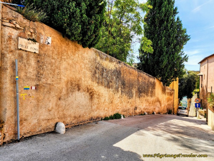 The Onward Way of St. Francis Along the Via delle Fonti
As you can see in the photo below, you will soon follow the city Roman walls on your right as well.
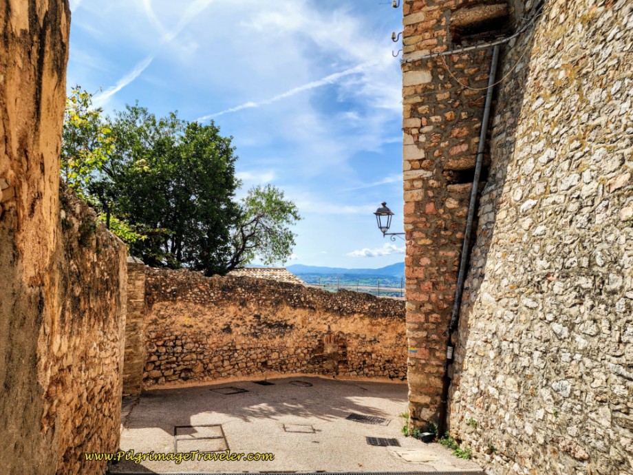
Continue down this steep, double, high-walled street until you come to the southern Roman gate of Trevi, the Porta del Cieco, or the "Dead-end Gate." For a photo of this gate, click on this link for my article on Trevi, and scroll to the last photo on the page.
At the gate, the Way turns to the left and continues down the steep hill along the Via dell'Angelo Custode, shown below.
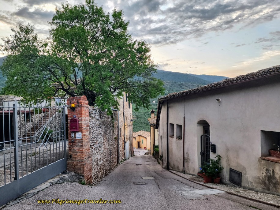 The Way Descends on the Via dell'Angelo Custode
After less than 100 meters, the Way joins the Via Antonino Fantosati, by continuing straight onwards. You can see this intersection, in the photo above, where the stop sign is at the end of the street.
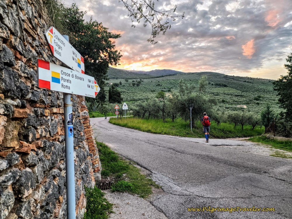
Only a few meters after joining the Via Antonino Fantosati, look for a Y-intersection, where you will stay to the right, descending farther, now along a narrow, paved lane.
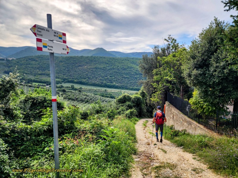
This intersection is easy to miss! The sign says Croce di Bovara, the next town is 1.2 kilometers away, Poreta is 11 and Roma is 215!
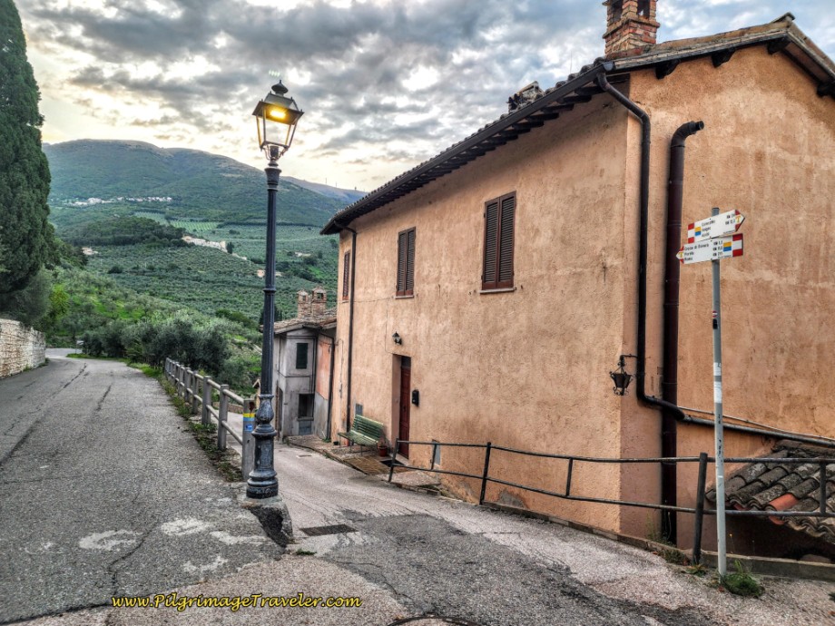 Right Turn at Sign-posted Y-Intersection
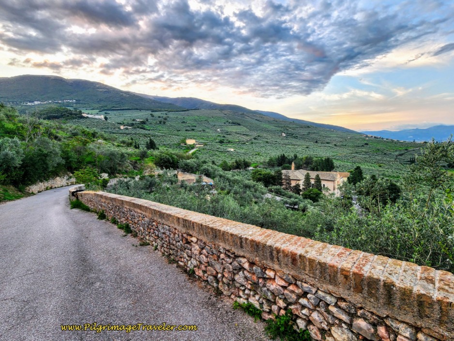
As you leave the city, descending on the quiet paved lane with a low wall, the Chiesa di Madonna delle Lacrime, the Madonna of Tears Church is visible in the valley below. The scene was so beautiful in the dawning light!
Unfortunately we did not take the opportunity to visit the church. (We had a long day ahead of us, combining day thirteen and fourteen.) The Madonna of Tears Church was built in 1487 to commemorate the miraculous event of the Madonna shedding blood-red tears, with frescoes by Spagna and Perugino, newly renovated in 2021-2023.
After walking several minutes, and after a total of about 1/2 kilometer, come to a crossroads, where the Way continues straight onward, now onto a nice, gravel lane see next photo.
However, if you wish to visit the Madonna of Tears Church, turn right at this intersection instead.
 Cross Over to Gravel Road
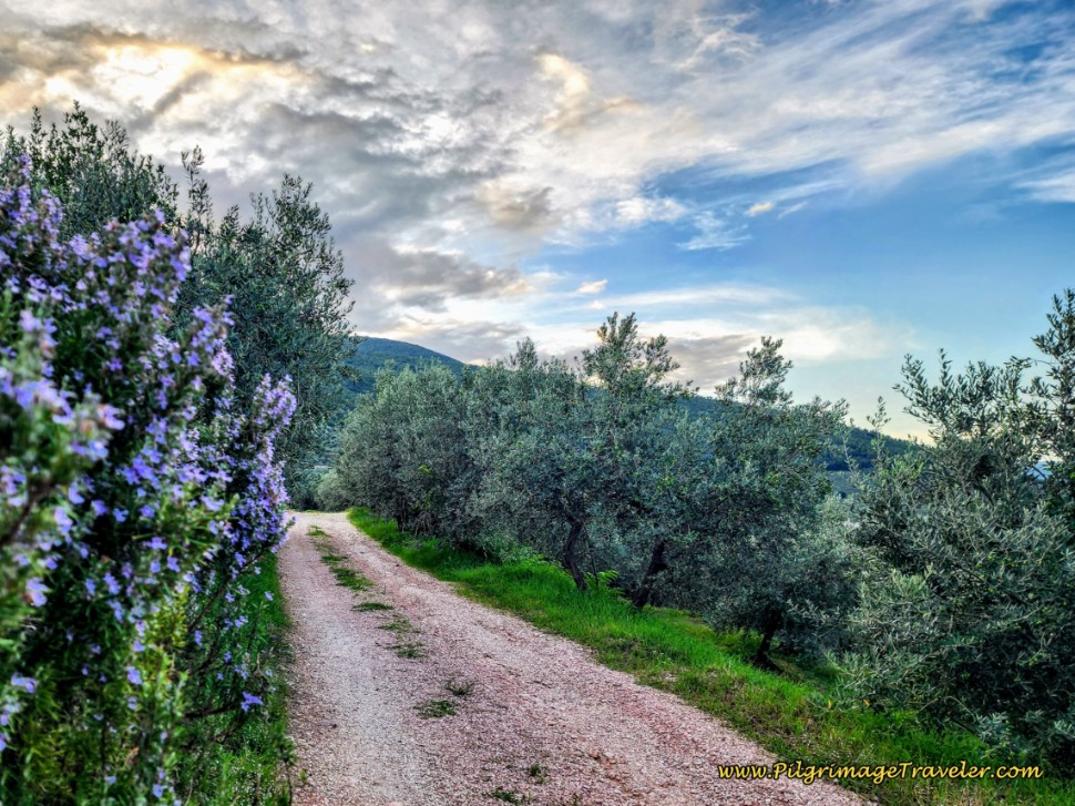
On the gravel road, you will pass a high wall on your right, as you walk through lovely olive groves. After a few more minutes of walking, you will join another, wider gravel road.
As you walk along this gravel road, the descent from Trevi ends, and you can see the beginning of the first long climb of the day, just ahead. You are now beginning this climb.
After 1.3 kilometers total into day thirteen, the wider gravel road ends, and the Way joins the paved SP425, turning to the right at the T-intersection.
As you walk along the SP425 for the next one-quarter kilometer, notice expansive views of Trevi, on your right shoulder.
Next, pass the entrance sign for the town of Bovara. After the sign, come to the top of a small hill, where there is a church, Chiesa di Croce di Bovara.
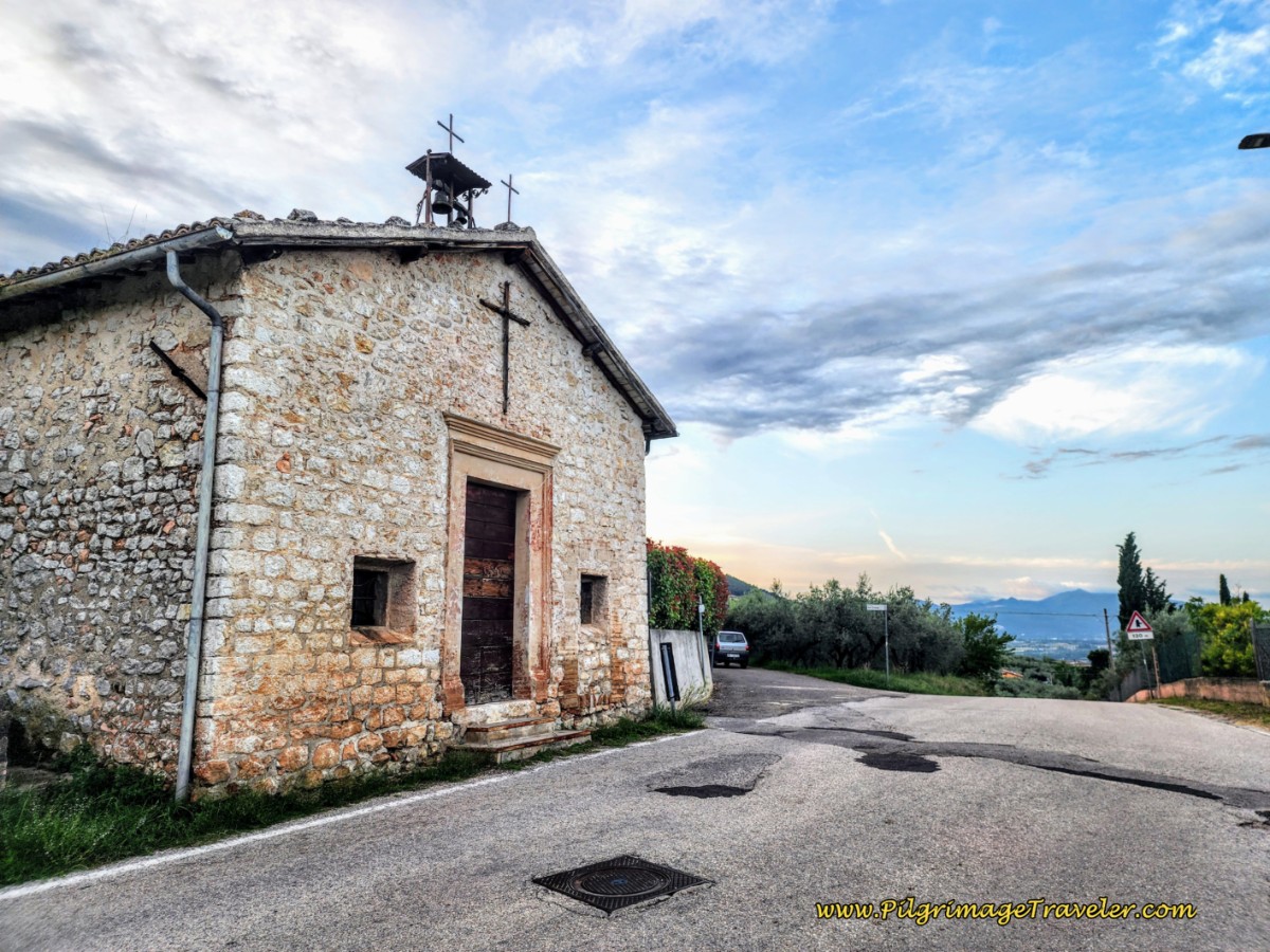 Chiesa di Croce di Bovara
You will turn left immediately after the town church, onto the narrow, paved Località La Croce. Stay straight here and continue on the SP425 if you plan to take the shorter, orange alternative into Spoleto.
Continue to climb on this road, about 400 meters and arrive at a crossroads.
Continue straight onwards, continuing the climb towards the next cluster of homes called the Località Alvanischio which you can easily see in the distance on the hill ahead.
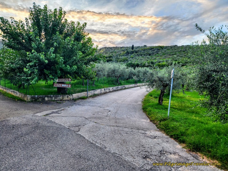 Straight Onwards at Crossroads
About 1/4 kilometer later, we arrived in the cluster of buildings. There are two accommodations here, the Il Tramonto Holidays and the Casa Venturini, if you wish to call it a day.
After arriving at the Località Alvanischio and after about 2.25 kilometers into the day, take the first turn to the left and climb steeply for a few meters, passing the organic olive oil farm, when the road takes a hard bend to the right. Pass the final buildings, and the road turns to gravel. You are still climbing!
You are still climbing as you walk along for the next 1/4 kilometer. The gravel road levels out and for a short while you will be walking on a shelf-road, high above the plain. The Eremo Francescano delle Allodole is about 2.1 kilometers from here.
This is a lovely walk, where you get views of the valley below as you go along.
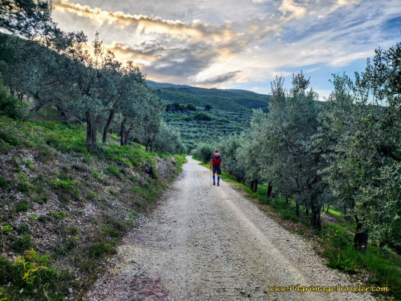 Shelf Road Towards the Eremo
After about 1/4 kilometer more, the gravel road steepens and climbs up to the next hamlet, the Località I Camponi, after about 3.0 kilometers from Trevi. In this cluster of buildings, there is a potable water fountain, see photo below.
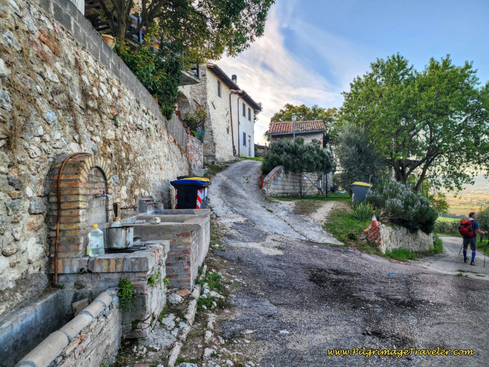 Località I Camponi, Potable Water Fountain
After leaving the Località I Camponi, continue on the roughly paved road as it now descends. A ruined building of some sort was visible above us.
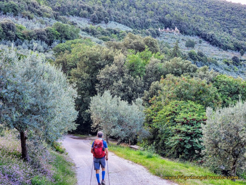 Ruined Buildings Above, Way of St. Francis, Trevi to Poreta
The road comes to a hairpin turn to the right and on the far side, a dirt tractor lane leaves it to the left. The Way continues by leaving the pavement and taking the gravel road. The Via di Francesco sign states that the Eremo is 1.4 kilometers away. Poreta is 7.9.
After only a few minutes of walking, arrive in the next cluster of buildings called the Località Falcione. Walk by some buildings and ahead to where the tractor lane ends at a gate, see photo below. If you look to the right, you will see a faint path that leads to the right, through the farm buildings. Take this path.
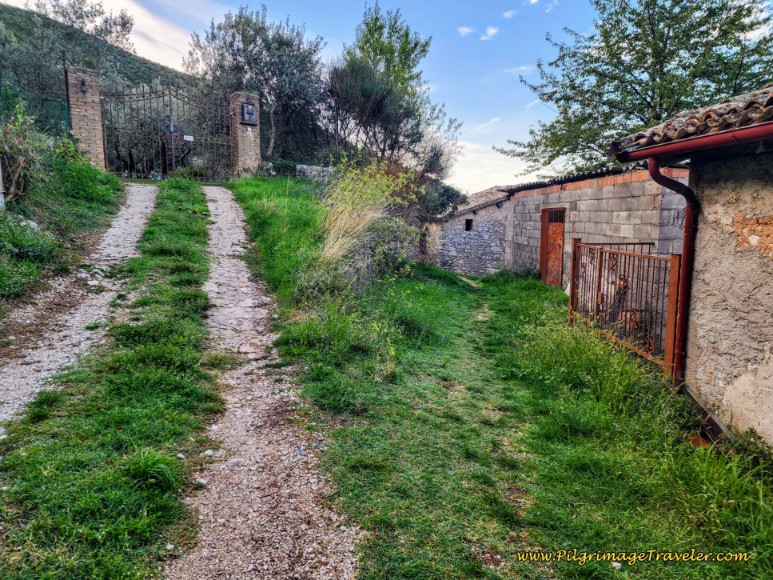 Right Turn Onto Path Through Buildings
Follow the path until the buildings end and bring you to an intersection with another tractor lane. Stay to the right and only a few meters later, come to a T-intersection with an improved gravel road. This time turn left.
You are now beginning the final, steep climb of 100 meters (330 feet) to the Eremo, which is 1.1 kilometers away. During this climb through the countryside, the road is paved with concrete at times, which I felt was for erosion prevention.
About 600 meters later, you will come to a Y-intersection, where the climb essentially ends. Take the lower lane to the right, below photo.
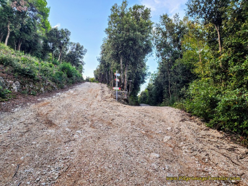 First Climb of the day Ends at Y-Intersection
The Way now descends along this gravel lane to the Eremo Francescano delle Allodole 1/2 kilometer away.
Having started our day at sunrise, when we arrived at the Eremo Francescano delle Allodole, pictured next, after 4.8 kilometers. It was 8:15 in the morning and it was closed. There was a sign on the gate stating to ring the bell. When we did, the sister who came to the gate stated that the nuns were in prayer and "perhaps" in 45 minutes they would be able to give us a tour.
Hmm, we had over 22 kilometers to Spoleto and didn't have 45 minutes to wait, plus another hour or so for a tour. What a pity! While I was very disappointed, because this Eremo gets so many accolades from pilgrims, I had to be realistic.
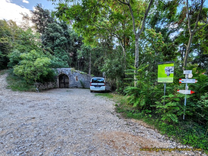 Entrance Gate to the Eremo Francescano delle Allodole
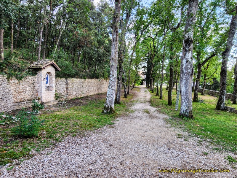
We peered inside the gate, to the walkway to the Eremo. You cannot see much from outside the walls.
Reluctantly, we turned to the right, just before the gate to continue onward along the Via di Francesco. The signs now point the way towards the next town of Campello Alto which is 4.1 kilometers and Poreta is 6.4.
Initially, the trail follows the wall of the Eremo. It is rocky, loose and steep in the descent to come so be careful of your footing.
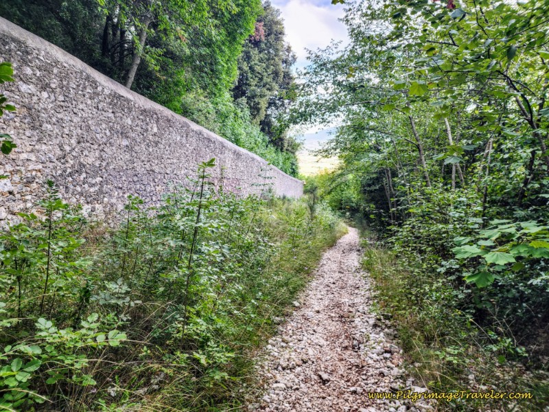 Trail Follows the Eremo Walls
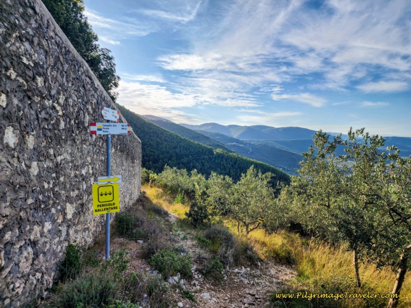
Around the wall on the southern side of the Eremo, the Way turns right, and continues its steep descent, now through olive groves. The yellow sign says "Danger" and warns you to slow down! It is seriously steep and loose so heed the warning!
The trail switchbacks steeply down, following the terraces of the olive trees. I tried to stop and look up, despite the need to look at my footing, because I wanted to take in the fabulous views! When I did, especially to take these photos, it would bring me into the present moment, for the Peace that settled me!
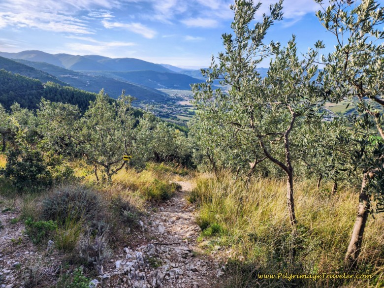 Rocky, Loose & Steep Trail, Following Terraces of the Olive Trees
You may notice that onward from the Eremo, you will see supplementary yellow arrows to help guide you. If you look in the photo above, you can just see a yellow arrow in the olive tree to the left of the path. These arrows do indeed indicate the correct route.
After not quite one kilometer on the steep descent, and after about 5.72 kilometers into the day, you will come to the bottom of the first hill climb, at this second danger sign, pictured below.
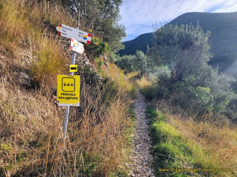 Turn Left Onto a Path at the Bottom of the First Climb
And of course, also at this point, the Way now begins its second steep climb of the stage on the Way of St. Francis from Trevi to Poreta.
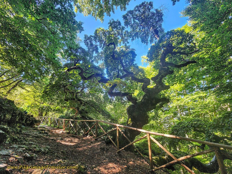
Within about 1/3 kilometer of climbing and entering a thicker forest, you drop down a bit into a gorge. At the gorge there is a split-rail fence, shown below, that takes a strong bend to the right to cross the gorge. I shot this photo on the far side, to try to get a perspective of how deep this gorge is but the photo does not do a good job of depicting the depth!
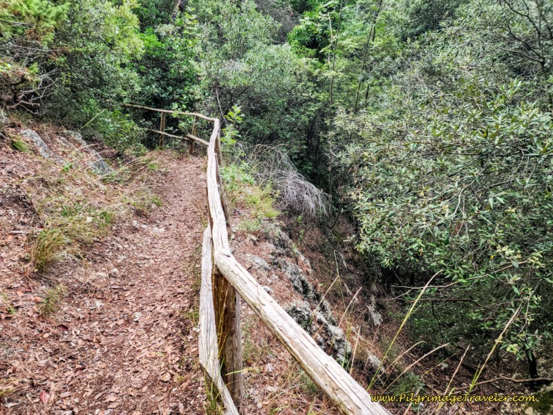 Cross Deep Gorge
After passing the gorge, the Way climbs out steeply on the other side. A few minutes after the gorge you will arrive at a T-intersection where the Way turns to the right onto a nice two-track gravel lane. The sign says Campello Alto is 2.7 kilometers away and Poreta is 5.o.
The way forward is through more olive groves on this pleasant tractor lane.
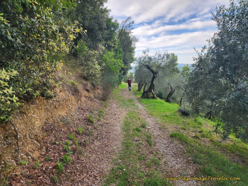 Tractor Lane Through Olive Groves Towards Campello Alto
A quick 200 meters later, join a wider, improved gravel road at a T-intersection and turn to the left, continuing the climb!
And while I have not pictured it, make sure you look back here, as you can really see the walls of the monastery behind you, showing the hill it resides upon and the steep way you have just come!
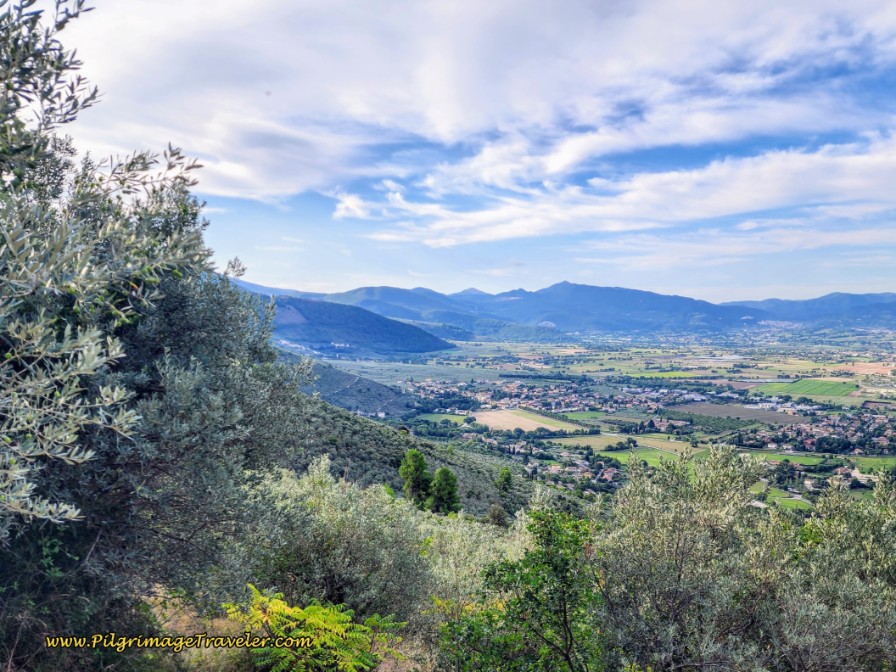
Through this next section of about one kilometer, it is more open and exposed, as you complete the second steep climb. At least the gravel is small on this road and it is easier walking, without having to keep an eye on your footing!
Just look at one of the many views that we saw as we walked along! I deeply breathed it in!
Finally, after a total of about 7.4 kilometers, the Way turns to the right onto another improved gravel road, and you will reach the top of the second ascent.
Campello Alto is getting very close at 1.5 kilometers as you can see in the photo below. Poreta is 3.8 kilometers.
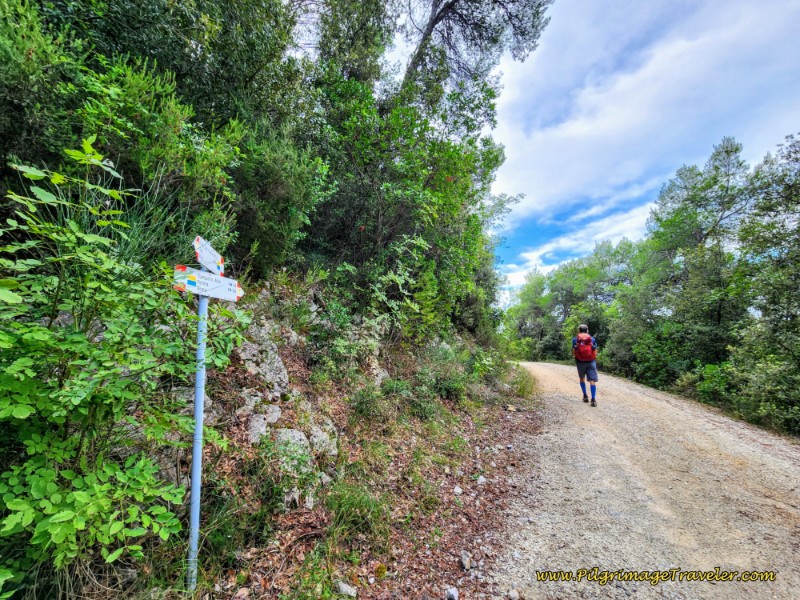 Right Turn At Top of the Second Climb of the Day
As you walk along on this high and flatter road you will get wonderful views of the buildings and ridges above.
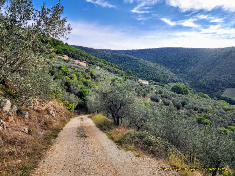 Gravel Lane Towards Campello Alto
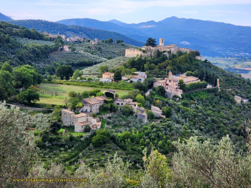
You will also see wonderful views of the town of Campello Alto from above. It is a small town with a castle on the top!
Eventually the Way joins the paved Via del Poggio at a T-intersection, shown below, by turning right and starting the descent into town. Civilization is a stone's throw away.
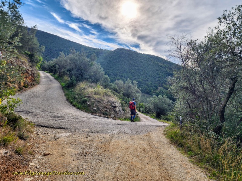 Join the Paved Via del Poggio
The Way descends steeply on the paved road for the next kilometer, through some thick woods, and drops down on switchbacks to cross another gorge. On the other side of the gorge, climb up and out on more switchbacks.
Just before entering town, pass the Agriturismo Il Palazzetto, and come to a T-intersection after 9.0 kilometers into the day. This is the bottom of the descent, just below the town. You can see Campello Alto ahead, and the castle walls loom above you.
The turn is to the left, and the signage now points to the next town of Lenano, just one-half kilometer away.
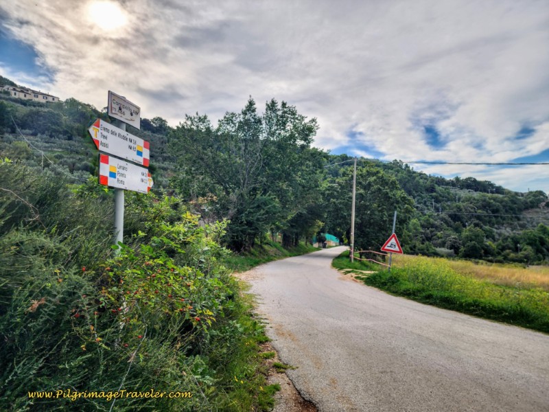 Left Turn, Bottom of the 2nd Descent
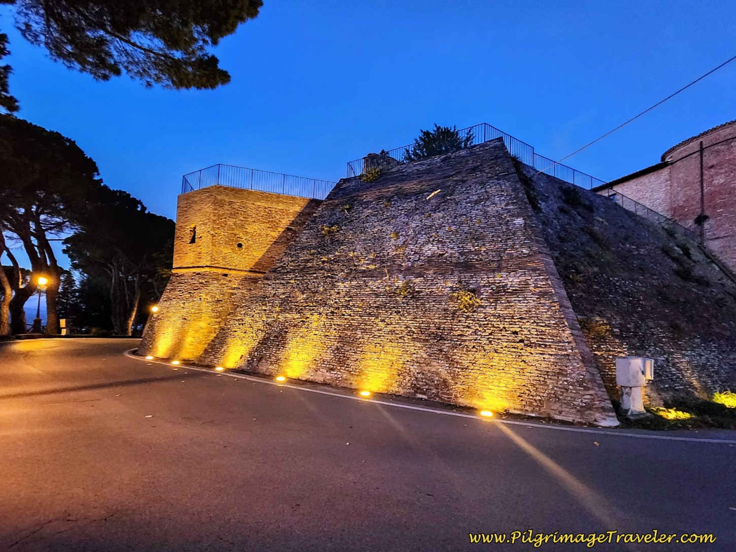
We chose not to go into town, since there is only an expensive dinner restaurant and we did not need a break. We admired the Castello di Campello Alto from the road below, as we passed below the ramparts.
There are several touristy accommodations in Campello Alto if you choose to stay here, but most are beyond the range of a pilgrimage traveler. In addition to the Agriturismo Il Palazzetto we just passed, there is the Relais Borgo Campello on the north side of town and the luxurious Il Castello di Campello within the castle walls itself.
From the left turn at the foot of Campello Alto, it is a short, climb up to the next town of Lenano. The climb is on pavement and it is the 3rd and final climb you see on this stage. Stay high and to the left at a Y-intersection along the route.
When you have almost reached the top of the climb on the pavement, come to a T-intersection and turn to the right onto the Via delle Torrette to enter the town of Lenano. A few steps later you will see the very attractive B&B Le Torrette on your right.
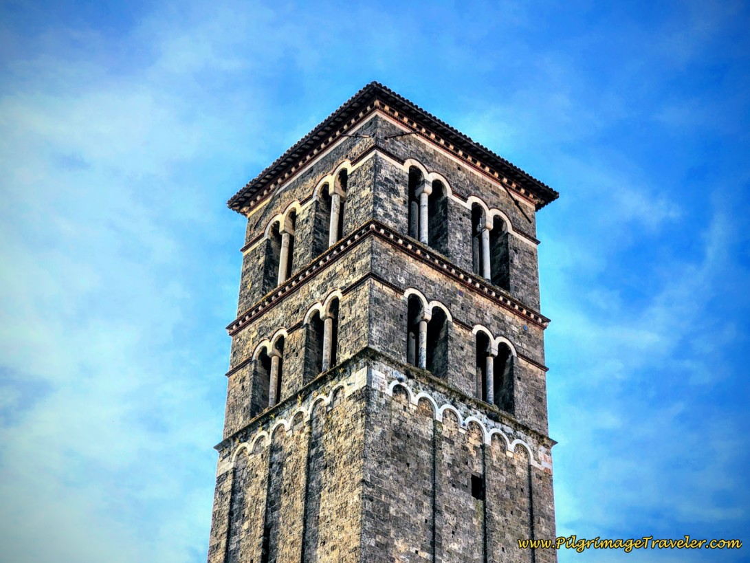
And a few steps past the B&B, on your left, is the simple-looking and plain building shown below, the Romanesque San Lorenzo Chapel. It is not identified as a church, and I had a hard time realizing this was the building I had located on the map. It is now more of a museum than a chapel, but we were thrilled that it was open when we arrived. The chapel is maintained by FAI Umbria and part of small heritage restoration circuit since 2022.
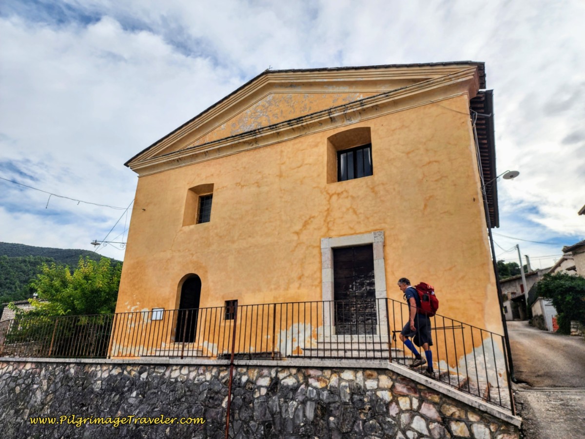 San Lorenzo Chapel
Within this small rural former chapel are fabulous and recently restored frescoes from the second half of the 12th and 14th centuries. They tell the stories of San Lorenzo, an early Christian martyr from the 3rd century during the Roman empire. Here is the altar, below.
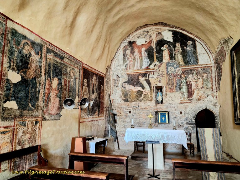 Frescoes, San Lorenzo Chapel, Lenano
And I really enjoyed the frescoes of the Madonna and Child in the back corner. What a lovely little reprieve this was, on day thirteen along the Way of St. Francis from Trevi to Poreta! Especially after not being able to see the Eremo!
I said my gratitude out loud, to those souls who made this chapel open and available to pilgrims. It was definitely a moment of Peace as I sat in silence for some moments.
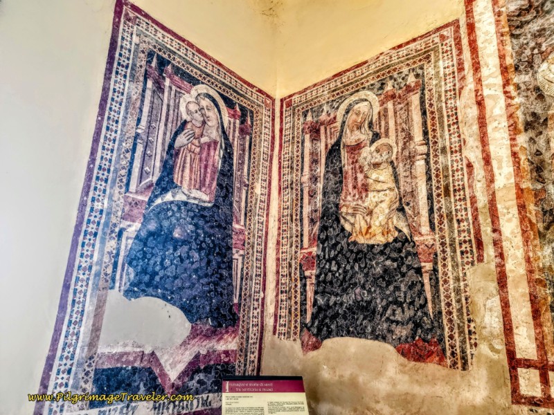 Madonna and Child Frescoes, San Lorenzo Chapel, Lenano
After the chapel visit, we continued a few more meters on the Via delle Torr through this small town. After about 1/2 kilometer, and 10.3 kilometers total into day thirteen, along the Way of St. Francis from Trevi to Spello, you are directed to leave this road and turn right onto the Via Carvello.
Only a few steps later, take the dirt lane to the left, shown below, very steeply descending on a sometimes rough and eroded lane. Poreto is less than one kilometer away as the sign declares.
Below is a photo of the lane when it smoothed out a bit.
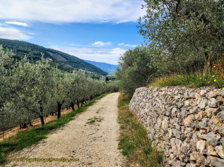 Rough Lane Through Olive Grove
After the steep descent and about one kilometer later, climb up to a T-intersection with a paved road. Turn left. Only a few meters later, turn to the right at the first intersection, with a sign pointing towards Poreta.
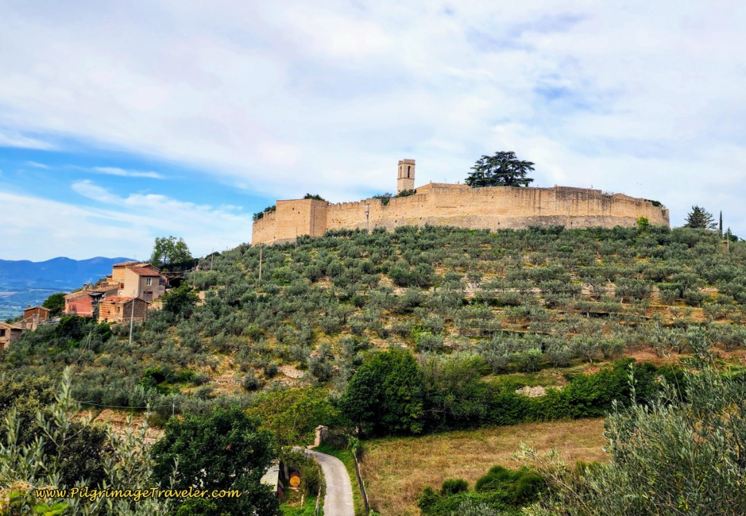
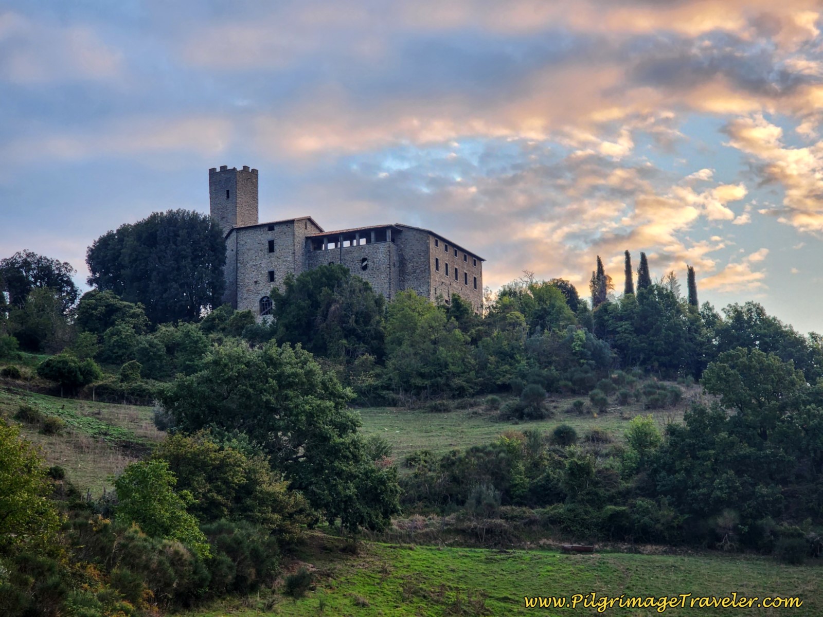
This is the final stretch on the paved road into Poreta, for the final 3/4 kilometer. As you near town, look up the hill to your left to see the Castello di Poreta. This is an important landmark.
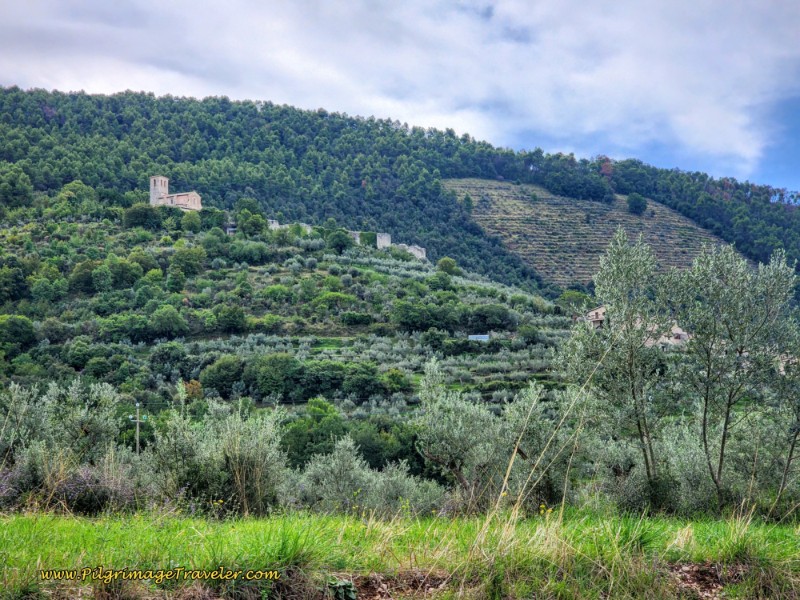 Castello di Poreta
As you enter town, the former town church is ahead. But when you come to this intersection, below, pay attention to the brown sign! There are two ways to go from here. The brown map shows you your two choices. You can go to the left here, and climb up to the Castello di Poreta. Or you can go straight and avoid the climb.
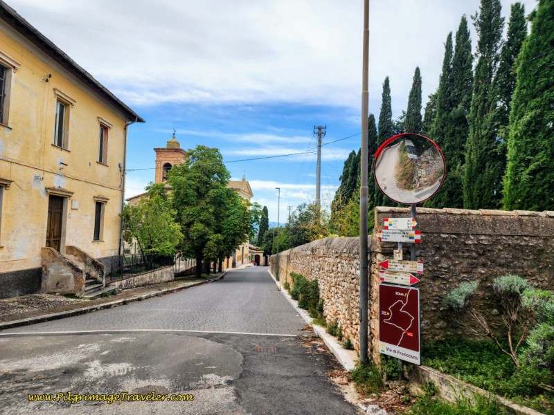 Bifurcation of Routes in Poreta
We chose to first go straight and find the Bar Alimentari Rosa Orazi to have a coffee break after 12 long, strenuous kilometers. After our stop at the bar, we continued onward to the south, to avoid the walk back and up to the Castello di Poreta.
See our day fourteen for a full description starting from Poreta and onward to Spoleto and a comparison of routes. We made the choice of staying on the lower route, because Rosa, the proprietress of the bar told us the castle and the church, the Chiesa di Santa Maria della Misericordia inside, have been closed for years! (This site may be open occasionally for cultural events).
We didn't see the point in adding an extra 1/2 kilometer in distance and 80 meters in elevation gain, on an already super long day to Spoleto! Especially if it were only for the views! We already had plenty of gorgeous views and there were plenty more to come!
Rosa's bar is somewhat hidden, so stay on the road through town, past the former church, and you will see it on your right, in a driveway after the high wall, hidden farther back from the road. The signs for the bar are obscure and you will likely pass by it before you see them! This is the same bar where you can purchase food if you are staying in Poreta and wish to cook.
There are several accommodations in Poreta, the first is A Casa di Francesco (+39 349 830 9327), run by the daughter of Rosa. Her name is Cinzia. She caters to pilgrims and gets excellent reviews on Google.
There is also the Villa del Cardinale, the Borgo della Marmotta Farm Resort & Restaurant, and La Palombaia. Some of these are quite expensive, so pilgrims beware!
Reflections, The Way of St. Francis, Trevi to Poreta
If you are walking this stage alone, I would highly recommend you spend time in places where we did not, the Chiesa di Madonna delle Lacrime in Trevi, the Eremo Francescano delle Allodole, the Castello di Campello Alto and maybe even the Castello di Poreta e Chiesa di Santa Maria della Misericordia, perhaps at sunset!
In many ways I wish we had spent more time on this stage, but in hindsight, I do not regret spending a full day in Spoleto (article coming soon!) the next day.
It was indeed a strong effort to continue onward to Spoleto, so consider your own choice wisely.
I loved the views on day thirteen and the moments where I was able to fully live in the present moment. Indeed, this joyous stage was without anxiety and doubt, as St. Francis would have loved!
Salutation
May your own Way of St. Francis from Trevi to Poreta be filled with peace and meditation, where there is neither anxiety nor doubt! Ultreia!
Way of St. Francis EBook Guide
Walk smarter with our ad-free, beautifully formatted Way of St. Francis eBook Guide, La Verna to Assisi,* in PDF format ~ perfect for offline use in mountainous and remote areas along this Way. Includes daily stage details, alternative routes and stunning photos. Our eBook Guide is unique because we also immerse you with our story.
Don't carry a heavy paper book, but use our digital eBook on your mobile device instead! You can walk with clarity and confidence, deeply connect to nature, following in the footsteps of St. Francis, through the Italian countryside!
📲 Instant download. 💸 Money-back guarantee. 🔄 Free updates for 1 year.
👉 Click here for more information OR BUY NOW.
*Please note that our eBook for the Southern Route from Assisi to Rome will be available in early 2026!
Way of St. Francis Stages
Northern Route, Via del Nord ~ La Verna to Assisi
Southern Route, Via del Sud ~ Assisi to Rome
More Stages to Rome, Coming Soon!
Please Consider Showing Your Support
Many readers contact me, Elle, to thank me for all the time and care that I have spent creating this informative website. If you have been truly blessed by my efforts, have not purchased an eBook, yet wish to contribute, I am exeedingly grateful. Thank you!
Search This Website:
🙋♀️ Why Trust Us at the Pilgrimage Traveler?

We’re not a travel agency ~ we’re fellow pilgrims! (See About Us)
We've trekked Pilgrimage Routes Across Europe since 2014!
💬 We’ve:
- Gotten lost so you don’t have to. 😉
- Followed waymarks in the glowing sunlight, the pouring rain and by moonlight. ☀️🌧️🌙
- Slept in albergues, hostels & casa rurals. Ate and drank in cafés along the way. 🛌 😴
- Created comprehensive and downloadable GPS maps and eBook Guides, full of must-have information based on real pilgrimage travels. 🧭 🗺️
- Shared our complete journeys, step by step to help YOU plan your ultimate pilgrimage and walk with your own Heart and Soul. 💙✨
Every detail is from our own experiences. Just fellow pilgrims sharing the Way. We have added a touch of spirituality, heartfelt insights and practical guidance from the road ~ offering a genuine connection to the spirit of pilgrimage. Tap into the wisdom of seasoned pilgrims!
Ultreia and Safe Pilgrimage Travels, Caminante! 💫 💚 🤍
Follow Me on Pinterest:
Find the Pilgrimage Traveler on Facebook:
Like / Share this page on Facebook:
***All Banners, Amazon, Roamless and Booking.com links on this website are affiliate links. As an Amazon associate and a Booking.com associate, the Pilgrimage Traveler website will earn from qualifying purchases when you click on these links, at no cost to you. We sincerely thank you as this is a pilgrim-supported website***
PS: Our eBook Guide books are of our own creation and we appreciate your purchase of those too!!
Shroud Yourself in Mystery, along the Via de Francesco!
Walk in the Footsteps of St. Francis, and Connect Deeply with the Saint and to Nature in the Marvelous Italian Countryside!
Need suggestions on what to pack for your next pilgrimage? Click Here or on the photo below!
Find the Best Hotel Deals Using This Tool!
Carbon Trekking Poles ~ My Favorites!
Carbon fiber construction (not aluminum) in a trekking pole makes them ultra lightweight. We like the Z-Pole style from Black Diamond so we can hide our poles in our pack from potential thieves before getting to our albergue! There are many to choose from! (See more of our gear recommendations! )
Gregory BackPack ~ My Favorite Brand
Do not forget your quick-dry microfiber towel!





Your Opinion Matters! Comments
Have you had a similar experience, have some advice to give, or have something else you'd like to share? We would love to hear from you! Please leave us a comment in the box below.