- ~ Home
- The Way of St. Francis
- The Way of St. Francis, Spoleto to Macenano, Day Fifteen
Jump to Way of St. Francis Stages
Day Fifteen on the
Way of St. Francis ~
Spoleto to Macenano, 20.9 Kilometers (13 Miles)
Disclosure: the PilgrimageTraveler.com is an associate of Booking.com, Roamless, and Amazon. As associates of these merchants, we earn from qualifying purchases from our links.
Our day fifteen along the Way of St. Francis from Spoleto to Macenano was full of surprises! It included a strenuous hike up the mountain to Moneluco and the sublime Eremo there, a surprise finding on the other side of the mountain and a final, lovely walk along the Valnerina river valley.
"Surprise is the greatest gift which life can grant us." ~ Boris Pasternak (1890–1960), Russian poet, novelist, and composer
🙋♀️ Why Trust Us at the Pilgrimage Traveler?
We’re not a travel agency ~ we’re fellow pilgrims! (See About Us)
We've trekked Pilgrimage Routes Across Europe since 2014!
💬 We’ve:
- Gotten lost so you don’t have to. 😉
- Followed waymarks in the glowing sunlight, the pouring rain and by moonlight. ☀️🌧️🌙
- Slept in albergues, hostels & casa rurals. Ate and drank in cafés along the way. 🛌 😴
- Created comprehensive and downloadable GPS maps and eBook Guides, full of must-have information based on real pilgrimage travels. 🧭 🗺️
- Shared our complete journeys, step by step to help YOU plan your ultimate pilgrimage and walk with your own Heart and Soul. 💙✨
Every detail is from our own experiences. Just fellow pilgrims sharing the Way. We have added a touch of spirituality, heartfelt insights and practical guidance from the road ~ offering a genuine connection to the spirit of pilgrimage. Tap into the wisdom of seasoned pilgrims!
Ultreia and Safe Pilgrimage Travels, Caminante! 💫 💚 🤍
While this stage is only 21 kilometers, it is more difficult than most because of the steepness of the grade, both up and down.
The ending in Macenano has only one accommodation, a more expensive hotel, however, you can stop in Ceselli after 16 kilometers, which has more appropriately-priced pilgrim accommodations, including a parish donativo.
Or for the stronger, longer walkers, the choice to continue another 4.8 kilometers to Ferentillo, for a total of 25.7 kilometers, is also an alternative. However, the price of the accommodation in Ferentillo, with several choices, is not cheap either!
Maps and Stats, The Way of St. Francis, Spoleto to Macenano
Here is our interactive, GPS-created Google map for this stage and a direct link here: day fifteen from Spoleto to Macenano.
There are no alternative routes or side trips for this day, just a choice in lengths as described above.
As you can see below, there is a strong, 420 meter climb (1378 feet) to the Convento di San Francesco over 2.7 kilometers and then an additional but less steep climb of about another 168 meters (550 feet) over more than four kilometers.
The long downhill afterwards is not for faint knees! This is why I chose to end our stage in Macenano. However, the way onward (not pictured) continues along the Nera River Valley for the 5K to Ferentillo, with almost no elevation changes, so if you do choose to continue onward it would be easy enough!
 Elevation Profile, Way of St. Francis, Day Fifteen Spoleto to Macenano
Photo-Rich Travelogue, The Way of St. Francis, Spoleto to Macenano
Day fifteen begins across from the cathedral of Spoleto in the dead center of town. With you back to the cathedral, the Way leaves the Piazza del Duomo, taking the stairway called the Via dell'Arringo, shown below. All was quiet just after sunrise - a stark contrast from the prior afternoon.
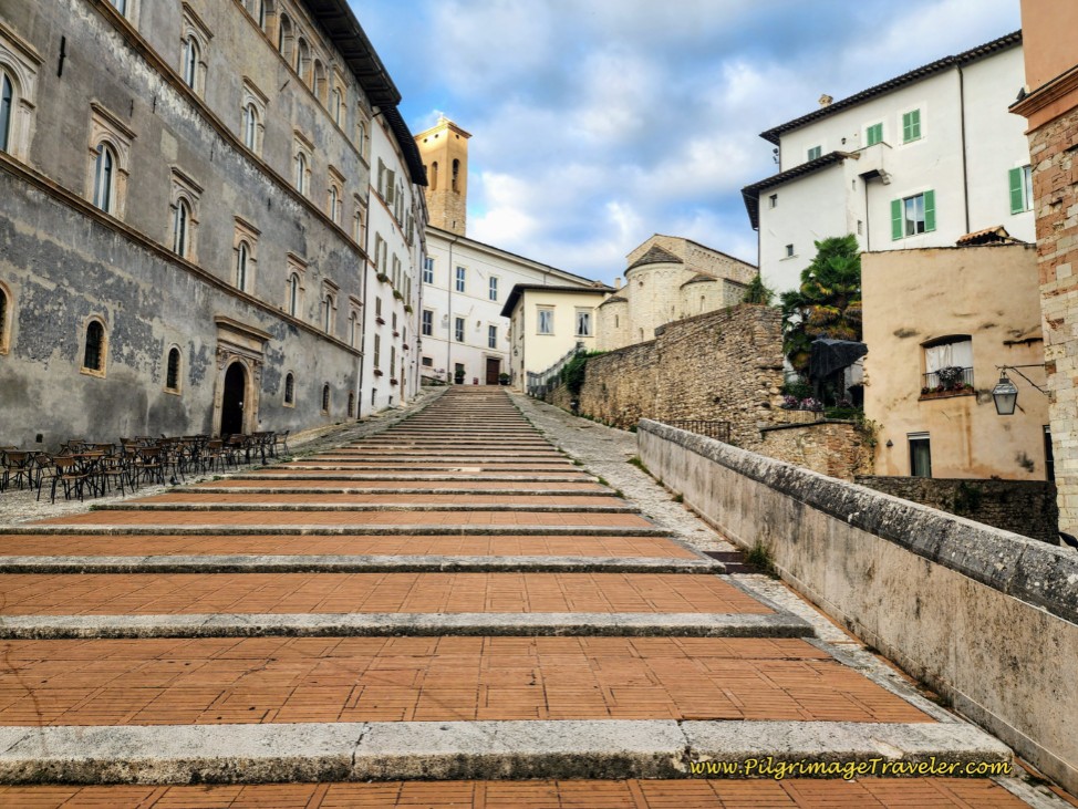 Via dell'Arringo Stairway from the Piazza del Duomo
At the top of the stairway, turn left onto the Via Aurelio Saffi and cross under a wonderful double archway.
Continue onward until you see another set of stairs and a monument, the Monumento ai Caduti, or a War Memorial ahead, pictured below. Take this stairway to climb up towards the monument and the fortress.
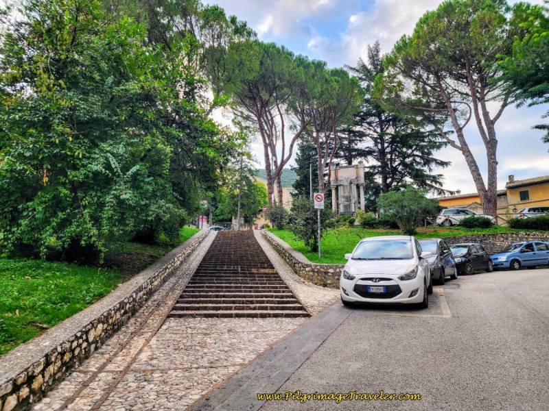 The Monumento a Caduti, War Memorial is Ahead
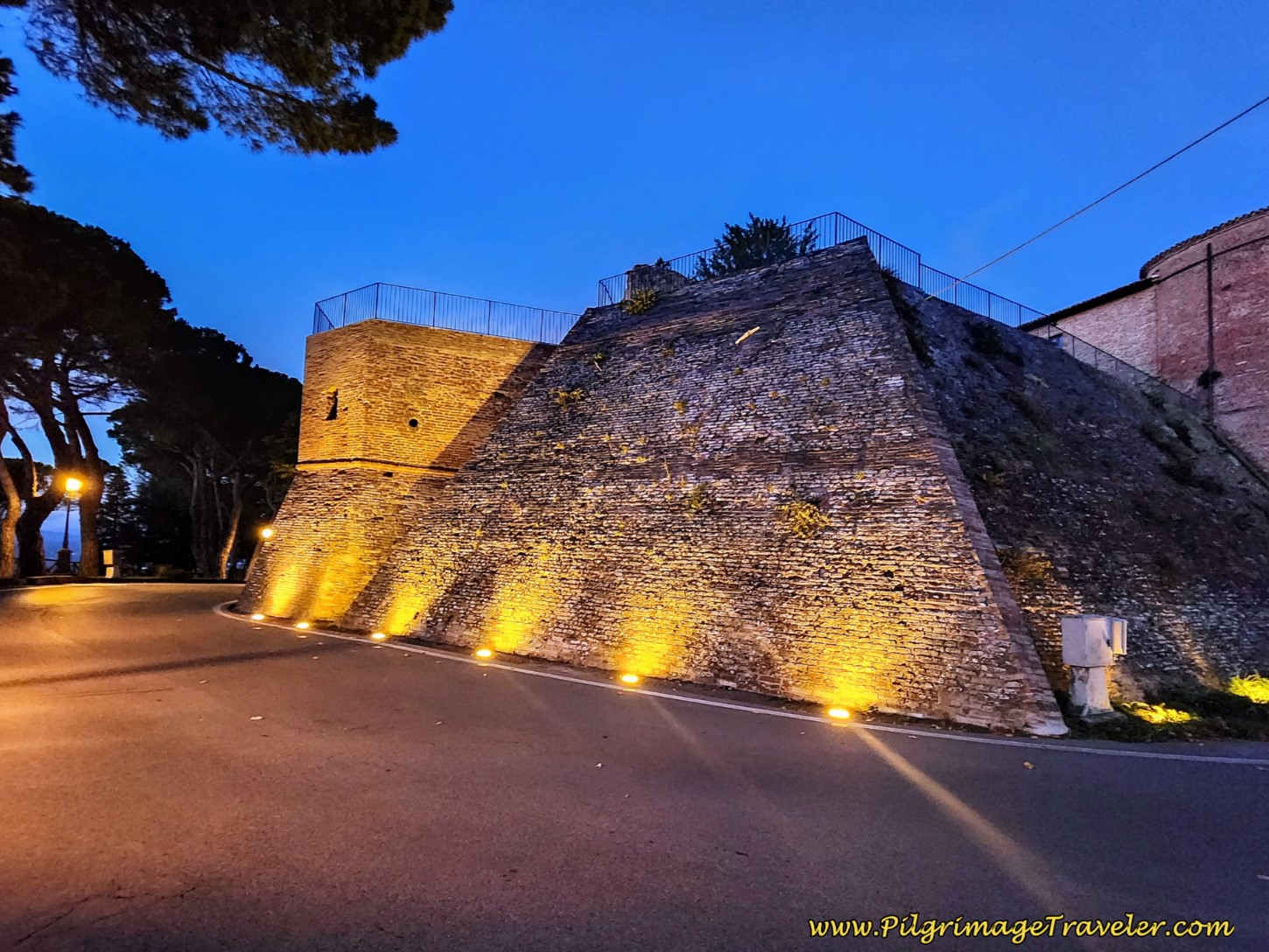
A few steps after the war memorial, arrive at the entrance to the fortress, the Rocca Albornoziana. Hopefully you were able to visit this castle, which is now mostly a museum with some nicely preserved frescoes.
Stay walking to the right of the entrance and onto the Via del Ponte.
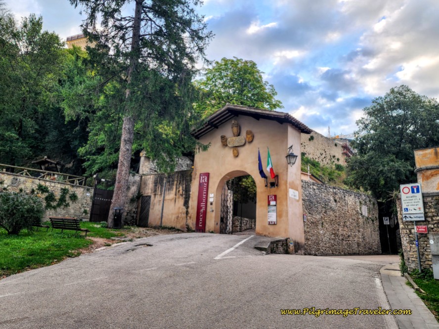 Pass the Fortress Entrance, the Rocca Albornoziana
The Via del Ponte (Bridge Street) initially follows along the fortress walls, then arrives at an overview point with cafes overlooking the recently restored Ponte delle Torri. It was lovely to hang out here sipping coffee on a sunny day!
Continue onward, and the bridge comes into clear view, below. This is your destination.
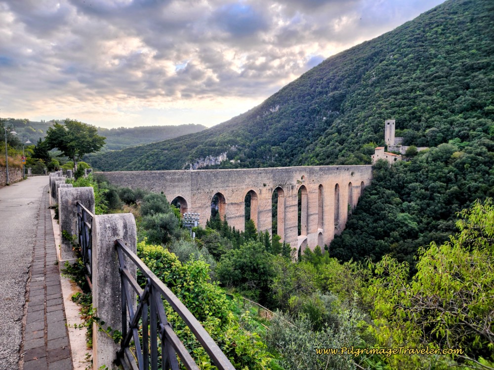 Ponte Delle Torri Ahead
Arrive at the bridge after about 600 meters from the cathedral at the start.
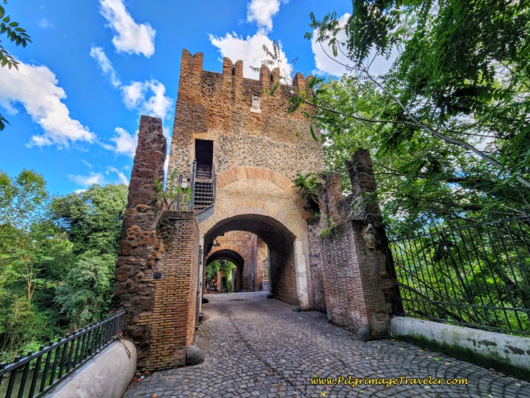
The 14th century bridge and aqueduct is a medieval marvel. Its dual function was to span the gorge of the Tessino River, connecting the fortress behind you to the Mulini fortress (Monteluco) in front of you. At the same time, it brought water from the Cortaccione springs into the city.
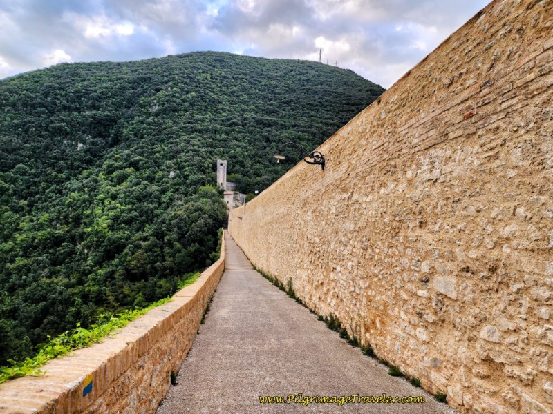 Cross the Ponte delle Torri
As you walk across the bridge, peer into the depths of the gorge! After a long 1/4 kilometer distance, arrive at a cobblestone paved path on the other side and turn left and start the long climb of the day.
A nice sign identifies the road as the Via Giro dei Condotti, essentially meaning the Aqueduct Tour or Loop Road.
A few steps later, arrive at the fortress, the Fortilizio dei Mulini. Below is a lovely view of the Rocca Albornoziana from the Fortilizio dei Mulini.
You can climb up even higher than this photo below shows, to capture even more spectacular views of the bridge, the fortress on the other side and the town of Spoleto.
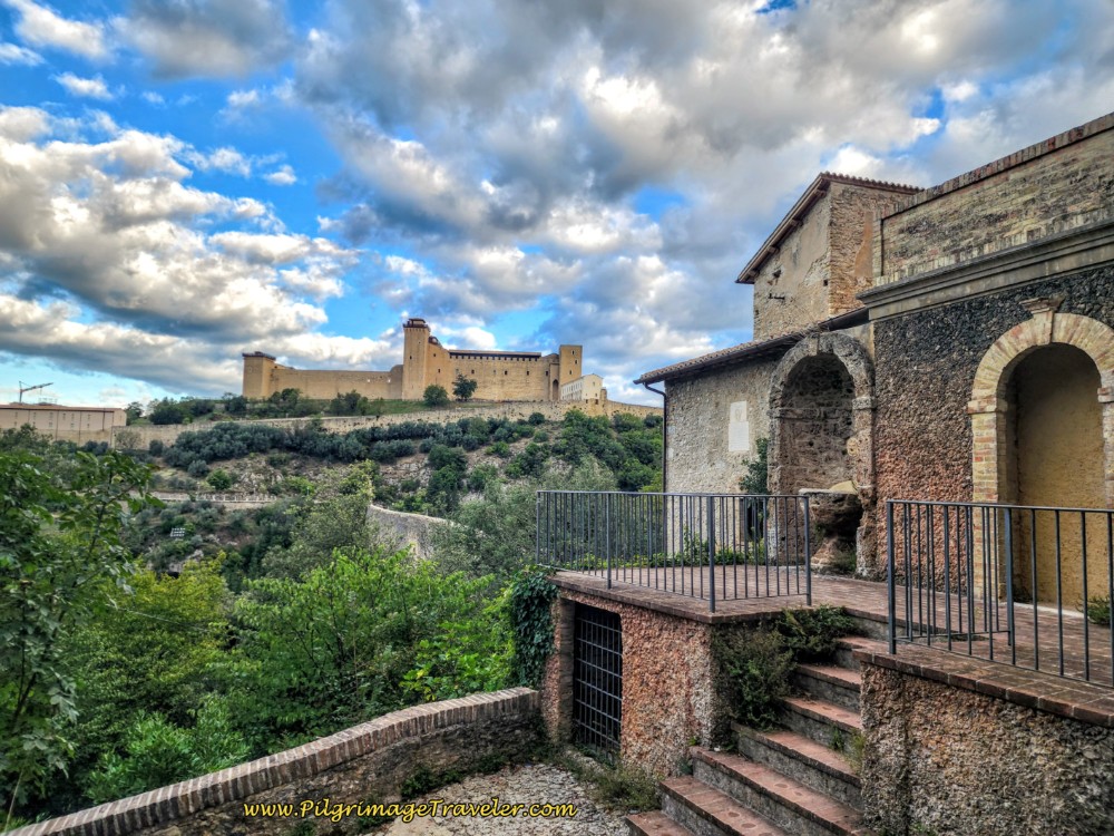 Fortress to Fortress View
After admiring the views, the Way now zig zags up the mountain on steep switchbacks via a terraced path that is no longer cobblestone. When you reach this sign, pictured next, after about 1.0 kilometer from the start, the Convento San Francesco in Monteluco is only 1.7 kilometers away. But get ready - the way is steep!
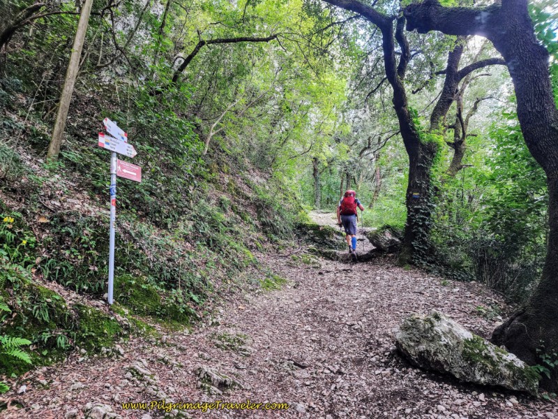 Forest Path Toward Monteluco
After about 1.3 kilometers from the Duomo in Spoleto, you will come to a sign directing you to turn to the left. The sign states that you are 1.4 kilometers away from Monteluco.
The Way takes several tight switchbacks and continues its steep climb.
300 meters along a straight path, arrive at a Y-intersection, when the sign states that you are 1.1 kilometer from Monteluco. Stay straight (left) through here.
Merge with a semi-paved road and arrive at an abandoned shrine, except for pilgrims placing rocks inside it, and what looks like a water-control tower a bit farther onward.
A few steps later, pass the entryway gate to an abandoned estate, staying high and to the left. Shortly, come to a second shrine, pictured below, and make a left turn. The count-down to Monteluco is 1.0 kilometer, not quite halfway up this section of the climb.
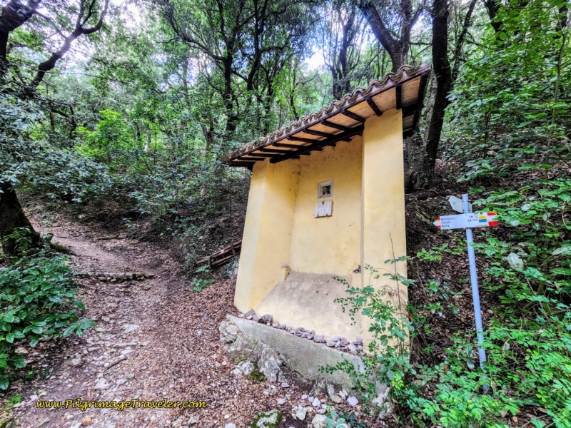 Turn Left at Second Shrine
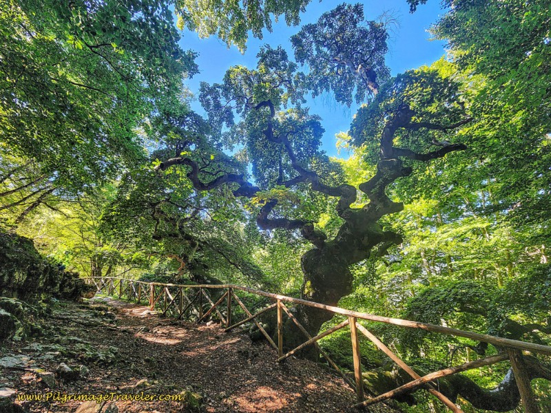
Begin another series of tight switchbacks, crossing over a rough road, to join another semi-paved road to the right, now lined with a nice split rail fence.
Arrive at a third shrine with remnants of frescoes, below. Leave the rough road here by turning left onto a terraced pathway lined with a split rail fence.
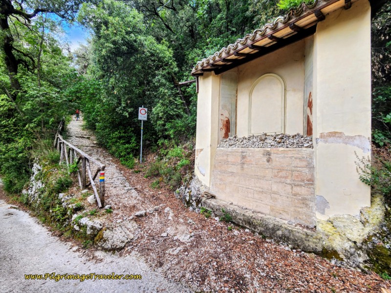 Take Terraced Path by Third Shrine with Frescoes
After the third shrine, a few meters later, arrive at the backside of the Eremo delle Grazie, not pictured, which is no longer a hermitage, but appears to still host events.
The pathway takes a hard bend to the right after the former hermitage, and now walks straight and along a high wall to another (abandoned?) estate on your left.
Continuing the straight climb onward, pass under a faux "entryway," or perhaps a gate, shown below. What this gate is to is totally unmarked, perhaps the hermitage to come?
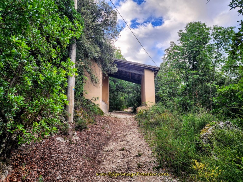 Pass Under Blind "Entryway"
A few steps after this faux entryway, arrive at an intersection with a dirt road and stay high and to the left.
Continue on this road for a few meters when you see the entryway to the abandoned Eremo di San Girolamo Dottore after 2.0 kilometers total. The Way leaves this road and continues climbing on the path to the left that you can see in the photo.
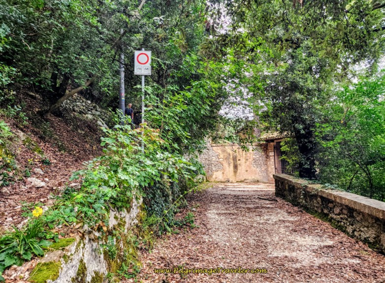 Entryway to the Eremo di San Girolamo Dottoro
Negotiate several switchbacks more, coming to a more maintained estate building, just before a strong bend to the right, and a climb up on a somewhat paved road to the SP462 roadway.
Cross the SP462 and take the split rail fence-lined path on the other side. Monteluco is only 1/2 kilometer away.
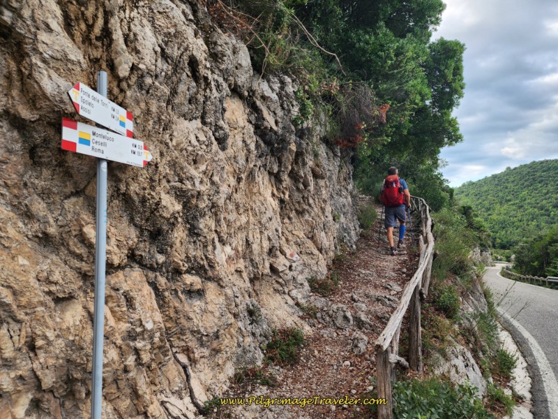 One-Half Kilometer to Monteluco
There are a few more steep switchbacks to go along the terraced path, when you arrive at the walls and the backside of the buildings of the Convento San Francesco.
The forest was appropriately glowing in the sunlight at our arrival! It was such a welcoming sight!
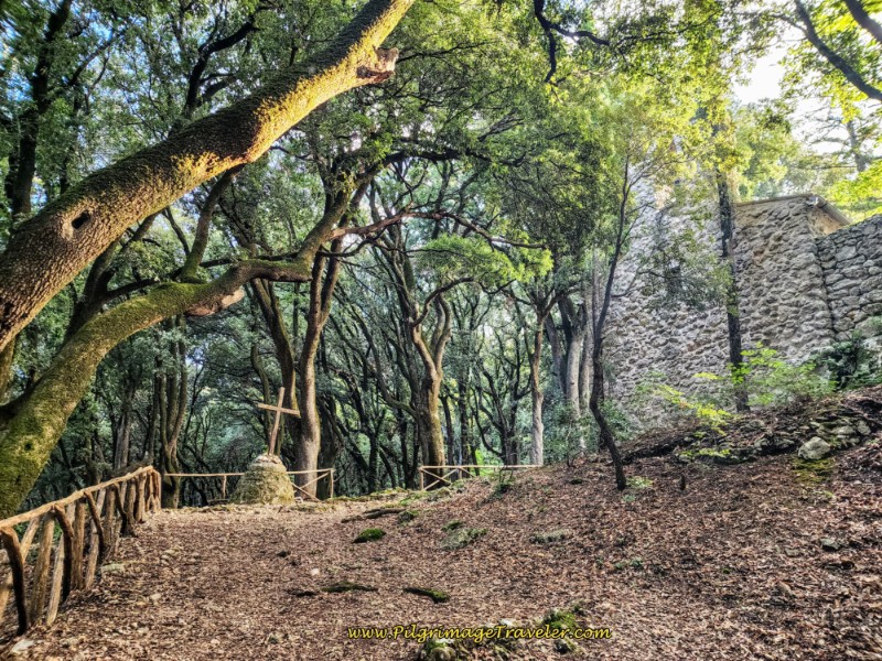 Glowing Bosco Sacro and Cross
The Way now takes the pilgrimage traveler around the north side of the Convento, and past a wonderfully shaded picnic area.
The trees are definitely more stately here in the Bosco Sacro, or the Sacred Forest. According to the convent's website, Monteluco has been a sacred place since the 2nd century BCE with an established monastic community in the Eastern traditions by monks fleeing Syria, until the 5th century CE. It was not until the 13th century that the Franciscian Friars Minor established the current convent after St. Francis was given the chapel on site.
When you arrive at the entryway, shown below, you can see that the Eremo is a simple, humble and sacred place. Pilgrims can stay here for a donation, contact +39 0743 40711, advanced reservations are required.
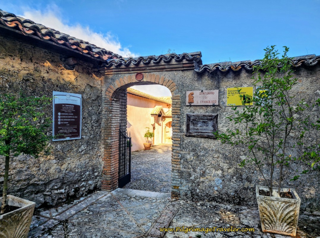 Entryway, Convento di San Francesco
The first stop after entering the inner courtyard is the Chiesetta di Santa Caterina d’Alessandria, the chapel to St. Catherine of Alexandria, pictured below. The simplicity of the altar within the sanctuary creates a reverent hush that is unbeatable. The painting is of the Madonna and Child with Saints including Catherine and Francis.
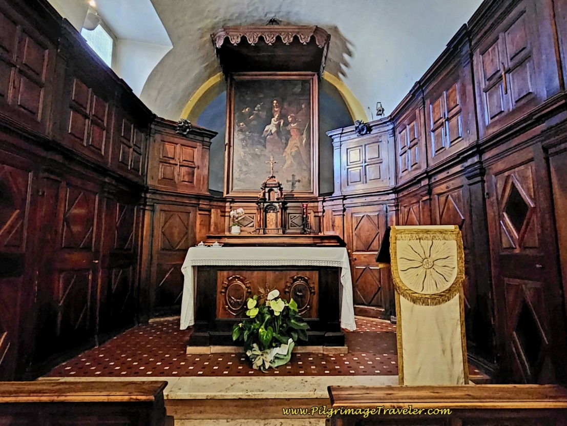 Altar in the Santuario di San Francesco
Within a frescoed niche of the oratorio, is an altar over a rock, which translated states: "On this rock Saint Francis abandoned himself to his Lord."
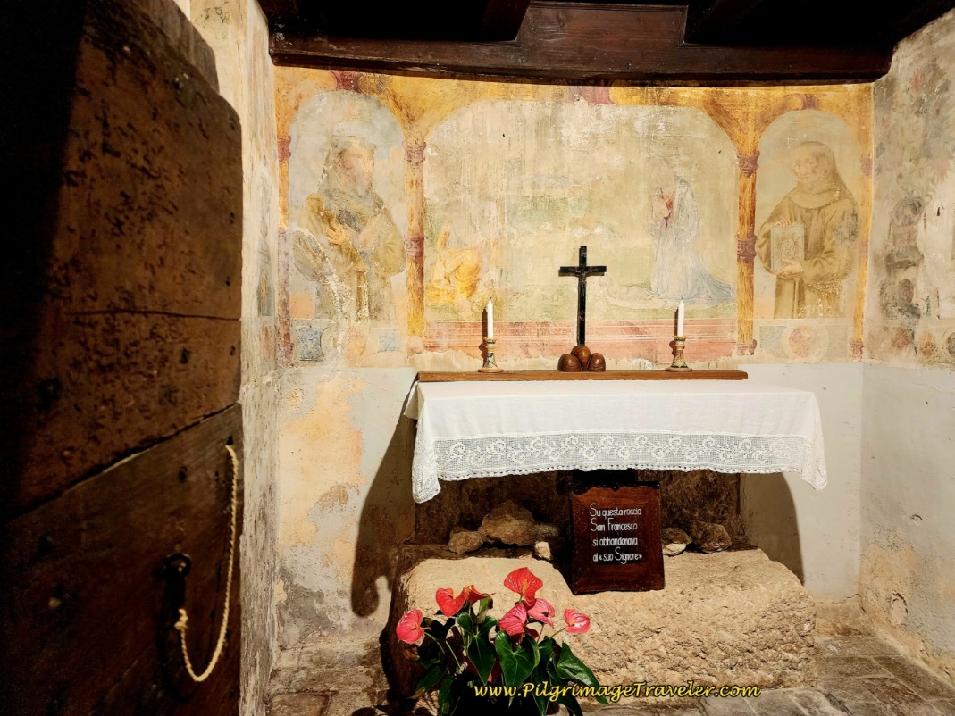 Roccia di San Francesco
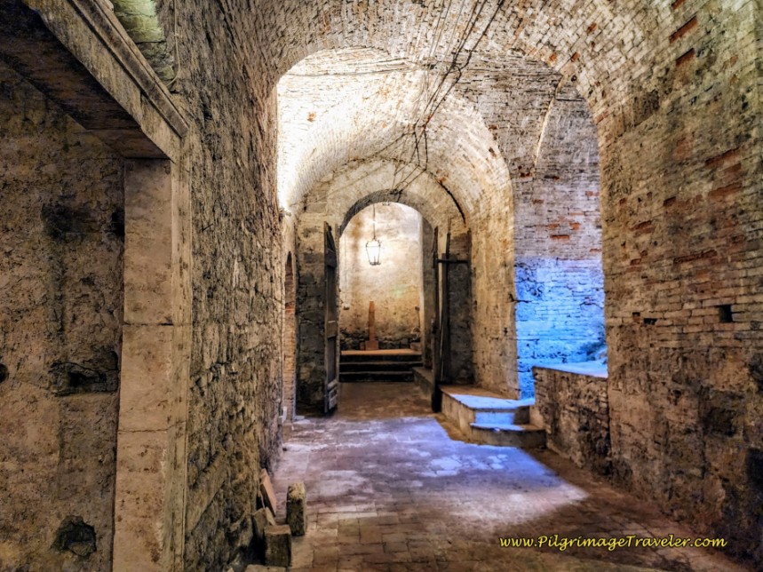
And most interestingly, the friars have preserved the original cells of the convent, called the Convento Primitivo 1218, for visitors to see how they lived. Here is one of the cells.
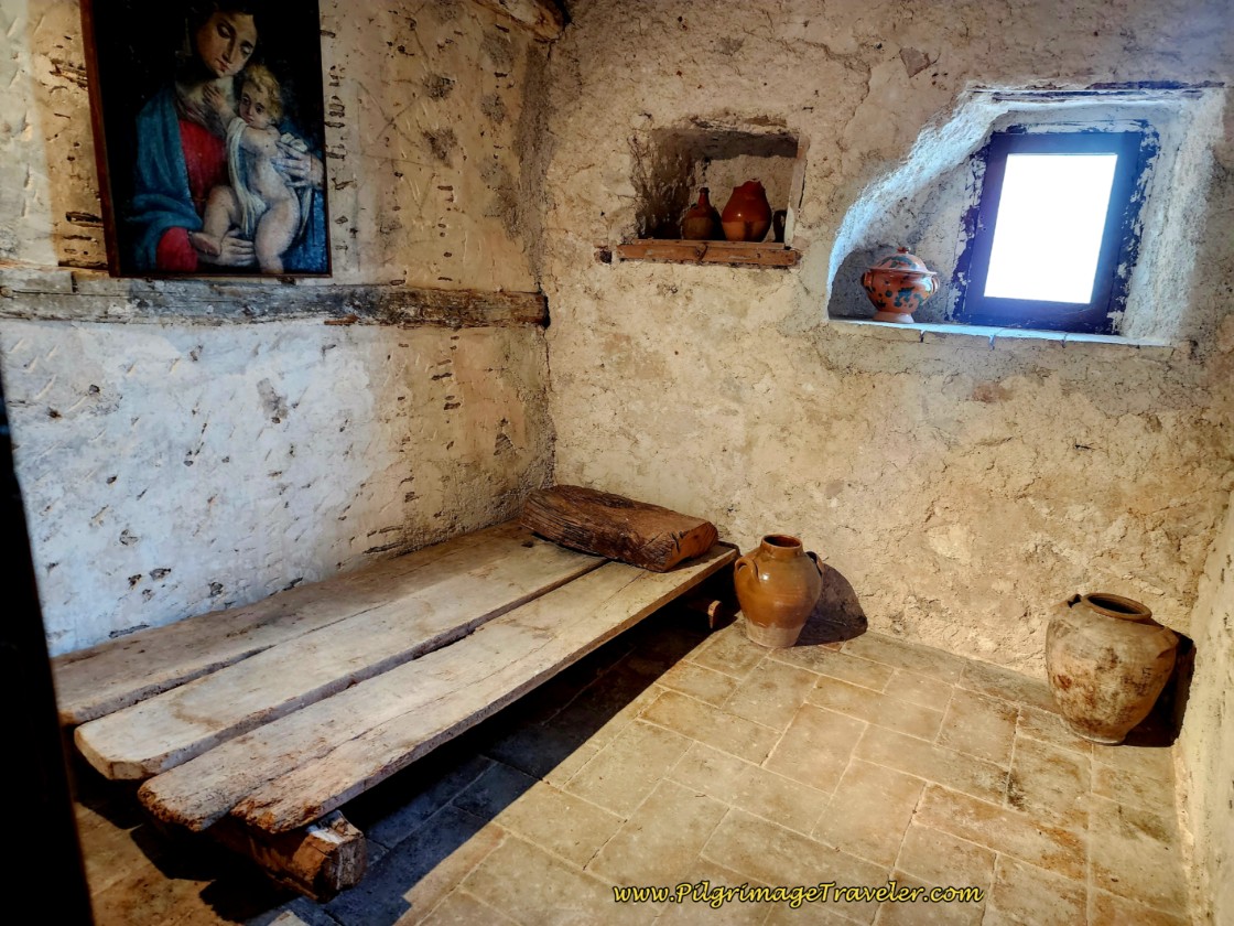 Monk's Cell, Convento di San Francesco
There are two more possible accommodations in Monteluco, both directly across from the convent, the Albergo Ristorante Ferretti and the Hotel Albergo Paradiso, if you wish to spend more time in Monteluco.
Just beyond the Convento entryway, by a large open park, there is a paved road that the Way joins, which goes past public restrooms and an outdoor café.
We knew that the next 13 kilometers for the day's pilgrimage would have no services, so we had a quick coffee and a snack after visiting the convent.
After our break, we continued the walk, straight along the paved road, taking the first right turn, past a row of wonderful houses and onto a gravel road shown below. This nice flat road lasts for about 1/2 kilometers as it walks through the row of residences, with deep, deep woods to the right.
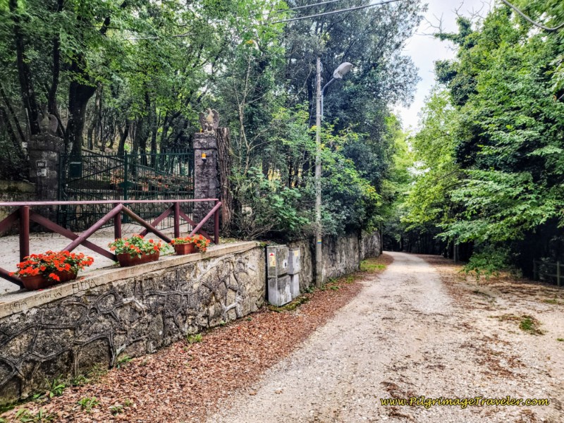 Right Turn Onto Gravel Road
After about 3.5 kilometers into the day, the Way comes to a Y-intersection, at the waymark sign that says 12.8 kilometers to Ceselli, where you will keep high and to the left. You are now beginning another section of the long climb of the day.
The forest that you will walk through for the next 3/4 kilometer is lush and magical. However, the trail is very rocky and loose, as well as significantly eroded at times, so you may need to watch your step.
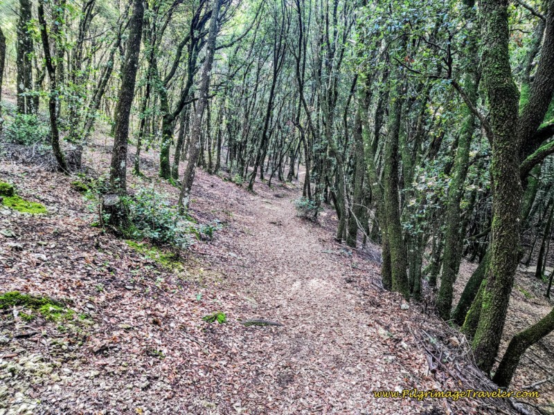 Magical Forest Walk
After about 1/3 kilometer on this trail, cross a prominent drainage, staying up and to the right of it, as the climb steepens.
Cross the drainage the second time, this time to the left, and onward the trail may be even more eroded.
Arrive at an opening in the forest after approximately 4.2 kilometers. Ahead is the I Camini picnic ground and a junction with a paved road, below. Ceselli is 11.6 kilometers away. Turn left onto the paved road at the picnic ground.
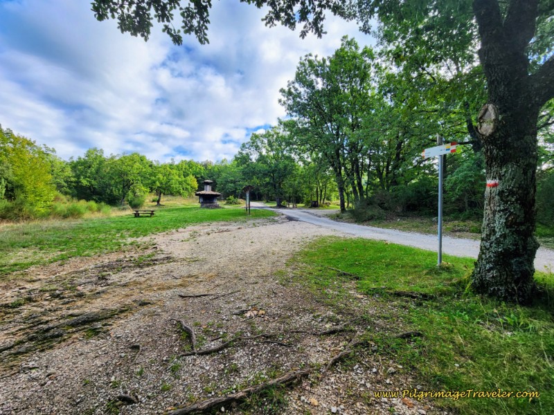 I Camini Picnic Ground
After only a few meters on the paved road, the Way turns to the right to return to the forest on another path. Follow this path as it bends to the right.
When the forest opens up again, the Way follows a chain-link fenceline along a field.
Next, you will come to a T-intersection, and turn right onto a lane. Notice a cluster of farm buildings ahead, your next destination of Le Porelle. Wind your way through the buildings.
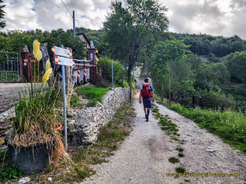 Walk Through Farm Buildings of Le Porelle
At the far end of the buildings, the road ends and comes to this gate below. Continue through the gate, closing it behind you and follow the path ahead, climbing again but on a pleasant grade that is not as steep nor as difficult as earlier.
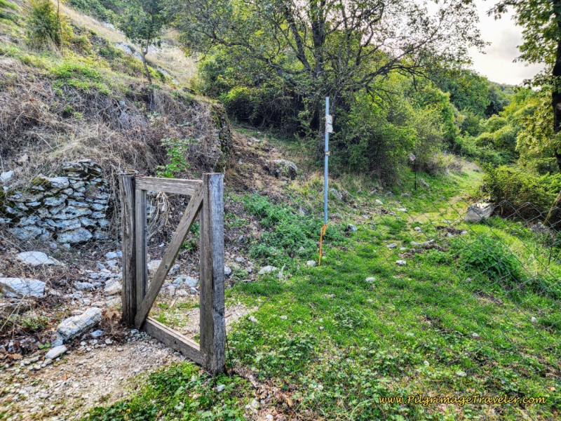 Walk Through Gate
This trail follows the path of the road, and you may hear cars on your left, but may not be able to see them.
Not even 1/2 kilometer later, this short and easy climb is complete, when the path comes out to an open meadow, and to the paved road you were following, called the Forca delle Porelle, or the Porelle Pass after 5.1 kilometers.
After a few steps along the road, you will cross it and look for another path leaving the road to the left, shown below.
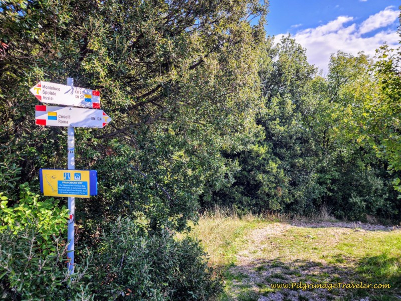 Descent from the Forca delle Porelle
For about the next 1.5 kilometers through the thick forest, there is a mild descent that is well-signed. Stay to the right at a Y-intersection ahead, as directed.
When the trail takes a strong bend to the left and crosses a rocky drainage, you will notice a bit of a climb out on the other side, below.
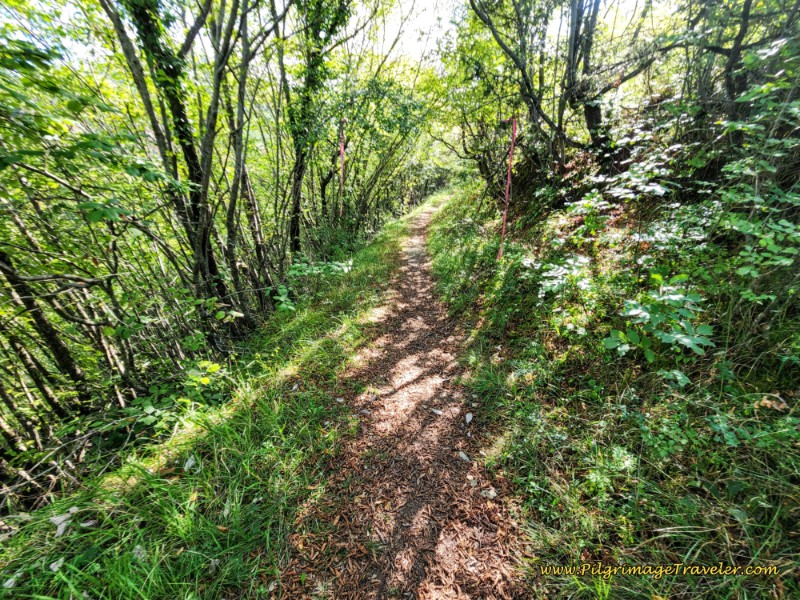 Final Ascent for the Day
When the forest thins and comes to an open flat area, after 7.1 kilometers, you have arrived at the ultimate top for the day, called the Forcella de Castelmonte. Here the sign says Ceselli is 8.6 kilometers away.
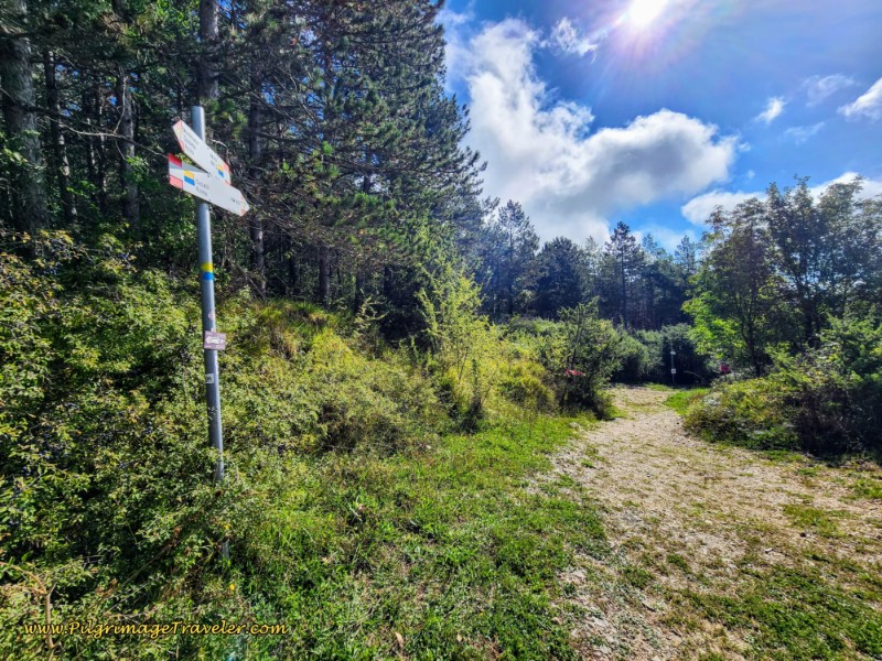 Forcella de Castelmonte, Ultimate Top at 7.1 Kilometers
Come to a crossroads with a gravel road, and continue straight onwards. Be careful on the narrow trail ahead, as it may be quite eroded in some places.
The forest path ahead will now eventually afford fantastic views as you walk along the high ridge. Stop and look and breathe in this lofty place!
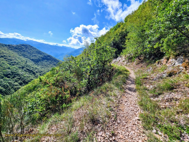 High Ridge Views
Just shy of 8.0 kilometers, arrive at a prominent Y-intersection, and keep low and to the right.
And at 8.0 kilometers into the day from Spoleto to Macenano, come to a left turn off the trail, with signs for "Coffee!" pointing to the left. I'm thinking, "What? Coffee?" I checked the map and we were at the place I wanted to see, the Chiesa di Sant'Antonio Abate. However, this place was to be quite the surprise!
While we didn't need more coffee, I said to Rich, that indeed this chapel was a place I bookmarked to go to have and look, and so we turned to the left!
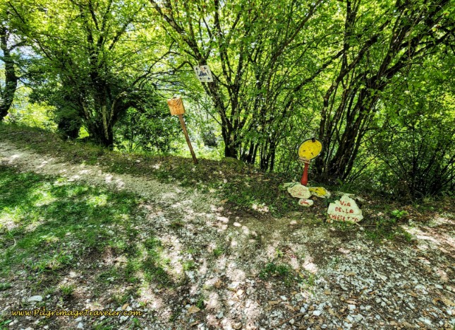 Turn for the Chiesa di Sant'Antonio Abate
Only a few steps farther on, the pilgrim arrives at the small Chiesa di Sant'Antonio Abate. And it was a surprise to find out that there was a resident in the chapel! Mario has been given permission by the monks who own it, to live there for no charge, be a care-taker of the site and minister to pilgrims! He has lived here, full-time and off the grid for three years!
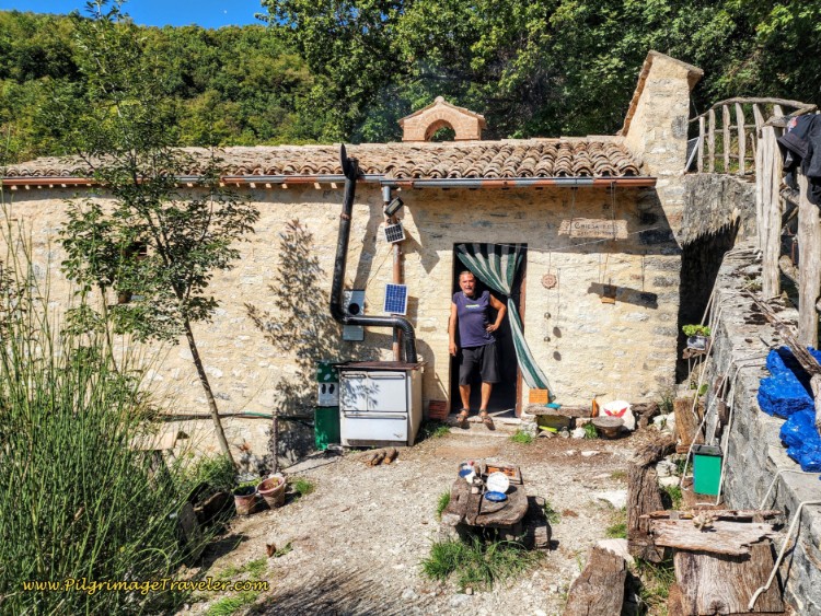 Resident Mario at the Chiesa di Sant'Antonio Abate
Mario will indeed give you coffee, and he was even just taking a cake out of his outdoor oven which runs on propane that you can see in the photo above. He does all this for a donation. And he speaks perfect English, so no translator is necessary!
And here is the interior of his "home," complete with the chapel frescoes. You can see his rough-framed bed to the left, in the photo below. There is also a small kitchen, but no running water and a small woodstove, none are in the photo.
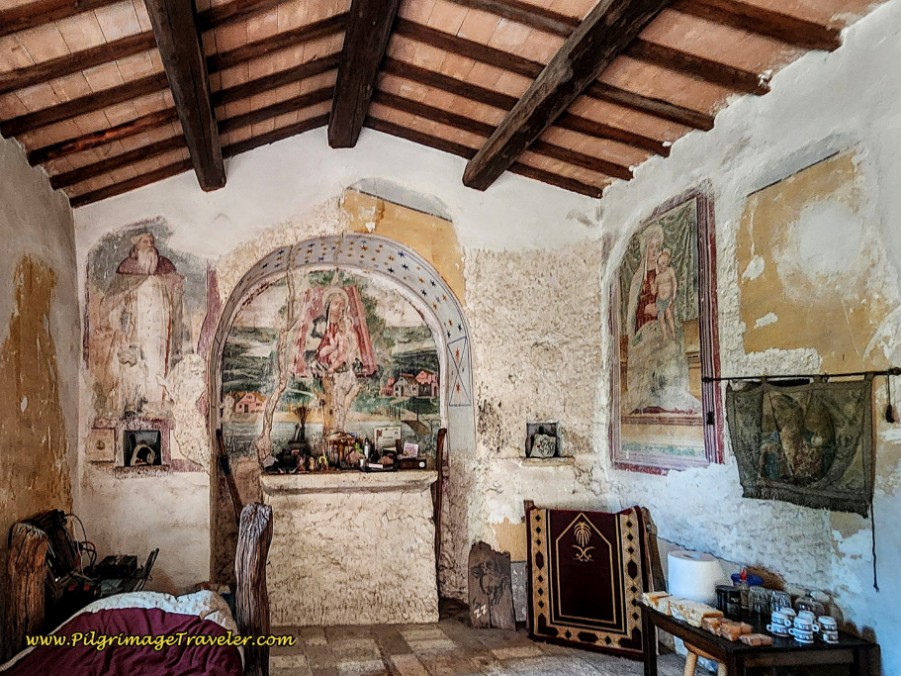 Frescoes, Chiesa di Sant'Antonio Abate
What a simple and interesting way to live! I suppose, not for most. I wondered what the long, cold winters would be like!
After our break with Mario, we continued down the trail, descending to the ghost town of Sensati, a few meters away. I could find absolutely no information about this ghost town, so your own imagination will have to fill in the gaps!
As you walk along toward the town, notice the many funky paintings, signs and sculptures, often hanging from the trees and some on the ground that Mario has filled his time in making!
First walk by the ruined walls of the town.
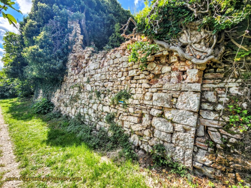 Sensati, Ruined City Walls
You will come to a functioning water fountain, shown below, at a large bend at the edge of the ruined town. You will need to look closely for it as it is a bit hidden by all of Mario's sculptures! Mario says the water is good. It is his exclusive water supply, and he says he hasn't turned green yet!
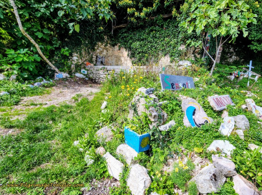 Sensati's Water Fountain
Next to the fountain, but not pictured, there is a ladder and many signs with sayings, one that I found enlightening, "Another day in Sensati, another day in heaven, another day of real life." I guess we know how Mario views his lifestyle!
He also had made a sign, "Sensati, Pop: 1 Person, 3 Ghosts." Too funny ~ what a delightful treat Mario was!
As we reluctantly walked onward through the forest after Sensati, we were surprised by the trail improvements on this side of the mountain. Here is an initial section of the trail.
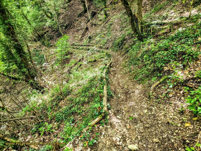 The Onward, Descending Trail Through the Forest
The long descent ahead follows the ridgeline of the mountain above it and to the right, called the Monte di Patrico, as it continues on a shelf-like road towards the Valnerina (Nera River Valley) below.
And as you would expect, where there are no trees, the views continue to be phenomenal. Here are limestone cliffs along the slopes of Monte di Patrico as you descend into a gorge.
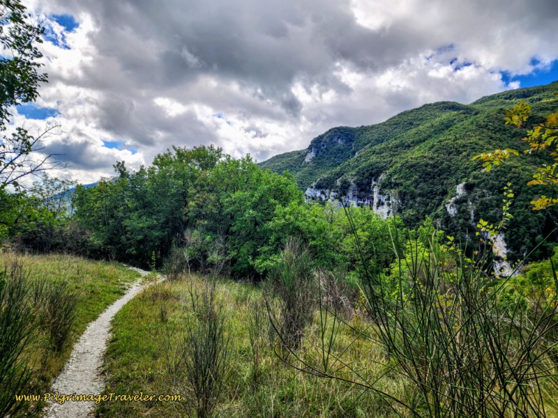 Limestone Cliffs on the Slopes of Monte di Patrico
Here is a photo walking past these limestone cliffs through the gorge, with wonderful valley views.
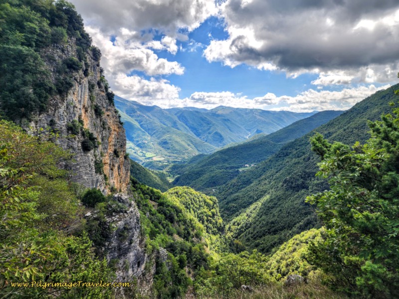 Valnerina Valley Views Below
Ahead along the trail you will also see many embankments shored up with timbers where there is loose rock to cross. Rich liked to call these rocky areas, "rip rap."
And the trail soon crosses a drainage on a sharp bend to the left, where this small waterfall cascades down the limestone wall.
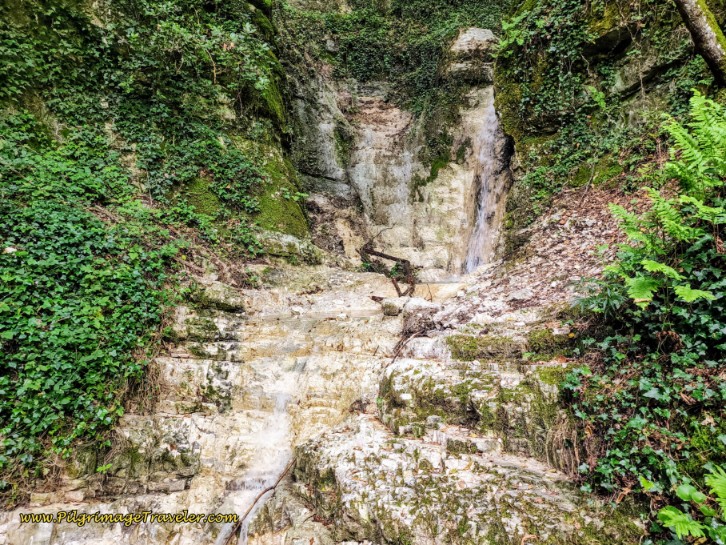 Limestone Spillway
From your lofty height, eventually views of the town of Pontuglia are visible below, nestled in the valley floor. This is the next destination.
As the crow flies, Pontuglia looks pretty close, however, as the Via di Francesco goes on its upcoming circular route, it is still a full four kilometers away!
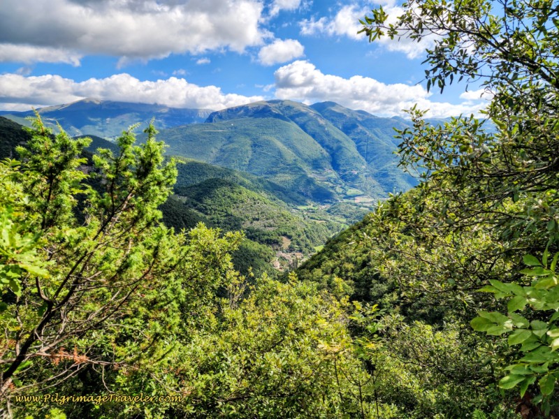 Pontuglia Visible Below
As the trail continues through the forest, many more spectacular views are ahead.
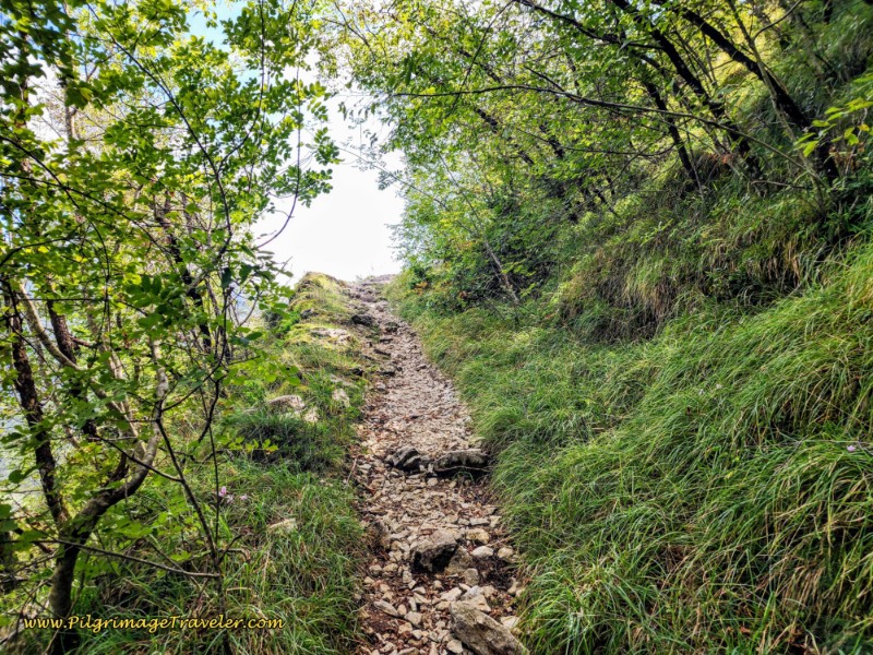 Trail to a Another View
Finally, The Way arrives at this intersection, where it descends to the left.
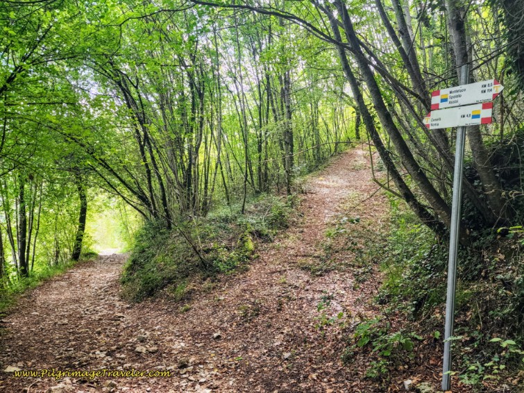 Descend Left Towards the Road and the Cemetery
And after 11 kilometers total for this stage, just after this intersection, the trail ends at a T-intersection with a gravel lane. The Way is to the left. Ceselli is 4.8 kilometers away.
After joining the road, the Cimitero di Le Cese is just ahead on the left. We sat by the cemetery on a nice bench for a few minutes and had sandwiches, after only achieving about half the distance for the day! But the remaining kilometers would prove to be much faster and easier.
The Way continues on the lane, past the cemetery where it begins to steeply switchback down the remaining slope toward the next town of Pontuglia.
After three full hairpin turns, the road straightens out and heads for a homestead, shown next. The vines were laden with wonderful-looking grapes! I was glad to see the vineyard was fenced, otherwise the temptation to pick a few would have been too great!
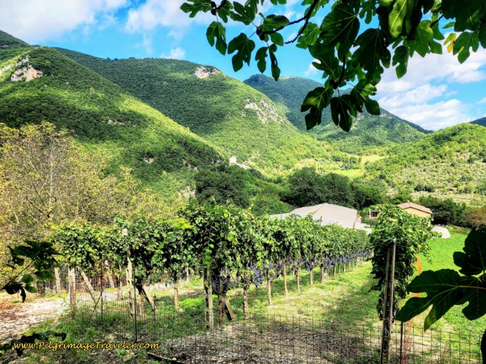 A Large Homestead Ahead
The road will now go entirely around this homestead, as it completes the final steep descent into Pontuglia. And now we get to see the views of the limestone cliffs overhead!
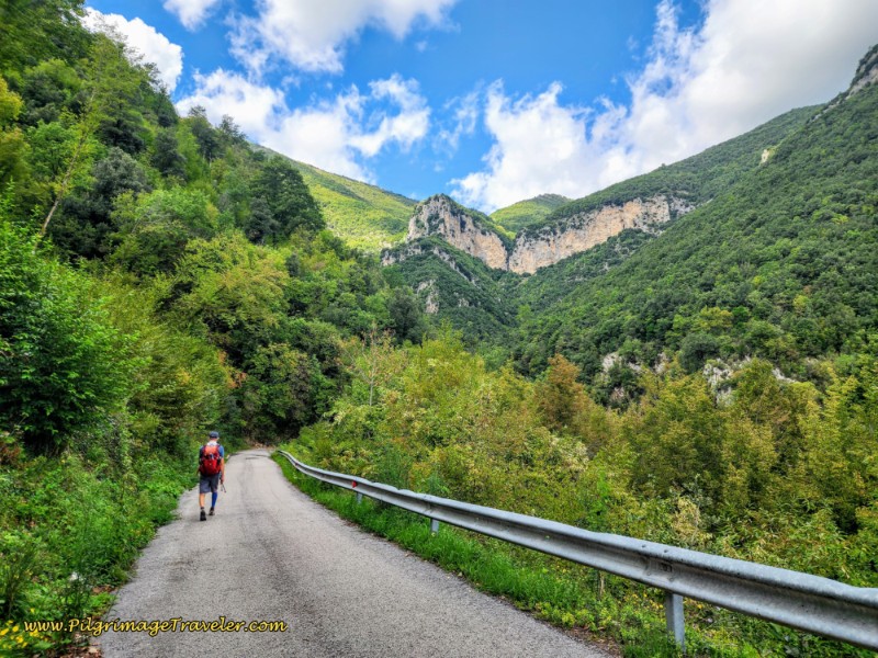 Steep Pavement Towards Pontuglia
At the entrance to town, cross a stream and arrive in Pontuglia after 14 kilometers into the day. There are no services here, and it is somewhat of a dead town.
However, there are surprisingly three possible places for accommodation, if you wish to stay here. This town is way more attractive than Ceselli, in my opinion, which is only a few more kilometers down the road.
There is the B&B Beep Beep, Tranquillo, uphill and behind the town in the hamlet of Schioppo, about 400 meters away. Look for the directional signs to it, as you enter town.
There is La Quiete Umbria B&B in town, and right by the historic grist mill, pictured below, Il Tartuffo (+39 392 796 9944). It is number 15, the building to the left side of the photo, that I captured inadvertently.
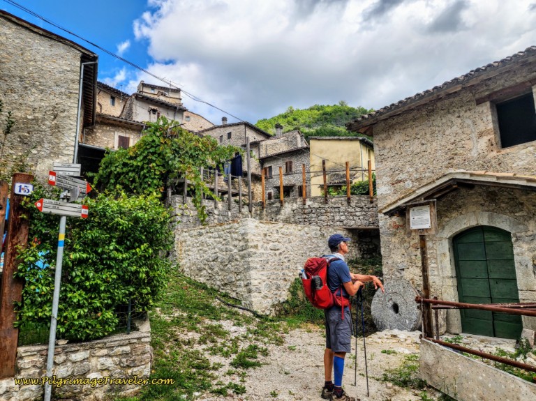 The Castello di Pontuglia and the Historic Grist Mill
After passing the grist mill, which Rich is admiring in the photo above, the Way now descends along a stream, the Fosso le Cese. This is a lovely and easy walk along the narrow and rural Via di Pontuglia, towards Ceselli.
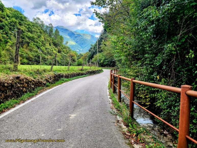 Via di Pontuglia, Along the Fosso le Cese Stream
By 15.4 kilometers, arrive in the town of Ceselli.
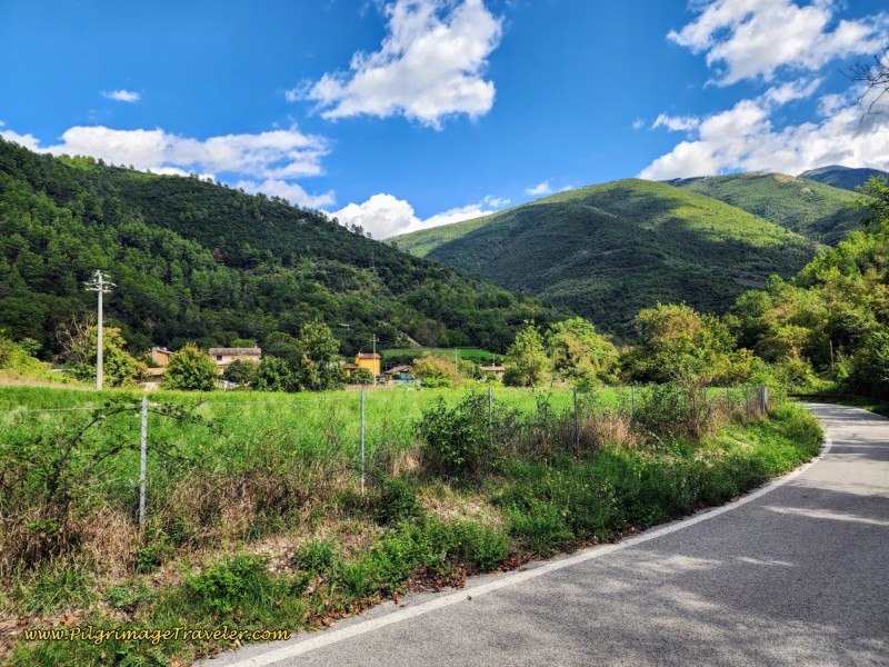 Ceselli Ahead
There is one restaurant in town, the Locanda Il Ruscello Di Benedetti Barbara, a few steeps to the left from the main road but it was closed up tight when we arrived. They have very limited and seasonal hours, so don't count on this being available!
There is also the attached accommodation, the Casa Vacanze Il Ruscello. They supposedly have a pilgrim's hostel, but again, all that was here was a locked gate when I investigated it. l'd strongly advise you make a reservation and make sure they are not closed when you wish to stay here.
The good news is that there is a donativo with a shared dormitory beside the town church, the Chiesa di San Michele Arcangelo, called the Casa della Diocesi (Diocese House, +39 333 7642516 or
+39 366 8630823). You can find it about 400 meters off route, along the Via Ceselli, a right hand turn from the first intersection along the main road.
And finally, some sources say you can contact the Ceselli Pro Loco (town resource people) who will put you up in cots in the Community Center for a donation. The community center is by the prominent soccer field along the main road and directly on the Way. You can try their numbers if you need assistance with accommodation at (+39 339 242 8928 or +39 0743.613345).
Otherwise, continue onward, and arrive at a major crossroads with the SP 209 after 15.9 kilometers. There is a water fountain on the NE corner if you need it. Macenano is 4.7 kilometers away.
A few meters past the crossroads, arrive at a bridge that crosses the Valnerina (Nera River) below. Cross this bridge and note yet another water fountain on the other side on the right, and next to a car park and a shaded picnic bench.
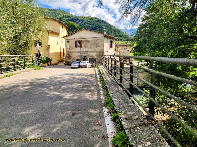 Bridge Across the Nera River
My feet were feeling hot and tired after all that downhill pavement pounding, so we sat in the shade and took off our shoes and socks and cooled our feet in the fountain! We would have cooled them off in the river, but it was rushing so fast, I didn't dare!
It is only about 1/4 kilometer later when you are directed to turn off the paved road and onto this dirt lane, shown below, through the countryside.
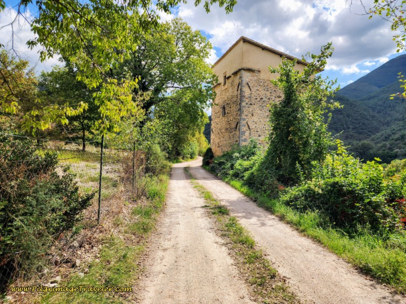 Long Dirt Lane to Macenano
It is a straight shot of 4.5 kilometers on this lane, all the way to Macenano, following the path of the Valnerina, or the Nera River as we know it. It is an easy, flat walk!
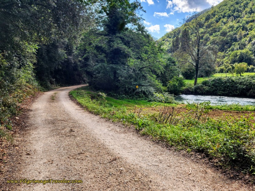 Following the Valnerina
You will see and hear the SP209 highway, which also follows the river, but on the other side.
You will walk up a slight rise in the roadway after about 17.1 kilometers, where recently work was done on the road and embankment to clear a landslide. (Note we had to do an easy detour through the meadow to the right, so be aware if the detour is still necessary.)
Come to a crossroads with a paved road after 19.3 kilometers, with Macenano 1.5 kilometers away, and continue straight through, staying on the dirt lane.
And after about 20 kilometers, total, you will see the small town of Sambucheto on the other side of the river to the right.
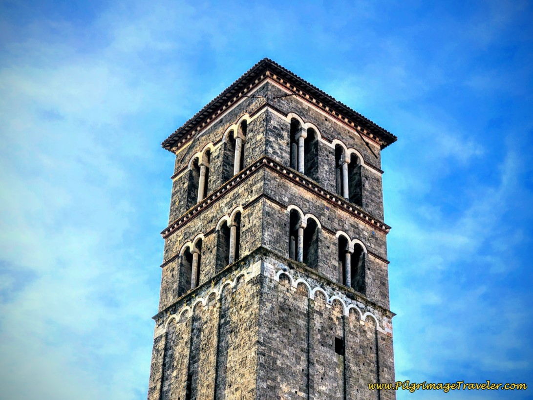
Only a few meters onward, the town of Macenano is visible ahead, below. Its distinctive clock tower rises above the town.
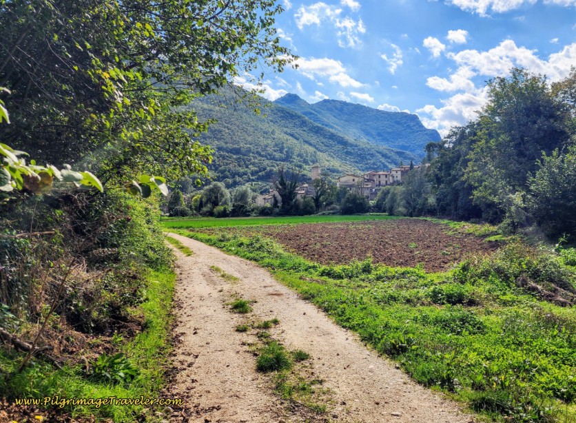 Macenano Ahead
When you arrive into the town of Macenano itself, look for a right hand turn at a T-intersection, shown below.
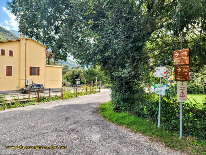 Crossroads in Macenano
After the right turn, you will see the town looming above, and the river crossing ahead.
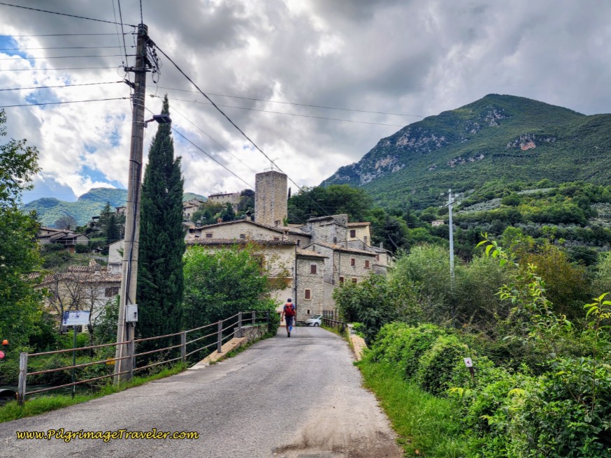 Entering Macenano
If you are staying here at the Hotel e Restaurante Ai Tre Archi, keep straight across the river and the hotel is above you on the main road through town. You can take a nice shortcut path, a few meters after the bridge, to the left and onto a stairway up to the church to get to the main road.
If you need a rest break there are wonderful, shaded picnic benches on the other side of the river.
Or if you are heading onward, take a left turn before the river to continue along the Way towards Ferentillo.
The family that runs the Ai Tre Archi are very pilgrim friendly, especially the matriarch, who I found delightful and very motherly. We had a wonderful room on the second floor, overlooking the valley, from a large terrace where we could hang our hand-washed clothes. And the dinner was superb, however, it came with a nicer price tag. If you have the budget, I highly recommend this place.
Reflections, The Way of St. Francis, Spoleto to Macenano
For me (and us) this was a most lovely day, with the surprises of the beauty of the Eremo, the humor and warmth of Mario, the incredible mountain views and the lovely, easy saunter along the Nera River.
It was the perfect length for me, the perfect amount of stops and the perfect reception from the matriarch of the Ai Tre Archi to end my already perfect day.
Salutation
May your own Way of St. Francis from Spoleto to Macenano be filled with surprises to delight you! Ultreia!
Way of St. Francis EBook Guides
Walk smarter with our ad-free, beautifully formatted Way of St. Francis eBook Guides, in PDF format ~ perfect for offline use in mountainous and remote areas along this Way. Includes daily stage details, alternative routes and stunning photos. Our eBook Guide is unique because we also immerse you with our story.
Don't carry a heavy paper book, but use our digital eBooks on your mobile device instead! You can walk with clarity and confidence, deeply connect to nature, following in the footsteps of St. Francis, through the Italian countryside!
📲 Instant download. 💸 Money-back guarantee. 🔄 Free updates for 1 year.
👉 Click here for more information! OR BUY NOW ~ Northern Route: La Verna to Assisi, OR BUY NOW ~ Southern Route: Assisi to Rome. OR BUY BOTH HERE
Way of St. Francis Stages
Northern Route, Via del Nord ~ La Verna to Assisi
Southern Route, Via del Sud ~ Assisi to Rome
Please Consider Showing Your Support
Many readers contact me, Elle, to thank me for all the time and care that I have spent creating this informative website. If you have been truly blessed by my efforts, have not purchased an eBook, yet wish to contribute, I am exeedingly grateful. Thank you!
Search This Website:
🙋♀️ Why Trust Us at the Pilgrimage Traveler?

We’re not a travel agency ~ we’re fellow pilgrims! (See About Us)
We've trekked Pilgrimage Routes Across Europe since 2014!
💬 We’ve:
- Gotten lost so you don’t have to. 😉
- Followed waymarks in the glowing sunlight, the pouring rain and by moonlight. ☀️🌧️🌙
- Slept in albergues, hostels & casa rurals. Ate and drank in cafés along the way. 🛌 😴
- Created comprehensive and downloadable GPS maps and eBook Guides, full of must-have information based on real pilgrimage travels. 🧭 🗺️
- Shared our complete journeys, step by step to help YOU plan your ultimate pilgrimage and walk with your own Heart and Soul. 💙✨
Every detail is from our own experiences. Just fellow pilgrims sharing the Way. We have added a touch of spirituality, heartfelt insights and practical guidance from the road ~ offering a genuine connection to the spirit of pilgrimage. Tap into the wisdom of seasoned pilgrims!
Ultreia and Safe Pilgrimage Travels, Caminante! 💫 💚 🤍
Follow Me on Pinterest:
Find the Pilgrimage Traveler on Facebook:
Shroud Yourself in Mystery, along the Via de Francesco!
Walk in the Footsteps of St. Francis, and Connect Deeply with the Saint and to Nature in the Marvelous Italian Countryside!
Need suggestions on what to pack for your next pilgrimage? Click Here or on the photo below!
Find the Best Hotel Deals Using This Tool!
Carbon Trekking Poles ~ My Favorites!
Carbon fiber construction (not aluminum) in a trekking pole makes them ultra lightweight. We like the Z-Pole style from Black Diamond so we can hide our poles in our pack from potential thieves before getting to our albergue! There are many to choose from! (See more of our gear recommendations! )
Gregory BackPack ~ My Favorite Brand
Do not forget your quick-dry microfiber towel!

