- ~ Home
- Camino Portugués Maps
Jump to Camino Portugués Stages
Camino Portugués Maps ~ GPS Tracks
Disclosure: the PilgrimageTraveler.com is an associate of Booking.com, Roamless, and Amazon. As associates of these merchants, we earn from qualifying purchases from our links.
Last updated:
🙋♀️ Why Trust Us at the Pilgrimage Traveler?
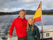
We’re not a travel agency ~ we’re fellow pilgrims! (See About Us)
We've trekked Pilgrimage Routes Across Europe since 2014!
💬 We’ve:
- Gotten lost so you don’t have to. 😉
- Followed waymarks in the glowing sunlight, the pouring rain and by moonlight. ☀️🌧️🌙
- Slept in albergues, hostels & casa rurals. Ate and drank in cafés along the way. 🛌 😴
- Created comprehensive and downloadable GPS maps and eBook Guides, full of must-have information based on real pilgrimage travels. 🧭 🗺️
- Shared our complete journeys, step by step to help YOU plan your ultimate pilgrimage and walk with your own Heart and Soul. 💙✨
Every detail is from our own experiences. Just fellow pilgrims sharing the Way. We have added a touch of spirituality, heartfelt insights and practical guidance from the road ~ offering a genuine connection to the spirit of pilgrimage. Tap into the wisdom of seasoned pilgrims!
Ultreia and Safe Pilgrimage Travels, Caminante! 💫 💚 🤍
My Camino Portugués maps, created on Google My Maps from my own personal GPS tracks, can be easily accessed, or downloaded and then uploaded for your personal use. This is a maps-only guide I created, just for you and for your successful pilgrimage!
If you are looking for elevation profiles, you will need to jump to the Camino Portuges Stages, below and click on each day's description.
My Camino Portugués maps are easily opened, with just a click on one of the links below, and can be used on your mobile device, using the Google maps feature, or the Google Maps App. You will need a cellular connection to use the maps for full functionality, while walking the Camino. For that, I suggest you try Roamless, if you have eSIM capability on your cell phone. It is all that I use now for data, after years of trying different eSim products.
However, you can still use my Camino Portugués maps offline, jump to this section for more infomation.
Or, if you prefer to download the GPS file(s) using the instructions, below, you can open the same map in Google Earth. (You must have the Google Earth app on your laptop or personal mobile device.)
⬇️ How to Download the GPS Files from My Google Maps
If you want the actual KMZ files so you can view the day in Google Earth, follow the instructions below. You must have the Google Earth App on your phone, tablet or your laptop.
Otherwise, just click on any or all links below to open my map in Google Maps. You will need the Google Maps App on your mobile device if you wish to use them offline. Otherwise, you can use them with a data connection (think Roamless), without the Google Maps app.
I encourage you download the Google map every day, as it is the best way to navigate when you follow along in our tracks. Plus, I have located all the accommodations and services for each day to help you in your planning for each and every day! It is indeed like using a maps-only guide.
Here are the instructions on how to download my GPS files with all the features, for the individual day's file for viewing in Google Earth and its App. It is a lot of fun to see the Camino this way:
On your laptop: When you open one of the links below, it will take you to my Google Map for that day in your browser for google maps (Safari, Chrome and Firefox browsers work best).
- Click on the top three dots in the red title bar next to the map name. You will see on the drop down menu that opens, "Download KML." Choose this option.
- In the window that opens, choose "Export as KML..." box if you want that format. Otherwise if you want the entire map downloaded, just click "OK." The file will download to your downloads file. You can also choose the Tracks only, instead of the Entire map on the Export window, if you wish to upload this file to another GPS device.
- Alternatively, from the three dots drop down menu, you can also choose "View map in Google Earth" if you wish to go directly there. You must have the Google Earth app on your laptop for this option. I recommend the Google Earth Pro version. It's free and more useful.
- Have fun with these files!
On your cell phone or tablet: This is rather tricky, but it can be done.
- Instead of clicking on a link below, long tap (hold you finger on the link) until you get a menu pop-up. Click on "Download link." This will create an automatic download of the map.
- After the file downloads, open it.
- If you get a message that says, "Viewing an offline copy of this page - Reload," click on Reload.
- This will take you to my Google Map in a browser. The page will look very small on a mobile device, so look closely for three dots in the red title bar next to the map name. You can pinch open the screen to help. Click on the three dots.
- Next, you will see on the drop down, "View map in Google Earth." Click on this for the Google Earth view (You must have the Google Earth app on your device.)
- If you want to export this map, you also have a choice in the drop down that says "Download KML." Choose this option for another window pop-up.
- Click on the KML box if you want that format, otherwise click on "OK." You can also click on the "Entire Map" and choose only the tracks if you want to upload to another GPS device. After clicking OK, the file will download to your downloads file.
🌍 Entire Route Maps in One File, Without Downloading
For the entire GPS file for the Portugues Way from Lisbon to Santiago de Compostela, including the Coastal, Senda Litoral, Central Routes and crossovers between them, click here. This link will automatically open this file to your laptop or personal mobile device. No need to download. This is GPS tracks only, no features.
For individual maps with features, (a true maps-only guide) click on the following links: Central Route Lisbon to Porto, Central Route from Porto to SdC, and Coastal Route with the Senda Litoral.
For the entire GPS file for the Variante Espiritual of the Camino Portugués from Pontevedra to Pontecesures, click here. This link will also automatically open this file to your laptop or personal mobile device including all the features.
For the individual, daily files, listed all in one place see just below. Use this option if you wish for smaller files to manage.
🌍 Each Stage Direct Links to Google Maps Without Downloading
🏰 Lisbon to Porto Route:
Day One, Lisbon to Alverca do Ribatejo
Day Two, Alverca do Ribatejo to Azambuja
Day Three, Azambuja to Santarém
Day Four, Santarém to Golegâ
Day Five, Golegâ to Tomar
Day Six, Tomar to Alvaiázere
Day Seven, Alvaiázere to Alvorge
Day Eight, Alvorge to Condeixa-a-Velha
Day Nine, Condeixa-a-Velha to Coimbra
Day Ten, Coimbra to Mealhada
Day Eleven, Mealhada to Águeda
Day Twelve, Águeda to Albergaria-a-Nova
Day Thirteen, Albergaria-a-Nova to São João de Madeira
Day Fourteen, São João de Madeira to Porto
🏖️ Porto to Redondela Via the Coastal and/or the Senda Litoral
Day Fifteen, Porto to Vila do Conde
Day Sixteen, Vila do Conde to Esposende
Day Seventeen, Esposende to Viana do Castelo
Day Eighteen, Viana do Castelo to Caminha
Day Nineteen, Caminha to Mougás (Viladesuso)
Day Twenty, Mougás (Viladesuso) to A Ramallosa
Day Twenty-One, A Ramallosa to Vigo
Day Twenty-Two A, Vigo to Redondela
(Skip to Day Twenty-Two Below, Central Route, for the Continuation to Santiago.)
⛪ Porto to Santiago de Compostela Via the Central Route
Day Fifteen, Porto to Vairão (Vilarinho)
Day Sixteen, Vairão (Vilarinho) to Barcelinhos (Barcelos)
Day Seventeen, Barcelinhos (Barcelos) to Ponte de Lima
Day Eighteen, Ponte de Lima to Rubiães
Day Nineteen, Rubiães to Tui
Day Twenty, Tui to O Porriño
Day Twenty-One, O Porriño to Redondela
Day Twenty-Two, Redondela to Pontevedra
Day Twenty-Three, Pontevedra to Magariños (Valga)
Day Twenty-Four, Magariños (Valga) to O Milladoiro
Day Twenty-Five, O Milladoiro to Santiago de Compostela
♱ Variante Espiritual from Pontevedra to Pontecesures
Day One, Pontevedra to CombarroDay Two, Combarro to Barrantes
Day Three, Barrantes to Vilanova de Arousa
Day Four, Arousa to Pontecesures
⬆️ Uploading to Wikiloc App or Other Apps or GPS Devices
Wikiloc is a mapping app more often used in Europe, and especially Spain, however, more people from the USA are becoming aware of it. It is my preferred app when on routes in Europe.
However, in order to upload my GPS files to use in Wikiloc, you will need to export only the part that says "Tracks." You can find the tracks only by clicking on the three dots next to the upper title of the map, where you will see on the drop down, "export to KMZ/KML." Chose the export function, then you will have a choice that says "Entire Map," and an up/down arrow. Click on this and choose the part that begins with "Tracks." This will give you a KMZ file for the tracks only without the features.
If you choose the entire map, the features and/or tracks will not show up correctly on Wikiloc. This is why I encourage you to use my GPS tracks in the Google maps apps (and a use a Roamless eSim for full functionality).
I have not tried uploading to any other map apps to see if the features function works or not. Most likely they will not. Nor have I tried uploading to a Garmin, or to GPS watches or other GPS devices. If you wish to comment on your experience using my Camino Portugués maps with any of these devices, please comment below. We'd love to hear from you!
🗺️Using My Camino Maps Offline with Google Maps
While the My Maps feature on Google does not technically offer an off-line version, because Google relies heavily on GPS data to find your location, you can still use my maps when you are offline. You can still see your location, the blue dot on the GPS track as you walk along. You will also be able to see the location of all the features I placed on the map, such as fountains, churches and accommodation. However, when you tap on a feature, you will not be able to retrieve that information.
Here are the steps for using Google maps offline on your mobile device (It's not as difficult as it looks):
- Click on any direct map link above. The Google Maps App will open and you will see the map you selected. (If the Google maps app doesn't open, but it opens in your browser instead, just go to the app and you should see it there as well.)
- To save this map for offline use, pick any location on the map, and type it in on the search bar at the top. For example, if you are using the day fifteen map starting in Porto, type in "Porto" in the search bar, or whatever city in the current map you want. Enter.
- You will still see my Google map, but now adjust the view until the entire day's route in centered on the screen.
- On the task bar at the bottom, with all the map features, like directions, swipe until you see "more." Tap on it.
- From the menu bar that pops up, select, "Download offline map." A screen pops up asking if you want to download the map. Before you click, "Download," make sure you readjust the map to include the day's walk. After clicking the download button, the map will now download to your device. It may take awhile.
- To test this feature, place your phone on airplane mode and turn off wifi. The map will stay open and you will see all the features and the path. As you are walking, your blue dot will be there, telling you if you are on the path or not. You just will not be able to retrieve information if you click on a feature. But you will still be able to use Google's functions to search and navigate. Cool, huh?
- When you navigate away from this map, to find it again, open the Google maps app. Click on your account in the top right-hand corner, and choose "Offline Maps." Pick the map you want.
Salutation
I hope my Camino Portugués Maps will provide you with information that will make your pilgrimage more successful! Ultreia!
Camino Portugués Overview
Camino Portugués Stages
Central Route: Lisbon to Porto Stages
Central Route: Porto to Santiago Stages
Senda Litoral or the Coastal Routes: Porto to Santiago Stages
Skip to Central Route Above, for Final Days 22-25 to Santiago
Variante Espiritual Stages
Please Consider Showing Your Support
Many readers contact me, Elle, to thank me for all the time and care that I have spent creating this informative website. If you have been truly blessed by my efforts, have not purchased an eBook, yet wish to contribute, I am exeedingly grateful. Thank you!
Search This Website:
🙋♀️ Why Trust Us at the Pilgrimage Traveler?

We’re not a travel agency ~ we’re fellow pilgrims! (See About Us)
We've trekked Pilgrimage Routes Across Europe since 2014!
💬 We’ve:
- Gotten lost so you don’t have to. 😉
- Followed waymarks in the glowing sunlight, the pouring rain and by moonlight. ☀️🌧️🌙
- Slept in albergues, hostels & casa rurals. Ate and drank in cafés along the way. 🛌 😴
- Created comprehensive and downloadable GPS maps and eBook Guides, full of must-have information based on real pilgrimage travels. 🧭 🗺️
- Shared our complete journeys, step by step to help YOU plan your ultimate pilgrimage and walk with your own Heart and Soul. 💙✨
Every detail is from our own experiences. Just fellow pilgrims sharing the Way. We have added a touch of spirituality, heartfelt insights and practical guidance from the road ~ offering a genuine connection to the spirit of pilgrimage. Tap into the wisdom of seasoned pilgrims!
Ultreia and Safe Pilgrimage Travels, Caminante! 💫 💚 🤍
Follow Me on Pinterest:
Find the Pilgrimage Traveler on Facebook:
Like / Share this page on Facebook:
***All Banners, Amazon, Roamless and Booking.com links on this website are affiliate links. As an Amazon associate and a Booking.com associate, the Pilgrimage Traveler website will earn from qualifying purchases when you click on these links, at no cost to you. We sincerely thank you as this is a pilgrim-supported website***
PS: Our eBook Guide books are of our own creation and we appreciate your purchase of those too!!
Shroud Yourself in Mystery, along the Via de Francesco!
Walk in the Footsteps of St. Francis, and Connect Deeply with the Saint and to Nature in the Marvelous Italian Countryside!
Need suggestions on what to pack for your next pilgrimage? Click Here or on the photo below!
Find the Best Hotel Deals Using This Tool!
Carbon Trekking Poles ~ My Favorites!
Carbon fiber construction (not aluminum) in a trekking pole makes them ultra lightweight. We like the Z-Pole style from Black Diamond so we can hide our poles in our pack from potential thieves before getting to our albergue! There are many to choose from! (See more of our gear recommendations! )
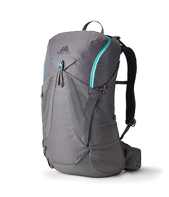
Gregory BackPack ~ My Favorite Brand
Do not forget your quick-dry microfiber towel!


















Your Opinion Matters! Comments
Have you had a similar experience, have some advice to give, or have something else you'd like to share? We would love to hear from you! Please leave us a comment in the box below.