- ~ Home
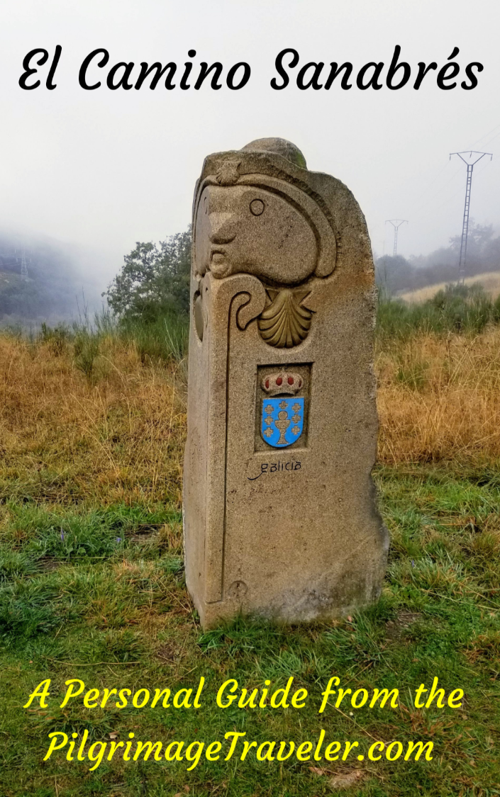
- ~ Camino Sanabrés (The Sanabrés Way)
- A Venda da Capela to A Laza, Day Nine
Jump to Camino Sanabrés Stages
Camino Sanabrés, A Venda da Capela to A Laza, Day Nine,
25.2 Kilometers (15.66 Miles) via the Official Route
OR 24.4 Kilometers (15.16 Miles) via the Mountain Alternative
Our day nine on the Camino Sanabrés from A Venda da Capela to A Laza, was a joyous walk on high mountain paths and roads, with stunning views. The rain had cleared and the lifting fog allowed us to breathe, relax and be in the moment for the first time in several days.
🙋♀️ Why Trust Us at the Pilgrimage Traveler?

We’re not a travel agency ~ we’re fellow pilgrims! (See About Us)
We've trekked Pilgrimage Routes Across Europe since 2014!
💬 We’ve:
- Gotten lost so you don’t have to. 😉
- Followed waymarks in the glowing sunlight, the pouring rain and by moonlight. ☀️🌧️🌙
- Slept in albergues, hostels & casa rurals. Ate and drank in cafés along the way. 🛌 😴
- Created comprehensive and downloadable GPS maps and eBook Guides, full of must-have information based on real pilgrimage travels. 🧭 🗺️
- Shared our complete journeys, step by step to help YOU plan your ultimate pilgrimage and walk with your own Heart and Soul. 💙✨
Every detail is from our own experiences. Just fellow pilgrims sharing the Way. We have added a touch of spirituality, heartfelt insights and practical guidance from the road ~ offering a genuine connection to the spirit of pilgrimage. Tap into the wisdom of seasoned pilgrims!
Ultreia and Safe Pilgrimage Travels, Caminante! 💫 💚 🤍
Quote for Day Nine on the Camino Sanabrés, A Venda da Capela to A Laza,
"The miracle is not to walk on water. The miracle is to walk on the green earth, dwelling deeply in the present moment and feeling truly alive.” ~ Thích Nhất Hạnh, Vietnamese monk, renowned Zen master, poet, and peace activist.
No quote could have described our day more beautifully! With light hearts and feet we had not a care in the world on this day! It was a rare day indeed. It is amazing how different the day was from day eight, a horrific weather day to be endured, and which was cut short.
Maps and Stats of Day Nine on the Camino Sanabrés, A Venda da Capela to A Laza
Here is our interactive Google map of our day, created from our GPS tracks. Because of our weather-abbreviated day eight, this is where we chose to hire a taxi to take us back up the mountain to A Venda da Capela to pick up our Camino where we had left off the day before.
Most likely you will start this day in A Gudiña and finish it in Campobecerros after 21 kilometers, or continue 28 kilometers to As Eiras where there are two accommodations, the Donativo Albergue Ultreia and the Casa Terra Alma, a casa rural, OR continue on to A Laza for a whopping total of 35.4.
The map below shows this entire stage of 35.4 kilometers. It also shows the choice of two routes after A Venda de Capela, 24.4 kilometers total via the mountain alternative that we did on day nine, in orange, and the 25.2 kilometer official route via the pavement, in blue. See farther below for a discussion of your choices of routes.
From A Venda da Capela, it is a lofty walk for 7.5 kilometers, including a small altitude push, then a steep descent into Campobecerros after about 10 kilometers, a climb out, then a long and steep, almost 10 kilometer descent into A Laza.
There is minimal elevation difference between the two routes as you can see below, however, you can see the difference in the distance, not quite one kilometer more via the official route and the difference in the steepness of the descents between kilometers 7.5-10.


👣 Camino Sanabrés EBook:
Offline Guide with Bonus Route
~ Includes 4-5 additional days on the Vía de la Plata from Salamanca!
Walk smarter with our ad-free, beautifully formatted Camino Sanabrés eBook Guide, perfect for offline use ~ important in the mountainous and remote areas. Includes daily stage details, stunning photos, historical background and a BONUS digital guide on the Vía de la Plata from Salamanca, called the Camino Fonseca. This allows you the opportunity to add 4-5 more days to your Camino in the beginning.
Don't carry a hard copy guide book to increase your pack weight. Use our frequently updated digital guide on your next Camino instead!
📲 Instant download. 💸 Money-back guarantee. 🔄 Free updates for 1 year.
👉 Click here for more info or BUY NOW!
Jump to Camino Sanabrés Stages
Photo-Rich Travelogue for Day Nine on the Camino Sanabrés, A Venda da Capela to A Laza
We hired the hospitalero from O Albergue da Rosario to drive us back up the mountain to A Venda da Capela, precisely where we left off the day before. After breakfast, we had said goodbye for the day, to Miguel, Nadine and Norm who were walking onward from Campobecerros to A Laza, where we would all meet up at the Pensión Casa Blanco Conde that afternoon.
We could not get a very early start, because of the hospitalero's schedule, but since our reservation was secure in Laza, and it was only 24 kilometers, we were not at all concerned, nor in a hurry.
We began our walk around 09:15. Our timing was actually perfect, as the skies were only beginning to clear after the deluge!
At the exit to town is this row of small cottages, shown below, that were once used by workers in the construction of the railway. They are now abandoned. Too bad, because they are quite quaint. Remember the word "venda" means country inn in Spanish, and these accommodations may have also housed agricultural workers at one time.

Across from the ruined cottages is a water fountain and some benches to rest if you need a break here.
Down to the right of the ridge road, near the railroad tracks, all of a sudden the sun burst out of the clouds for a brief moment. We had to pause and admire the view. We were ecstatic to not only see the sun, but to see the views! We had no idea that it was so beautiful here.

You may have noticed that in the above photo, Rich is not wearing a backpack, but a small string bag. The hospitalero allowed us to store our backpacks in the albergue for a few hours, so we could actually enjoy the 10 kilometers without them! Sweet!
This high ridge is a dry and desolate place, known in the area as "La Serra Seca" or dry ridge. It wasn't very dry on our walk, but indeed I could understand it, as very little grows here.
After about 500 meters from the exit to A Venda da Capela, you are directed to the left, off-road and onto the lane shown below. The locals I learned call off-road "by way of the mountain" or "de la montaña." I love it!
 Turn Left Onto Lane
The rough road ahead climbs a small hill, shown below.
 High Road
My dear Camino follower, MaryEllen, who lives in A Coruña, and walked this high route recently, has sent me some photos on the improvements through this area. If you read my previous day eight, you are aware that major improvements have occurred on that day's high elevation tracks.
The same is true for this section, and here is a photo from MaryEllen of this same road, shown below, with its improvements! She is the shadow, of course, and the new improvements are fantastic.
 Road to Galicia's Highest Swing*
And what is that ahead at the top? Really? A Swing? Yes, indeed it is a swing, called the Columpio de Vilariño de Conso or the swing of Vilariño de Conso, also known as Galicia's highest swing! My friend, MaryEllen, joked that she would have appreciated servicios instead!
That is her son swinging on the swing, pictured first. It is located after about 500 meters from the turn off at 1075 meters high, where the views abound.


And from the swing, the view of the reservoir is fabulous that you will be able to see on a clear day. As you swing and face northward, the Embalse de As Portas, can be seen from the ridge heights.

Jump to Camino Sanabrés Stages
It is only about 650 meters total on this lane, and about 150 kilometers after the swing when you get back on-road again, and turn left, shown below.
 Left Turn Onto Primary Lane
Here is the view of the reservoir that we saw on our day. I was thrilled to have the opportunity to see it, despite the high and clearing clouds. It is most beautiful through here.

The mountains surrounded us in this high area and the valleys were still full of the morning mist. I felt truly alive and in the moment. I am a lover-of-high-altitude girl, and this walk did not disappoint me!
 Up With the Clouds
After a slight descent, you enter the next town of A Venda do Bolaño after about 3.1 kilometers into day eight on the Camino Sanabrés from A Venda da Capela to A Laza.
 Entering Venda do Bolaño
There is really not much to this town, and if ever a country inn existed here, it is now long gone.

After leaving town at about 1075 meters in elevation, the road turns to pavement again, and there is a bit of a climb that you can see ahead and around the bend.
 Road Turns to Pavement
Here is a photo of the final hill to climb, before the steep descent into Campobecerros.

 High Altitude Road
After just about six kilometers into the day, you will come to this intersection, below, at the 181.174 kilometer waymark. The official route now is to stay on the pavement, on a nice downhill cruise, all the way into Campbecerros about 4.12 kilometers later. This is also the recommended route if the weather is bad.
 Left Turn Onto High Lane
This next photo shows the new waymark and a post by the bush that is no longer there, offering the alternative to the left, on a mountain lane. The sign on the post states that this was (and may still be) the horse route!
It seems like there has been a back and forth over the last several years, over which is the official route.
 Decision Point*
However, it is entirely possible to take the mountain route, "de la montaña," to the left, off the pavement for a shorter, 3.25 kilometers total into Campobecerros.
I believe that you should be the one to choose! Many pilgrims go this mountain route on a fair weather day because it is almost a full kilometer shorter!
However, be warned that the mountain lane ahead is very, very steep and slippery when wet, and our young friend Miguel fell down through this section in the rain! Even though it is longer, if it is raining like it was on our day eight, you should take the safer pavement.
Most likely, many a pilgrim has been injured taking the mountain route, which may be the reason for the official change. If you do choose the mountain route there is a short climb up a bit more, a mere 66 meters (216 feet), followed by a sharp descent into town.
Long and easy or shorter but harder? Let your personal skills and the weather be your guide.
We took the harder route because this was the official route at the time of this writing and the roadway had begun to dry out.
After the turn, is the final small hill before the high point of the day, pictured below. There is nothing dramatic about this climb, over about the next kilometer.
 Another Small Hill Ahead
The high point is at 1136 meters (3727 feet), about 7.0 kilometers from A Venda da Capela. You can clearly tell you are at the top, with something now waiting for you on the other side on this part of the Camino Sanabrés from A Venda da Capela to A Laza.
When you reach this top, it is actually a long flat road which you walk along for about 1/2 kilometer before the strong descent. This is a very exposed place and it can be brutal in bad weather.
 Topping Out
Jump to Camino Sanabrés Stages
On the other side is the welcome sight of Campobecerros, which is somewhat spoiled with the view of the new AVE high speed line to the south. You can also clearly see the old train station.
In addition, you can see the road westward and out of Campobecerros that you will be taking on the way to Portocamba. Wow! What a view. And thus begins the serious descent!

As I stated, the way down is extremely steep and rocky. This was one of the worst sections, shown below. Negotiating this in the pouring rain would not have been fun at all. I leaned heavily on my poles for balance through here, even though it was mostly dry.

Once again, the sun tried so hard to poke its way through the clouds, and it briefly lit up Campobecerros. The views through here are stunning!

And just when we thought it couldn't get any more beautiful, a rainbow presented itself. It was as if it was our personal reward, to choose to come back up the mountain, by ourselves, without encumbrances. It was a day and a view to celebrate!

The rough road switchbacks its way down the mountainside, and ends abruptly at this turn, shown below, a left onto the Campobecerros Road. This is the place where the official route coming down the highway meets the mountain route.
 Left Turn Onto the Rúa Campobecerros
And just shy of kilometer 10, we arrived on the edge of town, passing by the town church, the Iglesia de la Asunción.
 Entering Campobecerros
Across from the church, you take a narrow side road to the left, shown here. (Or you could just continue straight along the main road.)
 Left Turn Onto Side Lane
This short detour off the main road takes you through the center of town and by several landmarks. You will go by the Estatua de Peliqueiro, a statue with carnival dress, that I explained above from the carnival and the Monumento Os Carrilanos, a monument to the area's railway workers.
A few meters later, the detour brings you back to the main road near the Bar Casa Núñez, (+34 988 07 76 24), shown below, after about 10.2 kilometers.
To find the O Albergue da Rosario, turn to the right and take the first left turn. We did go there for a brief stop to get our backpacks once again. Hopefully this nice albergue will open again soon!
The Bar Casa Núñez, (+34 988 07 76 24), has rooms and is where we had a fabulous lunch the day before. There was construction going on here at the time, as you can see. This is the only accommodation in town at the present time.
 Bar Casa Núñez, Camino Sanabrés, A Venda da Capela to A Laza
Jump to Camino Sanabrés Stages
The onward Camino goes to the left after joining the main road, the OU-114.
Here is the road that climbs up and out of Campobecerros on the west side. It had stopped raining during our climb and the weather was even starting to clear!
 Climb Out of Town on the OU-114
The way to Portocamba is entirely on the pavement of the OU-114, for all three kilometers, about half of which is uphill.


As you get closer to town, cross the AVE railroad tracks. As you enter town, below, the way through is on the low road to the right, after approximately 13 kilometers on the Camino Sanabrés from A Venda da Capela to A Laza.
 Low Road Into Portocamba
Here is yet another Spanish rural town that has abandoned the traditional homes.

Continue to follow the OU-114 as it crosses a river, then turns left into the center of town. There are no services at all in this small village and very few inhabitants that we saw, other than a dog or two!
 Walking Through Portocamba
There is a fountain with potable water that you will pass by and benches to rest on, if needed.
 Public Fountain in Portocamba
And after 600 meters or so, you are through town, and once again climbing up and out on the pavement of the OU-114.
 Road Climb Out of Portocamba
The top of this climb on the pavement is at the wayside cross, called the Cruz do Milladorio, shown below, after approximately 14.1 kilometers.
This is where the Camino finally leaves the OU-114, and turns to the left before the cross and onto a gravel lane.
 Wayside Cross at the Top
After turning off-road "de la montaña," there is a Y-intersection, where you stay to the left, shown below. We stumbled onto Miguel's walking stick that he had left here by mistake. He texted us earlier to look out for it for him! And there it was, ready for our delivery to him.

There is a final, short climb after leaving the pavement, of only a few meters.
 Along the High Forest Lane
After approximately 14.9 kilometers, come to the top of the final climb for the day, before the almost 10 kilometer descent into A Laza.
 High Point After Portocamba
More stunning views open up after this top, shown in the next photos. The sky was clearing even more, so we could certainly see it all, including the amazing AVE tunnels and bridges. At many points along the way, we could see long stretches of the road ahead.


 Hairpin Turn, Camino Sanabrés, A Venda da Capela to A Laza
 The Way in the Distance

Here we paused for the rare photo of yours truly! I was so happy, with my feet on the green earth! I had absolutely no knee problems on this day. It was a fantastic day for me. I was elated for the entire day.

As we descended lower, by about 17 kilometers, the sweeping views were replaced with pine forests. There are lots of hairpin turns through this section.
 Winding Forest Road Descent
 More Descent on Forest Road
And suddenly the terrain changes and you see the buildings of the next town of As Eiras ahead.
 Road Towards As Eiras, Camino Sanabrés, A Venda da Capela to A Laza
This is a gorgeous little mountain town, with its residents particularly fond of hydrangeas.

In the center of town, after about 18.5 kilometers, you can't miss the pilgrim's rest stop and Albergue Ultreia, (+34 650 883 004), shown below, the "Ultreia Bar," commanding you to stop, rest, and breathe! There are snacks here, beverages, and an albergue with four beds, all for a donation.
This stop is run by the local Asociación Amigos do Camiño, "Ultreia-As Eiras." There are instructions in four languages, Spanish, English, German and French. You can also get a stamp.
It was lovely to rest a moment and indeed, breathe and read the log book entries of various pilgrims from all over the world who had signed.

Just across from the rest stop, is a painted sign declaring only 6 kilometers to Laza!

Jump to Camino Sanabrés Stages
If you have walked far enough, you can also choose to stay at the Casa Terra Alma right after the 6K sign on the right, not pictured. Both accommodation choices are after 28 kilometers from A Gudiña, a very respectable day.
And here is the road onward from As Eiras. It is still a long five kilometers descent on this paved secondary road. Fortunately, it remains a beautiful walk.
 Pavement Leaving As Eiras
 Forest Descent Continues, Camino Sanabrés, A Venda da Capela to A Laza
After about 23.2 kilometers, the final off-road segment is waymarked by a carving from sculptor, Nicanor Carballo, that leads you to the right onto a lane.

The lane continues to descend steeply.
 Shortcut Lane to A Laza, Camino Sanabrés, A Venda da Capela to A Laza
After about 23.3 kilometers, the Camino takes a hard left here, on this steep and rocky terrain. I could hear the sounds of a stream close by.
 Left Turn Towards the Río Cereixo
Sure enough, we crossed this lovely little river a few meters later, when the terrain finally became flat after 10 kilometers of intense downhill walking!

After kilometer 23.7 we joined the OU-112 into A Laza, at the one kilometer marker!

The city limits of Laza came into focus next.
 Entering A Laza
After 24.3 kilometers, you come to the turn to take you into the center of town, and the Albergue de Peregrinos de Laza. We, however, stayed straight on because we were staying in the Casa Blanco Conde, a casa rural. These are the only two accommodations in Laza. You can see the intersection below, with your choices.
 Right Turn in A Laza
The Casa Blanco Conde is only a few more meters along the OU-112. It is an inexpensive and comfortable place, with a laundry and kitchen, with breakfast included. Norm, Nadine and Miguel had already checked in and were resting in their rooms.
The proprietress is extremely friendly and explained to us, in Spanish, about the annual carnival, the Entroido de Laza that occurs in Laza every winter just before Lent.
Participants dress up in interesting medieval costumes, like the statue in front of the albergue in Campobecerros, shown in day eight. There are parades, flour and mud throwing, and giant ants! She said that more babies are born in November than any other month in Laza as a result of this festival! Click on the link above from the Xunta de Galicia for more information if you are interested in being here in the wintertime and also this very informative link.
 Pensión Casa Blanco Conde
We cleaned up and headed into town for a look around and for Happy Hour!
After the turn off from the OU-112, come to a T-intersection and take a left. Proceed a few more meters until you come to the traffic circle in the center of town. Stay to the right through the circle, as you head for the church that you can see ahead.
If you are going to the albergue, look for the Protección Civil de Laza. This civil center is in the southeast corner of the circle. You can’t miss the flags flying in front of the building. You must sign in here and obtain the keys to the albergue. The civil center is a total of about another 1/3 kilometer beyond the turn off of the OU-112.
The modern, 36-bed albergue is yet another 1/3 kilometer to the north of town, following the road past the church, northward for about 150 meters, then turning left following the signs for the albergue, arriving in another 150 meters. The albergue is in a sports center, (Pabillón Deportivo).
Miguel, Nadine and Norm had a big lunch at the Restaurante A Picota, shown below, just west of the church. They joined us again in the evening, but ate lightly. We had what they had for our dinner, the traditional Galician pork stew. We were told it was very famous. I thought it was good, but I didn't like how fatty the meat was. If you are interested, ask for the Estofado Gallego. The portions were incredibly generous, of meat, potatoes, chickpeas and vegetables.
 Café Bar and Restaurante A Picota
Reflections on Day Nine of the Camino Sanabrés, A Venda da Capela to A Laza
Today's Camino was a wonderful mountain walk for me, a day where I felt no pain of any sort. It was the most grounded of days, with my feet on the earth and my soul in the moment. It was a very special day for me. The views were spectacular and it made my heart soar through the heights.
The contrast of day nine, compared to day eight could not have been more dramatic.
Be forewarned, that if you do this high and exposed ridge in bad weather, be sure that you are well-prepared. In addition to ponchos and rain jackets, we would suggest rain pants, and layers to ward off the rain and sudden temperature changes at this altitude.
Salutation
May your own day nine on the Camino Sanabrés from A Venda da Capela to A Laza be filled with the miracle of walking on the green earth, may you dwell deeply in the present moment and may you feel truly alive! Ultreia!
*Photo credit given to my Camino Follower, MaryEllen, from La Coruña, Spain
Camino Fonseca Stages
~ Vía de la Plata Stages from Salamanca


~ Camino Sanabrés Stages


Please Consider Showing Your Support
Many readers contact me, Elle, to thank me for all the time and care that I have spent creating this informative website. If you have been truly blessed by my efforts, have not purchased an eBook, yet wish to contribute, I am exeedingly grateful. Thank you!
Search This Website:
The Pilgrimage Traveler Digital Guides
Our Guides Help You:
~ Know what to expect each day!
~ Locate historic sites along the Way!
~ Know where you are in your journey!
~ Discover a quote from the sages, for your daily reflection on the journey!
Click on a Photo Below to Get Your Copy.
A most popular alternative on the Central Route of the Camino Portugués!👇

The Portuguese Routes are rapidly gaining in popularity, especially the section from Lisbon! Plan to walk this one soon, before it is no longer a quiet experience!👇

Our most popular Portuguese guide! 👇

The most historic of the Portuguese Caminos ~ not to be missed!👇

The spiritual adventure of a lifetime, following in the footsteps of St. Teresa of Ávila!👇

The amazing mountain route alternative, the Camino Sanabrés, from Granja de Moreruela on the Vía de la Plata!👇
The most incredible mountain scenery on this camino from Leon to Oviedo!👇

The shortest of the caminos, but not easy!👇

The very first, Original Way from Oviedo to Santiago!👇

The pilgrimage to the "End of the World" ~ The perfect add-on to your camino!👇

All Banners, Amazon, Roamless and Booking.com links on this website are affiliate links. As an associate of these companies, the Pilgrimage Traveler website will earn from qualifying purchases when you click on these links. We have used and love all of our product recommendations and believe you will too! We sincerely thank you!

🙋♀️ Why Trust Us at the Pilgrimage Traveler?
We’re not a travel agency ~ we’re fellow pilgrims! (See About Us)
We've trekked Pilgrimage Routes Across Europe since 2014!
💬 We’ve:
- Gotten lost so you don’t have to. 😉
- Followed waymarks in the glowing sunlight, the pouring rain and by moonlight. ☀️🌧️🌙
- Slept in albergues, hostels & casa rurals. Ate and drank in cafés along the way. 🛌 😴
- Created comprehensive and downloadable GPS maps and eBook Guides, full of must-have information based on real pilgrimage travels. 🧭 🗺️
- Shared our complete journeys, step by step to help YOU plan your ultimate pilgrimage and walk with your own Heart and Soul. 💙✨
Every detail is from our own experiences. Just fellow pilgrims sharing the Way. We have added a touch of spirituality, heartfelt insights and practical guidance from the road ~ offering a genuine connection to the spirit of pilgrimage. Tap into the wisdom of seasoned pilgrims!
Ultreia and Safe Pilgrimage Travels, Caminante! 💫 💚 🤍
Follow Me on Pinterest:
Find the Pilgrimage Traveler on Facebook:
Shroud Yourself in Mystery, along the Via de Francesco!


Walk in the Footsteps of St. Francis, and Connect Deeply with the Saint and to Nature in the Marvelous Italian Countryside!
Need suggestions on what to pack for your next pilgrimage? Click Here or on the photo below!

Carbon Trekking Poles ~ My Favorites!

Carbon fiber construction (not aluminum) in a trekking pole makes them ultra lightweight. We like the Z-Pole style from Black Diamond so we can hide our poles in our pack from potential thieves before getting to our albergue! There are many to choose from! (See more of our gear recommendations! )
Gregory BackPack ~ My Favorite Brand


Do not forget your quick-dry microfiber towel!