- ~ Home
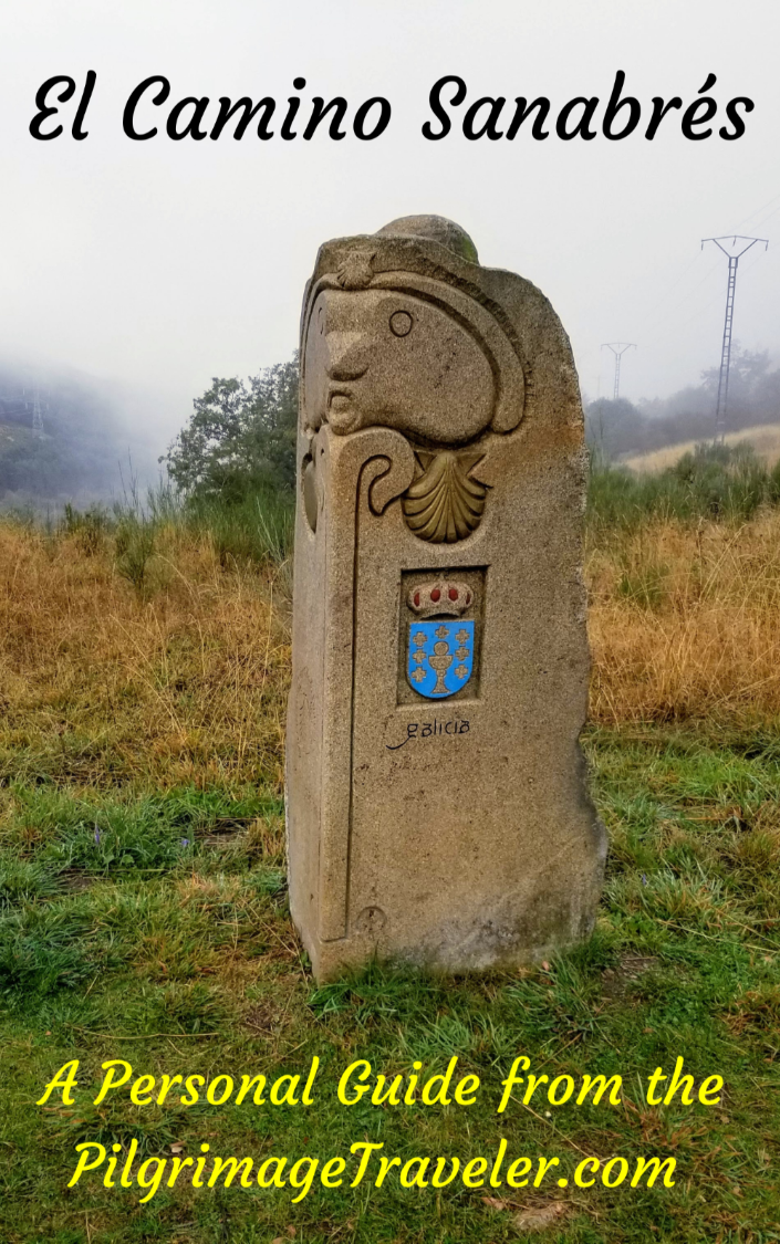
- ~ Camino Sanabrés (The Sanabrés Way)
- Santa Marta de Tera to Rionegro del Puente, Day Three
Jump to Camino Sanabrés Stages
Camino Sanabrés, Santa Marta de Tera to Rionegro del Puente, Day Three, 27 Kilometers (16.78 Miles)
Day three on the Camino Sanabrés, from Santa Marta de Tera to Rionegro del Puente is essentially a gentle and steady climb through increasingly deciduous forests, walking by a reservoir and on open lanes, and finally a descent into town.
🙋♀️ Why Trust Us at the Pilgrimage Traveler?

We’re not a travel agency ~ we’re fellow pilgrims! (See About Us)
We've trekked Pilgrimage Routes Across Europe since 2014!
💬 We’ve:
- Gotten lost so you don’t have to. 😉
- Followed waymarks in the glowing sunlight, the pouring rain and by moonlight. ☀️🌧️🌙
- Slept in albergues, hostels & casa rurals. Ate and drank in cafés along the way. 🛌 😴
- Created comprehensive and downloadable GPS maps and eBook Guides, full of must-have information based on real pilgrimage travels. 🧭 🗺️
- Shared our complete journeys, step by step to help YOU plan your ultimate pilgrimage and walk with your own Heart and Soul. 💙✨
Every detail is from our own experiences. Just fellow pilgrims sharing the Way. We have added a touch of spirituality, heartfelt insights and practical guidance from the road ~ offering a genuine connection to the spirit of pilgrimage. Tap into the wisdom of seasoned pilgrims!
Ultreia and Safe Pilgrimage Travels, Caminante! 💫 💚 🤍
Quote for Day Three on the Camino Sanabrés, Santa Marta de Tera to Rionegro del Puente
“For my part, I travel not to go anywhere, but to go. I travel for travel’s sake. The great affair is to move.” ~ Robert Lewis Stevenson, Scottish Author
Today's walk, at least for me, was not much more than just moving! I do enjoy the mere activity of the walk, despite the ultimate "going somewhere" to Santiago. This day is less interesting than some, but walking is what a pilgrim does, and today the focus was on the activity of moving itself.
Maps and Stats of Day Three on the Camino Sanabrés, Santa Marta de Tera to Rionegro del Puente
Here is my Google Map from my GPS tracks. While we did walk through several small towns, the services were either non-existent or unreliable. The first significant town, Calzadilla de Tera, is 11 kilometers down the road, without a café. It isn’t until Olleros de Tera another two kilometers farther along until you will find one. Much to our chagrin, this only bar in town was closed. Oh well ~ such is Camino life!
It is best to plan to find nothing on this day three and if something is available you will be pleasantly surprised. You may be able to get a reprieve at the Albergue Rehoboth, more than 21 kilometers into the day. This quaint place will give you coffee or tea, au gratis - a real refuge for pilgrims, however, a healthy donation is highly suggested.
The final destination of Rionegro del Puente has all the services that the pilgrim needs.
Please note there are three alternative routes in orange. The first is from Camarzana de Tera, if you had to walk on to the Juan Manuel hotel to find accommodations the night before. It is very easy to get back onto the Camino after walking west along the N-525 for 2/3 kilometer, then taking a left onto the ZA-105 and walking about one kilometer to the large gravel pit by the Tera River. See the description below. You will cut off about four kilometers of the day's total if you start from this hotel.
The second route in orange, is a small shortcut detour through Calzadilla de Tera, a frequently used option by pilgrims and the one to take if you are staying in the albergue there.
The third route in orange best taken in inclement weather when the path to the dam is slippery and muddy. This route is along the road designated as the way for bicycles.
The day is essentially a long gradual climb, with a few steeper areas thrown in. All-in-all the elevation gain is less than 300 meters (about 980 feet), so you will not be too taxed. A nice descent into Rionegro del Puente is a nice finish to a long day.

👣 Camino Sanabrés EBook:
Offline Guide with Bonus Route
~ Includes 4-5 additional days on the Vía de la Plata from Salamanca!
Walk smarter with our ad-free, beautifully formatted Camino Sanabrés eBook Guide, perfect for offline use ~ important in the mountainous and remote areas. Includes daily stage details, stunning photos, historical background and a BONUS digital guide on the Vía de la Plata from Salamanca, called the Camino Fonseca. This allows you the opportunity to add 4-5 more days to your Camino in the beginning.
Don't carry a hard copy guide book to increase your pack weight. Use our frequently updated digital guide on your next Camino instead!
📲 Instant download. 💸 Money-back guarantee. 🔄 Free updates for 1 year.
👉 Click here for more info or BUY NOW!
Jump to Camino Sanabrés Stages
Photo-Rich Travelogue for Three on the Camino Sanabrés, Santa Marta de Tera to Rionegro del Puente
We set off from Santa Marta before dawn, on a cool, crisp autumn morning. Everyone was up early in the albergue, and it felt like the bed race was on. In actuality, the municipal albergue in Rionegro del Puente had plenty of beds, 32 to be exact - almost triple the amount in Santa Marta.
We had fixed ourselves a hearty breakfast at the Albergue de Santa Marta. There is no nearby café.
Heading west from the albergue and towards the church, you walk past it and across the main square. You will see a "Camino de Santiago" sign on the west side of the square, with the iconic photograph of Santiago as a pilgrim, guiding you to stay high and to the right, above the wall and onto a small side road that leaves town. Do not drop down to cross the river by the way you entered town. Hopefully you noted this sign as you entered town the day before.
Within a short distance of about 1/4 kilometer, you come to more waymarks, ensuring that you are on the right track. By about 0.6 kilometers the pavement in town turns to a gravel lane.
After 1.12 kilometers, come to this intersection shown below, and take the lane to the left, crossing the small cement bridge. It is all clearly marked.
 Left Turn onto Southwest Lane
And thus begins the many seemingly endless farm roads for the day.
 Return to Walking on Farm Roads
At around 1.45 kilometers, on the Camino Sanabrés from Santa Marta de Tera to Rionegro del Puente come to a T-intersection and take a left. In another 1/2 kilometer, come to another T-intersection, shown below, where you are again directed to turn left. At this T-intersection, is yet another very old sign we had seen thus far, with a photograph of the iconic image of Santiago as a pilgrim, from the church in Santa Marta de Tera. It was finally light enough to try to get a decent snapshot of one of the signs.
 Very Old Pilgrim Santiago Waymark
After 2.57 kilometers, we passed what we believed to be a gravel pit, and our two French pilgrim friends.
After 2.89 kilometers, the main trackway looks like it goes to the right, and there is a small arrow that shows you to keep straight on instead, onto the lesser of the tracks.
We soon found ourselves walking through beautiful cultivated forests of poplar trees. As we walked through these poplar plantations, we found the tracks to now consist of deep sand and dirt. Could we dare believe we were finally leaving the harsh gravel behind?
 Walking Through Cultivated Forests
By approximately 3.39 kilometers into the day on the Camino Sanabrés from Santa Marta de Tera to Rionegro del Puente, we turned right at an intersection with the Tera River, shown below. It was much colder this morning, only about 41 degrees Fahrenheit. Walking along the river made it feel even colder. I found the wearing of gloves was quite useful, however, it made for more difficult photographing!
 Join the Río Tera
The Camino now follows the river for more than 2.0 kilometers. The morning was cool and glowing as we walked.

After around 3.9 kilometers, you come to a Y-intersection, just before this little abandoned, white building. You stay to the left.
 Pass Abandoned Building Along the River
By around 4.33 kilometers, we arrived at this triangular-looking intersection, where we stayed left along the river. The steam was really rising off the water. Several large trucks passed us through this area. Several more water trucks also passed us, watering the lane.
We could hear the humming of the motors of heavy equipment and there was a lot of dust in the air. It is more of an industrial area than we thought. Without the frequent watering of these dusty lanes, I'm sure it would have been much worse. The truck traffic was quite substantial through this section, so caminante beware!

Fortunately, the cultivated poplars provided some beauty with their splashes of golden color through this unpleasant area. The cool temperatures and fall color allowed us to really experience autumn for the first time. It was, after all, October 10th already!

After 5.74 kilometers, the gravel road turns to pavement at a big bend to the right and by a camping/picnic area. And suddenly, the source of all the noise became apparent. Below is a photo of the large gravel pit that you will see just across the highway ahead. The Camino joins the highway here.
 Come to Another Gravel Pit, Turn Left Onto ZA-105
Jump to Camino Sanabrés Stages
Upon reaching the highway, the ZA-105, the Camino turns to the left. It is here where the route from the Hotel Juan Manual joins the Camino. You will see the bridge immediately ahead that you will cross after 6.0 kilometers into the day on the Camino Sanabrés from Santa Marta de Tera to Rionegro del Puente.
There is a recreation area called La Barca on the opposite side of the highway, on both sides of the river. You can see a sign for the park, just discernible in the photo below. There are picnic tables and perhaps restrooms, and one restaurant here that opens late.
 Cross the Río Tera
As you cross the bridge, there is a very narrow sidewalk that offers a bit of protection, but you must still beware of the heavy truck traffic. Rich got off the sidewalk by mistake as he was crossing, and an approaching truck blared his horn at him! Oops!
The views on the bridge are lovely, especially on this fall day, as you can see below. Just take care when photographing it, that you don't step out on the roadway. It is easy enough to do.

Immediately after the bridge the Camino directs you to the right and into La Barca Recreation Area. Not much farther along, you leave the river and the park and walk through more poplar plantations on farm lanes. This area provides quite pleasant walking after the gravel pits, with the truck traffic now gone.


For the next three or so kilometers the Camino takes you through these lovely tractor tracks, without gravel, but nice soft dirt. The waymarking is perfect through here.

The farming fields alternate between corn and poplars. I also observed this unique concrete irrigation system.


The farmers lanes end after approximately 9.34 kilometers into day three on the Camino Sanabrés from Santa Marta de Tera to Rionegro del Puente, where you come out at the ZA-P-2547 roadway. You turn right onto the highway. Below is a stretch of this road, and as you can see, we saw quite a few peregrinos ahead.
 Join Highway ZA-P-2547 Briefly
Fortunately, the stretch on the roadway is only about 2/3 kilometer, when you are directed to turn to the right, after approximately 10 kilometers total on the Camino Sanabrés from Santa Marta de Tera to Rionegro del Puente. We are now turning onto a nice lane paralleling a long canal system, called the Canal Margen Derecho del Tera.
It was at this intersection that we caught up to and passed our Brazilian/Spanish trio who had needed to taxi ahead to the next accommodation. I guess we were all moving well in order to have overtaken them. Or they started later, most likely.
Shortly after the turn, about 1/3 kilometer later, you pass this lovely fountain. The signs warn you that the water is not safe to drink. The steps to the right lead you up to the bank of the canal and over it on a bridge.
 Pass the Fuente de Agua la Ribera
We continued straight on the lane as it walked up to the actual level of the canal, and came to another small bridge where you could cross it, after 10.5 kilometers (not shown). Then I saw the hill directly across the bridge and was gearing up to climb it. However, the yellow arrows on the bridge point to the right, to continue along the canal, avoiding the hill ahead.
Many pilgrims choose to go straight and up the hill directly through Calzadilla de Tera, the next town. This is the most efficient route if you are going to the Albergue de Peregrinos de Calzadilla de Tera. You can check the interactive map above to see this shortcut through town, in orange. When you reach the Calle de la Iglesia after about 1/2 kilometer, turn left and the albergue is about 1/4 kilometer straight south.
There are some historic sights to see as well in the center of town, the Ermita, La Virgen de la O and an old washing well.
We chose to continue along the canal. After the small bridge, the canal comes into clear view as the lane follows it closely. It is a lovely and flat walk.

Within about another 3/4 kilometer from the fountain, the buildings of Calzadilla de Tera come into view.
 Calzadilla de Tera Ahead
After 11 kilometers or so you come to an intersection with the paved road, where you can see the sign for Calzadilla de Tera. Turn left to join the road.
If you were planning to stay at the Albergue de Peregrinos de Calzadilla de Tera, this is your second opportunity to walk there. Continue on this road into town, crossing the canal. The donativo albergue is a straight shot south, for about 1/2 kilometer, off-Camino.
 Pass the Road Into Calzadilla de Tera
If you do stay at the albergue there is a Roman milario (Mile marker) that will help you identify the building. It is on the second floor of a shared building, with a retirement home on the first.
Otherwise, turn right just before the canal, to stay on-Camino and along the canal to bypass the town to the north. No one was interested in walking out of the way to see sights and since there is no café in town, we carried on.
Right along the Camino, on the other side of the canal, just before leaving town is the Casa Rural Lar Do Vento (+34 607 25 16 99) that has three rooms to inquire about, if you are interested, with a shared kitchen, living and dining rooms.
Along the way, about 1/2 kilometer later you see this old estate in ruins. I could not find any information about what this may have actually been. It made for an interesting distraction.

Jump to Camino Sanabrés Stages
After about 12.7 kilometers into day three, the canal takes a bend and we saw another town ahead, Olleros de Tera, on the Camino Sanabrés from Santa Marta de Tera to Rionegro del Puente. We were excited and happy to have the opportunity for a break in town at a café.

Only a few meters later we came to a T-intersection, by a bridge leading into town. Turn left and cross the canal on the bridge.
Enter town and walk along the Calle el Caño for only about 130 meters. Turn right onto the Calle de la Fuente, or continue straight a few more meters to visit the town church that you can see ahead.
After less than 100 meters along the Calle de la Fuente, come to an open plaza. If you go to the right, one block later you will encounter the only café in town, which is also an albergue, the Albergue Bar La Trucha, (+34 673 91 05 92, closed Wednesdays), after approximately 13.3 kilometers into the day. Or, stay to the left to continue onwards along the Camino.

We arrived at the bar at 10:30 in the morning, only to find the café was closed. Two British pilgrims had arrived just before us and the woman was almost hysterical, running around the square trying to find someone to open the café, since there was nothing else in town.
When she finally found someone, she was told that the proprietor was out partying too late last night, so he was not going to open any time soon! It was certainly a disappointment. Rich and I sat down on a step on the street, to have a bite and to wait for Norm and Nadine to catch up.
The four of us took a break in the city street and ate from our packs. The lesson, as usual, is to have your own food available at all times.
Back at the plaza and the Y-intersection, the onward Camino is along the Calle de la Agavanzal to the left. Walk through the remainder of town along this street for the next 350 meters.
Arrive at the ZA-P-2547 once again. Turn right onto it and enjoy a short section with a long row of trees. A few meters after the turn you see a potable water fountain. At the fountain you are directed to turn left, and onto a long, paved road that is very open, hot and boring.
The long asphalt road soon turns to concrete as you can see below, with an interesting building ahead. There is an occasional bench along this stretch to sit and rest if needed, leading me to believe that the building ahead was a road to something special.
 Long Concrete Road After Olleros de Tera
It is about 1.4 kilometers on the open road when the special place, the Ermita Nuestra Señora de Agavanzal, resides at the end of the concrete pavement as seen below. This road is a pilgrimage road to the Ermita. How lovely!
 Ermita Nuestra Señora de Agavanzal
It is after about 15 kilometers total on the Camino Sanabrés from Santa Marta de Tera to Rionegro del Puente, when you arrive at the Ermita Nuestra Señora de Agavanzal.
Across from the Ermita, there is this lovely building to rest, shown below. We found our french pilgrims here, and they were taking a break with a local elderly man.
Too bad I hadn't researched this prior to our street stop in Olleros de Tera. After only 1.4 kilometers down the road from town, this would have been a much, much nicer stop for "lunch" than on a street step. There are benches inside this building and picnic tables outside, to choose the sun or the shade.
The local in the shelter was a sweet, old Spanish gentleman, most certainly waiting to commune with whatever pilgrims walked by. Most likely it was his daily routine on fair weather days - a 1.5 kilometer walk from town to chat with the pilgrims!

Here is a photo of the front of the Ermita, which faces the rest area and the river. While the hermitage was closed, there is a small peep slot in the door that you can peer inside the old building. You can just see Norm at the door, peering inside.

Jump to Camino Sanabrés Stages
After the Ermita, you walk on these lanes that parallel the Río Tera and almost immediately the dam at the reservoir comes into view. You can see the dam in the photo below. That is the next destination.
 Southward Lane Follows the Río Tera
After 15.8 kilometers, we saw a little hill ahead, and thus, a more significant climb commences.
After about 800 meters after leaving the Ermita, there is a very interesting intersection, when the dirt road makes a big bend to the left. I approached the intersection first and waited for the others to catch up to help make a decision.
At this intersection, there is a sign pointing up the road and to the left for bici's (bicycles), that stays on the road. There is also a mojón, directing you to the left. However, there may be an arrow made of stones, pointing to the right and onto a path. There is also a yellow arrow on the “danger” sign, seen in the photo below, also indicating the way is onto the path.
 Watch Out For This Sign!
You have a choice of two routes here, as noted on the interative map above. If you chose to go the bicycle way, it is really far out of the way to the dam road compared to the direct path ahead through the brush. The difference is about 1.1 kilometers. But if it is raining or muddy, the road may be the better choice!
Also note that this shortcut turnoff may be easy to miss, so if it is dry weather and you want to take it, stay alert for it.
On the unimproved trail we encountered many raspberry bushes and their concomitant thorns! It may still be overgrown, depending on the last time trailwork was completed. I believe this path is an unofficial route, but one that is sufficiently well-trodden by pilgrims to be a viable alternative.
The trail does get a little better, like below, then it drops down to just by the river. It looked like it could be quite swampy in rainy conditions.

After dropping to the river, the trail leaves it and starts to climb, rather steeply. This is the first nice elevation gain that you see on the elevation profile, after around 16.6 kilometers. The way is well-marked with yellow arrows on rocks and trees as you can see below.
After around 16.9 kilometers into day two on the Camino Sanabrés from Santa Marta de Tera to Rionegro del Puente, you come to this crazy steep, final climb up and out of the path. It is actually an embankment, up to an unnamed, paved road where the shortcut ends after only a bit less than one kilometer through the brush. This is where you rejoin the bicycle route.
 Steep Final Climb Up to Road
Once you get above the embankment, go left onto the paved road shown below. You can clearly see views of the dam along the road.
 Join Roadway at Top of Climb
 Reservoir Dam Ahead
The road takes a significant bend, and is not quite 400 meters along it, when you come to another T-intersection, after 17.4 kilometers. The Camino takes a turn to the right here and onto the dam road shown below.
The views from the dam are nice, and you can see the Ermita off in the distance, from where you came. Take your time crossing the dam and drink in the views!
 Cross Dam Road
After about 17.8 kilometers, on the other side of the dam, at the next intersection, you go left onto another paved road.
After only about 100 meters more, go left again onto a secondary road, and notice this encouraging sign at the turn. Maybe we would have coffee today after all?? We tried not to hope too much!
 Café 3.5 Kilometers Ahead
The secondary road is paved and essentially follows the contours of the reservoir for the next 2.8 kilometers.


And finally, after the road takes a small bend to cross a little bridge, walk another 200 meters, and after about 20.6 kilometers, you come to a T-intersection. Here you take a left turn onto this divided highway, shown below, and the sign for the next village is ahead, Villar de Farfón. We arrived in town at about 1:00 in the afternoon.
 Welcome to Villar de Farfón
At the first intersection in town, see this lovely old stone building, and a sweet, wooden Camino sign, directing you to the left.
 Left Turn in VIllar de Farfón
Walk to the church, with the now-familiar Camino placard, only 40 meters later and turn to the right. This is an amazingly quaint little town.
 Iglesia San Pedro Apóstol, Villar de Farfón
100 meters later, turn right again and you are already leaving town. Pass an old wooden stock holder, where livestock were tethered to re-shoe. Stay straight on at the stockholder.
Less than 100 meters later, after about 21.3 kilometers into the day, you come to the 4-bed donativo Albergue Rehoboth (+34 679 86 32 85) shown below. What a quaint and wonderfully restored place this is! This was where we would be able to take a respite and get coffee or tea as the blue sign indicated, almost exactly 3.5 kilometers ago.

Jump to Camino Sanabrés Stages
We were offered Nescafe or tea and cookies, which we gratefully took! The proprietor also allowed us to eat our own food at the table. He was very helpful and friendly and told us he was from South Africa. He and his wife had been missionaries and felt called to the Camino, lovingly restoring this rundown place.
He does quite a bit of proselytizing as you would expect from a missionary, but his stories, especially of forgiveness, were very, very compelling. I could have stayed longer than we allowed. There was a little more than five kilometers to go to Rionegro, and after we left a donation for the refreshments, we needed to move on.
As we left the Rehoboth, the lane ahead looked like an ancient road. We thought this type of road and terrain looked more familiar and more "Camino-like" from our prior Caminos. It was so much better than the God-awful gravel lanes we had walked upon for so many days prior! I was hoping that we had left the hot and hard-on-the-feet gravel lanes for good.

This next section of about three kilometers would constitute the final climb of the day of about 50 meters (160 feet), a steady, but gradual gain in elevation.
I was fascinated with the double waymarks, like below. These were not even at an intersection. It would be very difficult if not impossible to get lost.
 Country Lane Waymarking
After approximately 23.6 kilometers into day two on the Camino Sanabrés from Santa Marta de Tera to Rionegro del Puente, you cross under a power line in an open field, and then go back into the forest. The road is lined with occasional pavers that suggested to us this had indeed been an established ancient road. I would have guessed it to be Roman, as in typical Roman fashion, they just built the road directly up and over the mountain!
 Begin Final Climb
By 24 total kilometers into day two, after this intersection, below, you reach the crest of the rocky hill, shown in the next photo.
 Nearing the Top
When you can see Rionegro del Puente in the distance, like in this photo below, you will know that you have arrived at the top for the day, at 844 meters (2769 feet). From here on, it is a nice downhill cruise!

Jump to Camino Sanabrés Stages
Around 25.2 kilometers, the road merges with another lane and bends to the right, as you continue down the hill.
After another big bend, you cross an arroyo and the buildings of the town appear.
 Rionegro del Puente Just Ahead
After around 26 kilometers as you are approaching town, you are walking on a parallel lane with the N-525. Walk by the abandoned Hostal Maxim's, not pictured.
We could see the steeple of the town church and the bridge across the river, as the lane led us down and away from the highway, to the placard shown below. Rich began to smell the barn and he literally picked up the pace to an almost run.

The placard above is the entrance to the park by the river, with nice picnic tables. Next, you come to a concrete footbridge and cross the Río Negro, parallel to the highway bridge above.
Turn right at the intersection after the footbridge and walk under the highway bridge. It is a really, really nice way to cross the river.
On the opposite side of the highway bridge, you turn left and up the lane shown below. Ahead is the Rionegro del Puente sign, and some old mining equipment that you will pass. The town church is looming above you.
 Walk Under the Highway N-525
At the top of the hill, where the lane meets the street, a lovely pilgrim statue and the Albergue de Peregrinos Virgen de la Carballeda greet you. This wonderfully restored albergue has 31 beds by my count. It was actually an original hospital for pilgrims, so I was thrilled that it was still in use.
There are two floors of dormitories and bathrooms/showers on each floor. There is a washing machine and dryer, but they didn't really work well when we were there. Plus, instead of waiting in the long line to use them, we found it easier to just wash by hand and line dry as usual. There is a kitchen with minimal features, like a hotplate only, but we didn't care as our plan was to go to the famous Me Gusta Comer Restaurante, just across the street.

After cleaning up and doing our laundry, we first had a happy hour at the bar right next to the albergue.
Our next stop was farther along the N-525 to find the Panaderia, or the bakery, which had many more groceries than just bread. We needed to restock our packs for the coming day. It is about 1/3 kilometer past the albergue.
The Restaurante Me Gusta Comer and Chef Teo's fame precedes himself, and I cannot say that we were disappointed. It is located conveniently, right across the street from the albergue to the south. Everyone knows about it, it seems.
 Restaurante Me Gusta Comer
The five course meal was fantastic, starting with this paté and toast as the appetizer, followed by soup and then the entree, Pork La-Orange. Every plate was finely decorated as you can see.
 Me Gusta Comer Appetizer
The final food delight was the dessert, a torte with ice cream, hazelnuts and chocolate! Then we ended with shots of liquor. Mmm Mmm.
 Me Gusta Comer Dessert
Here we are, Roque, Belén, yours truly, Vim, Ledi, Nadine, Norm, Catherine and Rich.
 Pilgrim Gathering at Me Gusta Comer
After we finished our amazing dinner, and walked to the albergue, the town church was lit and crowned with the moon above! It was a glorious evening.

Reflections on Day Three on the Camino Sanabrés, Santa Marta de Tera to Rionegro del Puente
On this day, we had a typical pilgrimage day, moving one foot at a time to complete the course of the day. All went without a hitch through the changing and cooler terrain. AND, we had an amazing end to our day at the incredibly nice pilgrim's historic albergue and our fabulous meal at the Me Gusta Comer.
Salutation
May your own day two on the Camino Sanabrés from Santa Marta de Tera to Rionegro del Puente be moving for moving's sake. May also you travel for travel's sake. May you always put one foot in front of the other. Ultreia!
Camino Fonseca Stages
~ Vía de la Plata Stages from Salamanca


~ Camino Sanabrés Stages


Please Consider Showing Your Support
Many readers contact me, Elle, to thank me for all the time and care that I have spent creating this informative website. If you have been truly blessed by my efforts, have not purchased an eBook, yet wish to contribute, I am exeedingly grateful. Thank you!
Search This Website:
The Pilgrimage Traveler Digital Guides
Our Guides Help You:
~ Know what to expect each day!
~ Locate historic sites along the Way!
~ Know where you are in your journey!
~ Discover a quote from the sages, for your daily reflection on the journey!
Click on a Photo Below to Get Your Copy.
A most popular alternative on the Central Route of the Camino Portugués!👇

The Portuguese Routes are rapidly gaining in popularity, especially the section from Lisbon! Plan to walk this one soon, before it is no longer a quiet experience!👇

Our most popular Portuguese guide! 👇

The most historic of the Portuguese Caminos ~ not to be missed!👇

The spiritual adventure of a lifetime, following in the footsteps of St. Teresa of Ávila!👇

The amazing mountain route alternative, the Camino Sanabrés, from Granja de Moreruela on the Vía de la Plata!👇
The most incredible mountain scenery on this camino from Leon to Oviedo!👇

The shortest of the caminos, but not easy!👇

The very first, Original Way from Oviedo to Santiago!👇

The pilgrimage to the "End of the World" ~ The perfect add-on to your camino!👇

All Banners, Amazon, Roamless and Booking.com links on this website are affiliate links. As an associate of these companies, the Pilgrimage Traveler website will earn from qualifying purchases when you click on these links. We have used and love all of our product recommendations and believe you will too! We sincerely thank you!

🙋♀️ Why Trust Us at the Pilgrimage Traveler?
We’re not a travel agency ~ we’re fellow pilgrims! (See About Us)
We've trekked Pilgrimage Routes Across Europe since 2014!
💬 We’ve:
- Gotten lost so you don’t have to. 😉
- Followed waymarks in the glowing sunlight, the pouring rain and by moonlight. ☀️🌧️🌙
- Slept in albergues, hostels & casa rurals. Ate and drank in cafés along the way. 🛌 😴
- Created comprehensive and downloadable GPS maps and eBook Guides, full of must-have information based on real pilgrimage travels. 🧭 🗺️
- Shared our complete journeys, step by step to help YOU plan your ultimate pilgrimage and walk with your own Heart and Soul. 💙✨
Every detail is from our own experiences. Just fellow pilgrims sharing the Way. We have added a touch of spirituality, heartfelt insights and practical guidance from the road ~ offering a genuine connection to the spirit of pilgrimage. Tap into the wisdom of seasoned pilgrims!
Ultreia and Safe Pilgrimage Travels, Caminante! 💫 💚 🤍
Follow Me on Pinterest:
Find the Pilgrimage Traveler on Facebook:
Shroud Yourself in Mystery, along the Via de Francesco!


Walk in the Footsteps of St. Francis, and Connect Deeply with the Saint and to Nature in the Marvelous Italian Countryside!
Need suggestions on what to pack for your next pilgrimage? Click Here or on the photo below!

Carbon Trekking Poles ~ My Favorites!

Carbon fiber construction (not aluminum) in a trekking pole makes them ultra lightweight. We like the Z-Pole style from Black Diamond so we can hide our poles in our pack from potential thieves before getting to our albergue! There are many to choose from! (See more of our gear recommendations! )
Gregory BackPack ~ My Favorite Brand


Do not forget your quick-dry microfiber towel!