- ~ Home
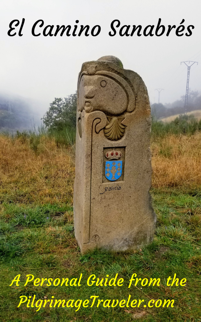
- ~ Camino Sanabrés (The Sanabrés Way)
- Tábara to Santa Marta de Tera, Day Two
Jump to Camino Sanabrés Stages
Camino Sanabrés, Tábara to Santa Marta de Tera, Day Two, 22.9 Kilometers (14.23 Miles)
Our day two on the Camino Sanabrés from Tábara to Santa Marta de Tera was perhaps the most historically important day for the pilgrimage traveler. While the day's walk itself is relatively routine and boring, the pilgrimage culminates in Santa Marta de Tera's historic Romanesque church. The church contains the oldest image known of Santiago dressed as a pilgrim. This most significant sculpture is not to be missed.
🙋♀️ Why Trust Us at the Pilgrimage Traveler?

We’re not a travel agency ~ we’re fellow pilgrims! (See About Us)
We've trekked Pilgrimage Routes Across Europe since 2014!
💬 We’ve:
- Gotten lost so you don’t have to. 😉
- Followed waymarks in the glowing sunlight, the pouring rain and by moonlight. ☀️🌧️🌙
- Slept in albergues, hostels & casa rurals. Ate and drank in cafés along the way. 🛌 😴
- Created comprehensive and downloadable GPS maps and eBook Guides, full of must-have information based on real pilgrimage travels. 🧭 🗺️
- Shared our complete journeys, step by step to help YOU plan your ultimate pilgrimage and walk with your own Heart and Soul. 💙✨
Every detail is from our own experiences. Just fellow pilgrims sharing the Way. We have added a touch of spirituality, heartfelt insights and practical guidance from the road ~ offering a genuine connection to the spirit of pilgrimage. Tap into the wisdom of seasoned pilgrims!
Ultreia and Safe Pilgrimage Travels, Caminante! 💫 💚 🤍
Quote for Day Two on the Camino Sanabrés, Tábara to Santa Marta de Tera
“I can’t change the direction of the wind, but I can adjust my sails to always reach my destination” ~ Jimmy Dean, American Musician and King of packaged spicy sausage.
This quote was perfect for us, as traveling in a group always, always requires adjustments. Our group was no exception. According to Jimmy Dean, an American musician, famous for his packaged, spicy sausage, he is essentially saying that a minor injury must be accepted, you must adapt and keep going.
The question for our group was, how would we adapt? How would that look? Could we stay together walking as a group? We are all committed friends, so resolving this issue would be of primary importance, going forward.
Maps and Stats of Day Two on the Camino Sanabrés, Tábara to Santa Marta de Tera
Here are my GPS tracks that I uploaded to Google maps. Please remember that if you are starting your day at the donativo Albergue de Peregrinos Tábara, because it is farther south, your total GPS figures may be different than mine. However, because this route is more direct, when you look at the map, the total distance may be quite similar to mine from town. My distances should always be taken as an approximation anyway, as no one person's steps are identical to another's.
I have placed services available for pilgrims on my map below. There are no services until after 14 kilometers, in Villanueva de las Peras. Santa Croya de Tera is the next town for refreshments, about 7.5 kilometers later, but it is only 1.5 kilometers away from your final destination in Santa Marta de Tera.
You will notice several route alternatives on the map below, that I will describe. One is the alternative from the albergue, vs from town, one is an official alternative halfway through the route and the other is a local-made alternative in the town of Villanueva de la Peras. A day of choices!
You will also notice a 4.7 kilometer extension that you will need to take should the albergue in Santa Marta de Tera be full. That would make your day a 27.6 kilometer day.
Santa Marta de Tera is a pinch point for pilgrims, having only one albergue with a mere 14 beds. It was problematic for us when we were there, even in October, so have a back-up plan in the event that you arrive and the albergue is full.
If you must keep walking to find a bed, or take a taxi to another town, plan on spending at least a small amount of time seeing the historic, Romanesque church in Santa Marta before you move on! See farther below for photos of this extraordinary and historic place.
As you can see, for the first time since Salamanca, there are frequent climbs, while not super strenuous, they are quite noticeable for their steepness and directness. Plus the topography continues to change, with more variety from the open lanes, giving way to more trees along with the hills. The warm up to the mountains ahead is continuing!

👣 Camino Sanabrés EBook:
Offline Guide with Bonus Route
~ Includes 4-5 additional days on the Vía de la Plata from Salamanca!
Walk smarter with our ad-free, beautifully formatted Camino Sanabrés eBook Guide, perfect for offline use ~ important in the mountainous and remote areas. Includes daily stage details, stunning photos, historical background and a BONUS digital guide on the Vía de la Plata from Salamanca, called the Camino Fonseca. This allows you the opportunity to add 4-5 more days to your Camino in the beginning.
Don't carry a hard copy guide book to increase your pack weight. Use our frequently updated digital guide on your next Camino instead!
📲 Instant download. 💸 Money-back guarantee. 🔄 Free updates for 1 year.
👉 Click here for more info or BUY NOW!
Jump to Camino Sanabrés Stages
Photo-Rich Travelogue for Day Two on the Camino Sanabrés, Tábara to Santa Marta de Tera
After our breakfast in the Bar El Roble, right by the albergue where we stayed, we set off for the day. The bar opened at 7:30, and in October the sun doesn't rise until 8:00, so we had time for a café con leche and tostada before dawn. I never like leaving in the dark anyway, since I can't take lovely photos for you and this guide!
As we passed the Iglesia de Santa María de Tábara, it was gorgeous in the pre-dawn light. This is my favorite time of the day, when the world is peaceful and the veil is thin. I was feeling great and renewed, as always, and my left knee pain that had plagued me in prior days had all but vanished. Yay!
Nadine, our injured group member, had a good night, her right shin was feeling better and she was willing to give the day a go. We all agreed that she must walk at her own pace to avoid further injury, that Rich and I would walk ahead if we wanted to go faster, Norm would hang with Nadine and we would all join up at points along the way. We all had operating phones to stay in touch.

If you are looking for a shortcut, if you stayed in town, at the church, take the N-631 left/west, out of town, for about 1/2 kilometer. Then you turn right onto the ZA-100 northward, and join the main Camino after about 1.25 kilometers. This shortcut is entirely on the pavement, but you will save about 600 meters taking this way.
If you stayed in the donativo albergue, you can avoid the town altogether. You start out on the Camino Sotillo, heading up the hill to the left and NW for less than 100 meters, then turn right onto the main artery, the Carretera Riofrío. After about 2/3 kilometer, you will see and cross over the N-631. Continue northward, on the same road that now becomes the ZA-100 for the same 1.25 kilometers, until rejoining the main Camino route.
I could see other pilgrims from the donativo, walking along the ZA-100, in the distance, while walking on the standard route north of town. I was surprised when I measured the shortcut on the ZA-100 route from town, that it saved quite a bit of distance, so make your own choice as you see fit.
There are yellow arrows to guide you on the alternative way from the donativo. If you need breakfast, be sure to get something in town the day before, as you will not pass any cafés on this route. If you are like me and must have breakfast and have nothing on you, the cafés by the Plaza Mayor are open early, and on a relatively short day, this would not be all that far out of the way.
Here is Nadine and Rich, passing the first indicator of the Camino, just after the church shown above as we began the standard route. We started out slowly, and Nadine was "settling into" her right leg, as she described it. I had taped up her shin with kinesiology tape, and with that support she was feeling positive about the day.
 Join the Camino at Waymark After Town Church
The clear skies greeted us as we left town for the open space. The rising sun cast the windmills on the ridge ahead into a wonderful silhouette.
 Windmills in Silhouette on the Ridge
The ridge with the windmills is your first destination, and your first hill climb, beginning at about 5K into the day on the Camino Sanabrés from Tábara to Santa Marta de Tera. You can see the pass off to the far left in the photo below, where you will pass.

After 1.62 kilometers, the Camino takes a hard left, shown below, where the railroad tracks impede any progress to the north.
 Approaching the Railroad Tracks
After the bend in the road, a prominent railroad bridge is in your primary view ahead. While it seemed that the way was across the bridge, the Camino instead went around it to continue westward.

Jump to Camino Sanabrés Stages
Here is the intersection after just a bit more than 2.0 kilometers, where the waymark is clearly sending you to the left and away from the bridge, now on your right. We continued westward.
 Left Turn Westward at Intersection
The lane after the turn is long and straight, shown here. You can faintly see the ZA-100 crossing at the bottom of the hill. It is after about 2.5 where the Camino crosses the ZA-100. This is where the route from the albergue and the shortcut I described above, join the route.

You cross the highway and continue on the farm road, the "Camino Agricola." Arrive at the next intersection after 2.85 kilometers into the day, and take a right turn. There was a funky yellow arrow at this turn, shown in the left lower portion of the photo below, and no usual mojón. The GPS tracks I was following were different, so I suspected that the route had been recently changed.
 Rich at the Right Turn Northward Again
After 3.45 kilometers thus far on the Camino Sanabrés from Tábara to Santa Marta de Tera and about 2/3 kilometer after the prior turn, you see the railroad tracks again. This time you walk up and over them on this bridge shown below.
 Cross Railroad Tracks on the Bridge
The road ahead continues to be open and essentially flat, for now.
 Continuing Northward After Railroad Tracks
Just before the approaching ridge, we passed a huge sheep pen, shown below. The sheep are corralled for the night for their safety. As we walked by, one, then two, then at least four very menacing dogs came racing out towards us! I can't believe I got this photo! I was farther away than it appears, because I did crop the photo significantly.
The lead white dog, in the center of the photo below came right up behind us, and was about three feet from my husband's heels, barking and snarling. We held our poles close to our chest and walked very, very fast. The dog never bit us, but boy did my adrenaline kick in!
 Menacing Sheep Dogs
Norm and Nadine were walking a ways behind us, and after the dogs left us alone, we stopped and called them to warn them. Then we waited for Ledi, who we knew was walking farther behind, and made sure that she got through safely as well.
 Begin 1st Hill Climb on the Camino Sanabrés from Tábara to Santa Marta de Tera
After 5.81 kilometers, it seemed like we had reached the crest of the first ridge climb. Here is a pilgrim reaching this false top.

Jump to Camino Sanabrés Stages
In actuality, there is another short stretch of climbing, and then you reach the true summit at 6.35 kilometers. The waymarking is great on these lanes, so you cannot get lost. In addition to the mojón, there are now concrete pillars, often side by side like in the photo below!
 New Waymark at Top
After around 7.2 kilometers we came to a high meadow where it is nice and flat and with shade for the first time. This open and high meadow, interspersed with trees was very, very pleasant walking for several kilometers.
This meadow had a few deciduous trees that actually gave us a little splash of fall color too! There were also fields of cultivated trees around us, all neatly lined up in a row.
 Cross High Meadow
More good news was that despite her injury, Nadine was essentially staying with the group, hobbling along with her slight limp. I was concerned that she needed a rest day, perhaps, but she was insistent that she was OK.
The trees were getting thicker now, as we walked onward. I was thrilled with this, as the weather felt cooler. I wasn't sure if it was because we had gained altitude or if the day was actually cooler, or if it was the psychological assistance from the trees! It didn't matter, as I was very content.

Our nice little flat area was actually a descent, as the elevation profile shows, and this soon changed as we began the second ridge climb of the day. It was after 8.62 kilometers when we crossed the named Arroyo de Zamarrilla, just ahead at the low spot in the photo below. It is just after this crossing that the second climb begins.
 Second Climb Begins
We reached what I thought was the top, but it was just a hump in the road. There was more of a long hill ahead, shown below. All the climbs on this day are quite gradual with no more than 50 meters (164 feet) of elevation gain.
 Climb Continues
It was here, shown below in the distance, after 10 kilometers into the Camino Sanabrés from Tábara to Santa Marta de Tera that we reached the second ridge crest. You can see an ant of a pilgrim at the very crest of the climb.
 Top of Second Hill
Once arriving at the top, you can see wonderful vistas ahead, of the next town of Villanueva de las Peras, more than three kilometers away yet and the higher mountains in the distance. I was very encouraged about leaving the high plains for the cooler and more diverse topography.
It was at this waymark at the top, shown below, when I decided to have a seat in the shade and relax and wait for the group to catch up. I was keeping a good pace, I guess, with my new-found elatedness. Plus, after more than 10k walking, I was hungry and needed a break.

After we all sat for a short break, the Way from here was downhill to the next landmark, shown below. This is after about 10.4 kilometers into the day, after crossing another arroyo and is the decision point for two different routes, as I had described in the opening of the article.
If you stay straight you will go through Villanueva de las Peras, which has a bar and the Albergue la Alameda, (+34 696 32 12 23).
The two signs on the far right, the first contains official Camino information from the Xunta de Zamora, and the one on the far right is a hand-painted arrow with the word "Bercianos" on it. This direction to the right is for a second, waymarked route through the town of Bercianos de Valverde.
There is no bar nor any accommodations in Bercianos, so I am not sure why anyone would choose this way. Plus, the route through Villanueva, by my GPS, is shorter by 1/2 kilometer than the route through Bercianos. We, of course, chose the way to Villanueva de las Peras because we wanted refreshments!
 Decision Point
Also in this opening by the Arroyo de las Cañadas is the now-familiar placard with the iconic image of Santiago on it, announcing your entrance into Villanueva de las Peras.

Jump to Camino Sanabrés Stages
A bit farther along you can clearly see Villanueva de las Peras and the cliffs behind it on the horizon, as shown in front of Norm and Nadine in this photo.
 Downhill Towards Villanueva de las Peras
Now at 12.4 kilometers on the Camino Sanabrés from Tábara to Santa Marta de Tera, you join the pavement at this bus stop, to carry on straight, after first crossing over the ZA-P-1509. The center of town is still about 1.5 kilometers away. We could almost smell the coffee!
 Bus Stop at the ZA-P-1509
The road straight on into town, shown below, is the ZA-120 on day two of the Camino Sanabrés from Tábara to Santa Marta de Tera.
 Follow ZA-120 Into Villanueva de las Peras
You pass a nice picnic area rest stop on your left just before entering the town limits after 13.6 kilometers.

Only about 1/3 kilometer farther on, one block from the center of town, you will see a small sign for the private Albergue La Alameda (+34 696 32 12 23), pointing to the right and down the Calle Escuela. It is only about 100 meters away. This photo below does not show this sign, but a pole with a yellow arrow, frequently seen to guide you through town.
 Sufficient Yellow Arrows in Town
By about 14 kilometers, the town center is in view and this café is greeting you, the Café La Plaza. We had the best tortilla here than I think I ever had! We met up with our Spanish pilgrim friend and he recommended the tortilla (egg/potato dish). Between his broken English and my broken Spanish, we communicated well!

To the east of the plaza, by a small tienda (store) you will see signs for the Camino, leading the pilgrim to the right onto the Calle de Abajo. This is in conflict with the sign on the café that says the Camino continues along the ZA-120, straight and north. This is actually an alternative route through town that joins the main route a short while later.
We took the standard route by the Café La Plaza, and up the hill toward the town church, staying along the main road, the ZA-120. The road uphill will lead you to the back steps of the church if you want to visit it. We did not, but took the bend to the right to turn eastward, leaving the ZA-120 after about 300 meters from the café and out of this small town.
 Uphill Toward Church on the Camino Sanabrés from Tábara to Santa Marta de Tera
 Leaving Villanueva de la Peras, on Eastward Lane
Jump to Camino Sanabrés Stages
We had to negotiate more open, dry lanes after town. There were more interesting plots of cultivated trees, I'm not sure what kind, but they were deciduous and showing some fall color.
 Dirt Lanes Begin Again
After one-and-a-third kilometers from town, and after 15.7 kilometers total, the Camino takes a hard left. At this same intersection is where the alternate route through Bercianos de Valverde joins the main route.
Suddenly ahead, you can see the 3rd ridge climb for the day, see photo below.
 Begin Third Ridge Climb
This is another small, energetic climb that will tax you a bit if it is hot, like it was for us. This is the crux of the climb.

You are almost at the top, about 3/4 kilometer later when the lane takes a hard bend, not shown. The next photo does show the top, with some grand evergreen oak trees. It is a very short climb, fortunately, of less than one kilometer.
 Top of Third Hill
It was through here that Rich offered to carry Nadine's pack. He felt that her limp would benefit by a lighter load. She wanted to keep carrying it, so we let her, of course.
After 17.8 kilometers, you come to this interesting Y-intersection, staying to the right as directed. We thought we had about four kilometers left in the day on the Camino Sanabrés from Tábara to Santa Marta de Tera.

 Downhill to Santa Croya de Tera Begins
It was after around 19.2 kilometers total that we crested a wee hill, and suddenly we could see the town of Santa Croya de Tera in the distance.

500 meters later, we crossed this very significant irrigation canal.
 Cross Irrigation Canal
After another 200 meters, the Camino joins the ZA-120 once again. And there to greet us was the Santa Croya placard. Since we were so close to our destination, we were looking forward to seeing the real statue of the oldest Santiago as a pilgrim!
 Welcome to Santa Croya
After approximately 20.5 kilometers into the second day on the Camino Sanabrés from Tábara to Santa Marta de Tera, we passed the Santa Croya de Tera town limits sign.
From the time you pass the town sign until arriving at the first buildings, the city has placed nice purple benches to rest if you need!
This town is also easy to navigate through.
 Yellow Arrows Abound in Santa Croya
After 21.2 kilometers we came to the town hall, on the main square and a café. I ran in quickly to get a stamp on my credential and an Aquarius to go, but Rich didn't care. We had tried getting a stamp at the Ayuntamiento (town hall) but no one was around, even though the building was open.
A few meters past the main square is a building that says "Alimentación y Tabacos" (food and tobacco) but it too was closed. Siesta time for all. If you hope to purchase food here for the albergue in Santa Marta, plan to arrive before 2 pm or after 5 pm or it will be closed. It is 1.4 kilometers from here to Santa Marta de Tera.
 Bar in Santa Croya Square
We continued north through town and came to a lovely park, with antique implements, and a soccer field. Shortly we joined a river walk, shown here.

Jump to Camino Sanabrés Stages
After 22 kilometers, you cross the Río Tera on this bridge.
 Left Turn Onto Bridge Over Río Tera
Then you cross the second, longer bridge and arrive in Santa Marta de Tera on the other side.
 Santa Marta Across the Río Tera
After the long bridge, the road bends to the right, and up a small hill.
 Walk Uphill Into Town
At the top of the hill is the Iglesia de Santa Marta de Tera, shown here, with the sign for the albergue, only a few steps ahead. You have essentially arrived, on this second day on the Camino Sanabrés from Tábara to Santa Marta de Tera!

Here is the front façade of the church, with its unusual, detached bell tower. I snapped the photos as we walked by.

The sign in front indicates that the church and albergue are run by the same people, and indeed you need to check into the albergue at the church museum entrance, when it opens after siesta, from 4:00-8:00 pm. Hopefully you will not arrive here on a Monday, as the church is closed.
 Sign for Albergue and Iglesia
Past the church, a few steps further you come to the Albergue de Peregrinos de Santa Marta de Tera. We chose our bunk beds and settled in while waiting for Norm and Nadine to arrive. We guessed that they were at least 20-30 minutes behind us. We waited anxiously as we watched this 12-bed albergue fill up quickly. Santa Marta de Tera is a pinch point, as this is the only accommodation for pilgrims.
We tried to save two beds, but two more pilgrims came along and took them. The rule is that you can't save beds anyway, so I had to give them up. When our friends finally arrived, Nadine got the last bed, and we were very, very lucky to see another mattress that we could put on the floor for Norm. We dodged a bullet this time!

At least four pilgrims were turned away later that I was aware of. Our three Portuguese friends did not arrive in time and taxied to the next albergue 12 kilometers away in Calzadilla de Tera, the donativo Albergue de Peregrinos de Calzadilla de Tera. You would have to be a very strong walker to add this amount to a 23 kilometer day, but it would be possible. It is a tiny place with only 6 beds and the town has few services. See day three for more information.
The other option is to walk about 5 kilometers off-Camino, on the N-525 as it leaves Santa Marta to Camarzana de Tera, where there is the Hotel Restaurante Juan Manuel, which has special pilgrim prices. Call them at +34 980 649 019 for a recent quote. This is where we would have gone if we had not found beds at the albergue, as adding 5 kilometers, only one hour additional walk, would have been quite doable. You can continue onward on the N-525 to rejoin the Camino farther west, with no need to re-trace any steps. See the map above for its location.
The albergue in Santa Marta has two dormitories with 6 beds each, no wifi, but a nice kitchen where we were able to create a nice pasta carbonara dinner and a hearty breakfast the next morning.
There is a small tienda where you can buy groceries, just a short distance away. This tiny place is totally unmarked and a bit tricky to find. I placed it on the map above, but be sure to inquire about it before you go, as I would not be sure of its sustainability. It had a very small, interesting selection of food.
There once was a bar across the street from the church, which sadly is no longer there. We all had a lovely happy hour after getting cleaned up and doing our laundry. We joined Katherine and Patrick from France, Roque from Portugal and Belén from Spain. Friendships were being forged.
 Goofy Selfie at the Bar (Permanently Closed)
There is now absolutely no bar in Santa Marta for inexpensive food. The only restaurant here is more expensive than most pilgrims would consider and is only open for the lunch period from 1-4 pm. You should not count on the small tienda to be open, so your best bet would be to purchase food in Santa Croya de Tera as you walk through, for your dinner and breakfast.
After our happy hour we all went to the Iglesia de Santa Marta de Tera to get registered and pay for the albergue. This historic Romanesque church is a museum now, as it should be, so we paid for the entrance admission as well.
The famous pilgrim Santiago sculpture was a bit tricky to find. I knew it was outside, but that was all. We had to walk all the way around the back of the church to find it. We actually did this before the museum opened up, or I would have asked. I was quite eager to see it.
Shown below is the rear doorway where it is hung, opposite another supposed apostle on the right, who is unidentified. Because these two statues are cut off at the knees, it is believed that they were moved here from an unknown location, perhaps a steeple, where there may have been all twelve apostles.

The church is all that remains of what was once a monastery, perhaps as old as 1077 A.D. when its construction was mentioned in a historic document. I could find no information regarding the age of the Santiago carving, but most likely it was done sometime in the 11th century. See the Santa Marta de Tera website for more complete information.
This figure of St James, or Santiago is clearly a pilgrim, with his staff, his gourd and the scallop shell on his pouch. We sat and admired him for some time, in the warm sunshine of that afternoon. The gardens and cemetery surrounding the church are quite inviting and peaceful.

If you are going onward from Santa Marta, try to spend at least some time seeing the interior of the church and the museum. It is worth the admission price. While the altar is not all that striking, what is becoming more and more famous is the column to the left of the altar, shown below in both photos.
The capitol of the column, shown close up, contains a pearl or medallion being lifted by angels, in which a naked, androgynous figure resides. The arms of the figure are missing. Because of wounds in the feet, it is believed to depict the Ascension of Christ or perhaps the ascension of the Soul.
Regardless of what the figure was meant to represent, the attraction is that twice a year on the equinox, the sun streams through the small round portal window above the altar and lights up the figure. This phenomenon attracts large crowds at this time of the year. Click here to see an amazing photo of this phenomenon.


Reflections on Day Two on the Camino Sanabrés, Tábara to Santa Marta de Tera
All-in-all our day went quite well. We managed to adjust the sails a bit, as a group, Nadine was just fine, and we were very lucky to get a bed in the albergue in Santa Marta.
The icing on the cake, for the day, was the wonderful historic church and its iconic and original statue of Santiago in pilgrims garb. We know the history to follow, where the idea of St. James as a pilgrim grew to such an extent that his image as a pilgrim is ubiquitous throughout Spain. What a pleasure to be at the birthplace of his creation as a pilgrim!
The concept of St. James as a pilgrim, perhaps guiding pilgrims of the ages since his creation, seems to have taken hold quickly in the conscious minds of the Spanish people. I think Santiago's image as a pilgrim is a very comforting vision and it unites all pilgrims, past, present and future.
My only regret in visiting the church of Santa Marta de Tera was that I was not at this unique place at the time of the equinox.
Salutation
May your own day on the Camino Sanabrés from Tábara to Santa Marta de Tera be filled with the splendor of the birthplace of Santiago as a pilgrim. May you be so lucky to be there at the equinox!
May you invite in the flexibility to adjust your sails as needed, despite any change in the winds. May you always reach your destination, however that looks for you. Ultreia!
Camino Fonseca Stages
~ Vía de la Plata Stages from Salamanca


~ Camino Sanabrés Stages


Please Consider Showing Your Support
Many readers contact me, Elle, to thank me for all the time and care that I have spent creating this informative website. If you have been truly blessed by my efforts, have not purchased an eBook, yet wish to contribute, I am exeedingly grateful. Thank you!
Search This Website:
The Pilgrimage Traveler Digital Guides
Our Guides Help You:
~ Know what to expect each day!
~ Locate historic sites along the Way!
~ Know where you are in your journey!
~ Discover a quote from the sages, for your daily reflection on the journey!
Click on a Photo Below to Get Your Copy.
A most popular alternative on the Central Route of the Camino Portugués!👇

The Portuguese Routes are rapidly gaining in popularity, especially the section from Lisbon! Plan to walk this one soon, before it is no longer a quiet experience!👇

Our most popular Portuguese guide! 👇

The most historic of the Portuguese Caminos ~ not to be missed!👇

The spiritual adventure of a lifetime, following in the footsteps of St. Teresa of Ávila!👇

The amazing mountain route alternative, the Camino Sanabrés, from Granja de Moreruela on the Vía de la Plata!👇
The most incredible mountain scenery on this camino from Leon to Oviedo!👇

The shortest of the caminos, but not easy!👇

The very first, Original Way from Oviedo to Santiago!👇

The pilgrimage to the "End of the World" ~ The perfect add-on to your camino!👇

All Banners, Amazon, Roamless and Booking.com links on this website are affiliate links. As an associate of these companies, the Pilgrimage Traveler website will earn from qualifying purchases when you click on these links. We have used and love all of our product recommendations and believe you will too! We sincerely thank you!
🙋♀️ Why Trust Us at the Pilgrimage Traveler?
We’re not a travel agency ~ we’re fellow pilgrims! (See About Us)
We've trekked Pilgrimage Routes Across Europe since 2014!
💬 We’ve:
- Gotten lost so you don’t have to. 😉
- Followed waymarks in the glowing sunlight, the pouring rain and by moonlight. ☀️🌧️🌙
- Slept in albergues, hostels & casa rurals. Ate and drank in cafés along the way. 🛌 😴
- Created comprehensive and downloadable GPS maps and eBook Guides, full of must-have information based on real pilgrimage travels. 🧭 🗺️
- Shared our complete journeys, step by step to help YOU plan your ultimate pilgrimage and walk with your own Heart and Soul. 💙✨
Every detail is from our own experiences. Just fellow pilgrims sharing the Way. We have added a touch of spirituality, heartfelt insights and practical guidance from the road ~ offering a genuine connection to the spirit of pilgrimage. Tap into the wisdom of seasoned pilgrims!
Ultreia and Safe Pilgrimage Travels, Caminante! 💫 💚 🤍
Follow Me on Pinterest:
Find the Pilgrimage Traveler on Facebook:
Shroud Yourself in Mystery, along the Via de Francesco!


Walk in the Footsteps of St. Francis, and Connect Deeply with the Saint and to Nature in the Marvelous Italian Countryside!
Need suggestions on what to pack for your next pilgrimage? Click Here or on the photo below!

Find the Best Hotel Deals Using This Tool!
Carbon Trekking Poles ~ My Favorites!

Carbon fiber construction (not aluminum) in a trekking pole makes them ultra lightweight. We like the Z-Pole style from Black Diamond so we can hide our poles in our pack from potential thieves before getting to our albergue! There are many to choose from! (See more of our gear recommendations! )
Gregory BackPack ~ My Favorite Brand


Do not forget your quick-dry microfiber towel!