- ~ Home
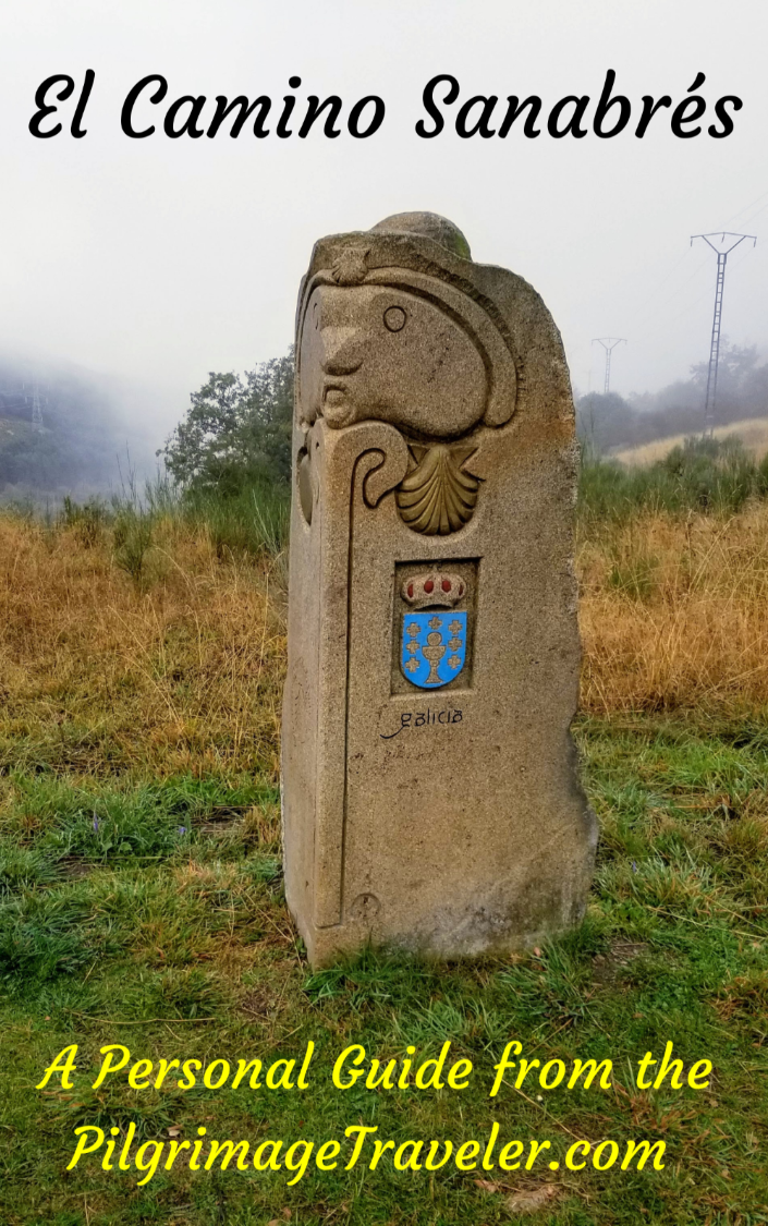
- ~ Camino Sanabrés (The Sanabrés Way)
- Cea to Estacion de Lalin, Day Fourteen, Part One
Jump to Camino Sanabrés Stages
Camino Sanabrés, Cea to Estación de Lalín, via Oseira, Day Fourteen, Part One, 32.7 Kilometers (20.32 Miles)
Our day fourteen on the Camino Sanabrés from Cea to Estación de Lalín was a magical day, perhaps my favorite of all on this Camino! This day consists of walking on long sections of enchanting Roman road, visiting the astounding monastery of Oseira and becoming intimately acquainted with the Galician countryside.
Because of the length of this day, the magnitude of the Mosteiro de Oseira, and the enchantment of the many Roman roads on which we walked, I have chosen to break this day up into two parts, even though we walked it all in one day.
Despite the enchantment of this day, it would come to a devastating end for a member of our group. Nadine had woken up with a swollen left knee, no doubt a compensation injury, a result of her severe right lower leg tendonitis.
🙋♀️ Why Trust Us at the Pilgrimage Traveler?

We’re not a travel agency ~ we’re fellow pilgrims! (See About Us)
We've trekked Pilgrimage Routes Across Europe since 2014!
💬 We’ve:
- Gotten lost so you don’t have to. 😉
- Followed waymarks in the glowing sunlight, the pouring rain and by moonlight. ☀️🌧️🌙
- Slept in albergues, hostels & casa rurals. Ate and drank in cafés along the way. 🛌 😴
- Created comprehensive and downloadable GPS maps and eBook Guides, full of must-have information based on real pilgrimage travels. 🧭 🗺️
- Shared our complete journeys, step by step to help YOU plan your ultimate pilgrimage and walk with your own Heart and Soul. 💙✨
Every detail is from our own experiences. Just fellow pilgrims sharing the Way. We have added a touch of spirituality, heartfelt insights and practical guidance from the road ~ offering a genuine connection to the spirit of pilgrimage. Tap into the wisdom of seasoned pilgrims!
Ultreia and Safe Pilgrimage Travels, Caminante! 💫 💚 🤍
Quote for Day Fourteen on the Camino Sanabrés, Cea to Estación de Lalín
“Centuries of travel yore suggest that when we no longer know where to turn, our real journey has just begun.” ~ Phil Cousineau
The evening prior, we as a foursome discussed this day's staging and how it should go, considering Nadine's ongoing limp that appeared to be worsening, and my strong desire to see the Mosteiro de Oseira.
There is a choice of two routes out of Cea: The route into the mountains to see the monastery in Oseira is a full 5.6 kilometers longer than the official route via Piñor, according to my GPS tracks, and with some additional ups and downs.
The route via Oseira is rugged, with long sections on old Roman roads that make for a rough path to walk. The scenery, however, is stunning and the monastery, in my opinion, is an absolute do not miss! I made it clear to the group that there was no other choice for me and that this was the route that Rich and I would do.
Finally, Nadine and Norm made the decision that they must go their own way, and do the shorter, easier route, yet still had a length of 27.1 kilometers. I strongly encouraged them to consider stopping in Dozón for the night, or taking a taxi for some portion of the day, to preserve Nadine's leg. We still had over 80 kilometers to get to Santiago!
It was unfortunate that we had made reservations at the Hostal A Taberna De Vento (+34 629 30 66 79) in Estación de Lalín, the end of our chosen stage. I made these reservations because we had heard from a fellow pilgrim that he had a hard time finding a room the night before.
It was because of this reservation, I feel, that we all pushed too hard to arrive for the reservation, to not lose any deposit money. In perfect hindsight, we could have all agreed to stay in Castro Dozón.
For Nadine, this day would be the final straw. While her pilgrimage was looking like it was about to end, indeed her journey was just beginning.
Maps and Stats of Day Fourteen on the Camino Sanabrés, Cea to Estación de Lalín
There are sufficient services on this day, regardless of the route that you choose. Here is our interactive map, from our GPS tracks where I show the services that are available for your planning purposes.
I recorded the track to Oseira, and Nadine recorded the track through Piñor. I will not supply a description of the standard route. If you wish to go this way, please download Nadine's tracks.
I have no photos of the standard route, as Nadine was suffering so horribly that she was unable to focus on anything but the painful placement of one foot in front of the other for the entire day. Oh my!
When I examine the standard route, almost half of the way to Dozón is on pavement, first on the OU-0406 out of Cea, then the OU-0402 all the way to the hamlet of A Ponte, through about kilometer six. The remaining eight kilometers to Dozón are on paths and country lanes.
As you can see from the elevation profiles below, this is a strenuous day, from both routes perspective, with a 989 meter (3245 feet) elevation gain for the Variante Oseira, shown below. There are more elevation changes on this route, as you can see in the profile, and the final 100 meter (328 feet) climb for both routes into A Xesta will feel taxing after a long day.
The elevation profile below shows the entire day of 32.7 kilometers via the Variante Oseira. The standard route through Piñor joins this profile in Castro Dozón, after 19.6 kilometers into the profile.

Here is the elevation profile of the standard route through Piñor, from Cea to Estación de Lalín, a total of 27.1 kilometers. There is a long, steady climb, to a few meters higher than the Oseira route, but with a total elevation gain of 813 meters (2667 feet), about 176 meters (577 feet) less.
The standard route joins the Oseira route on this profile after about 14.5 kilometers.

👣 Camino Sanabrés EBook:
Offline Guide with Bonus Route
~ Includes 4-5 additional days on the Vía de la Plata from Salamanca!
Walk smarter with our ad-free, beautifully formatted Camino Sanabrés eBook Guide, perfect for offline use ~ important in the mountainous and remote areas. Includes daily stage details, stunning photos, historical background and a BONUS digital guide on the Vía de la Plata from Salamanca, called the Camino Fonseca. This allows you the opportunity to add 4-5 more days to your Camino in the beginning.
Don't carry a hard copy guide book to increase your pack weight. Use our frequently updated digital guide on your next Camino instead!
📲 Instant download. 💸 Money-back guarantee. 🔄 Free updates for 1 year.
👉 Click here for more info or BUY NOW!
Jump to Camino Sanabrés Stages
Photo-Rich Travelogue for Day Fourteen on the Camino Sanabrés, Cea to Estación de Lalín
We set off from the albergue in the pre-dawn light, and headed back for the clock tower in the main plaza. (See day thirteen for a description.)
 Sculpture Carving, Praza Maior, Cea
The streets were quiet, and as you approach the main square, stay to the right (east) of the clock tower and find a narrow street just after the Plaza Café Bar in the main plaza. You will see the Nicanor Carballo carving shown here, on the corner of a building, just beyond the bar.
Continue northward, for one more block. Next you cross the main east/west street through Cea, the OU-0405, and see yet another carving on the street curb, sending you straight onward and up the hill, where you pick up the street called the Rúa Lodairo.
However, it is here at the intersection with the OU-0405 that you will also see Camino signs, giving you the choice of routes.
To the left, down the hill along the OU-0405 is the route via Piñor, 83.8 kilometers from Santiago. To the right, via the Oseira route says 90.1, a difference of 6.3 kilometers between the two routes, according to the officials! Make your choice wisely, or break up this long stage.
We wanted a café con leche, so we went to the left on the main street, where we found the Sol y Luna open for breakfast. This was the same place we had a wonderful dinner the night before. We were happy to be patrons of this place for the second time.
It was at the Sol y Luna that we said goodbye for the day to Norm and Nadine as we went up the hill on the OU-0405, and they went down the hill on the OU-0405 to continue along the route to Piñor.
We walked the block and a half, back to the intersection with the Rúa Lodairo, turned left on it, and up the hill. Thus begins the long, initial climb of the day, for the next 5.6 kilometers!
The Rúa Lodairo will take you out of town, shown below. The buildings you see ahead are the town's municipal tennis courts and pool. The stone carving waymark on the bottom of the pole says to stay left here by the municipal buildings.
 Uphill Out of Town
After you walk between the buildings, bend to the right to follow the wall of the tennis courts. Just beyond the wall, come to a T-intersection, where you will turn to the right. Again, there is signage here reminding you of your choice of routes, left for the standard route and right for the route via Oseira.
100 meters after the intersection, the road bends to the left, or northward. After just shy of 1.0 kilometers into the day, come to this sign, below, where you are directed to the right and onto this nice lane.
 Right Turn Onto Country Road
And thus begins the amazing 3.25 kilometer off-pavement jaunt through the countryside, where you will walk on the most amazing Roman roads.
And within about one more kilometer, you sense the historic path that is ahead. Whenever I see the stone walls on both sides of the road, as shown below, I know that I am most likely on or coming to an ancient road.

Indeed, within a few hundred meters after the appearance of the walls, the paved ancient road begins. There are remnants of pavers with deep wagon ruts, as you can see.


In fact, this area of Roman road is so wonderfully preserved and so mystical a place, that I chose this photo, below, from this section of the Camino Sanabrés to be my website image, at the very top! (And now you know!)

Enjoy this place while you can, and feel the spirits of all those taking a pilgrimage to the monastery ~ past, present and future. This makes it a special journey indeed, walking in the footsteps of the ancients.

You can see in the photos that negotiating this Roman road isn't easy! You are mostly climbing on rough and uneven ancient pavement. As is true for most Roman roads I have been on through the mountains, they take a direct, up and over line. No easy switchbacking here!
If it is raining, the rocks become slippery, so extra time and care will be needed.
 Continuing on the Ancient Road
It is around this high, rutted area shown above, after about 4.0 kilometers into the day, that there appears to be a Y-intersection in the road. There are no clear waymarks that we could see.
Look and stay to the left, and you will see this huge rock cairn just ahead, shown in the photo below, that may have a painted yellow arrow on it. This is the way to go.
 Rock Cairn Marks the Way
It is only a bit beyond the rock cairn, after 4.2 kilometers into the day on the Camino Sanabrés, Cea to Estación de Lalín, you finally leave the Roman road and join the pavement of this quiet country road, shown below, that takes you to the next hamlet of Silvaboa. This is a left hand turn onto the narrow road.

Jump to Camino Sanabrés Stages
When you enter Silvaboa, after about 4.45 kilometers you are directed to turn left at the Y-intersection here. There is a water fountain where the pavement ends, almost immediately after the turn. This town is a mere cluster of buildings, and the lane ahead climbs steeply, up and away from the few buildings.
This pleasant 1/2 kilometer diversion from the paved road takes you on what appears to be an ancient road once again, with quaint high walls. There have been frequent fires through here for which you will see evidence as you climb.
When the lane joins the pavement again, it turns left, but you still have about another 600 meters climbing on this road, pictured below.
 Climb Up and Out of Silvaboa
It is at kilometer 5.6 that you reach the summit of the first long climb of the day at 700 meters (about 2300 feet) in altitude, on the Camino Sanabrés, Cea to Estación de Lalín. It was a steep climb, and I was happy that I was fresh in the day.
 The Descent Towards Pieles
Your reward for the long climb will now be a nice downhill cruise towards the next town of Pieles, which you will reach after about 6.1 kilometers. As you enter town, in a few more steps, you see the Café O'Toxo, shown below right. Unfortunately, this bar is no longer open.
 Café O'Toxo, Pielas
At the crossroads after the bar, walk straight through the intersection, crossing the OU-0406. In years past, the Camino turned right here to walk along the roadway, all the way to the Mosteiro de Oseira. This shortened the route by about one-half kilometer over the next three kilometers. However, the off-road diversions may be worth your while if you have a shorter day.
After crossing through the OU-0406, walk about another 170 meters through town. You will feel like you are taking a journey back in time, with the old, low stone buildings that have been abandoned. Take a right turn into a dead end with another group of old stone buildings. At the edge of the last building, pick up a very narrow, stone-walled path through the field descending toward the Rego de Pieles.
This is a very quaint pathway and it will take you to an old flour mill along the river. From the muiño (mill), you will climb up out of the drainage, continuing along the path that turns to a wider lane, for a total of about another 275 meters. Join the OU-0406 by turning left.
Walk along the roadway for about 1/4 kilometer, when you are directed to turn left onto a path, after about a total of 7.0 kilometers and toward the next town of A Ventela. This lane takes you by the lovely little Capela de Santa Isabel after about another 1/2 km, pictured below.

After passing the chapel look to your right and the Way is to join the OU-0406 once again, by turning left onto it. Barely 100 meters, after joining the road and just beyond the exit sign for A Ventela, you will be directed to a right turn, onto a lane that parallels the OU-0406 roadway. The Camino climbs up and walks through a forested area for the next 1.1 kilometers.
This is the official way to go, and will take you off-pavement on a very pleasant lane that follows a high wall, eventually dropping back down to a lovely park, walking along a canal, and crossing it to arrive into town and the northern side of the monastery.
However, you will also add 300 meters to your total distance, and a few more meters of climbing! Because the OU-0406 is a very quiet road anyway, we chose to just stay on the road. It is up to you!
While you will catch a nice view of the monastery from above when walking along the lane at a higher altitude, this is the view from the road, pictured below. It is an imposing sight.

There is an Albergue de Peregrinos del Monasterio de Oseira (+34 988 28 26 86) within the complex. It now has a total of 42 dormitory beds. The Monastery Website may be useful for you.
As you walk towards the north side of the monastery, passing a water fountain, you will reach the main entrance after 9.4 kilometers on the official route. After you walk through the front gate, you will see the main courtyard with the towering church façade before you, below.

In order to see the monastery, you must take a tour, and alas, they had none in English. They did give us a hand out to read which helped quite a bit!
On the day we arrived, the first tour did not leave until 11:00 a.m. so we had to kill 1/2 hour as it was only 10:30. We went to the lovely café by the front gate, the Casiña D'Avoa to wait for the tour to begin. It was a treat to enjoy another cup of coffee, though it was hard to wait, when we had more than 20 kilometers left in the day! This establishment also has private rooms if you wish to stay here.
You may want to check the visiting hours, before your planned arrival as these change from season to season, Sundays and holidays. In the summer, they have an earlier tour that begins at 10:30 which is a more convenient time if you are walking from Cea.
The tour took one full hour, so we did not get back on the road until noon ~ a delay of 1.5 hours! But I can honestly say that it was worth it!
Below are just a few of the many photos I took considering the many interesting nooks and crannies that are in this monastery. And I didn't even stay here overnight. Many pilgrims state the highlight of their stay was evening vespers with the monks, so plan your visit accordingly!
The first areas we visited on the tour were the main church, its central nave and altar. The altar piece, the Virgin of the Milk, or Virgen de la Leche, is unusual in that the Madonna is actually nursing the baby Jesus.
As I had learned in the cathedral museum of Salamanca, it wasn't until the 16th century that the image of a Nursing Madonna was considered disrespectful by the church. This altar is a very precious and rare depiction, dating back to the 13th century. This piece was never destroyed which is also amazing!


For me, the most fascinating place was the Room of the Stone Palms, or the Sala de las Palmeiras Pétreas, shown below. According to the handout we received on the tour, which was for English speakers, this room was originally used as a chapter house, then in the 17th century, a sacristy. The four columns, each of them unique, were designed by Juan de Castillo in the 15th century, in his own Manuelino style. A most beautiful and unusual place it is!

We toured two of the three cloisters, shown next. You may want to read about them, in much more detail on the Mosteiro de Oseira website. The history is quite fascinating.


Jump to Camino Sanabrés Stages
After a whole hour of touring, in Spanish, we were ready to get back on the trail.
As you leave the monastery from the front gate, it is a left turn and up a very steep hill. In less than 50 meters, you are directed to the right, shown below, for more steep uphill climbing on the Camino Sanabrés from Cea to Estación de Lalín. There is also another water fountain here.
 Right Turn Uphill After Monastery
Pictured next is the amazing steep climb up the hill, and the look-out from on top of a promontory.

We paused and gazed one more time upon this grand monastery from above! The monastery is the icing on the cake for this day on the Camino Sanabrés, Cea to Estación de Lalín.

Then it was onward for the continued steep climb over the next 1.1 kilometers and not quite 200 meter (650 feet) gain in elevation.
About 50 meters after the lookout area, you see the left hand turn that takes you back onto the ancient road. Judging by the rubble, I could tell that this section of Roman road would be interesting indeed!
 Left Turn Onto Ancient Road
Again, the ancient road does a direct hit on the mountain, up and over quite steeply. Unlike the previous Roman road section, the road through here is very rugged and uneven.


I felt bad that Norm and Nadine were not here to experience this historic section, but yet I knew that Nadine would have struggled horribly through this rough terrain.
Here is my favorite photo through here, when the pavers were a bit smoother.

After just shy of 10 kilometers, the ancient road crosses this secondary, paved road, and continues straight on, for more ruggedness!
 Cross Secondary Road
I am always so enchanted with these ancient roads, that I took a ton of photos! You are seeing less than half of them! Ha!
 Even More Rugged Road
 Road Very Slippery When Wet
Here is a portion of the old rugged road, just before the top.

Jump to Camino Sanabrés Stages
It is at approximately 10.7 kilometers when you reach the summit top at 818 meters, (2684 feet) on the Camino Sanabrés, Cea to Estación de Lalín.
 The Summit Top Awaits!
Shortly after the top, after 10.9 kilometers, is when you reach the pavement of the OU-0452 and join it.
 Join the OU-0452 at the Top
You walk on the pavement for only 300 meters, when you are directed to return onto the old road, shown below.
 Leave the OU-0452, Camino Sanabrés, Cea to Estación de Lalín
The old road here is a shortcut from the modern road, on the way to the next town of Vilarello. The 150 meter shortcut is extremely steep and rocky. However, there are gorgeous views over the valley from here, just don't look at the view without stopping first or you may trip!
Rich and I discussed that perhaps this day had more lengths of Roman roads than any other day that we could recall. In fact, my feet were growing a bit weary of the ruggedness of these roads. This romanticist never thought she would ever say that!

The shortcut ends by joining the OU-0452, shown here, in Vilarello. Turn left as shown to walk again on the pavement. You are about 11.3 kilometers into the day on the Camino Sanabrés, Cea to Estación de Lalín.
 Rejoin the OU-0452 in Vilarello
The Camino does not actually take you through the town of Vilarello, but to the south of it along the OU-0452. You continue to walk on this road for about 1/2 kilometer, until you see the turn to the right, onto another old pathway, shown below.
 Leave the OU-0452 Again on This Path
This next off-pavement section lasts for over 800 meters. Again, it seems like it is the continuation of the ancient road.
 Back on the Ancient Road
 Moss Covered Rocks
The Camino continues to descend through this section, steeply dropping to a stream crossing at 12 kilometers into day fourteen on the Camino Sanabrés, Cea to Estación de Lalín.
It is after about 12.5 kilometers that you see the buildings of the next town of Carballediña ahead.
 Entering Carballediña, Camino Sanabrés, Cea to Estación de Lalín
Come to a narrow paved road, and cross it at a bus stop. Continue on a narrow road through town, shown below. It is like stepping back in time here!

After walking through the first buildings in town, you will come to the Asociación de Ayuda al Peregrino en el Camino. This is a volunteer association for giving aid to pilgrims. You can stop and rest and get breakfast foods, after 12.7 kilometers into your day. It is a welcome reprieve, halfway between Oseira and Dozón and just before the next big climb!


Jump to Camino Sanabrés Stages
Soon after you leave the town and its hórreos behind, you come to the bottom of the descent from the top, at about kilometer 12.9.
It is about 900 meters from Carballediña to the next town of Outeiro de Coiras on this road.

 Entering Outeiro de Coiras
Leave the road from Carballediña at approximately 13.8 kilometers, and turn to the right, to enter the town of Outeiro de Coiras, shown below.
 Right Turn Through Outeiro de Coiras
The town is all of the buildings you see in the photograph above, and soon you are on a lane and back in the forest, climbing once again.
 Back Into the Forest
The long path through the forest lasts for not quite another two kilometers. Some sections are cut deeply into the rock, like shown below.
 Deeply Cut Road
When the climb finally levels out and the forest makes way for the fields on either side of the high roadway walls, you know that you are getting close to the next town of A Gouxa.
 Getting Close to A Gouxa
It is after approximately 15.6 kilometers, when the Camino brings you to the road that leads you into A Gouxa, shown below. When you come to the T-intersection with the pavement, turn to the left to enter town.

Please click here for our continued story of the unfolding of this day fourteen, on the Camino Sanabrés, Cea to Estación de Lalín.
Camino Fonseca Stages
~ Vía de la Plata Stages from Salamanca


~ Camino Sanabrés Stages


Please Consider Showing Your Support
Many readers contact me, Elle, to thank me for all the time and care that I have spent creating this informative website. If you have been truly blessed by my efforts, have not purchased an eBook, yet wish to contribute, I am exeedingly grateful. Thank you!
Search This Website:
The Pilgrimage Traveler Digital Guides
Our Guides Help You:
~ Know what to expect each day!
~ Locate historic sites along the Way!
~ Know where you are in your journey!
~ Discover a quote from the sages, for your daily reflection on the journey!
Click on a Photo Below to Get Your Copy.
A most popular alternative on the Central Route of the Camino Portugués!👇

The Portuguese Routes are rapidly gaining in popularity, especially the section from Lisbon! Plan to walk this one soon, before it is no longer a quiet experience!👇

Our most popular Portuguese guide! 👇

The most historic of the Portuguese Caminos ~ not to be missed!👇

The spiritual adventure of a lifetime, following in the footsteps of St. Teresa of Ávila!👇

The amazing mountain route alternative, the Camino Sanabrés, from Granja de Moreruela on the Vía de la Plata!👇
The most incredible mountain scenery on this camino from Leon to Oviedo!👇

The shortest of the caminos, but not easy!👇

The very first, Original Way from Oviedo to Santiago!👇

The pilgrimage to the "End of the World" ~ The perfect add-on to your camino!👇

All Banners, Amazon, Roamless and Booking.com links on this website are affiliate links. As an associate of these companies, the Pilgrimage Traveler website will earn from qualifying purchases when you click on these links. We have used and love all of our product recommendations and believe you will too! We sincerely thank you!

🙋♀️ Why Trust Us at the Pilgrimage Traveler?
We’re not a travel agency ~ we’re fellow pilgrims! (See About Us)
We've trekked Pilgrimage Routes Across Europe since 2014!
💬 We’ve:
- Gotten lost so you don’t have to. 😉
- Followed waymarks in the glowing sunlight, the pouring rain and by moonlight. ☀️🌧️🌙
- Slept in albergues, hostels & casa rurals. Ate and drank in cafés along the way. 🛌 😴
- Created comprehensive and downloadable GPS maps and eBook Guides, full of must-have information based on real pilgrimage travels. 🧭 🗺️
- Shared our complete journeys, step by step to help YOU plan your ultimate pilgrimage and walk with your own Heart and Soul. 💙✨
Every detail is from our own experiences. Just fellow pilgrims sharing the Way. We have added a touch of spirituality, heartfelt insights and practical guidance from the road ~ offering a genuine connection to the spirit of pilgrimage. Tap into the wisdom of seasoned pilgrims!
Ultreia and Safe Pilgrimage Travels, Caminante! 💫 💚 🤍
Follow Me on Pinterest:
Find the Pilgrimage Traveler on Facebook:
Shroud Yourself in Mystery, along the Via de Francesco!


Walk in the Footsteps of St. Francis, and Connect Deeply with the Saint and to Nature in the Marvelous Italian Countryside!
Need suggestions on what to pack for your next pilgrimage? Click Here or on the photo below!

%20line%20on%20the%20road%20as%20you%20leave%20the%20town%20of%20Carballedi%C3%B1a.)
Carbon Trekking Poles ~ My Favorites!

Carbon fiber construction (not aluminum) in a trekking pole makes them ultra lightweight. We like the Z-Pole style from Black Diamond so we can hide our poles in our pack from potential thieves before getting to our albergue! There are many to choose from! (See more of our gear recommendations! )
Gregory BackPack ~ My Favorite Brand


Do not forget your quick-dry microfiber towel!