- ~ Home
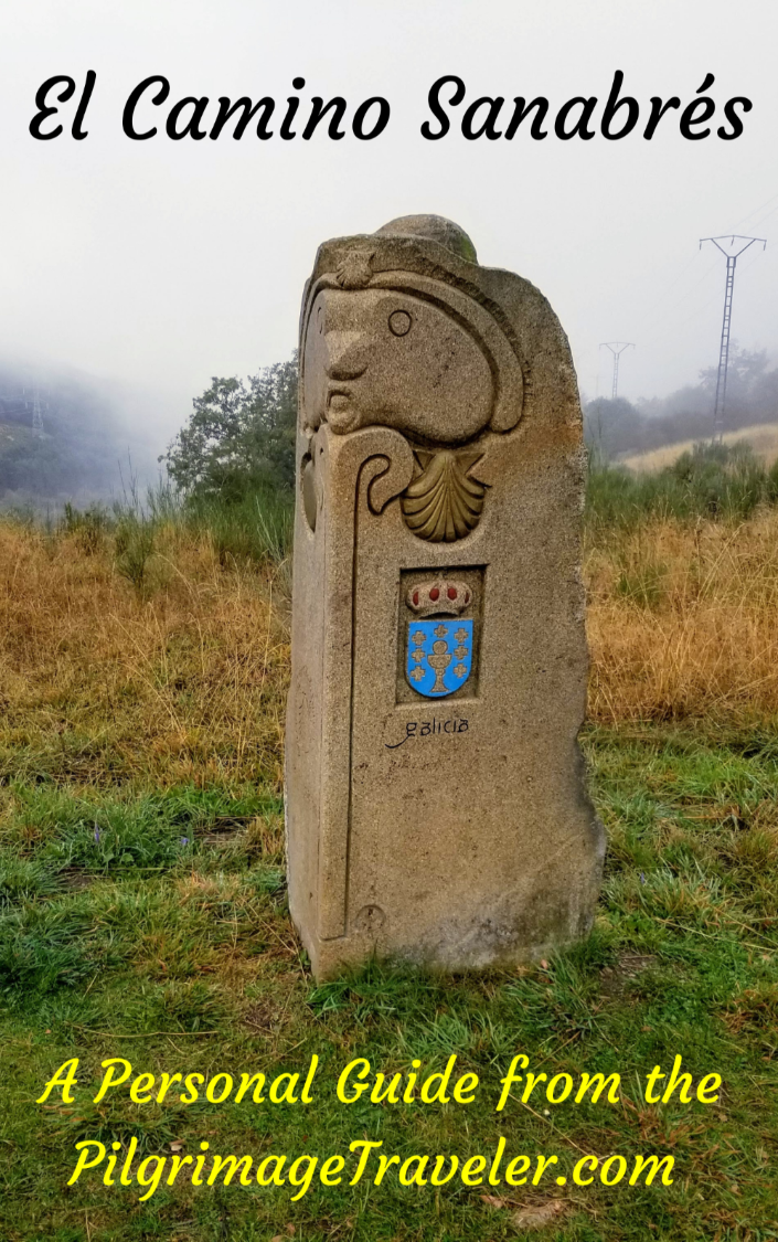
- ~ Camino Sanabrés (The Sanabrés Way)
- Ourense to Cea, Day Thirteen
Jump to Camino Sanabrés Stages
Camino Sanabrés, Ourense to Cea, Day Thirteen, 22.5 Kilometers (13.98 Miles)
Our day thirteen on the Camino Sanabres from Ourense to Cea consisted of a tough morning climb, but on the beautiful cobblestone Royal Road, the Camiño Real, taking the pilgrimage traveler through fascinating medieval hamlets along the way.
The continued and easier remaining walk is on many forested paths including ancient Roman roads, before coming to the final destination in Cea, yet another historic town with medieval buildings.
🙋♀️ Why Trust Us at the Pilgrimage Traveler?

We’re not a travel agency ~ we’re fellow pilgrims! (See About Us)
We've trekked Pilgrimage Routes Across Europe since 2014!
💬 We’ve:
- Gotten lost so you don’t have to. 😉
- Followed waymarks in the glowing sunlight, the pouring rain and by moonlight. ☀️🌧️🌙
- Slept in albergues, hostels & casa rurals. Ate and drank in cafés along the way. 🛌 😴
- Created comprehensive and downloadable GPS maps and eBook Guides, full of must-have information based on real pilgrimage travels. 🧭 🗺️
- Shared our complete journeys, step by step to help YOU plan your ultimate pilgrimage and walk with your own Heart and Soul. 💙✨
Every detail is from our own experiences. Just fellow pilgrims sharing the Way. We have added a touch of spirituality, heartfelt insights and practical guidance from the road ~ offering a genuine connection to the spirit of pilgrimage. Tap into the wisdom of seasoned pilgrims!
Ultreia and Safe Pilgrimage Travels, Caminante! 💫 💚 🤍
Quote for Day Thirteen on the Camino Sanabrés, Ourense to Cea
“It is your road, and yours alone. Others may walk with you, but no one can walk it for you” ~ Rumi, 13th Century, Sufi Mystic, Scholar and Poet
I love this quote from Rumi, as it applies to all of life's metaphorical journey. The Camino is indeed a place for self-discovery and a path that the individual must walk alone.
While we walked as a group of four, each of us walked our own way, discovering more with each day, who we really were.
Maps and Stats of Day Thirteen on the Camino Sanabrés, Ourense to Cea
Here is our interactive map of the day on the route via Tamallancos, shown on the map in blue. This is the official route and one that I cannot recommend highly enough, as noted above that it is filled with quaint medieval towns and forested paths.
You can choose the alternative route, which is one kilometer shorter via Canedo, shown in orange. We did not walk this one, but I have provided the GPS tracks from Wikiloc, for your convenience. Both routes are well waymarked.
The route via Canedo may be shorter, but it also has more pavement and the initial climb is much steeper, albeit shorter. I found our route via Tamallancos to be very scenic and at only 22.5 kilometers total, it is not a long nor super-strenuous day.
There are sufficient services on the Tamallancos route as you can see on the interactive map below.
There is only one bar along the Canedo route, after about 6.5 kilometers, and not again until Casas Novas, after 17.7 kilometers total, when the two routes converge near the end of the stage. If you do this alternative route, stock your pack!
As you can see from the elevation profile, it is a long climb of 350 meters (1150 feet) over eight kilometers, up from the Minho River in Ourense to the altitude top. The next eight kilometers are essentially downhill, all the way to the medieval bridge at Ponte Sobreira, the depression shown below at about 16.5 kilometers. Then the final six kilometers are a less strenuous climb to Cea, the destination for the day.

For your information and reference, here is the elevation profile for the alternative route via Canedo, that I did not experience first hand. You can see that there is a longer walk initially through Ourense, on the flat, followed by the short and steep climb up from the river on a scenic country asphalt road. The additional pavement on this route is mostly on very quiet, secondary country roads, that look pleasant enough on Google maps.

Good luck choosing your route, but for me personally, I prefer walking through interesting towns, especially medieval ones on the Tallamancos route, over the monotony of long paved roads through the countryside.
The Canedo route, however, would have less distractions and more opportunity for an inward journey of reflection, if that is what you need!
👣 Camino Sanabrés EBook:
Offline Guide with Bonus Route
~ Includes 4-5 additional days on the Vía de la Plata from Salamanca!
Walk smarter with our ad-free, beautifully formatted Camino Sanabrés eBook Guide, perfect for offline use ~ important in the mountainous and remote areas. Includes daily stage details, stunning photos, historical background and a BONUS digital guide on the Vía de la Plata from Salamanca, called the Camino Fonseca. This allows you the opportunity to add 4-5 more days to your Camino in the beginning.
Don't carry a hard copy guide book to increase your pack weight. Use our frequently updated digital guide on your next Camino instead!
📲 Instant download. 💸 Money-back guarantee. 🔄 Free updates for 1 year.
👉 Click here for more info or BUY NOW!
Jump to Camino Sanabrés Stages
Photo-Rich Travelogue for Day Thirteen on the Camino Sanabrés, Ourense to Cea
We had our breakfast before dawn in our apartment just north of the Cathedral of Ourense. I double backed to the cathedral, where I started my geotracking.
From the west side of the cathedral, on the Praza San Martíno, head north along the Rúa Arcedianos for only a few meters to the first intersection. Turn left onto the Praza de Santa Eufemia, and see the lovely Church of Santa Eufemia looming before you.
Turn right in front of the church and proceed northward through town. It was quiet and almost deserted for us, walking just before sunrise. Here is how it looked along the Rúa do Paseo after the church.

After about 1/2 kilometer, come to the huge park, the Parque de San Lázaro on your right sided corner, and turn left onto the Rúa do Concello. There is a funky bronze sculpture of two men sitting on a car, on the left corner, that you can barely make out in the left side of the photo below, by the red light.
 Left Turn at the Parque de San Lázaro
After about another 1/4 kilometer, come to this plaza, the Plaza Concepción Arenal, where you stay to the right or east side. You cross the street and walk past the church, shown below. You can see the Roman bridge ahead. That is your destination.
 Stay to the Right at the Plaza Concepción Arenal
After you cross the plaza and pass the church, you will see this street waymark on the Rúa do Progreso in front of the Colexio Salesianos building. This college houses a bilingual school. You can now clearly see the Roman bridge in front of you.
 Street Waymark by the College, Before the Roman Bridge
The bridge, the Ponte Romana de Ourense is a glorious sight and here is Nadine crossing it. I would ensure that you see this bridge in the daylight, to take in its wonders.

From the bridge, in the early morning light, the views across the river were fantastic. Here is a view of the Ponte do Milenio, the very modern bridge that you can see from the ancient one! A very interesting juxtaposition.
You are about 1.2 kilometers from the start at the cathedral, on this bridge, on the Camino Sanabrés from Ourense to Cea.

You continue to cross the bridge and join the Avenida das Caldas on the other side.
About 300 meters after the Roman bridge, you come to this intersection shown below, with the waymark carving from Nicanor Carballo that shows you the two choices of routes that you have from this point. If you go straight, this is the route via Canedo, and continues through Ourense for another four or so kilometers, before beginning its climb shown in the elevation profile above.
If you are taking the route via Tamallancos, you turn right here and onto the N525, called the Avenida de Santiago and immediately start the long 3.5 kilometer climb to the first landmark, the Ermida de San Marcos da Costa in the town of A Costa.
 Right Turn onto the Avenida de Santiago
After about 1/3 kilometer, you cross a set of railroad tracks on a bridge. Immediately after the tracks, we stopped at a bakery, the Panaderia Tito. There are now many cafés open along this section if you need one. We were game for a nice pastry before the long climb!
There continues to be nice shell waymarks on the pavement as you walk through town. Here is a shot of the walk along the Avenida de Santiago.
 Along the Avenida de Santiago
It is at kilometer 2.8, right after the Cepsa station, that you leave the Avenida de Santiago, after about one-and-a-third kilometers on it, and make a right turn onto the Camiño Real Cudeiro Sur, at the intersection shown here. There is a large Camino de Santiago sign as you can see.
 Leave the Avenida de Santiago Here
After the turn, the Way quickly becomes quite rural looking as you leave the city behind. You are now on the wonderful "Royal Road" or the Camiño Real Cudeiro Sur.
Stay right at this intersection, after a few meters on the Royal Road.
 Pick Up the Royal Road, the Camiño Real Cudeiro Sur
I tried to search the web for the history of this royal road, to no avail. This long walk that begins here and ends in Sartédigos is a bit more than four kilometers and leads you through lovely little historic towns along the way.
But first, after about 1/2 kilometer, the Camino crosses over the N-525 that it just left behind and that loops up and around back to this point.
 Next Cross the N-525
I loved the medieval-looking feel of the stone buildings that we would come across as we walked, starting with this high stone wall.

Jump to Camino Sanabrés Stages
The first quaint town on the uphill climb is Soutelo, shown below. Pictured below is the open Plaza de Soutelo, the main square, as I looked behind me to see Norm and Nadine climbing. You have reached approximately kilometer 3.75 at this plaza.

After the plaza, the green sign, below, identifies the town.
 Walking Through Soutelo on the Camiño Real Cudeiro Sur
All the streets, now made of pavers, are mostly high-walled and narrow. There is no traffic here! It makes for a lovely, historic walk on the way to the next town of Cudeiro. I was surprised to see palm trees brighten the road as well.

There are two lovely waymarks as you climb to the edge of Cudeiro, this Camiño Real sign, below, and farther up, a stylized pilgrim and a Camino de Santiago sign, barely discernible by Rich in the same photo. All lovely things to cheer up a pilgrim grunting up the hill! You can see that Rich is gaining on me!

At the center of Cudeiro is the plaza and the town church. Pause to contemplate it as you catch your breath!

You continue past the church on the Camiño Real Cudeiro Sur and cross the OU-150 after not quite 4.1 kilometers. If you need a bar, there is one to the left along the highway, a few meters off-Camino.
After crossing the OU-150, in the direction of "A Costa" come to this sharp bend in the Camiño Real. The way is well marked and you truly can't go wrong, especially if you stay in the direction of "up!"
 Right Road Bend on the Camiño Real Cudeiro Sur
You are very close to the Ermida when you can finally see it ahead on the top of a rock outcropping, after about 4.35 kilometers into the day on the Camino Sanabrés from Ourense to Cea.
 Almost to the Top
The Camiño Real Cudeiro Sur, bends around and takes a sharp, well-waymarked hard left, just before the top. The Ermida de San Marcos da Costa looms above you. You have a choice, first, to climb the stairs to the Ermida, shown below. The steps did not look appealing to us at all after the long climb on the cobblestone!

If you continue on the Royal Road a few meters farther, you will have the opportunity to use the steep road, shown below, which is a somewhat less strenuous climb after the grunt up from the river in Ourense! We chose the road.

You have walked about 4.7 kilometers from the Catedral de Ourense, when you reach this most amazing viewpoint, the Mirador Cudeiro. For me the Ermida is not very impressive, and if it were not for the views back toward Ourense, I would not have bothered climbing the final meters to it.
In fact, Norm and Nadine, who had struggled the last four kilometers, chose not to climb up to this most lofty view point.

Jump to Camino Sanabrés Stages
After admiring the views for a second longer, we joined Norm and Nadine on the Royal Road, and continued onward. The Camino now leaves the quaint medieval towns behind as it enters the countryside on the way to the next town of Sartédigos, about two kilometers away.
While the altitude gain is not as steep through this area, you are still climbing as you will continue to do until about 8.25 kilometers into the day on the Camino Sanabrés from Ourense to Cea.
 The Paved Country Road Toward Sartédigos
After about 5.3 kilometers, approximately 600 meters past the Ermida, the narrow pavement ends, as you make a left turn onto a sandy lane. The wide lanes are pleasant enough to walk upon and as you can see, the fog as of yet was resistant to clearing.
You are well-directed by waymarks as the Camino now meanders from lane to lane.
 Uphill Walking on Lane Continues
After almost exactly 7.0 kilometers, the Camino joins this secondary paved road, shown below, near Sartédigos, but does not walk into the town itself. It is at this clearly waymarked intersection, where you turn to the left, and the Camiño Real officially ends. There are no services in Sartédigos, so don't bother going off-Camino to walk into town.
It is important to note that at this juncture with the paved road that you will pass the 99.511 kilometer waymark. This is the closest we get to the final 100 kilometers designation.
 Join Pavement, End of Camiño Real
Only a few meters farther down the road, you encounter a sign, informing you of the way to the left to the Convento Clarisas de Vilar de Astrés. This is a relatively new convent, and knowing nothing about it at the time, we chose not to take the 350 meter diversion. Instead, we took the right hand turn to continue on the Camino.
 Right Turn by Grape Arbor and Convent Sign
Only about 140 meters later, you join the paved OU-0526, walking on it for only a few meters before veering to the right onto this inviting lane, shown below.

A few meters after the turn, come to this interesting landmark, labeled the "Saint's Fountain," or the Fonte do Santo. The water is marked as non potable. Stay left here by the sign.
 Fonte do Santo
This mossy section of forest, shown below, is after about 3/4 kilometer of walking through a luscious wooded area.

The Camino leaves the woods, coming out by a few buildings where the lane turns to pavement. You come to this intersection, below, where you turn towards the left and the next town of Boveda after approximately kilometer 8.05.
 Left Turn Toward Boveda
 Boveda Cluster of Buildings
Boveda is a small place and just past the buildings of town, after approximately 8.3 kilometers, you have finally reached the top of the long and steep climb from Ourense! Breathe deeply and know that the next 8.0 kilometers are essentially downhill!
Look for a water fountain with benches on your left as you walk through here, if you need it.
And suddenly, you are back into the wooded countryside, walking on this quiet paved road for about one-and-a-quarter kilometers after leaving Boveda.
 Paved Road Through Countryside
Jump to Camino Sanabrés Stages
After 9.65 kilometers, you come to the OU-0525 and cross it at this lovely estate.
 Cross the OU-0525
After the estate, the Camino returns to a wooded section, this time for about two kilometers. The route begins on pavement from the estate then turns to a dirt road, as it starts to descend.
While we were walking through this area, there was a recent project to improve the Camino by adding these wonderful and smooth pavers. While there was no rain today, I can imagine how much nicer the path would be with the improvements.

Along the way towards the next town of Tamallancos, the lane once again turns to pavement as you get closer to town.
 Paved Road Toward Tamallancos
The narrow paved road exits the forest at this landmark, shown below, the Barbosa industrial building, after about 11.5 kilometers into the day.
 Enter Tamallancos at Barbosa Building
After the Barbosa building, you cross over the N-525, to pick up this nice treed, side road. This side road is called the Camiño do Campo da Festa, shown below.
 Side Road Towards Center of Town
As we entered Tamallancos, this wonderful sign greeted us. We were more than ready for a break, so we turned to the left toward the café bar A Tua Taberna.
 Welcome Sign to the Bar
It is only about 120 meters off-Camino, taking the Camiño da Fonte, back to the N-525, to see the bar across the highway. Or, you could have remained walking on the N-525 from the Barbosa building. If you chose the N-525 route, it would be about 600 meters to the bar.

There is one accommodation in Tamallancos, the Hotel Via Stellae, just a few more meters beyond the bar and right along the N-525, if you wanted to call it a day here. At the bar, you are approximately 12.4 kilometers into the day on the Camino Sanabrés from Ourense to Cea, a bit more than halfway.
After our break, we returned to the Camiño do Campo da Festa, and to the square with an hórreo and this sign, below, showing the way. If you had missed the first sign for the bar, I doubt you would have missed this second one in the square.
 Onward Through Tamallancos
Jump to Camino Sanabrés Stages
Here is the road to the next town of Bouzas.
 Road Towards Bouzas
There is a nice looking bar, right along the Camino in Bouzas, if you need one, after 13.2 kilometers, about 800 meters more after Tamallancos, on the Camino Sanabrés from Ourense to Cea. The next bar is more than 5 kilometers away, so ponder whether or not you want to walk on by!
 Bar Estanco Terradillos
About 100 meters after the bar above, you come out at the N-525 again, and cross over it to find a tractor lane descending on the other side. This nice lane parallels the N-525 and takes you by this town washing area and fountain, or Lavadoiro.
 Fonte de Bouzas, Camino Sanabrés, Ourense to Cea
The folks at the first home, some meters onward, created this nice reception for pilgrims!

After the "townspeople" take the next right, and up the hill to this lovely wooden hórreo and a nice big green sign telling you that Bouza has a "Conxunto de Hórreos" or a cluster of granaries "a eira" or in a threshing circle. Look for a flat circular area at the top of the hill, with granaries around the circle.
I did not get what I was reading when we walked by so I missed the site. It is mostly in ruin, so it is not too hard to miss. The circle was traditionally used for threshing and is just to the left of the Conxunto de Hórreos sign. It is after about 13.5 kilometers into the day to help you know where you are.

Just after the big green sign, come to this intersection, below, and take a turn to the left, followed by an immediate turn to the right onto the next narrow road. A white kitty was watching over the Camino as we walked by!
 Left Turn at Top of Hill in Bouzas
After leaving Bouzas, it is not quite 400 meters, when you are directed to turn off the road, and onto this lane, shown below.
 Leave Bouzas on This Lane
It is back into the forest for about another one-and-a-quarter kilometers on the way to the next town of Sobreira.
 Wooded Lane Towards Sobreira
After about 15.2 kilometers, come out of the woods to join a paved road and a directional sign towards Sobreira. Here Rich hooked up briefly with a faster-walking Polish peregrino. He had started in Sevilla and today was not stopping in Cea but going all the way to Dozón! We knew we would not see him again.
 Road to Sobreira, Camino Sanabrés, Ourense to Cea
 Entering Sobreira
It is in the center of Sobreira that you come upon a most interesting architectural feature, shown in the next photo. Another large green billboard identified it as a "Peto Ánimas."
I have seen several Gallego translations of the word "peto" from pocket to breastplate. This is a sort of mortuary monument to the dead souls or "ánimas." These special monuments apparently can be found all over Galicia, but this is the first one that I had encountered.
Essentially the niche in the top of the carving was a place to leave offerings for souls in purgatory, to speed their entry from Purgatory into Heaven. The offerings could be money or food, and served as an exchange. The offerings helped the tormented souls on their journey to heaven so they would then intercede for the living to be granted a speedy entrance for themselves into heaven when the time came.
The Peto Ánimas can be found after approximately 15.3 kilometers in the center of Sobreira.

Jump to Camino Sanabrés Stages
Immediately after the monument, the Camino takes a turn to the left and continues through Sobreira. After about 300 meters, you turn left off the road and onto a lane, and shortly, come to this sign, below, pointing the way to the historic bridge, the Ponte Sobreira.
 Signpost for Ponte Sobreira
The Ponte Sobreira is about 1/2 kilometer down the lane from the sign and after about 16.1 kilometers into the day on the Camino Sanabrés from Ourense to Cea.
The bridge was built in the 13th or 14th century, according to the billboard next to it, and updated last in 1755. Here is a photo of Norm and Nadine on the moss-covered historic bridge.

Just beyond the bridge, the lane gives way to what appears to be original medieval paving, and some unidentified but interesting ruined buildings.

Then it is an onward climb that is rather steep from here for the next 1.5-2 kilometers. You walk through the countryside on unpaved lanes towards the next town of Faramontaos. After 400 meters when you come to this intersection with the stone fence, take a turn to the right, back onto the pavement.
 Right Turn Toward Faramontaos
After another 1/4 kilometer, take a left turn into town, climbing steeply to walk through it, at approximately kilometer 16.8 at its center. There are no services here.
 Walking Through Faramontaos
On this hill climb, Nadine was really, really slowing down. I could tell that she was hurting quite a bit, even though she said nothing. At this point, I voice journaled that I was not hopeful at all that she could continue this way, limping along for so many days now. We were still days from Santiago.
At the edge of Faramontaos, you continue on here, as the road turns to a lane. This time a black kitty was watching as we passed under the shaded grape arbor!
 Entering Roman Road Section
Once you are on this lane, you now begin an ancient way, almost one kilometer in length, on sections of well-preserved Roman road. Here is Rich on one of the sections. The Roman road parallels the N-525 which you can hear to the right.

Along the way there are improvements where the dirt road would be awash in mud if it were raining.

 More Ancient Road
After about 18.2 kilometers into the day on the Camino Sanabrés from Ourense to Cea, you enter the next town of Viduedo. The Way essentially flattens out for a bit through here.
 Entering Viduedo
You pass some colorful raised hórreos. When you come to the town church, shown below, several hundred meters later there is the Bar A Carballiza, if you need a stop when the Camino joins the N-525 once again, just after the church shown below. There is a tienda as well if you need to restock your pack.
 Pass Town Church
Jump to Camino Sanabrés Stages
Fortunately, the Camino does not follow the N-525 for but a few meters, when it turns off onto the lane shown below.
 The Camino Leaves Viduedo and the N-525
The Camino parallels the N-525 for about 1/3 kilometer, and then turns away to the north to enter another lovely shaded forest, with more improved paths. When we were here, we even ran into construction workers, building another section of the improved paved path.
 Improved Path Through More Forest
The forest through here must have been an ancient road, perhaps even a continuation of the Roman road, although no ancient pavers could be seen.

We were climbing again through this final segment of forest, and Nadine had slowed to a snail's pace. Rich and I pulled ahead, as Norm stayed with her.
And within a kilometer and a half, the buildings of Casas Novas come into view.
 Entering Casas Novas, Camino Sanabrés, Ourense to Cea
As you enter Casas Novas, pass by the fountain, Fonte de Boriño, not pictured. Continue on a few more meters to the center of town. It is here in the center of Casas Novas at kilometer 20.4, that the alternative route from Ourense via Canedo joins with the standard route.
The Camino continues on through town, and onto this onward lane, shown below.
 Straight On in Casas Novas
The path ahead is forested once again on the final section towards Cea.
 Forest Path Towards Cea
The lane comes out to this intersection, after approximately 21.6 kilometers, where you see a sign for the municipal albergue and a school. Carry on straight here.
 Straight On Towards the Albergue
After approximately 21.7 kilometers, turn left at a municipal building, and walk around it, until you see an overpass ahead where you will cross under a major highway through a tunnel.
On the other side of the underpass, you come to this most interesting sign, below. The official waymark would have you go to the right, and a yellow arrow would have you go to the left.
 Double Waymark Dilemma
As it turns out, the official way takes you on the road into town, and the yellow arrow takes you into town on a parallel lane. We chose the more inviting lane where we didn't have to climb the hill!
The lane follows a ditch and in not quite 200 meters, at the end of it, take a left turn onto the road into town.
About another 50 meters later, you see the sign for the albergue, where you turn left onto the Travesia de Santo Cristo. The Camino continues on straight here, if you are walking onward.

Jump to Camino Sanabrés Stages
It was here that we waited for Norm and Nadine to catch up. We wanted to ensure they found the albergue. Indeed they made it!
For the albergue, walk another 50 meters to a T-intersection and a right turn takes you to the Albergue de Peregrinos de Cea housed in a wonderful historic building shown below, with a huge hórreo out front, not seen in the photo.

The albergue has adequate facilities, with heat and 40 beds in the upstairs dormitory. It has a full kitchen and an hórreo on the roof, shown below. We hung our clothes out to dry by the hórreo!

Immediately beside the albergue is a casa rural, A Castelana de Cea (+34 634 194 464). Call for pilgrim rates. And a few more steps along the street is a third accommodation, A Quinta de Cea. They have both rooms and apartments.
If you were to continue onward past the turn off for the albergue, a few meters later, pass the Casa Diaz, another apartment accommodation for up to four people.
And after only about 30 meters total, after only about 30 meters, come to this historic hórreo, where you will turn to the right. If you missed the turn-off to the albergue, you can turn left here and follow the signs.

Right beside the hórreo to the left (west) is this wonderful old medieval home with the cantons like we saw in Seixalbos on day twelve.

After the hórreo, walk another 100 meters until the road bends northward and in a few meters comes to the clock tower in the center of town.

There are several bars in Cea and as we wandered around, the Sol y Luna's specials caught our eye. It is to the north of the main square, along the OU-0405, the main highway through town.
They served us a most delicious and very hearty Galician meal of beef and potatoes. The proprietor says he has this dish at all times and loves to serve it to peregrinos! We love it too!

I had to also take a photo of the unusual dessert we were served, a jelly-like fruity thing, called Membrillo with a big hunk of the local cheese. Membrillo is made from quince paste, and may also be called quince cheese. The proprietress stated she makes this paste by hand! The cheese and fruit combo were lovely!

We all slunk back to the albergue, bellies way full and our hearts content!
Reflections on Day Thirteen of the Camino Sanabrés, Ourense to Cea
I enjoyed this day immensely, on my own personal journey. The history, the towns, the Roman roads and gorgeous forests enchanted me to the max.
Yet in the middle of my enchantment, my heart was becoming increasingly heavy as I saw Nadine continue to struggle along with her limp. I did not understand how she could continue to push forward, yet she did. The limp was taking its toll, though, as her pace was really slowing down. It felt inevitable.
Her burden was hers alone to bear as she found her own way of moving forward. I hoped it was enough to see her through to Santiago, yet I could not condone the fact that a serious injury was perhaps in store for her if she continued to carry on with her now-severe tendonitis of the right shin.
Salutation
May your own day thirteen on the Camino Sanabrés from Ourense to Cea be your road and your road alone as you make your own way on the Camino de Santiago! Ultreia!
Camino Fonseca Stages
~ Vía de la Plata Stages from Salamanca


~ Camino Sanabrés Stages


Please Consider Showing Your Support
Many readers contact me, Elle, to thank me for all the time and care that I have spent creating this informative website. If you have been truly blessed by my efforts, have not purchased an eBook, yet wish to contribute, I am exeedingly grateful. Thank you!
Search This Website:
The Pilgrimage Traveler Digital Guides
Our Guides Help You:
~ Know what to expect each day!
~ Locate historic sites along the Way!
~ Know where you are in your journey!
~ Discover a quote from the sages, for your daily reflection on the journey!
Click on a Photo Below to Get Your Copy.
A most popular alternative on the Central Route of the Camino Portugués!👇

The Portuguese Routes are rapidly gaining in popularity, especially the section from Lisbon! Plan to walk this one soon, before it is no longer a quiet experience!👇

Our most popular Portuguese guide! 👇

The most historic of the Portuguese Caminos ~ not to be missed!👇

The spiritual adventure of a lifetime, following in the footsteps of St. Teresa of Ávila!👇

The amazing mountain route alternative, the Camino Sanabrés, from Granja de Moreruela on the Vía de la Plata!👇
The most incredible mountain scenery on this camino from Leon to Oviedo!👇

The shortest of the caminos, but not easy!👇

The very first, Original Way from Oviedo to Santiago!👇

The pilgrimage to the "End of the World" ~ The perfect add-on to your camino!👇

All Banners, Amazon, Roamless and Booking.com links on this website are affiliate links. As an associate of these companies, the Pilgrimage Traveler website will earn from qualifying purchases when you click on these links. We have used and love all of our product recommendations and believe you will too! We sincerely thank you!

🙋♀️ Why Trust Us at the Pilgrimage Traveler?
We’re not a travel agency ~ we’re fellow pilgrims! (See About Us)
We've trekked Pilgrimage Routes Across Europe since 2014!
💬 We’ve:
- Gotten lost so you don’t have to. 😉
- Followed waymarks in the glowing sunlight, the pouring rain and by moonlight. ☀️🌧️🌙
- Slept in albergues, hostels & casa rurals. Ate and drank in cafés along the way. 🛌 😴
- Created comprehensive and downloadable GPS maps and eBook Guides, full of must-have information based on real pilgrimage travels. 🧭 🗺️
- Shared our complete journeys, step by step to help YOU plan your ultimate pilgrimage and walk with your own Heart and Soul. 💙✨
Every detail is from our own experiences. Just fellow pilgrims sharing the Way. We have added a touch of spirituality, heartfelt insights and practical guidance from the road ~ offering a genuine connection to the spirit of pilgrimage. Tap into the wisdom of seasoned pilgrims!
Ultreia and Safe Pilgrimage Travels, Caminante! 💫 💚 🤍
Follow Me on Pinterest:
Find the Pilgrimage Traveler on Facebook:
Shroud Yourself in Mystery, along the Via de Francesco!


Walk in the Footsteps of St. Francis, and Connect Deeply with the Saint and to Nature in the Marvelous Italian Countryside!
Need suggestions on what to pack for your next pilgrimage? Click Here or on the photo below!

%20is%20this%20wonderful%20old%20medieval%20home%20with%20the%20cantos%20that%20we%20saw%20in%20Seixalbos%20on%20day%20twelve.)
%20and%20local%20cheese%20for%20dessert%20at%20the%20Bar%20Sol%20y%20Luna%20in%20Cea.)
Carbon Trekking Poles ~ My Favorites!

Carbon fiber construction (not aluminum) in a trekking pole makes them ultra lightweight. We like the Z-Pole style from Black Diamond so we can hide our poles in our pack from potential thieves before getting to our albergue! There are many to choose from! (See more of our gear recommendations! )
Gregory BackPack ~ My Favorite Brand


Do not forget your quick-dry microfiber towel!