- ~ Home
- ~ Vía de la Plata (The Silver Way)
- Montamarta to Granja de Moreruela, Day Five
Jump to Vía de la Plata Stages
Vía de la Plata, Montamarta to Granja de Moreruela, Day Five, 22.9 Kilometers (14.23 Miles)
Our day five on the Vía de la Plata, from Montamarta to Granja de Moreruela was yet another day of undulating gravel lanes, taking the pilgrimage traveler through field after field and from one small village to another. It was by no means a difficult day as we walked again through the high central plain of Spain, the Meseta.
🙋♀️ Why Trust Us at the Pilgrimage Traveler?

We’re not a travel agency ~ we’re fellow pilgrims! (See About Us)
We've trekked Pilgrimage Routes Across Europe since 2014!
💬 We’ve:
- Gotten lost so you don’t have to. 😉
- Followed waymarks in the glowing sunlight, the pouring rain and by moonlight. ☀️🌧️🌙
- Slept in albergues, hostels & casa rurals. Ate and drank in cafés along the way. 🛌 😴
- Created comprehensive and downloadable GPS maps and eBook Guides, full of must-have information based on real pilgrimage travels. 🧭 🗺️
- Shared our complete journeys, step by step to help YOU plan your ultimate pilgrimage and walk with your own Heart and Soul. 💙✨
Every detail is from our own experiences. Just fellow pilgrims sharing the Way. We have added a touch of spirituality, heartfelt insights and practical guidance from the road ~ offering a genuine connection to the spirit of pilgrimage. Tap into the wisdom of seasoned pilgrims!
Ultreia and Safe Pilgrimage Travels, Caminante! 💫 💚 🤍
Quote for Day Five on the Vía de la Plata, Montamarta to Granja de Moreruela
"Thank God for the things that I do not own." ~ St Teresa of Jesus, Santa Teresa de Jesús (de Ávila)
Every pilgrimage we do, and this one was no exception, we contemplate the simple life of the Camino and how very little it takes to be happy. This Camino, we especially dwelled on the subject as we noticed so many of our interactions with others inevitably led to discussions about attachment to places and things that had been acquired over time.
My husband and I try our hardest to live simply and without accumulation of things to burden us; things we have to maintain. And every pilgrimage, we find, that if we really look at it, we still have way more than we need. We discussed again, our need to cleanse our lives, of things and otherwise.
St. Teresa says it best above, and we had come to love her and her teachings. This is why we chose to walk her pilgrimage in Spain, just prior to this one, connecting one with the other for a long walk to Santiago, starting with the Camino Teresiano and onward through Salamanca on the Ruta de la Plata which we were now on.
Maps and Stats of Day Five on the Vía de la Plata, Montamarta to Granja de Moreruela
Here is our interactive Google map, with the services for the day placed within it, as usual. You can see two diversions in red on the map. Even though the red routes are the official routes, if you do not need services in these two towns, you can save yourself a bit more than a kilometer of walking by taking the blue routes, straight through.
On this leg, in the first town of Fontanillas de Castro, there is no café, only the municipal pilgrim's Albergue de Peregrinos de Fontanillas de Castro, after about 13 kilometers into the stage. You will need to bring your own food if you plan to stay in this albergue.
In the second town of Riego del Camino after 16.5 kilometers into the day, there is another municipal Albergue de Peregrinos de Riego del Camino and only one café next to it, about ½ kilometer off-Camino. So, as always on this lonely Camino, come prepared with your own supplies.
When you look at the elevation profile below, it looks more difficult than it is. The undulations that you see comprise only a few meters of elevation change. It is a more interesting terrain than the prior day's flatness. While you will notice the hills, it will not take much energy from you at all.

👣 Camino Sanabrés EBook:
Offline Guide with Bonus Route
~ Includes 4-5 additional days on the Vía de la Plata from Salamanca!
Walk smarter with our ad-free, beautifully formatted Camino Sanabrés eBook Guide, perfect for offline use ~ important in the mountainous and remote areas. Includes daily stage details, stunning photos, historical background and a BONUS digital guide on the Vía de la Plata from Salamanca, called the Camino Fonseca. This allows you the opportunity to add 4-5 more days to your Camino in the beginning.
Don't carry a hard copy guide book to increase your pack weight. Use our frequently updated digital guide on your next Camino instead!
📲 Instant download. 💸 Money-back guarantee. 🔄 Free updates for 1 year.
👉 Click here for more info or BUY NOW!
Jump to Vía de la Plata Stages
Photo-Rich Travelogue of Day Five on the Vía de la Plata, Montamarta to Granja de Moreruela
In the early morning, pre-dawn light, we worked our way from the Albergue de Peregrinos de Montamarta, back by the official route. It would have been just as easy to have walked down the highway, straight along the N-630 and saved a few steps, but I wanted to log the amount of the actual route. Plus, to me it never feels safe to walk on the highway at night. It is about 800 meters shorter if you go the direct route along the highway.
You can go to our prior day to see the photos of the places along the official route that I took in the daylight. From the albergue, going north, turn left to walk back under the N-630 via the tunnel.
After about 150 meters from the tunnel, at the first intersection, turn right. In only a few meters, take the first left and then after about another 150 meters, turn at the next right, to re-join the official route. This is where the pavement and sidewalks begin, and the street lighting as well, if you were walking in the dark. It is 1/2 kilometer in distance to re-join the Camino.
The street is called the Calle la Mojada and it will take you to the center of town. The waymarking with yellow arrows is good through the streets here.
About 2/3 kilometer later, at a total of 1.15 kilometers from the albergue, follow the yellow arrow to turn left at the Y-intersection and onto the Calle Morales. You can see the steeple of the town church ahead, the Iglesia de San Miguel, in the Plaza Mayor, the main plaza.
Walk by the plaza with a statue of a man with a pitchfork and after about 100 meters stay left at the church. Note the waymark column with the pilgrim's staff and gourd by the church!
Just after the church, pass Marce's on your right and the town hall on your left. One block later, take a right, following a yellow arrow, and come to the reservoir soon after. You are now on the north side of town and get to make a choice, depending on whether or not the reservoir is full of water.
If the reservoir is dry as it was for us, follow the waymarks to cross it, and head towards the lovely Ermita de la Virgen del Castillo on the hill ahead of you. Not quite 1/2 kilometer later, after passing the Ermita on your left, take the second left turn up the hill, following the waymark to join the route from the N-630.
This route across the reservoir will save you about 250 meters from the total of 22.9 kilometers.
If the reservoir is full, you must turn to the lane to your right, and walk 1/4 kilometer until you see the bridge of the N-630. Turn left to cross the river on the bridge. After crossing, on the other side, you take the first left towards the Ermita and join the dry route.
We did turn right to parallel the reservoir instead of the shorter way across it, because we were meeting up with other pilgrims to have breakfast at 07:30 at the Rosamari Café, just before the bridge on the N-630. True to her word, she opened on the dot at 07:30!
Because we had no supplies remaining in our packs, and the town tienda was closed yesterday, Sunday, we had Rosamari make us sandwiches for the road. This would prove to be a fortuitous thing. I have learned over many Caminos, to never, ever have a pack with no food (or water for that matter).
Below is a photo of the Ermita in the early morning light, and it shows the left turn just after the bridge, and the two roads ahead, after 2.1 kilometers total. Choose either route as they both come together eventually. You can see another nice waymark pillar at the top of the hill behind the Ermita on the Vía de la Plata from Montamarta to Granja de Moreruela.
It would have been nice to spend some time watching the sunrise at the hermitage, but alas, there was no time to do so, walking with the group who were eager to go onward. Besides, walking is meditation anyway.

It was a much chillier day than it had been prior, on this early October morning. I had gloves on my hands and some of us had our buffs on our heads. The sunrise was clear and sweet.


After 4.15 kilometers, you come to an intersection, with this mojón, guiding you straight on.
 Straight Onwards at the Crossroad
Eventually you will notice a power line on your right, along the elevated bed of a railroad line that you are following. You can see a tunnel ahead, which is where the Camino will turn right.
With the long stretches of road ahead, we could see more pilgrims than on other days, forming a bit of a conga line, or as much of one that you would see on the lesser traveled Vía de la Plata!

Jump to Vía de la Plata Stages
It is not until 5.0 kilometers into the Vía de la Plata from Montamarta to Granja de Moreruela, that you see the waymark leading you on a right hand turn to walk under the railroad tracks through this tunnel.

On the other side, turn left. You will walk up a small hill and next turn to the right, as you are guided by the waymark shown below.
 Right Turn and Up Hill
At the top of the hill, after you reach the scrubby trees, the Camino takes another right hand turn to head towards the A-66. Just before the interchange, take a sharp turn to the left and onto a ramp to cross the highway on an overpass after about 5.8 kilometers, shown below.
 Cross the A-66 on Overpass
After crossing the highway, the Camino turns to the left onto this gravel lane and walks the pilgrimage traveler on a parallel course.

After about only 1/2 kilometer, the Camino veers to the right and away from the highway. A few hundred meters later, it turns to the left and northward, and soon passes what appears to be a granary on the right, after about 6.7 kilometers on the Vía de la Plata from Montamarta to Granja de Moreruela.
And lo and behold, the Way bends back to the west, towards the A-66 and horror of horrors, begins to climb a relatively significant hill, shown below. I was walking with my friend Nadine, and commented that we were not yet accustomed to climbing hills!
As it turns out, the crest of the hill is just ahead, so the climb, while a bit steeper than previously, was short and sweet.
 Climb Embankment of the A-66 on a Frontage Lane
Here is the way down the embankment on the other side! It was very clear sailing!

The Camino once again follows the path of the highway for at least 1.5 kilometers. It is not all that miserable, nor all that pleasant.
Along the way, after about 7.78 kilometers, cross over the exit for San Cebrián de Castro, a town off-Camino to the east a ways. Here I also noticed on the sign that the A-66 was called the Autovía, Ruta de la Plata. Many things in this part of the world get their name from this old Roman passageway!
Through this section, as you hug the A-66 running to your left, after crossing through the crossroad, pass what appeared to me to be a highway maintenance building on the right, then climb another small embankment, even shorter than the last, shown below.
Here I am looking back to Nadine climbing the hill behind me, and the maintenance building off to the left.
 A Look Back to Peregrina Nadine
And then ahead, we picked up this lane, to climb a small hill and turn towards the right. It appeared that we were leaving the A-66, but instead it was a big bend to the right, on a small detour.

After this Camino diversion to the right, you can still see the A-66 farther to your left, and this highway bridge crossing the dry reservoir bed. If you look closely, you can see a small bridge just below the highway one. This small bridge was obviously built in low water conditions many years ago, before the modern bridge replaced it. I imagine it is now submerged for most of the time.

The wide bend around this dry reservoir area, turns back toward the highway, and suddenly, you can see the way ahead, up and over this overpass to cross the A-66 once again. This bridge is after approximately 9.65 kilometers on the Vía de la Plata from Montamarta to Granja de Moreruela.
 Overpass of the A-66 Ahead
We passed two pilgrims on the bridge, as we crossed, the woman with some serious blisters. We never saw them again. Immediately after the bridge, the Way turns right and northward to briefly follow the A-66 now on the left.
 Down the Embankment on the Other Side
As you walk along the highway through here, you will notice an exit sign for the next town of Fontanillas de Castro. It is not far away from here.
And finally, after another 350 meters or so, the Camino turns left and away from the highway for now. The total distance is about 10 kilometers into the day on the Vía de la Plata from Montamarta to Granja de Moreruela.
 Left Turn Away From the Highway, Finally
After around 10.6 kilometers, you crest a hill and a ruined city comes into view. This is the abandoned medieval city of Castrotorafe. This city and its castle are known locally as Zamora la Vieja, or old Zamora. You can click on the links for information on this site.
 Ruined City of Old Zamora Ahead
As we neared the ruined walls, the hugeness that was once this place was surprising. It was hot, and after 11 kilometers into the day, the group was eager for a break and a respite. No one, not even myself had the energy to go exploring. If you wanted to explore this ruined city, it is not very far out of the way. For me, other than the walls, it looked like there was not much left to see.
Here you will need to make a decision at a white pillar (not pictured), to find the easiest way over to the ruins.


Jump to Vía de la Plata Stages
Later I did wish I had the energy to take a visit, because as we passed the ruins and I looked back, the turreted walls of a castle became visible, shown below. They were better-preserved looking than the city walls. I do love a medieval castle, even if it is a ruin.
And this castle, I later learned presides over a view of the Esla River. Click on the above links to see closer photos, and make an informed decision if you want to take the time to stop and poke around. Maybe even for a picnic lunch.

With more than half of the day ahead of us, we carried on.

It was 12.3 miles into the day when we came to an intersection, where we turned right and eastward to head for Fontanillas de Castro.
After about 1/2 kilometer farther east, at 12.8 kilometers total for the day, we came to this intersection, below. This is the turn you need to take if your destination is the 12-bed Albergue de Peregrinos Castrotorafe, a donativo in Fontanillas de Castro. This albergue is a full 32 kilometers from Zamora, a doable day if you chose not to stay in Montamarta.
 Towards the Albergue in Fontanillas de Castro
There is no café at all in Fontanillas de Castro itself. If you were to turn left at this intersection instead, you could bypass the town altogether on a nice shortcut if you are walking onward and not to the albergue.
A bit more than 1/2 kilometer onward, at this intersection, below, is where you would return from Fontanillos de Castro if you are coming from the albergue.
 Back on the Camino at this Intersection
We walked onward about 3.7 more kilometers on this open road to the next town of Riego del Camino.

Jump to Vía de la Plata Stages
After about 14.4 kilometers you come to an intersection and stay straight onwards by all the cultivated trees in neat rows to your left.
You pass long pig pens on the way. Pork is the national food of Spain, and pig farms are everywhere!
 Pass Pig Houses
After about 15.4 kilometers into the day on the Vía de la Plata from Montamarta to Granja de Moreruela you drop down to an arroyo and cross it on a concrete bridge, and climb back out on the other side.
 Drop Down and Cross Arroyo at These Trees
After about another 200 meters, turn right and follow the waymark, avoiding the hill straight ahead. Along this gravel lane you can see the white tower of Riego del Camino come into view.

It is at this intersection, with the prominent deciduous tree (see photo above), after about 16 kilometers that the pilgrimage traveler will make another choice for the day. If you go straight, you will head into Riego del Camino. If you go left, you can avoid town, and take a shortcut, by about 1/2 kilometer, if you do not need any services at this point.
There is one bar here and the highly recommended Albergue de Peregrinos de Riego del Camino.
If you are not going into town, turn left here and just stay straight through at the next three intersections, until you see the Camino waymarks once again.
I am not sure why you would want to take the official, but longer route into town if you are not going to the bar or the albergue.
 Keep Straight Here if Going to Riego del Camino
If you are going straight onward to the bar in town, after 400 meters turn right at a 5-point intersection. Pass a park on your right, just before you reach the N-630, after another 150 meters. We turned to the left and onto the N-630, shown below, on the way to the café.
 Take the N-630, Left, Into Riego del Camino
Walk about 200 meters along the N-630 through town, and come to an intersection with the Calle del Monte. You will see a yellow “A” for albergue on the concrete pole, and a yellow arrow pointing to the right. Turn right here and follow the arrows due east to come to the municipal Albergue de Riego del Camino (+34 699 360 203) after about 1/4 kilometer. This municipal albergue just reopened recently and gets high acclaim for the hospitalero’s cooking.
Back along the N-630, a few meters past the turn to the albergue, if you look to your left, the onward Camino turns to the left at another yellow arrow on a concrete pole and onto the continuation of the Calle del Monte.
However, if you walk just another few meters and turn right onto the Calle Misleo, the Bar La Biblioteca is another 100 meters on your right. This diversion to the bar only adds about 500 meters total to the day.
To return to the Camino, head back to the N-630, cross over it and almost immediately turn to the right and onto a dirt road where you will join the onward Camino.
About 200 meters later, turn right at the next intersection, pictured below. A water tank is visible ahead.
Jump to Vía de la Plata Stages
 Back on Open Road
After our 30 minute break and with only about another 6k to go, we were on the open road once again.

 Long Hot Road Ahead
You follow this long, open road towards Granja de Moreruela, for 1.6 kilometers until you approach the path of the A-66 once again. You can see the diversion that you take around it, shown in this photo.

Then it is up and over the highway embankment, where after about 19 kilometers into your day on the Vía de la Plata from Montamarta to Granja de Moreruela, you cross over to the east side of the A-66 on the bridge shown below.

Once again the Camino follows the highway, now on your left, as shown below. I voice journaled through here about how horrible it was to have to walk along the highway, in the open, hot and dry lanes.
 Follow the A-66 Again
Rich and I diverted our attention to discussing more ways to simplify our lives, to unload ourselves of unnecessary items, as we discussed how we need to lighten our Camino packs.
And then, the highway sign for the exit to Granja de Moreruela appeared and we knew it would not be long until we would arrive in town. Yay!
 Highway Exit to Granja de Moreruela
After cresting the hill after the exit sign and after about 20.4 kilometers, you finally see Granja de Moreruela ahead, shown in the photo below. It was almost two full kilometers paralleling the highway, until you come to the diversion to the right to head toward town.

There is a giant truck stop after 21 kilometers, on both sides of the highway, that you will see on your left, with a store and a cafeteria. If you were worried about finding food during siesta, these truck stops along the highways are always open in the afternoon.
It was indeed a long, hot and dry walk through this section but at least the final few kilometers were downhill for the homestretch! About 22 kilometers into the day on the Vía de la Plata from Montamarta to Granja de Moreruela, we came upon the first town buildings.
 Entering Granja de Moreruela
At this next intersection with the pillar on the left and a public fountain on the right, you have walked approximately 22.4 kilometers. Rich all of the sudden put it into gear with his fast tracks on! We were all getting tired and just wanted to be there. I motored to keep up.
 Cross Pavement, Fountain on Right
We carried on and came to a sign within about another 200 meters for the Bar Tele-club (which is where you get the keys for the albergue) and the albergue itself.
And if you stay straight, in another block you will reach another sign for the municipal Albergue de Peregrinos de Granja de Moreruela, shown below, the small brown sign on the building. If you were to turn to the right at either intersection, you would come to the N-630 in another 200 meters or so where you will turn left for the albergue a few meters later.
 Sign for Municipal Albergue
Continuing onward, at the next block there is a very important landmark to note, see the photo below. If you are not staying in Granja de Moreruela, but walking on, it is here that you must make your choice between two Caminos.
If you are staying on the Vía de la Plata, you will turn right, where the sign says, "por Astorga." Astorga is where the Vía de la Plata meets the Camino Francés to the north, after about 95 more kilometers.
If you are going onward via the Camino Sanabrés, follow the direction of "por Ourense" and go left! The tiny blue sign is visible in the photo below.
 Bifurcation of Caminos
If you miss this first sign, and go right along the street called the Calle Dr. Damián González Galindo, you will encounter the second notice of the bifurcation, shown on the building here! It is a bit clearer, despite the shadow!
 Second Notice of Bifurcation in Caminos
And if you miss the 2nd notice, a few more meters toward town you will see this official bifurcation sign, where the route por Astorga heads to the north. Por Ourense, you must turn around and go back the direction in which you came.

We were staying in town, but were ready for an albergue respite, and instead of going the direction of the albergue, we stayed on the Calle Dr. Damián González Galindo for La Casa del Tío Quico, a wonderful casa rural. Here is Nadine looking at the instructions, while I called the proprietress to let her know we had arrived. I had made a reservation the day before.
 Nadine by La Casa del Tío Quico
Normally I don't post a lot of photos on accommodations, but in this place everything was so tastefully done with antiques, and the proprietress was so warm and inviting that I have made an exception. She was so proud of her uncle, (Tío Quico) and had lovingly restored his home for guests. She gave us a tour of the home and nothing was off limits, except another guest's room.
She let us use her washer in the courtyard. The home even has a sauna to use, but only if you rent the entire home.
All of this for only 60 Euros for two, and for this room with a bathroom ensuite. We were in a room that actually would sleep three, but she charged us for two. There was a double and a single bed.
Our friends took another room with two single beds, and a private bathroom, but down the hall, for only 50 Euro.
 La Casa del Tío Quico Bedroom
We had the full use of the house's well-equipped kitchen and this lovely dining area. This is where she registered us when we first came in.
 La Casa del Tío Quico Indoor Dining Area
But who would use the indoor space when the outdoor dining area was as incredible as this, with a courtyard full of flowers and antiques from her uncle's farm.
 La Casa del Tío Quico Outdoor Dining Area and Courtyard
After cleaning up we visited the town's small but well-stocked store, just steps down the street and bought supplies for happy hour and dinner. We felt like royalty as we wined and dined in the lovely courtyard.
After our happy hour and a nap, we wandered around the town. The town church shown below had two lovely Vía de la Plata placards, shown farther below. You can see the old one, in the shadow of the church, to the left of the door, and the new one in the sun, in front of the door.
 Town Church, Iglesia de San Juan Bautista
I love these placards, and the reference to the Path of Peace. Both signs tell you that this is where the Caminos bifurcate.
 Old Vía de la Plata Placard
 New Vía de la Plata Placard
The 20-bed municipal Albergue de Peregrinos de Granja de Moreruela is just steps south of the church on the N-630. It has two floors, 12 beds upstairs and 8 beds downstairs. It has no kitchen. The albergue was almost full on the day we arrived. When we walked over to take a look we saw many new faces!

And the final accommodations in town are the Casas Rural, Donde Victor Luna and the Casa Abuela Angela, both along the N-630.
Many pilgrims start their Camino here in Granja de Moreruela, who plan on doing the Camino Sanabrés. This was worrisome, as I knew that the next destination town of Tábara had plenty of beds, but that the next after that, Santa Marta de Tera would be a pinch point. That story is to come.
Reflections of Day Five on the Vía de la Plata, Montamarta to Granja de Moreruela
And thus, on this day from Montamarta to Granja de Moreruela, we ended our journey on the Vía de la Plata. I was not sad. While there would be many more dry, open lanes in the days ahead along the Camino Sanabrés, the topography would eventually change as we approached the cooler mountains of Galicia.
This day was successful, but long in the heat. Despite the conditions, we were able to discuss how to divest of things which were unnecessary in our lives. We vowed to clean out our sheds and our garage of that which no longer served us.
Salutation
May your own day five on the Vía de la Plata from Montamarta to Granja de Moreruela, be filled with lightening your load, both in your pack and in your life. May you evaluate your journey, and what it is that you truly need. Ultreia!
Camino Fonseca Stages
~ Vía de la Plata Stages from Salamanca


~ Camino Sanabrés Stages


Please Consider Showing Your Support
Many readers contact me, Elle, to thank me for all the time and care that I have spent creating this informative website. If you have been truly blessed by my efforts, have not purchased an eBook, yet wish to contribute, I am exeedingly grateful. Thank you!
Search This Website:
The Pilgrimage Traveler Digital Guides
Our Guides Help You:
~ Know what to expect each day!
~ Locate historic sites along the Way!
~ Know where you are in your journey!
~ Discover a quote from the sages, for your daily reflection on the journey!
Click on a Photo Below to Get Your Copy.
A most popular alternative on the Central Route of the Camino Portugués!👇

The Portuguese Routes are rapidly gaining in popularity, especially the section from Lisbon! Plan to walk this one soon, before it is no longer a quiet experience!👇

Our most popular Portuguese guide! 👇

The most historic of the Portuguese Caminos ~ not to be missed!👇

The spiritual adventure of a lifetime, following in the footsteps of St. Teresa of Ávila!👇

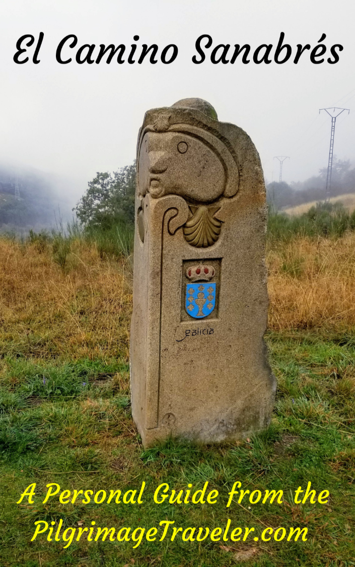
The amazing mountain route alternative, the Camino Sanabrés, from Granja de Moreruela on the Vía de la Plata!👇
The most incredible mountain scenery on this camino from Leon to Oviedo!👇

The shortest of the caminos, but not easy!👇

The very first, Original Way from Oviedo to Santiago!👇

The pilgrimage to the "End of the World" ~ The perfect add-on to your camino!👇

All Banners, Amazon, Roamless and Booking.com links on this website are affiliate links. As an associate of these companies, the Pilgrimage Traveler website will earn from qualifying purchases when you click on these links. We have used and love all of our product recommendations and believe you will too! We sincerely thank you!

🙋♀️ Why Trust Us at the Pilgrimage Traveler?
We’re not a travel agency ~ we’re fellow pilgrims! (See About Us)
We've trekked Pilgrimage Routes Across Europe since 2014!
💬 We’ve:
- Gotten lost so you don’t have to. 😉
- Followed waymarks in the glowing sunlight, the pouring rain and by moonlight. ☀️🌧️🌙
- Slept in albergues, hostels & casa rurals. Ate and drank in cafés along the way. 🛌 😴
- Created comprehensive and downloadable GPS maps and eBook Guides, full of must-have information based on real pilgrimage travels. 🧭 🗺️
- Shared our complete journeys, step by step to help YOU plan your ultimate pilgrimage and walk with your own Heart and Soul. 💙✨
Every detail is from our own experiences. Just fellow pilgrims sharing the Way. We have added a touch of spirituality, heartfelt insights and practical guidance from the road ~ offering a genuine connection to the spirit of pilgrimage. Tap into the wisdom of seasoned pilgrims!
Ultreia and Safe Pilgrimage Travels, Caminante! 💫 💚 🤍
Follow Me on Pinterest:
Find the Pilgrimage Traveler on Facebook:
Shroud Yourself in Mystery, along the Via de Francesco!


Walk in the Footsteps of St. Francis, and Connect Deeply with the Saint and to Nature in the Marvelous Italian Countryside!
Need suggestions on what to pack for your next pilgrimage? Click Here or on the photo below!

Carbon Trekking Poles ~ My Favorites!

Carbon fiber construction (not aluminum) in a trekking pole makes them ultra lightweight. We like the Z-Pole style from Black Diamond so we can hide our poles in our pack from potential thieves before getting to our albergue! There are many to choose from! (See more of our gear recommendations! )
Gregory BackPack ~ My Favorite Brand


Do not forget your quick-dry microfiber towel!