- ~ Home
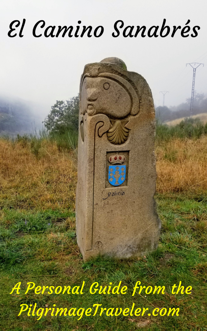
- ~ Camino Sanabrés (The Sanabrés Way)
- Estacion de Lalin to Bandeira, Day Fifteen
Jump to Camino Sanabrés Stages
Camino Sanabrés, Estación de Lalín to Bandeira, Day Fifteen, 22.3 Kilometers (13.86 Miles)
Our day fifteen on the Camino Sanabrés, Estación de Lalín to Bandeira was a mostly rainy day through the historic countryside, often following the path of the N-525. It was as if the day was shedding tears for my friend who could no longer walk her pilgrimage.
🙋♀️ Why Trust Us at the Pilgrimage Traveler?

We’re not a travel agency ~ we’re fellow pilgrims! (See About Us)
We've trekked Pilgrimage Routes Across Europe since 2014!
💬 We’ve:
- Gotten lost so you don’t have to. 😉
- Followed waymarks in the glowing sunlight, the pouring rain and by moonlight. ☀️🌧️🌙
- Slept in albergues, hostels & casa rurals. Ate and drank in cafés along the way. 🛌 😴
- Created comprehensive and downloadable GPS maps and eBook Guides, full of must-have information based on real pilgrimage travels. 🧭 🗺️
- Shared our complete journeys, step by step to help YOU plan your ultimate pilgrimage and walk with your own Heart and Soul. 💙✨
Every detail is from our own experiences. Just fellow pilgrims sharing the Way. We have added a touch of spirituality, heartfelt insights and practical guidance from the road ~ offering a genuine connection to the spirit of pilgrimage. Tap into the wisdom of seasoned pilgrims!
Ultreia and Safe Pilgrimage Travels, Caminante! 💫 💚 🤍
Quote for Day Fifteen on the Camino Sanabrés, Estación de Lalín to Bandeira
"An injury is not just a process of recovery it's a process of discovery." ~ Conor McGregor, Irish professional mixed martial artist and boxer
The process of self-discovery, we know, can be a painful one. In this case, it was a worrisome physical pain, as well as the emotional and spiritual pain of having to give up the pilgrimage.
But Nadine's story of self-discovery is not mine to tell. That is for her, to one day perhaps, put into words what she experienced on her journey.
Maps and Stats of Day Fifteen on the Camino Sanabrés, Estación de Lalín to Bandeira
Here are our GPS tracks for the day. As you can see, as we get ever closer to Santiago de Compostela, there are many more services available.
Please also note that the Camino de Invierno joins the Camino Sanabrés in A Laxe, after about six kilometers into the day. Because of this, you may see more pilgrims than before.
The day begins with a 2.5 kilometer uphill climb, gaining 100 meters (330 feet), followed by an essentially long downhill of about 8.0 kilometers to the medieval bridge, the Ponte Taboada.
From the bridge, you will have another climb of 2.8 kilometers and 130 meters (430 feet) then some ups/downs for several kilometers until you reach Silleda after 15 kilometers, where the important climbing for the day ends.
Finally the day ends with a 7.5 easy kilometer walk downhill, until the destination town of A Bandeira. All-in-all, a not-too-strenuous day.

👣 Camino Sanabrés EBook:
Offline Guide with Bonus Route
~ Includes 4-5 additional days on the Vía de la Plata from Salamanca!
Walk smarter with our ad-free, beautifully formatted Camino Sanabrés eBook Guide, perfect for offline use ~ important in the mountainous and remote areas. Includes daily stage details, stunning photos, historical background and a BONUS digital guide on the Vía de la Plata from Salamanca, called the Camino Fonseca. This allows you the opportunity to add 4-5 more days to your Camino in the beginning.
Don't carry a hard copy guide book to increase your pack weight. Use our frequently updated digital guide on your next Camino instead!
📲 Instant download. 💸 Money-back guarantee. 🔄 Free updates for 1 year.
👉 Click here for more info or BUY NOW!
Jump to Camino Sanabrés Stages
Photo-Rich Travelogue for Day Fifteen on the Camino Sanabrés, Estación de Lalín to Bandeira
We woke up to the inevitable call from our friend Norm, that Nadine could not walk that day. In fact, she could not even stand on her legs at all.
When I went to see her and evaluate her, I realized that her injury was so severe, that she was not only unable to walk, but that she needed a medical evaluation to ensure that nothing serious was going on. Plus, she would need crutches and/or a wheelchair if she could not stand at all without pain.
It was no surprise that Nadine appeared so sullen. But it was what it was.
We three, without Nadine, walked over to the Bar A Taberna de Vento for breakfast and to bring something back for Nadine to have in the room.
The kind proprietor, when I appraised him of Nadine's situation, assisted us and called for a taxi to take her to Santiago to the nearest urgent care clinic for an evaluation.
Rich and I were assured that we should still walk on, that our Camino should not be ruined. From the hotel, Rich carried Nadine down the stairs and put her into the taxi, with the kindest and most helpful female driver. I spoke my elementary Spanish to the driver (she could not speak English) and they were off. Their walking pilgrimage was over.
It was with heavy hearts that we geared up for the day, getting a late start at 9:30 in the morning, after it was all said and done.
From the point just to the east of the traffic circle by the hostal, on the PO-534 we turned left and north to rejoin the Camino, on the secondary road toward the first hamlet of Baxán. The turn is at this very old building shown below.

It is an uphill climb from the beginning as you can see. Here is a photo of our arrival into the town of Baxán.
 Uphill Towards Baxán
You stay left at the first Y-intersection after about 1/2 kilometer, at the cluster of buildings shown above.
Walk through the tiny town and about 1/4 kilometer later, arrive at another Y-intersection with a covered picnic table and a fountain. Stay to the left.
After only a few meters more take a right turn after about 600 meters into the day to head for the railroad bridge shown below.
 Cross Under Railroad Bridge
You cross under the bridge, and immediately turn left and up a steeper hill. The road has a nice path on its side for the pilgrims. Crest the hill, shown in the photo below, after about 1.2 kilometers into the day on the Camino Sanabrés, Estación de Lalín to Bandeira.
 Road Parallels Railroad Tracks
The road loses a bit of elevation, as you walk down to the next Y-intersection, shown next. Stay right and on the roadway, to enter into the town of A Bouza.
 Turn Right Towards Botos
Walk through A Bouza, keeping to the main roadway through town. When you come to the town cross, in its center, a few meters to the right is the Igrexa de San Xoan de Botos if you care to visit it.
After leaving town a few meters later, the Camino follows a country road, shown below that continues northward. You stay straight on through various intersections through here.
 Quiet Secondary Road
After almost exactly 2.5 kilometers, you come to the altitude top for the day, and a crossroad where you stay straight onwards. The pavement turns into a lovely dirt lane that takes you into the forest, shown below.

Jump to Camino Sanabrés Stages
This is now a lovely walk through predominantly oak forests for about a kilometer. Then when you come to this T-intersection after 3.46 kilometers total, you will make a right hand turn into the town of A Eixere.
 Right Turn Towards Eirexe
That’s the Taberna Típica Ruta da Plata on the left side of the photo below, if you need a break.
 Walk Through Eirexe
200 meters later, come to the very quaint town church, shown below.

After leaving the center of town at the church, after about another 200 meters the Camino takes a left turn, shown below, towards the next hamlet of Donsión.
 Left Turn Towards Donsión
You never actually walk through Donsión, but take a right hand turn on its east side to skirt it at this building, shown below. You are now at approximately 4.1 kilometers into the day on the Camino Sanabrés, Estación de Lalín to Bandeira.
 Skirt Around Donsión
Once again you are back in the amazing Galician oak forest for about the next kilometer.

The Camino drops down to a stream called the Rego de Cabirtas after about 4.84 kilometers total, and crosses it on this little bridge.
 Cross the Rego de Cabirtas
The Camino comes out of the forest at the motorway, the AP-53 where it interchanges with the N-525 and walks alongside it on a frontage lane, shown below. It is hard to make out all the pilgrim-placed stick crosses on the chain link fence, but they are there!
 Walk on Parallel Lane Along the AP-53/N-525
The dirt lane becomes pavement, and continues its parallel journey, with the N-525 to the right, and in the direction of the next town of A Laxe, shown below. The rain was beginning to pick up a bit.
 Lane Joins Pavement to A Laxe
This parallel road never joins the N-525, but conveniently bends to the right and crosses it at kilometer 5.68 into day fifteen. This crossing is shown below.
 Cross the N-525 Here
After the crossing, in about 75 meters, take the first left in A Laxe. After about only 100 meters, you are already through town and you will find the Albergue de Peregrinos de A Laxe on the north side.
It is here at the albergue that the Camino de Invierno joins the Camino Sanabrés from the north. You are about 5.88 kilometers into your day when you arrive at the albergue.

Jump to Camino Sanabrés Stages
The Camino continues past the albergue and takes a westward (left) bend back towards the N-525, but then bends northward again to walk through these lovely old stone buildings.

After 6.12 kilometers, the nice side road joins the N-525, where the pilgrimage traveler must turn to the right and walk upon it. There is a nice wide shoulder that makes the pilgrim's passage a bit safer.
 Right Turn Onto N-525
From here we essentially follow the path of the N-525 for the remainder of the day.
Shortly after joining the N-525, about 120 meters later, we passed the Bar María José on the left side after about 6.25 kilometers into the day on the Camino Sanabrés, Estación de Lalín to Bandeira. We chose to get a few more kilometers under our belt before stopping for a break.
Right after the bar there is a waymark, where you turn left, leaving the N-525 for now. You can just see this waymark to the right side of the photo, below.
 Left Turn at the Bar María José
Ahead, it is about a 1.5 kilometer reprieve from the N-525, on lovely lanes, including a forested area where the pavement ends enroute to the next town of Prado. The rain was definitely steady now!

After walking into and out of the forest on the way to Prado, there is a crossroads after 7.33 kilometers, where the road turns back to pavement. If you turn left here, there is the Pazo de Bendoiro, an accommodation a few meters off-Camino to the south.
Otherwise, carry on straight at the crossroads, and re-join the pavement on this lane, shown below.
 Lane to Next Town of Prado
It is after 7.7 kilometers that the Camino rejoins the N-525, here in Prado.
 Rejoin N-525 in Prado
Once again, it is only a short distance, about 260 meters along the N-525 when you encounter this sign, directing you to the left and off the highway, just shy of 8.0 kilometers into the day.
 Leave the N-525 on this Path
However, our plans were different! We could see, just down the road, the bar, the A Taberna de Prado. We were ready to warm up and dry out after a total of about eight kilometers on the Camino Sanabrés from Estación de Lalín to Bandeira.

Jump to Camino Sanabrés Stages
The bar was really nice and we were reluctant to go back out in the rain. But that is what pilgrims do, so onward we went.
After the turn off the highway at the above waymark, there is a hard right turn onto a funky parallel lane that takes you behind the town.
Stay to the right at the first intersection, and continue on this tractor lane.

As you continue to walk parallel to the N-525, avoiding town on the tractor lane, come to this next distinct intersection, shown below, and again stay straight on.
 Straight On Here After Crossing the EP-6004
At the next T-intersection about kilometer 8.93, take a right hand turn onto a paved road.
After less than 200 meters more, come out to this paved road, shown next, and take a hard left turn. You can see the N-525, just ahead, but the Camino avoids it by turning left here.
 Come Out in Borralla, Turn Left
Along this two-lane road we had to stop and admire a cattle crossing. This is definitely cow country. You can smell them everywhere!
 Cow Crossing in Borralla
After the cattle moved out of the way, we saw this signpost at the intersection they had just taken: Santiago only 47 kilometers away now!

The pavement narrows as you walk along this road, winding around as you descend toward the Deza River.
 Lane Toward Ponte de Taboada
When you come to the first modernized medieval bridge (not pictured), across the river, do not take it, but notice this lane to the left just before the bridge, shown below. This lane follows the river on the east side. This is the Camino.
 Stay Left Here by Old Bridge
This forest lane you have now taken continues to descend strongly.
 Rich Walking Through More Forest
About 1/3 kilometer after the turn off, and after walking through another Galician oak forest, you come to this ancient road, shown below.

In just a few meters more, you come to the old bridge, the Ponte Taboada, also known as "A Ponte Vella." According to the Silleda Tourism website there is a rock inscription nearby that says the bridge was built in 912 A.D. and that this was the only passage across the river at that time.
It is a wonderful place, this bridge with a single arch. Some other nice pilgrims who were lingering here, took a photo of Rich and I on it.

It is approximately 10.5 kilometers from the start, at this bridge, on the Camino Sanabrés from Estación de Lalín to Bandeira. We were not quite halfway into the day at this point.

Then it was onward, as the ancient paved road continued for more than another 100 meters. Here I am in full rain regalia. I look like a big white, beached whale! Ha ha.

Jump to Camino Sanabrés Stages
It is a steep climb back up from the river, after the Ponte Taboada bridge.
After 10.7 kilometers, come to this intersection in the tiny town of A Ponte Taboada and turn right onto the road as indicated. On the right side here, there is another accommodation, the Posta da Prada (+34 986 58 00 11).
 Walking Through A Ponte Taboada
Continue walking uphill through A Ponte Taboada, staying to the right in a few more meters then left after 10.9 kilometers. 100 meters later, come to this T-intersection, shown below, and turn left.
 Left Turn Onto Tiny Lane
Continue onward along the tiny paved lane, for about another 1/3 kilometer, coming to a crossroads where you stay straight on, and onto this farmer's lane, shown below.
 Straight Onto Farmer's Lane
Continuing strongly uphill, the Camino is now entering the town of Taboada.
 Uphill Into Taboada
At kilometer 11.7, come to a T-intersection, and take a right hand turn onto the pavement. In a few more meters, take another right and pass by this public fountain, with potable water, where you can fill up if needed.

Just after the fountain, another T-intersection takes you left and onto a side road that brings you out to the N-525 after only a few more meters. Directly across the N-525 in Taboada, you will see a set of stairs below a cross. The 12th century Romanesque Iglesia de Santiago de Taboada is just behind the cross.
The Camino does not cross the road to the church, so if you choose not to see it, stay to the left on the road. If you want to go see the church, be very careful crossing the highway, as there is a blind curve here and the cars are moving very fast!

Unfortunately, the little church was closed on our arrival. But we still admired it from the outside. There is a nice carving of Samson over the door. You are about 11.8 kilometers into the day, here, on the Camino Sanabrés from Estación de Lalín to Bandeira.
Continue west (left) along the N-525 for about 70 meters, and you will see this pathway, heading left and into the woods. Be very careful, again, if you are crossing back over the N-525.
 Carefully Cross the N-525 Into the Woods
You are now beginning a short, 3/4 kilometer walk through the forest, once again. You are still climbing!

This forest walk comes out at the Silleda Industrial Park, shown below, at a T-intersection. Turn left.
 Silleda Industrial Park
This gravel road takes you back into the forest, on the way to the next town of Trasfontao. The forest canopy creates a nice shelter on a rainy day! It was a lovely walk through here, even in the rain.

Approximately another 3/4 kilometer of forested walking, brings you out into an open area in the small hamlet of Trasfontao, shown below, at kilometer 13.2.
There are two possible accommodations in Trasfontao, the Remanso de Trasfontao "Casa do Campo," a quite luxurious-looking casa rural (think expensive), and the Remanso de Trasfontao "Casa das Árbores & Bubble, (even more so!).
Trasfontao is a small place and when you arrive at a large open area, turn right, pass the town church then turn left and down the hill.
After a few more steps, after meandering through the remainder of town, you are directed northward (right turn), back into the woods and onto this ancient road.

Jump to Camino Sanabrés Stages
The ancient road extends for almost 1/2 kilometer. It was tricky rock-hopping in the rain and mud. Then it was onward along a dirt road, for about a total of 1.2 kilometers from Trasfontao, continuing the long climb through the countryside.
You come out of the countryside at this road, below, the PO-2205. You have now reached the southern outreaches of the large town of Silleda. You are at about 14.5 kilometers total, on the Camino Sanabrés from Estación de Lalín to Bandeira.
Cross over the PO-2205 here and continue on the tractor lane, the short length shown below.
 Cross PO-2205 Onto Lane
Join the pavement on the other side of the lane and walk through some industry, staying right until you come out at the street, the Rúa Santa Eulalia, about 1/2 kilometer later. As you enter town, you will see lots of billboards for restaurants and accommodations.
By the time you arrive in Silleda, you are at the end of the climb for the day. It is essentially downhill for the remainder of the stage
It was at this intersection, below, that we turned to the right to find the Bar A Pedra a few meters down the road. We were ready, once again, to dry out and have lunch. We were at almost exactly 15 kilometers into the day.

 Bar A Pedra, 9 Rúa Venezuela
 Rich Warming Up at the Bar A Pedra
The proprietress had a nice wood stove going in the back room, and led us there immediately! We took off our rain gear and spread it out to dry by the stove. It was fantastic.
We ordered a nice meal, lots of hot coffee with milk, and I think we even had dessert, we were so happy and comfortable in this cozy spot.
Just as we arrived at the bar, it started really pouring outside! Perfect timing!
Accommodations in Silleda
Because of the rain, we almost considered staying in Silleda. However, we decided we had seven more kilometers left in us, even if it was raining. Beyond that, we were not going to push it past A Bandeira.
If your camino brings you here for the night, there are several nice accommodations from which to choose. There are four private albergues, the Albergue Turístico Silleda, the giant El Gran Albergue Silleda, (+34 611 28 67 57), the Albergue Trabazo and the Albergue Santa Olaia. All of them can be pre-booked. Three of these albergues are just north of the Camino, if you take the Rúa Venezuela. The Santa Olaia is just steps away from the Camino after joining the N-525 and just behind the church. Check the map above for their exact location.
If you prefer a hotel, there is the Hostal Casasnovas, the Hotel Ramos, the Hostal Bar Toxo (+34 986 58 01 11) and the Hostal Pardo ( +34 986 58 09 65). All are very economical. The last two are centrally located, the Hostal Casanovas is along the Rúa Santa Eulalia, but turning east and away from the Camino. The Hotel Ramos is to the north, next to the Gran Albergue Silleda.
For even more options, you can click here, especially if you would like an apartment, and/or have a group traveling together. The options are numerous!
Jump to Camino Sanabrés Stages
Back on the Camino, Day Fifteen, Camino Sanabrés, Estación de Lalín to Bandeira
After our break, the rain eased up again, fortunately. Back on the Rúa Santa Eulalia, we headed westward and passed the church, shown below. The Camino turns right after the church and onto the Avenida da Parque.
We instead took a left, and walked one block south of the church and found an Eroski supermarket that had not yet closed for siesta. We went inside and stocked up our packs.
 Right Turn After the Iglesia de Santa Baia de Silleda
Back on the Avenida da Parque, after passing the church, walk north for only one block and come to a crossroads with our old friend, the N-525. Turn left.
Continue walking on the N-525 for only 1/4 kilometer.
 Along the N-525 in Silleda
It is after approximately 15.5 kilometers that you come to a concrete building, where there is a waymark tile on it, directing you to turn to the left. Immediately after this building, take a right turn to pick up another lane that parallels the N-525, shown below.
 N-525 Parallel Lane
The nice lane lasts for about 1/4 kilometer, then joins up with the N-525 again. Almost immediately after joining the highway, the Camino takes another side line diversion, shown here.
 Second N-525 Diversion
This second diversion is short lived and about 100 meters long. When you join the N-525 again, it is only for about 100 meters, before picking up the 3rd diversion, shown here.
 Third N-525 Diversion
This third diversion continues to follow the N-525, but just to the south on this funky path that takes you to the next town of O Foxo. At the entrance to town, pass by a water fountain.

Arrive in the center of O Foxo at approximately kilometer 16.3. Here the lane turns to pavement, continues on through town, passing the second water fountain, before bearing to the right to walk up a hill and to this T-intersection shown below. The Camino goes to the left, and onto the paved secondary road. The N-525 is on the embankment, just above you and to the right side of the photo.
 Leave O Foxo on Country Road
Walk on the quiet road for about 1/4 kilometer, until you come out at the N-525 again, shown below. However, the Camino avoids the highway once again, and you turn left here at the Nudesa Feed Mill, and onto another nice quiet paved lane. You are 16.8 kilometers into the day at this point, on the Camino Sanabrés from Estación de Lalín to Bandeira.
 Turn Left at Nudesa Feed Mill
It is a nice, straightforward walk on this road for the next 900 meters, or not quite a kilometer, staying straight on whenever given the choice, and through the hamlet of Margaride.
 Country Road Towards Margaride
 Walk Through Margaride
After 17.7 kilometers, the Camino leaves the paved road, and takes a right hand turn onto this gravel road. Rich is posing here at this turn, heading back into the forest.
 Right Turn Into Forest
A few meters later, it is a left turn onto the forest lane.
 Left Turn, Onward Into Forest
About 3/4 kilometer later, the lane crosses a paved road and continues on the lane on the other side.
We were descending sharply through this area.
It is 300 meters later, when you come out of the forest, turning left onto this lane, by a scrapyard, not seen in the picture below, but it is on the right side of the lane.
 Left Turn Onto Pavement by Scrapyard
As we walked onward along the lane, it was quite muddy as you can see, as we passed several more buildings in the scrapyard.
 Continue Down Scrapyard Lane
After about one kilometer on the lane, the Camino comes to this wooden-railed bridge over the Río Toxa. You are now at kilometer 19.5 at this landmark.

Jump to Camino Sanabrés Stages
The lane takes sharp "S" turns after the bridge, and turns to pavement soon after. The lane continues straight on here at the next crossroads.
 Straight On at Crossroads
Next, the lane walks through a tunnel and under the N-640, then 1/4 kilometer later, walks over the AP-53 on this bridge, shown below. This bridge marks 20.1 kilometers total on the Camino Sanabrés from Estación de Lalín to Bandeira.
 Cross the AP-53
It is a straightforward walk for the next kilometer after the bridge, with a welcoming cow in the town of Chapa. You can see the high-rise buildings of Bandeira in the distance as you get nearer to the destination!

After kilometer 21.1, turn right by these wonderful old stone estate buildings.
 Right Turn by Stone Estate Buildings
1/4 kilometer later, turn right, at this stone building.

You walk for 400 meters more on this lane, that turns to pavement, and of course, comes out at a T-intersection with the N-525. Turn left onto the highway to walk into Bandeira.
Bandeira is a sizable town, and here is a photo of the center as we walked along the N-525. It is an uphill walk as you stroll along the highway.

It is a bit more than 1/2 kilometer walk on the N-525 when you come to this intersection, shown below. The sign for the albergue is a bit small, but it is on the gray building in the picture. Turn right onto the street called the Rúa Louras.
 Right Turn Onto the Rúa Louras to the Albergue
The Albergue de Peregrinos de A Bandeira is only about another 200 meters from the N-525, according to the sign. It is a funky, modern, module-based place. It is new and with adequate facilities, but I did not like that I had to go outside from the dormitory pod to get to the bathroom pod, especially at night! Oh well, it was still a nice place.

There are two more accommodations in A Bandeira, the Hostal Conde Rey and the Hotel Victorino (+34 986 58 53 30) both along the N-525, just before the turn for the albergue.
I did not feel like going out for dinner on this evening. I felt like I needed to crash, seclude myself and have a bit of a melt-down, from all the events and turmoil of the day.
There is a DIA supermarket, a mere block from the albergue, if you choose to cook. The kitchen and dining room pod was nice, but with limited utensils available. There are plenty of bars along the main road, if you prefer that.
Reflections on Day Fifteen of the Camino Sanabrés, Estación de Lalín to Bandeira
Today seemed like a different Camino, entirely. Indeed it was! Without our friends, that change was palpable. While I felt relieved at no longer needing to feel responsible for our friends, at the same time it was not a good feeling. My heart ached. My gut flipped and flopped around. I felt lost.
I would have several days to process it all, before our own arrival in Santiago. I needed to temper my anger at what had occurred, with the grace of compassion, to best assist my friend's own process of discovery, during her recovery.
Rich and I had discussed the situation at length during the day, and we both agreed that what had happened was out of our control, and that we would be as supportive as possible once we all met up in Santiago in a few days.
Completing the pilgrimage and arriving in Santiago meant so much to Nadine that she had pushed herself beyond her own capabilities. She was devastated and we needed to be there to support her. I could only imagine what she was feeling, holed up in Santiago.
The news of Nadine's condition after her medical evaluation in Santiago, that we received during the day, was hopeful. She would heal, but it would take time. Her official diagnosis was severe tendonitis of the lower leg, and the x-ray of her compensation injury of the opposite knee showed no serious issues.
She would be on crutches for the short distances that her injury could bear, and in a wheelchair for longer distances. Who knew how long she would need assistive devices? I feared it would be a while.
Norm and Nadine decided not to change their flight arrangements and leave Santiago. Instead they would spend their remaining week resting and taking in the sites of Santiago and taking bus tours to Muxía and Finisterre. Their original plan was to walk to the End of the World, but that all changed now.
Our walking pilgrimage day, while much shorter than some, was drenched in rain, which always makes it tougher on the pilgrim. Especially since the October rains leave a chill in the bones. It didn't help that while it rained on the earth as we walked, it rained in our hearts as well.
Salutation
May your own day fifteen on the Camino Sanabrés from Estación de Lalín to Bandeira be injury free, as well as your entire Camino! But if you do have an injury, may it be a process of discovery and grace for you!
Camino Fonseca Stages
~ Vía de la Plata Stages from Salamanca


~ Camino Sanabrés Stages


Please Consider Showing Your Support
Many readers contact me, Elle, to thank me for all the time and care that I have spent creating this informative website. If you have been truly blessed by my efforts, have not purchased an eBook, yet wish to contribute, I am exeedingly grateful. Thank you!
Search This Website:
The Pilgrimage Traveler Digital Guides
Our Guides Help You:
~ Know what to expect each day!
~ Locate historic sites along the Way!
~ Know where you are in your journey!
~ Discover a quote from the sages, for your daily reflection on the journey!
Click on a Photo Below to Get Your Copy.
A most popular alternative on the Central Route of the Camino Portugués!👇

The Portuguese Routes are rapidly gaining in popularity, especially the section from Lisbon! Plan to walk this one soon, before it is no longer a quiet experience!👇

Our most popular Portuguese guide! 👇

The most historic of the Portuguese Caminos ~ not to be missed!👇

The spiritual adventure of a lifetime, following in the footsteps of St. Teresa of Ávila!👇

The amazing mountain route alternative, the Camino Sanabrés, from Granja de Moreruela on the Vía de la Plata!👇
The most incredible mountain scenery on this camino from Leon to Oviedo!👇

The shortest of the caminos, but not easy!👇

The very first, Original Way from Oviedo to Santiago!👇

The pilgrimage to the "End of the World" ~ The perfect add-on to your camino!👇

All Banners, Amazon, Roamless and Booking.com links on this website are affiliate links. As an associate of these companies, the Pilgrimage Traveler website will earn from qualifying purchases when you click on these links. We have used and love all of our product recommendations and believe you will too! We sincerely thank you!

🙋♀️ Why Trust Us at the Pilgrimage Traveler?
We’re not a travel agency ~ we’re fellow pilgrims! (See About Us)
We've trekked Pilgrimage Routes Across Europe since 2014!
💬 We’ve:
- Gotten lost so you don’t have to. 😉
- Followed waymarks in the glowing sunlight, the pouring rain and by moonlight. ☀️🌧️🌙
- Slept in albergues, hostels & casa rurals. Ate and drank in cafés along the way. 🛌 😴
- Created comprehensive and downloadable GPS maps and eBook Guides, full of must-have information based on real pilgrimage travels. 🧭 🗺️
- Shared our complete journeys, step by step to help YOU plan your ultimate pilgrimage and walk with your own Heart and Soul. 💙✨
Every detail is from our own experiences. Just fellow pilgrims sharing the Way. We have added a touch of spirituality, heartfelt insights and practical guidance from the road ~ offering a genuine connection to the spirit of pilgrimage. Tap into the wisdom of seasoned pilgrims!
Ultreia and Safe Pilgrimage Travels, Caminante! 💫 💚 🤍
Follow Me on Pinterest:
Find the Pilgrimage Traveler on Facebook:
Shroud Yourself in Mystery, along the Via de Francesco!


Walk in the Footsteps of St. Francis, and Connect Deeply with the Saint and to Nature in the Marvelous Italian Countryside!
Need suggestions on what to pack for your next pilgrimage? Click Here or on the photo below!

%20bend%20back%20towards%20the%20N-525%2C%20but%20then%20bends%20northward%20again%20to%20walk%20through%20these%20lovely%20old%20stone%20buildings%20in%20the%20town%20of%20A%20Laxe.)
Carbon Trekking Poles ~ My Favorites!

Carbon fiber construction (not aluminum) in a trekking pole makes them ultra lightweight. We like the Z-Pole style from Black Diamond so we can hide our poles in our pack from potential thieves before getting to our albergue! There are many to choose from! (See more of our gear recommendations! )
Gregory BackPack ~ My Favorite Brand


Do not forget your quick-dry microfiber towel!