- ~ Home
- ~ Camino Sanabrés (The Sanabrés Way)
- Lubian to A Gudina, Day Seven
Jump to Camino Sanabrés Stages
Camino Sanabrés, Lubián to A Gudiña, Day Seven, 24 Kilometers (14.91 Miles)
Our day seven on the Camino Sanabres from Lubián to A Gudiña was a long and strenuous walk, almost entirely on forest paths! This was unlike the prior day which was almost entirely on the highway. In addition, my spirits were more lifted because the rain had finally ceased, and the scenery was more delightful.
🙋♀️ Why Trust Us at the Pilgrimage Traveler?

We’re not a travel agency ~ we’re fellow pilgrims! (See About Us)
We've trekked Pilgrimage Routes Across Europe since 2014!
💬 We’ve:
- Gotten lost so you don’t have to. 😉
- Followed waymarks in the glowing sunlight, the pouring rain and by moonlight. ☀️🌧️🌙
- Slept in albergues, hostels & casa rurals. Ate and drank in cafés along the way. 🛌 😴
- Created comprehensive and downloadable GPS maps and eBook Guides, full of must-have information based on real pilgrimage travels. 🧭 🗺️
- Shared our complete journeys, step by step to help YOU plan your ultimate pilgrimage and walk with your own Heart and Soul. 💙✨
Every detail is from our own experiences. Just fellow pilgrims sharing the Way. We have added a touch of spirituality, heartfelt insights and practical guidance from the road ~ offering a genuine connection to the spirit of pilgrimage. Tap into the wisdom of seasoned pilgrims!
Ultreia and Safe Pilgrimage Travels, Caminante! 💫 💚 🤍
Quote for Day Seven on the Camino Sanabrés, Lubián to A Gudiña
"Clouds come floating into my life, no longer to carry rain or usher storm, but to add color to my sunset sky." ~ Rabindranath Tagore
In our case, the clouds from yesterday that were clearing out in the morning, brought us one of the most amazing sunrises that I had seen in some time.
Our day seven was again frequented by clouds, but bringing only a very light rain, that was welcome most of the day, because it aided it keeping us cool throughout our arduous climbs.
I had a bit of a personal meltdown in the afternoon, when I needed to dig more deeply to get through the difficult terrain in the late afternoon. Day seven was no cake-walk, despite its shorter length. I often get quite grumpy in the afternoon when I am tired, hungry and just want to stop walking!
Maps and Stats of Day Seven on the Camino Sanabrés, Lubián to A Gudiña
Here is my Google interactive map, showing the services available on this day to the pilgrimage traveler. There is not much along the rural pathways other than churches, and one café, not quite halfway, in Vilavella. Plan to have your pack full of food and water for this walk. With the energy required to get through the day, you will not be sorry.
As alluded to above, the day is strenuous, with two significant climbs, both of which require effort. The first climb of the day is short and steep. You must gain 322 meters (1056 feet) over 4.5 kilometers. Then you lose all the elevation that you gained, before the second. It is not so steep 138 meters (452 feet) over about five kilometers. Doesn't sound like much? Walk it and see for yourself!

👣 Camino Sanabrés EBook:
Offline Guide with Bonus Route
~ Includes 4-5 additional days on the Vía de la Plata from Salamanca!
Walk smarter with our ad-free, beautifully formatted Camino Sanabrés eBook Guide, perfect for offline use ~ important in the mountainous and remote areas. Includes daily stage details, stunning photos, historical background and a BONUS digital guide on the Vía de la Plata from Salamanca, called the Camino Fonseca. This allows you the opportunity to add 4-5 more days to your Camino in the beginning.
Don't carry a hard copy guide book to increase your pack weight. Use our frequently updated digital guide on your next Camino instead!
📲 Instant download. 💸 Money-back guarantee. 🔄 Free updates for 1 year.
👉 Click here for more info or BUY NOW!
Jump to Camino Sanabrés Stages
Photo-Rich Travelogue for Day Seven on the Camino Sanabrés, Lubián to A Gudiña
We arose to a foggy day, but without rain. We left our accommodations, the Casa de Irene and the Albergue de Lubián and met at 8:30 to walk up the hill and onto the Calle da Cruz by staying to the left. There were lots of old stone homes being renovated through this quaint town and already we could hear the sounds of construction and jackhammering.
As we reached the high-point on the street, the view of the lower town was wonderful and the clouds were hovering over the distant mountains.

It is a steep descent as the street makes a big bend, heading toward the lower part of town and the church bell tower.
You come to a Y-intersection, and stay again to the left, as the yellow arrow on the stone building directs, shown below.
 Left Turn onto the Calle San Mamés
By the time we arrived at the Iglesia de San Mamés, the sky was awash with color! The dissipating rain clouds had indeed added color to my sunrise sky! I just had to slow down and take photos of the most glorious sky that I had seen thus far on this Camino!


After the church, stay left at the next two intersections and get onto this street shown below. We continued to descend steeply as we continued our walk through this quaint town.

By about 2/3 kilometer into the day, you see the sign marking the end of town. Good-bye, beautiful place!
 Leaving Town on the Camino Sanabrés from Lubián to A Gudiña
Next, you continue down the hill on the wall-lined road for about another kilometer, as the countryside opens up and you can see the ridges ahead that you will be climbing soon! The motorway, the A-52 is in the river valley just below you and to your left.
At a huge hairpin turn, at kilometer 1.1 follow the pink sign and turn right into the forest, and toward your next destination, the Santuario de la Tuiza.
 Right Turn Toward the Santuario de la Tuiza
As you walk along the lovely, forested secondary road, the descent toward the river valley continues. Along this rather steep descent on the pavement, my left knee was acting up a bit. I hoped that this was not an omen of things to come.
The lichen and the moss through here is thick and amazing.

While it looks peaceful here, eventually we could hear the motorway in the valley to our left, and even catch glimpses of it. The huge viaducts rose above the ground, as engineering marvels.
 A-52 Motorway in Sight
Our Camino path drops all the way to the valley floor and crosses the Río Tuela on this footbridge after 2.0 kilometers into the day on the Camino Sanabrés from Lubián to A Gudiña.
 Cross the Río Tuela
Thus ends the descent, and the bridge marks the start of the 4.5 kilometer climb.
The dirt lane on the other side of the river walks under the viaduct! I must say, the architectural wonder actually added to my viewing pleasure.

Jump to Camino Sanabrés Stages
After walking under the viaduct, you take a hard left, after about 2.4 kilometers to walk by the hermitage, shown below. This 18th century Baroque church has a gorgeous belltower to admire. We lingered only a moment, with the climb ahead of us.

The Way from here is on paths until the next town of A Canda, for more than 5.5 kilometers. The waymarking on the path is good, and it would be almost impossible to get lost. You will see wooden signs and rocks with yellow arrows and concrete mojones to guide you.
We now followed in the path of the Arroyo de la Tuiza and at about kilometer 2.95 cross the stream on a footbridge shown below.
 Crossing the Arroyo de la Tuiza
After the crossing, the Way begins its serious climbing. The forest Way through here is lovely, but not as quiet as it could be. We could hear sounds from the motorway, now on our right, and could see glimpses of it through any clearing in the trees.
 Forest Path After the Santuario
 Path Rocky at Times and Steep
 Nadine and Norm on the Steep Climb
After almost 5.0 kilometers into the day, after a strong bend to the right, or eastward, we crossed this gorgeous little stream, on the Camino Sanabrés from Lubián to A Gudiña.

Not quite 200 meters later, the way takes another strong bend, this time to the left, or westward and you now get this open mountain and motorway view.

 Following the Frequent Wooden Signs
Here is another view in a clearing near the top of the climb to the Alto da Canda, after about 6.0 kilometers. Our pilgrim group was close together, talking, laughing and encouraging one another to the top, not far away now!

 Walking Through Another Moss Covered Forest Segment
We had overtaken another group of Spanish pilgrims, moving only a little slower than us. When I reached the top, I looked down and got this lovely pilgrim's salute from one of them!

At the top, it is about 6.5 kilometers from the start of the day. The mist was rolling in.
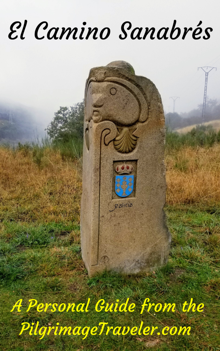
This high point is called the Alto da Canda, at 1262 meters (4140 feet), along the border between the provinces of Castilla y León and Galicia. At the border was this lovely carved marker, letting us know that we were entering Galicia at last!

One of the Spanish pilgrims offered to take a photo of our group, between the Camino de Santiago map and the Galicia border marker. We were happy to be here, with the big climb under our belts.

There is a look-out area with a fountain and benches at the top, but the visibility was not that good, and the weather did not invite us to linger for very long. We set off from the western side, guided by this waymarking shown below.

Jump to Camino Sanabrés Stages
We walked along, chatting with our new-found friends.
 Pilgrim Fellowship
The descent is as steep on the other side and the vistas abound.

By 7.88 kilometers, you come to a nice picnic area in the next small village of A Canda which only consists of a few buildings. The Spaniards decided to take a break here, but we were going to push on to the next town of A Vilavella where there is a café. The Café On had advertised on the path before the top, so we knew for sure that there was one ahead.
 Picnic Area in A Canda
Here in town, the road is now paved and you continue on it, for about one more kilometer, shown below. Along this way, the A-52 motorway is up the bank to the right.
 One Kilometer Walk on Pavement
About 8.8 kilometers, there is a large Camino sign that directs you to the left, off the roadway and onto a set of stairs, leading you down a steep descent. Here is Miguel negotiating the steps.
 Miguel Negotiates Left Turn on Steps
Despite the continued steep descent, the path through here is nicely improved.
 Improved Path on the Camino Sanabrés from Lubián to A Gudiña
Shortly, the path parallels a set of railroad tracks, up and to the left on a bank. By about 9.2 kilometers, you come to this tunnel and walk under the tracks.
 Tunnel Under Railroad
At kilometer 10.1 the Camino drops down and crosses a bridge across the Regueiro das Hortas, the next drainage.
 Cross the Regueiro das Hortas on This Bridge
The lane soon turns to pavement just before A Vilavella. Soon after entering town, at about kilometer 11, you come to the turnoff for the bar, shown below. If you don't need the bar, you can continue on straight here. From the photo below, you can see the direction we are going! The bar is only about a two block detour, off-Camino. We enjoyed our stop at this town bar.
 Walking Toward the Bar in A Vilavella
After A Vilavella you will be on more pathways for the next 3.4 kilometers until the pavement of the next town of O Pereiro.
Just after leaving the village, the walk takes you down steeply on a path with stepping stones, shown below and across a stream on the bridge shown next.


As always, after dropping into a drainage, you have to climb back out on the other side. On this climb, there looks to be remnants of an ancient walled road.
 Remnants of Roman Road
This is a lovely forested Way through parts of this section and the Camino now follows the pathway of the Río Abredo, adding a nice babbling sound to your walk at times.

Since we are now in Galicia, and its waymarking system, we can now trust the direction of the rays of the shell to tell us which way to go. It was a welcome sign that we were ever closer to Santiago!
 Waymark Poles, Camino Sanabrés, Lubián to A Gudiña
After approximately 14.5 kilometers, you reach the outskirts of the next town at this darling little country church the Ermita de Nosa Señora de Loreto. There were municipal workers clearing the trail as you can see below.

By about 200 meters later and at kilometer 14.7, you cross the OU-311 road to enter the town of O Pereiro.
 Cross the OU-311 Into O Pereiro
Surprisingly, there are no services in O Pereiro. I was really glad we had stopped in A Vilavella. This town was rather stark-looking to me, or perhaps it was only the gray weather?
 Walking Through O Pereiro
The town is a long strip along the main road, a bit more than 1/2 kilometer and the Camino takes no turns but walks straight on through it. We did walk by some eye-catching ruined buildings on the western edge of town.

Jump to Camino Sanabrés Stages
After leaving O Pereiro, it is about 4.7 kilometers of walking on paths to the pavement in the next town of O Cañizo.
The recurrent theme through this section is to walk in the open, then drop to a more protected drainage, only to get back out into the open again. It is exposed through here, and any serious weather could be a bit of a problem.

After 15.8 kilometers we came to this funky stepping-stone bridge.

As we climbed up and out of the drainage and into this exposed area for the beginning of the second climb of the day, of course it started raining! And in the most exposed area too!
 Second Climb of the Day Begins
It looked like moor-land through here. We encountered a herd of sheep and several large sheep dogs, but they were only curious and did not bother us.

Next, we dropped a little to this second drainage and crossed a stream after about kilometer 17.2 on the Camino Sanabrés from Lubián to A Gudiña.
 Drop to Second Drainage
You can see the open exposure of this next segment, as we got higher into the climb. The rain was only a drizzle, fortunately, so it served the purpose of keeping us cool, rather than soaking us.

After kilometer 18.2, you come out to a paved road, the OU-0953. Here is where you turn right to walk on it, but only briefly for a bit more than 100 meters.
 Join the Pavement of the OU-0953
On the brief roadway walk, you pass over these railroad tracks.
 Cross Railroad Tracks on the OU-0953
After crossing the railroad, you pick up a side road to the right and follow it a few meters, crossing back over the OU-0953 to continue straight on via another path. Things are a bit flatter through here, and there is not much climbing left. It indeed feels like you are on top of the world.
 Side Road of the OU-0953, Camino Sanabrés from Lubián to A Gudiña
Below is the tractor lane that you will now follow. You can see the old concrete mojón to the left of the photo.

I was happy to be on the flatter area, and I was feeling a bit congested in my chest. I had to dig deeply through here, because with only a few kilometers to go, I was tired and hungry. I felt like I hadn't eaten enough during the day.
My left knee felt OK, but my right toes felt hot. It just felt to me like we were all pushing very hard. Or maybe, it was because Rich and Miguel were ahead so far, and walking faster, that I felt pushed. I was happy that our next day would be shorter, at 19 kilometers. Miguel was already talking about doing a long day, of about 38 kilometers. No way was I doing that many kilometers the next day!
 Through Forest and Field
After 19.8 kilometers, you take a left hand turn on the lanes, to head towards O Cañizo. Here we are, entering the town, another place that is a long strip of buildings along the main road. There are also no services in this town.

You follow the yellow arrows through town, which are now more frequent in the province of Galicia. The yellow arrows are always such a comfort, don't you think?

As you walk through the lengthy strip of town, you are actually still gaining in elevation. You walk by this lovely little picnic area, under a tree - if the weather were nice.
 Walk By Picnic Area in O Cañizo
After about 20.7 kilometers, you come to this sweet sign directing you to the left and towards A Gudiña, now only about 3.4 kilometers from here! Yay!

Jump to Camino Sanabrés Stages
From the signpost, there is still a small amount of elevation gain to accomplish.
Walk about another 170 meters more on a dirt tractor lane that leaves town. Take the first right hand turn onto another lane heading northward.
In only 100 meters or so, come to the N-525 and cross over it, staying to the left onto a paved lane. After about 200 meters more, now cross over the A-52 on a bridge. At this bridge, you are now at the high-point after 21.2 kilometers approximately. It is all downhill into A Gudiña from here, for the final approach of 2.8 kilometers!
Immediately after crossing the highway bridge, take a left turn onto a frontage lane, following the path of the highway to the north for almost a kilometer.
Next you will see an exit ramp that you will now follow, continuing on the frontage lane, which is actually the exit ramp for the N-525 into A Gudiña.
It was still raining nicely, as we trudged along to the side of the highway, and then soon along the N-525 which felt like an old friend!
After briefly greeting the N-525, a bend to the right in the lane takes you farther to the north than the actual N-525, through a cluster of commercial buildings with a bank of solar panels the next destination. The Camino ascends slightly, up towards them and by the power line shown below.
 Safe and Protected Side Lane Toward Solar Bank
You are at 22.5 kilometers total when you reach the solar panels, with only 1.5 kilometers left to the center of town (the albergue is another 300 meters farther).
 Climb to the Bank of Solar Panel
After walking around the back of the solar panels, the Camino weaves around some industrial buildings, before rejoining the N-525, shown below. There is now a safe sidewalk for the pilgrim to walk into A Gudiña.

Here is Rich and Miguel walking through town on the N-525.
 Walking Through A Gudiña on the N-525
It is only about 700 meters on the main road, before the sign for the turn, shown below. It is important to note that if you are walking onward, the Camino stays to the right of the gray building and onto the concrete road you see here, parallel to the N-525. I thought the signage was a bit confusing. There is also a carved concrete waymark in front of the gray building, not very visible on the photo and a water fountain behind it.
If you are going to the albergue, continue onward on the N-525, past the intersection shown below and about another 300 meters for the new municipal. You can also take the more pleasant parallel lane to the right, along the onward Camino.
 Camino, Straight On Side Road
Jump to Camino Sanabrés Stages
Accommodations in A Gudiña
As you enter town, first along the main road is the Hostal Restaurante Oscar (+34 988 421 014), with 14 rooms, at the juncture where the Camino turns to the right in the center of town. It has no website, so you must call or drop by. The restaurant gets great reviews on Google.
There is only one albergue in town, the municipal Albergue de Peregrinos Casa da Viúva. This is in a newly restored historic building, right in the center of town, farther along the main highway, across from the town church.
Also farther along the main road, by about 1/2 kilometer from the albergue and clustered together is the Hotel Restaurante Bruma (+34 988 42 11 21) and the Hotel Restaurante Suizo ( +34 988 42 10 66).
As usual we were starving when we entered town, and by the time we cleaned up and washed our clothes, siesta was in full swing. We went from bar to bar, trying to find a place whose kitchen would feed us, around 5-6 o'clock in the afternoon. Miguel, our Spanish compadre and self-appointed guide, did his best to help us.
Finally, we came to the Café Bar Nicoya, right by the albergue, that made us delicious and giant hamburgers, when none of the other kitchens were open. We made their efforts worthwhile, with the five of us drinking lots and eating to our hearts content.
Reflections on Day Seven of the Camino Sanabrés, Lubián to A Gudiña
My knee actually held up well for the day, never giving me much more than a slight complaining twinge, and then only infrequently. I was not worried about it at the end of the day.
As stated earlier, this day was more strenuous-feeling for me than most. Although not all that long, I had to dig deeply, I believe for several reasons. I had failed to honor what I knew about myself and I didn't eat sufficient amounts for the day. I also tried to carry the fresh, young and new energy of Miguel as he walked stronger and faster than all of us.
When push comes to shove, I was learning that I really didn't like to walk alone. I didn't mind the absence of conversation, as long as the silence was accompanied by another individual! Ha!
My social husband was walking more quickly, ahead with Miguel and it just felt like I had to keep up, I guess. I could have walked slower and lingered with Nadine and Norm, however, that didn't feel right either. Perhaps it was merely a matter of ego, but for whatever reason, I arrived in A Gudiña quite spent.
My clouds for the day brought lovely color in the morning, but by the end of the day, no brilliance was left ~ only grayness and drizzle remained. And so it was ~ as it often is on the Camino, until Descanso (rest) and Comida (food) revived this pilgrim's soul once again. (Both with a Capital letter!)
After all, a pilgrim must get up and do it all over again the next day. And "tomorrow" would be the biggest challenge yet on our Camino.
Salutation
May your own clouds on your day seven of the Camino Sanabrés from Lubián to A Gudiña come floating into your Way to add color to your sky! May you truly see the brilliance that is there for you if you dare to "see." Ultreia!
Camino Fonseca Stages
~ Vía de la Plata Stages from Salamanca


~ Camino Sanabrés Stages


Please Consider Showing Your Support
Many readers contact me, Elle, to thank me for all the time and care that I have spent creating this informative website. If you have been truly blessed by my efforts, have not purchased an eBook, yet wish to contribute, I am exeedingly grateful. Thank you!
Search This Website:
The Pilgrimage Traveler Digital Guides
Our Guides Help You:
~ Know what to expect each day!
~ Locate historic sites along the Way!
~ Know where you are in your journey!
~ Discover a quote from the sages, for your daily reflection on the journey!
Click on a Photo Below to Get Your Copy.
A most popular alternative on the Central Route of the Camino Portugués!👇

The Portuguese Routes are rapidly gaining in popularity, especially the section from Lisbon! Plan to walk this one soon, before it is no longer a quiet experience!👇

Our most popular Portuguese guide! 👇

The most historic of the Portuguese Caminos ~ not to be missed!👇

The spiritual adventure of a lifetime, following in the footsteps of St. Teresa of Ávila!👇

The amazing mountain route alternative, the Camino Sanabrés, from Granja de Moreruela on the Vía de la Plata!👇
The most incredible mountain scenery on this camino from Leon to Oviedo!👇

The shortest of the caminos, but not easy!👇

The very first, Original Way from Oviedo to Santiago!👇

The pilgrimage to the "End of the World" ~ The perfect add-on to your camino!👇

All Banners, Amazon, Roamless and Booking.com links on this website are affiliate links. As an associate of these companies, the Pilgrimage Traveler website will earn from qualifying purchases when you click on these links. We have used and love all of our product recommendations and believe you will too! We sincerely thank you!

🙋♀️ Why Trust Us at the Pilgrimage Traveler?
We’re not a travel agency ~ we’re fellow pilgrims! (See About Us)
We've trekked Pilgrimage Routes Across Europe since 2014!
💬 We’ve:
- Gotten lost so you don’t have to. 😉
- Followed waymarks in the glowing sunlight, the pouring rain and by moonlight. ☀️🌧️🌙
- Slept in albergues, hostels & casa rurals. Ate and drank in cafés along the way. 🛌 😴
- Created comprehensive and downloadable GPS maps and eBook Guides, full of must-have information based on real pilgrimage travels. 🧭 🗺️
- Shared our complete journeys, step by step to help YOU plan your ultimate pilgrimage and walk with your own Heart and Soul. 💙✨
Every detail is from our own experiences. Just fellow pilgrims sharing the Way. We have added a touch of spirituality, heartfelt insights and practical guidance from the road ~ offering a genuine connection to the spirit of pilgrimage. Tap into the wisdom of seasoned pilgrims!
Ultreia and Safe Pilgrimage Travels, Caminante! 💫 💚 🤍
Follow Me on Pinterest:
Find the Pilgrimage Traveler on Facebook:
Shroud Yourself in Mystery, along the Via de Francesco!


Walk in the Footsteps of St. Francis, and Connect Deeply with the Saint and to Nature in the Marvelous Italian Countryside!
Need suggestions on what to pack for your next pilgrimage? Click Here or on the photo below!

Carbon Trekking Poles ~ My Favorites!

Carbon fiber construction (not aluminum) in a trekking pole makes them ultra lightweight. We like the Z-Pole style from Black Diamond so we can hide our poles in our pack from potential thieves before getting to our albergue! There are many to choose from! (See more of our gear recommendations! )
Gregory BackPack ~ My Favorite Brand


Do not forget your quick-dry microfiber towel!