- ~ Home
- ~ Camino Sanabrés (The Sanabrés Way)
- A Gudiña to Campobecerros, Day Eight
Jump to Camino Sanabrés Stages
Day Eight, A Gudiña to Campobecerros, 20.2 Kilometers (12.55 Miles) via the Mountain Alternative OR 21.1 Kilometers (13.11 Miles) via the Official Route
Our day eight on the Camino Sanabrés from A Gudiña to Compobecerros was very short and not-so-sweet in the wind and pouring rain, ending in a taxi ride from A Venda da Capela to the albergue in Campobecerros.
🙋♀️ Why Trust Us at the Pilgrimage Traveler?
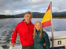
We’re not a travel agency ~ we’re fellow pilgrims! (See About Us)
We've trekked Pilgrimage Routes Across Europe since 2014!
💬 We’ve:
- Gotten lost so you don’t have to. 😉
- Followed waymarks in the glowing sunlight, the pouring rain and by moonlight. ☀️🌧️🌙
- Slept in albergues, hostels & casa rurals. Ate and drank in cafés along the way. 🛌 😴
- Created comprehensive and downloadable GPS maps and eBook Guides, full of must-have information based on real pilgrimage travels. 🧭 🗺️
- Shared our complete journeys, step by step to help YOU plan your ultimate pilgrimage and walk with your own Heart and Soul. 💙✨
Every detail is from our own experiences. Just fellow pilgrims sharing the Way. We have added a touch of spirituality, heartfelt insights and practical guidance from the road ~ offering a genuine connection to the spirit of pilgrimage. Tap into the wisdom of seasoned pilgrims!
Ultreia and Safe Pilgrimage Travels, Caminante! 💫 💚 🤍
Quote for Day Eight on the Camino Sanabrés, A Gudiña to Campobecerros
"People are like stained-glass windows. They sparkle and shine when the sun is out, but when the darkness sets in their true beauty is revealed only if there is light from within." ~ Elisabeth Kübler-Ross
Today was indeed a day to see what one was truly made of, light or darkness.
Maps and Stats of Day Eight on the Camino Sanabrés, A Gudiña to Campobecerros
Below is my interactive map, created from our GPS tracks. The map includes our walk on day eight, in orange, the adjacent and official route in blue, and our walk the next day, day nine, also in blue. (The narrative is from our first walk, before the official route was created on parallel lanes along the road. For the purpose of story-telling, I have included some photos of our original walk, in addition to photos of the official route.)
This map represents the full 34.5 kilometers of the blue route, for your planning convenience.
Also shown in orange on the map is the longer, official route along the highway, in the section just before Campobecerros. This is the route that you should take in inclement weather, because on the alternative mountain route, shown as a continuation of the route in blue, the approach to Campobecerros is very steep and very slippery when wet!
However, I have chosen to keep the shorter, non-official route to Campobecerros as blue, since few pilgrims take the longer official one via the road. If you choose to take the longer orange route, you must add 900 meters to your day for a total of 21.1 kilometers from A Gudiña to Campobecerros or 35.4 kilometers for the entire stage.
And here is the elevation profile of the entire route from A Gudiña to A Laza, also for your reference, if you wish to do the entire stage. The hills look less significant when you look at the whole route picture, and the downhill portion that begins soon after Portocamba, is significant.
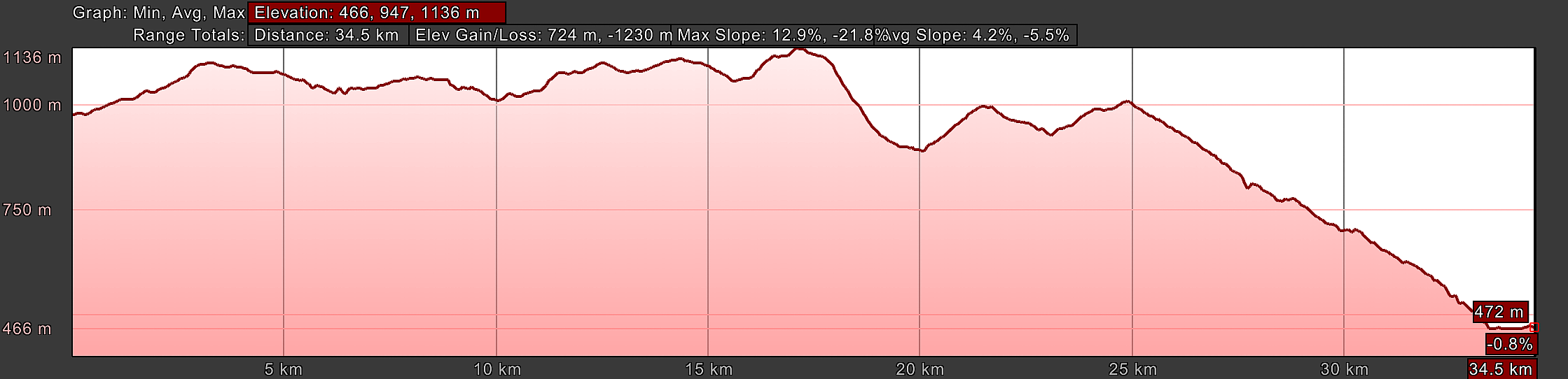 Elevation Profile, Camino Sanabrés, A Gudiña to A Laza, Entire Route
Had our day not been cut short due to the inclement weather, we would still have stopped in Campobecerros after about 20 kilometers total from A Gudiña. Our group was not willing to do over 30 kilometers in a day, because our driving factor continued to be Nadine's limp, which was not getting any better. In fact, to me, as a nurse, it was looking worse every day.
Fortunately, there is a casa rural, the Casa Terra Alma, and the donativo Refugio Ultreia in As Eiras, after 28 kilometers, so the stage, in good weather, would not have to be all the way to A Laza. This is the stage we have done in recent times and works out very well indeed!
Because of the severe weather, we made it only 10.2 kilometers, just past the high mark, the Alto da Espiño, before calling it quits and getting a taxi to take us down the mountain to Campobecerros.
There are absolutely no services for the 20k from A Gudiña to Campobecerros as you can see by the interactive map above, so make sure you stock your pack before setting out.
Campobecerros has a few services, including two accommodations and one bar, the private O Albergue da Rosario (+34 988 30 89 43) and the Casa and Bar Núñez (+34 988 07 76 24). If you do make it all the way to A Laza, there is every service available.
The Highway and Official Routes From A Gudiña to A Venda da Capela - A Close Up Comparison
There are two possible routes from A Gudiña through the high pass, the Alto do Espiño, to A Venda da Capela, that you can easily see if you zoom into the interactive map above.
A gravel road for pilgrims was created parallel to the paved road. This is a great thing, because this official route keeps the pilgrimage traveler off the main road as much as possible. You can see from the photos below, that this would greatly enhance one's safety, where the traffic was heavy with trucks, prior to A Venda da Teresa.
However, as I research this route, it seems that many pilgrims still choose the road, if it is shorter and/or if they feel it is easier. There is no consistency, but a pick and choose methodology as far as which section they do on the pavement!
After the turn off the main road to A Venda da Teresa, there is almost no traffic. For these reasons, I have chosen to keep both routes on my Google map for this section for comparison's sake, both the highway route in orange, as an alternative, and the official route in blue. After A Venda da Capela, the routes join until the mountain approach into Campobecerros.
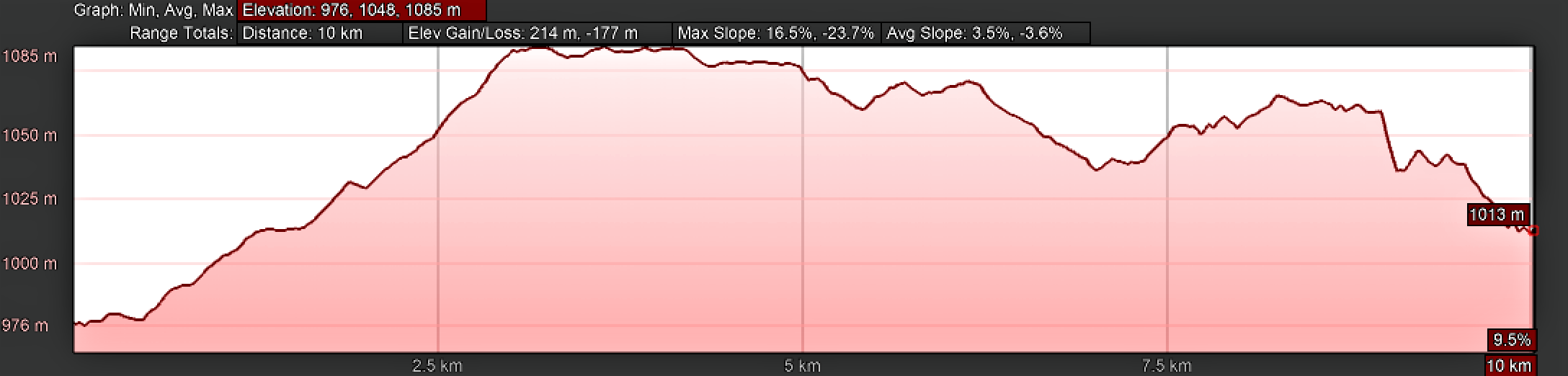
It will be up to you, whether you prefer the shorter and perhaps easier way on pavement, or the longer way on the gravel roads. All-in-all, the difference is only about 200 meters, but as you can see from the elevation profiles, the official route has a bit more of a climb, but by only 17 meters.
The Alto do Espiño, which I marked with a yellow star on the interactive map, is the third major high point on the Camino Sanabrés, at 1085 meters (3560 feet) and wouldn't it just be our luck to have to cross it on a bad weather day. The Camino road that runs from A Gudiña to Campobecerros is a high and exposed place as we were to find out.
The 3.0 kilometer climb up and out of A Gudiña on the highway route, shown first, below, has an elevation gain of 109 meters (358 feet) on an easy paved secondary road. On a normal day this climb does not feel all that bad, but with the weather it was a trial, to put it mildly! Especially on the road with traffic.
The remaining kilometers are mostly a bounce along the top, with a climb up about 30 meters into the town of A Capela da Teresa, followed by a descent into the hamlet of A Venda da Capela.
The official route, shown next, reaches the high point after 3.3 kilometers, and trends downhill until just before A Venda da Teresa, then climbs for two kilometers into the village itself. There are a few more ups and downs along the way with some additional elevation gain/loss, but nothing that significant. The final kilometer is a nice descent into A Venda da Capela.
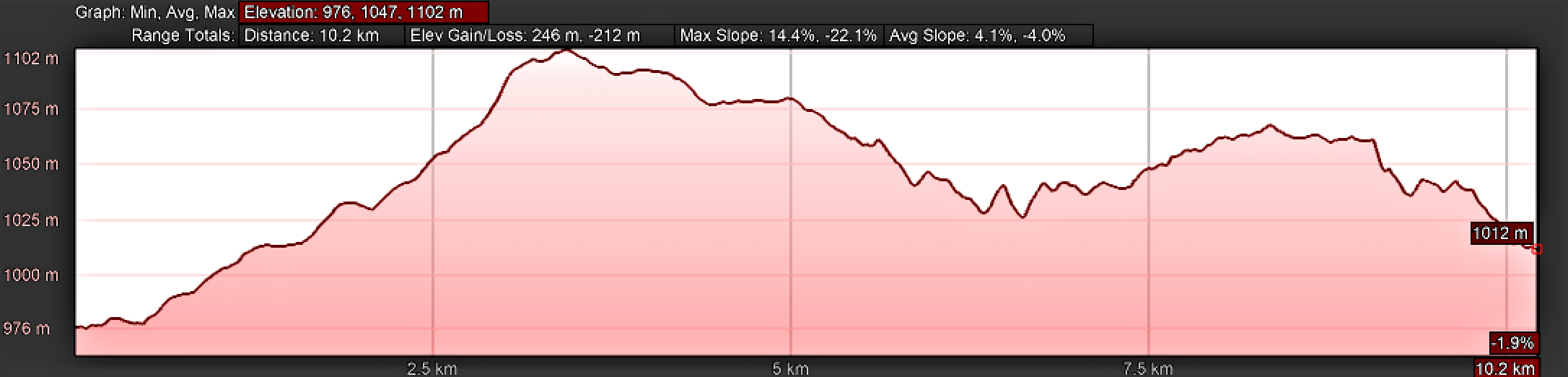 Elevation Profile, Camino Sanabrés, A Gudiña to A Venda da Capela, Official Gravel Route
Along the high ridge between A Gudiña and Campobecerros are four villages called A "Venda." In order of them that you will walk through, are A Venda do Espiño, A Venda da Teresa, A Venda da Capela, and A Venda do Bolaño.
Venda is the Galician word for country inn. The four villages were built around country inns that once upon a time sheltered seasonal agricultural workers traveling between Galicia and the meseta of Castille. Later they were used for workers on the railway which you can see on either side of the ridge road from time to time.
👣 Camino Sanabrés EBook:
Offline Guide with Bonus Route
~ Includes 4-5 additional days on the Vía de la Plata from Salamanca!
Walk smarter with our ad-free, beautifully formatted Camino Sanabrés eBook Guide, perfect for offline use ~ important in the mountainous and remote areas. Includes daily stage details, stunning photos, historical background and a BONUS digital guide on the Vía de la Plata from Salamanca, called the Camino Fonseca. This allows you the opportunity to add 4-5 more days to your Camino in the beginning.
Don't carry a hard copy guide book to increase your pack weight. Use our frequently updated digital guide on your next Camino instead!
📲 Instant download. 💸 Money-back guarantee. 🔄 Free updates for 1 year.
👉 Click here for more info or BUY NOW!
Jump to Camino Sanabrés Stages
Photo-Rich Travelogue for Day Eight on the Camino Sanabrés, A Gudiña to Campobecerros
We left the Albergue de Peregrinos de A Gudiña in the pre-dawn light.
If you stayed at the albergue, cross the N-525, turn at the church and walk northward to the Plaza Maior, see photo below, to join the route coming from the Rúa Maior which runs parallel to the N-525.
Turn left at the cross, and onto the Rúa Cima de Aldea. The name of this road literally means, “village top road.” How appropriate!
(Remember our original walk was on a very stormy day and I will include stormy photos, mixed in with sunny and clear ones!)
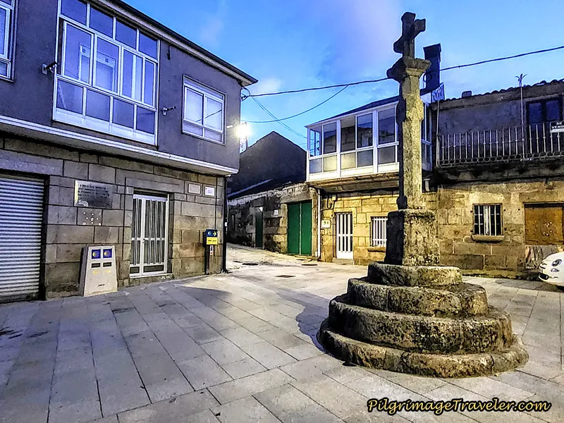 Day Begins in the Plaza Maior
Below is a close-up of the dual waymarks, denoting the bifurcation of route. Very few pilgrims actually walk the route “Por Verín,” the southerly variation that I mapped here, the southernmost route in orange. Maybe one day, I will do it!
We were taking the standard route to the right.
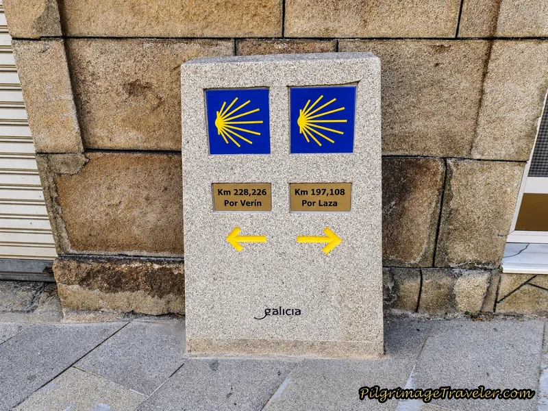 Bifurcation Waymarks in A Gudiña
Turning right for the route “por Laza,” you will leave town via the Rúa Cima de Aldea. Continue on this road for not quite a kilometer. As you can see in the next photo, this quiet, paved street is now getting higher on the ridge and is more exposed.
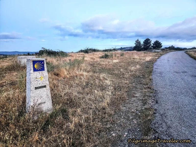 Outskirts of A Gudiña on the Rúa Cima de Aldea
After about kilometer 1.25, the Camino merges with the secondary paved road from A Gudiña and towards A Venda do Espiño, by turning to the right.
If you continue on the highway route it takes you via a 2.65 kilometer road slog to the high point, the Alto do Espiño, waymarked by a road identification sign, shown farther below, but the sign on the right side of the highway is now gone. There is still one on the left and facing the oncoming traffic.
The sky eventually started to brighten for us, but it was clear that the fog and rain were going to sock us in for the day. The next photos are of the journey on the road, which is no longer the official way, and you can see just how dangerous it was to walk along this road. As we climbed, increasing in exposure, the fog thickened and the wind and the rain worsened.
We could see almost nothing in any direction. There was the danger of large trucks passing us, as we jumped off the highway as they approached, below.
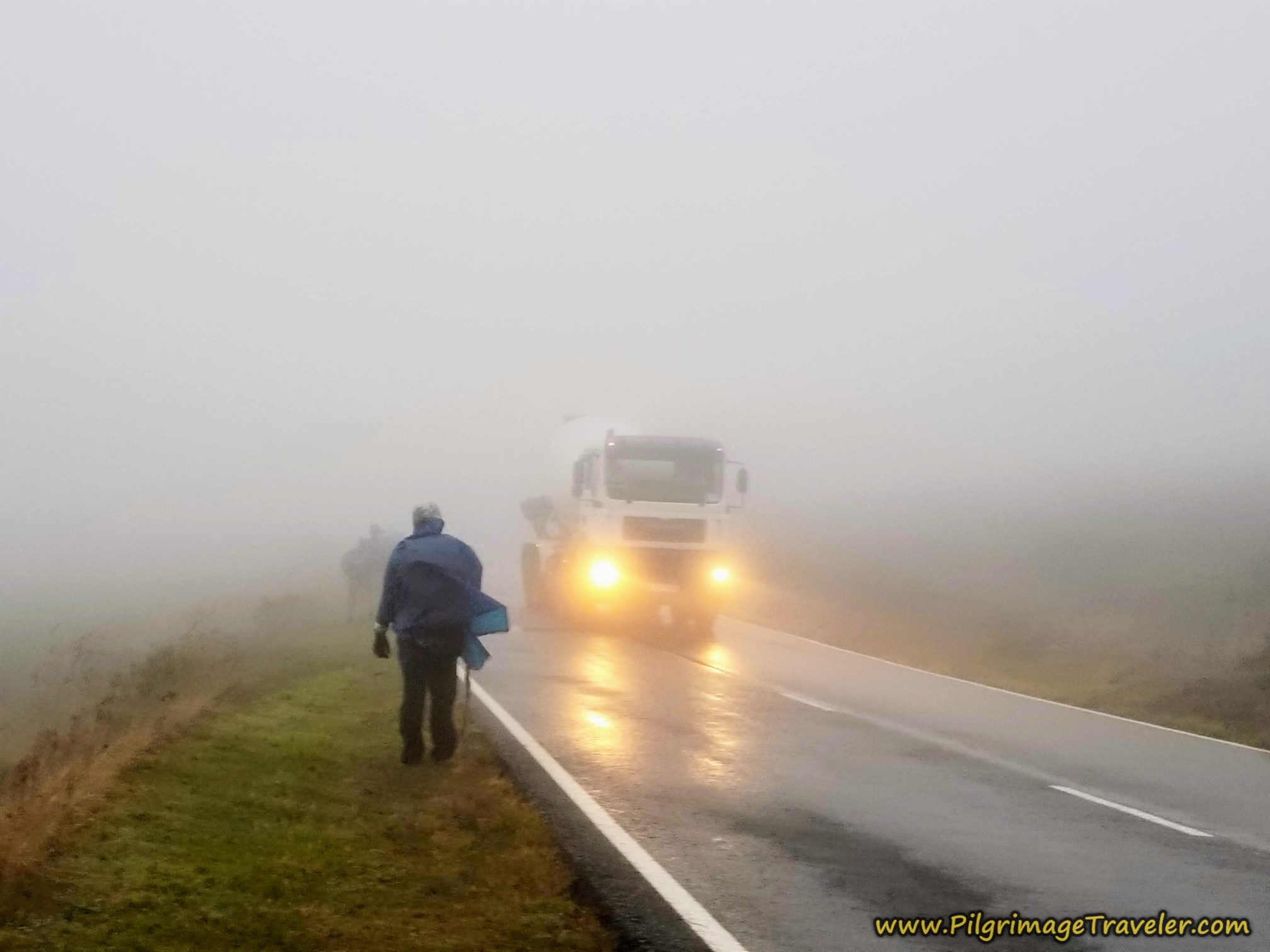
The backsplash from the trucks was intense! The drivers would blare their horns, warning us of their approach (as if we couldn't see them) and they would just shake their heads at us as they drove by. Nutty pilgrims!
Thank heavens this route has now changed! The fog cast an eerie light as we walked along the roadway. Rich was pushing forward in the lead, followed by Miguel. I was next, taking the photo, casting a constant and wary eye on Nadine and Norm following in the rear. I was worried about them.
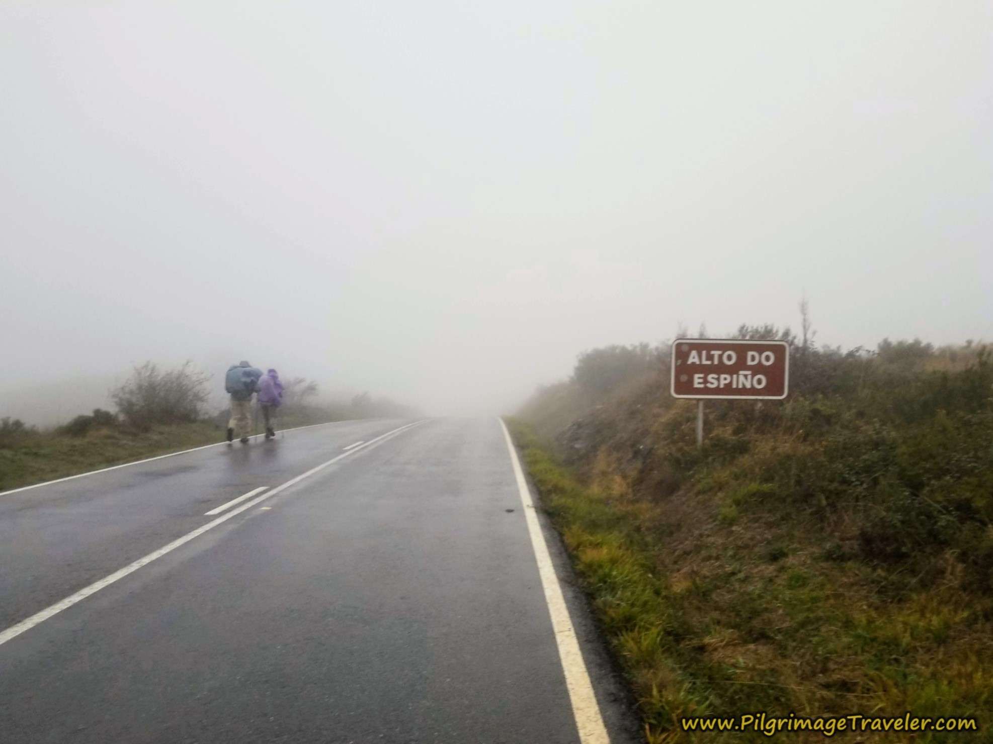
Here we are arriving at the summit top for the day, shown below, the Alto do Espiño, at 1085 meters (3560 feet), in the fog and pouring rain. If there was no sign, we would not have had a clue where we were. This sign is after approximately 4.1 kilometers into the day along the highway route.
And what a difference a clear day makes! If you are walking the official route to the Alto do Espiño, after the Camino leaves the main roadway at a total of 1.45 kilometers, it takes a nice gravel lane. This lane will parallel the roadway, at first closely, like in the photo below and later farther apart, for a distance of about 2.75 kilometers. It is open and exposed up here, and mostly treeless.
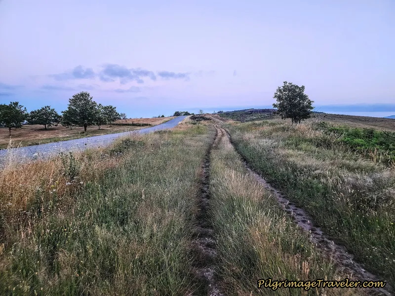 Parallel Lane to the Roadway
The official route summits the high point along this stretch, after about 3.3 kilometers into the day and at an elevation of 1102.
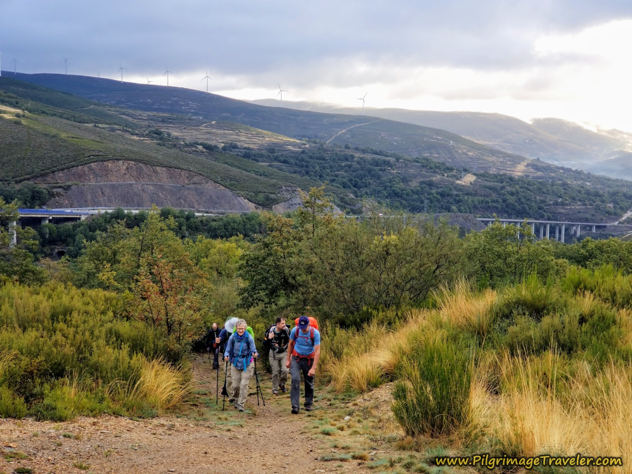
Below is a photo I took of Rich, climbing the ridge and just before the top, as I looked back towards A Gudiña. Be sure to turn around and look at this view. It is the best from here. There is no such view on the highway route.
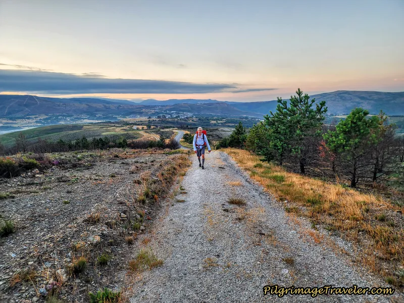 Climbing to the Alto do Espiño via the Official Route
You can actually see the highway just behind Rich in the photo. This official route definitely climbs quite a bit higher than the roadway, even though it is only about 25 meters more total. This is why I suspect so many pilgrims take the highway route instead. They don’t know what they are missing!
At the summit, there is a small, indescript monument, which is not very eye-catching. A pilgrim from Bosnia was sitting there at the top resting, so after exchanging a few niceties, we continued onward. He couldn’t speak English at all.
The walk along the top of this pass is really quite soul-inspiring, with sweeping views all around.
And again, there is evidence of a fire that came through here. About one kilometer from the top, the official way descends, crosses another lane and parallels the highway once again, after approximately 4.2 kilometers total.
The lane barely kisses the roadway, before both Camino routes take a right onto a side road, for a bit of a more sheltered walk into the first venda, the hamlet of A Venda do Espiño, shown in the next two photos below.
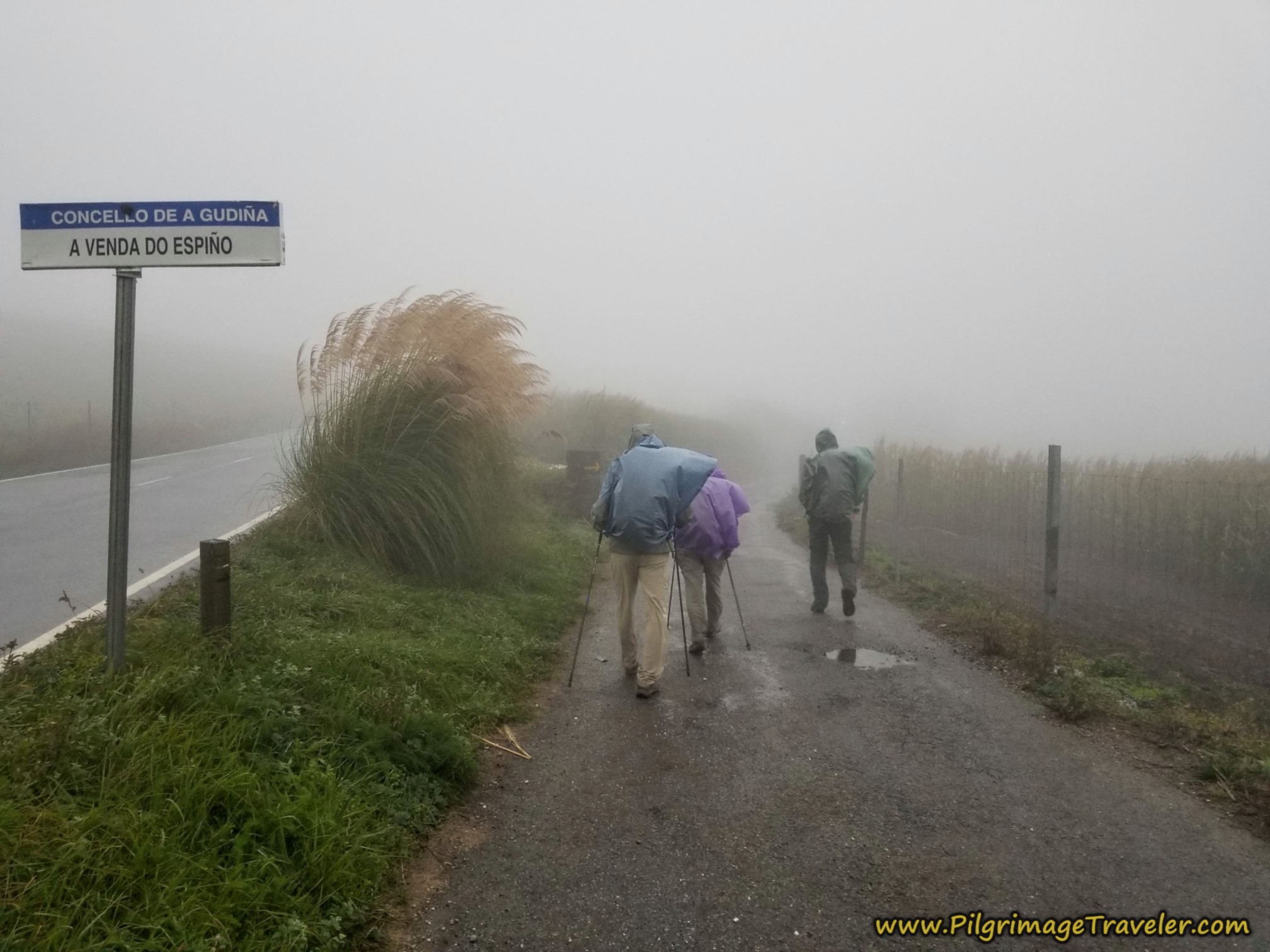 Side Road towards A Venda do Espiño on a Stormy Day
These are side-by-side photos of the same turn-off! The difference in the experiences were truly phenomenal. It is also amazing how less exposed it felt walking into the town while it was rainy.
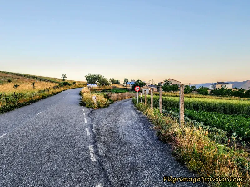 Side Road Towards A Venda do Espiño on a Clear Day
The few meter diversion through town soon led us back out onto the exposed pavement. The cars were very considerate that passed us and they all slowed way down, but there was no preventing the backsplash, no matter what they did. It drenched us.
The official route follows the roadway very closely on a parallel lane for a bit more than one-half kilometer so you no longer are faced with this scenario, shown below.
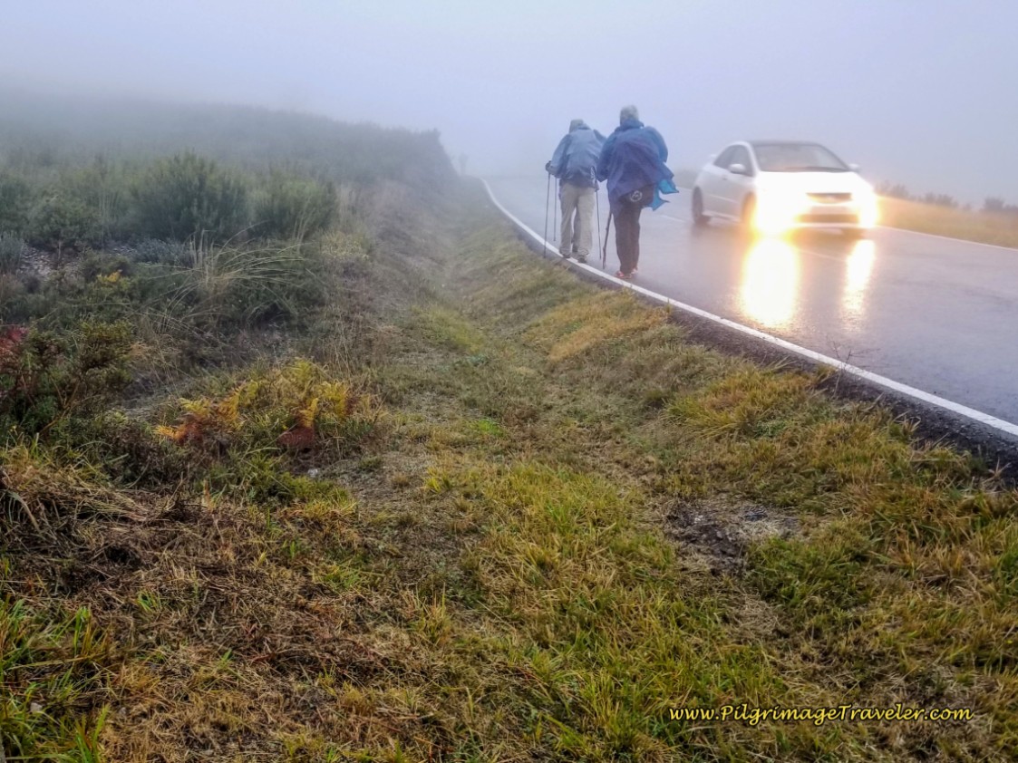
Through this section of highway I started to sing silly songs to keep our morale up and to stay happy and warm myself. Soon the other joined in. Miguel, a Spanish military nurse, actually knew some of our military songs that we tried on him, and he was able to sing along! He is a cheerful soul and he seemed impervious to the rain.
Norm and Nadine were not impervious to the conditions. I often would slow up and see how they were doing. Nadine kept her strained happy face on, but Norm looked grim. I, being the leader, felt responsible and wasn't sure what to do.
Rich just pushed ahead. When the going gets rough, he has a tendency to push harder. Miguel was showing no signs of cracking at all. Nadine and Norm were slowing down.
Back on the official route, parallel to the highway, in the photo shown next, after about 5.3 kilometers, it looks like you will join the pavement again, when the Way directs the pilgrimage traveler abruptly to the right, to pick up yet another gravel lane.
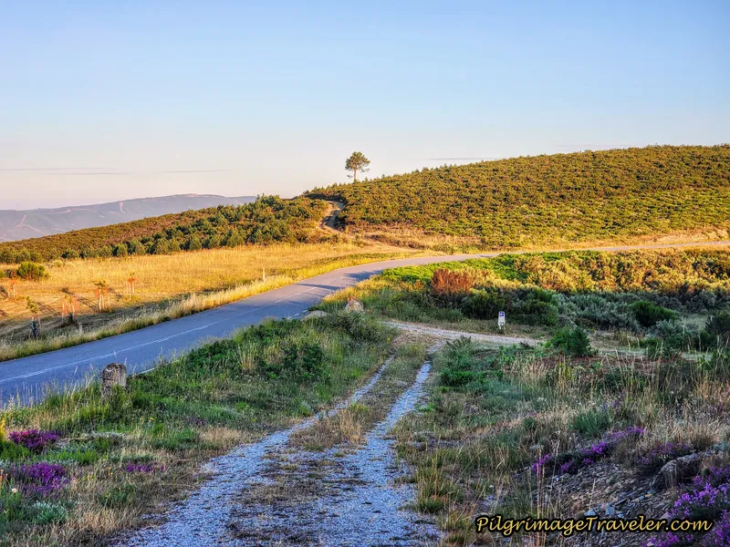 Abrupt Right Turn Avoids Pavement
Through this next section, is where the two routes diverge the most, with most of the additional distance as a result.
If I were to cut off a section of the official route and walk the roadway, this would be the place. The official way to the right takes a much wider gravel road and while the mountain scenery is stunning all around, the road itself is not as attractive.
Plus the official route loses a bit more elevation - which I never like. After the right turn, the Camino immediately bends to the left and descends strongly, see photo below, following just below the roadway for the next 1.5 kilometers. Along the way, as it meanders it has more ups and downs than the highway route takes.
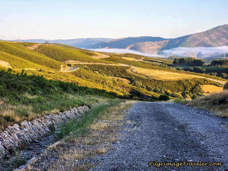 Strong Descent from Top
In the final section of this diversion, you will come to a T-intersection with a concrete road. Turn left and climb up very steeply on this scored concrete road to join the highway route once again, by turning right, shown below, after about 6.9 kilometers total.
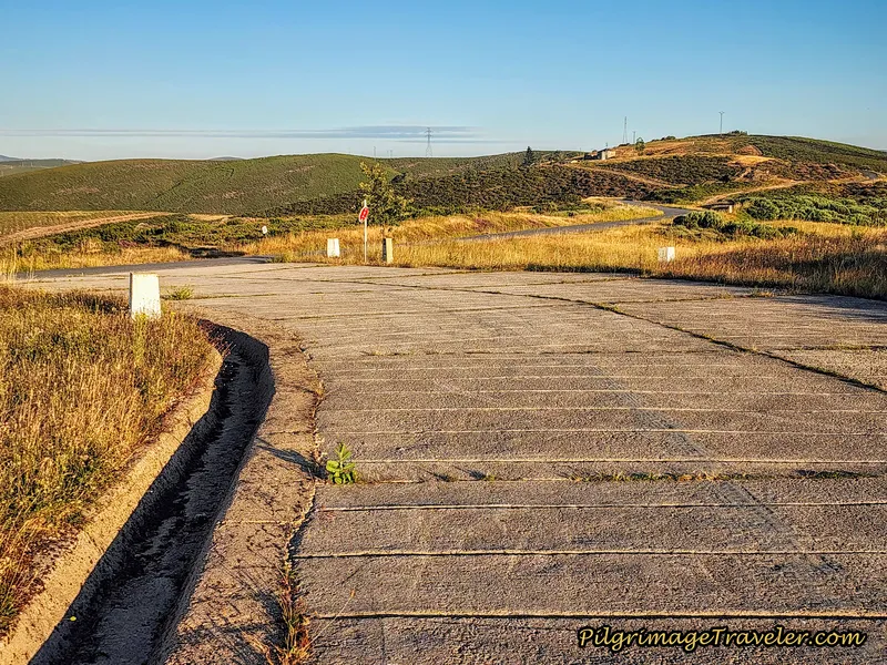 Climb Up to Highway on Scored Concrete Road
Fortunately the merged routes only require a few minutes walking on the roadway when the official route veers to the right along yet another gravel lane, skirting around a small hill ahead.
After about kilometer 7.2 the path joins the main road yet again and the highway route, by this small shelter, below, most likely a bus station at one time. The intersection you see is with the road to Carracedo da Serra, to the north. This is how the shelter appeared to us in the freezing rain, below.
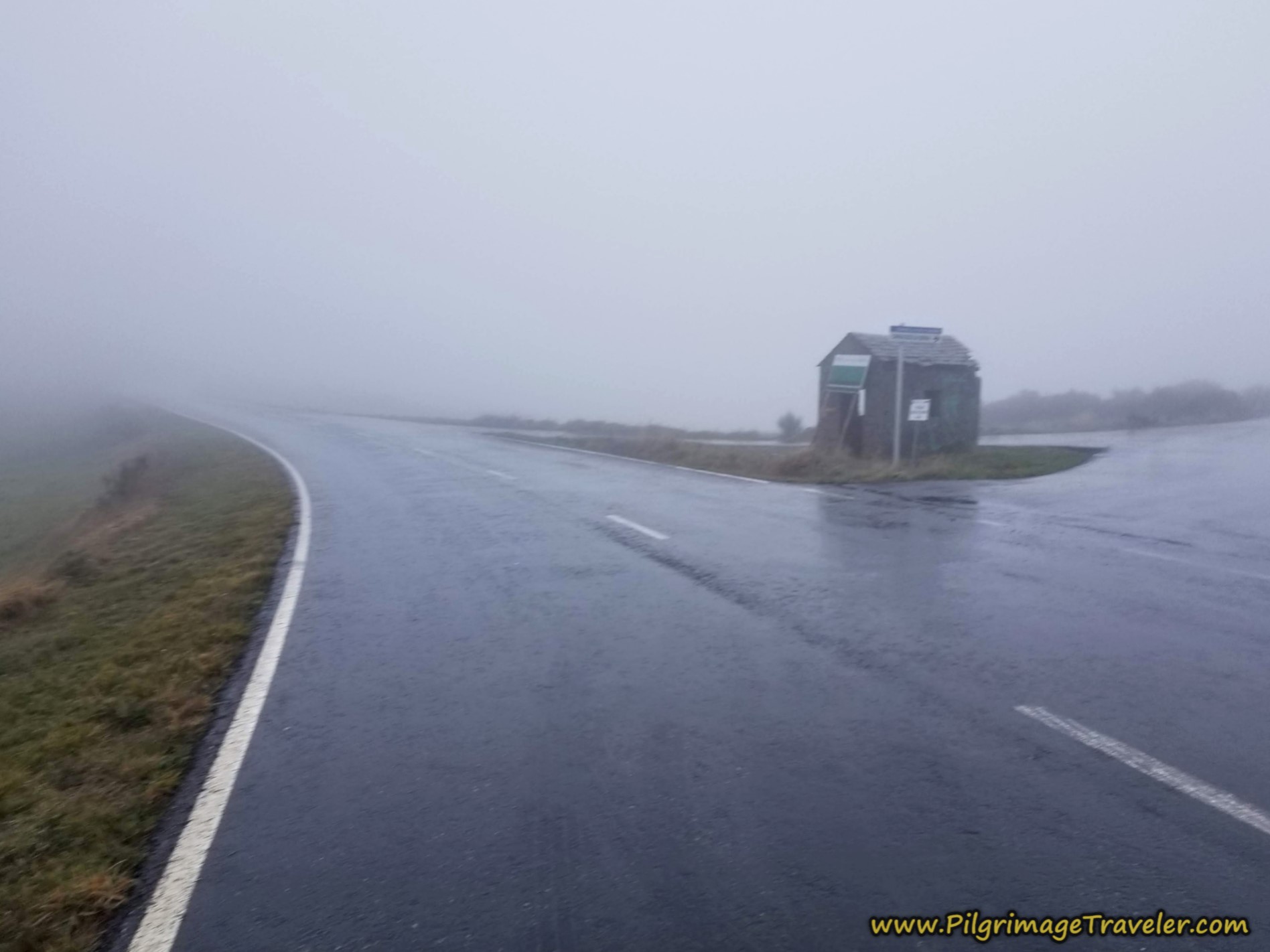 Small Shelter at Intersection
This is how the shelter appeared in lovely weather. You can see the gravel road where the official route meets the roadway of the highway route, at this intersection. The concrete mojón marks the direction.
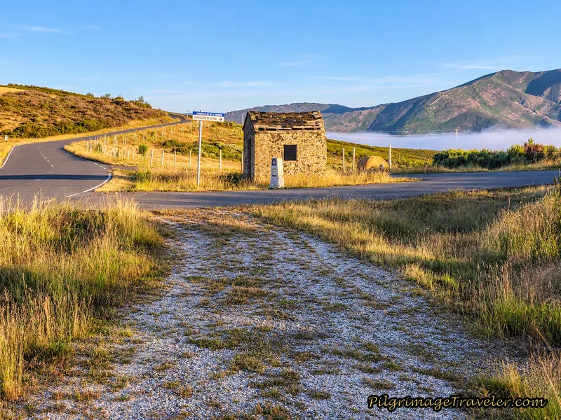
Jump to Camino Sanabrés Stages
On our rainy walk day, we all went towards the shelter and huddled inside for a brief respite from the wind and the rain. All the respite seemed to achieve was to make us colder, so after only a few minutes "inside" we carried onward.
Almost immediately after the shelter, the official route takes a tractor lane to the left for about 300 meters, ascending toward the next town of A Venda da Teresa, shown next.
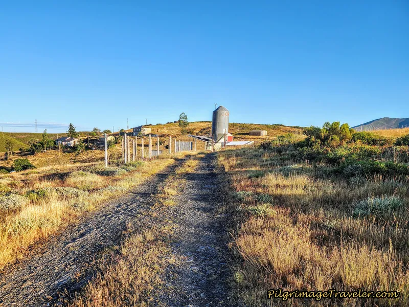 Left Turn Towards A Venda da Teresa
The highway route continues along the main road a few meters farther to take a left turn onto a side road also towards A Venda da Teresa.
When the official route's tractor lane ends in 300 meters at a T-intersection with another lane, it turns to the right and then an immediate left turn onto the paved secondary road through town, continuing its westward ascent. (The highway route stays straight at the T-intersection.)
The official route walks on an ascending traverse to the north of the main cluster of buildings that make up this hamlet. It takes a path to the north of the highway route which goes directly below it in a parallel traverse. Both routes through A Venda da Teresa are very quiet, with almost no traffic, so I'm not sure precisely why the route was changed through here.
After about 7.8 kilometers, in the center of A Venda da Teresa, Nadine declared that she must have something to eat. In the sheltered walls of the town, we all stopped and waited while Nadine pulled out and ate a bar. She is a slight person, and can crash quickly if she doesn't attend to her needs. While waiting, our metabolic rates slowed a bit. Without moving, a chill set in quickly.
None of the rest of us were hungry and we were eager to get going and stay warm. Rich kept his head down, and I could sense his grumpiness at the stop.
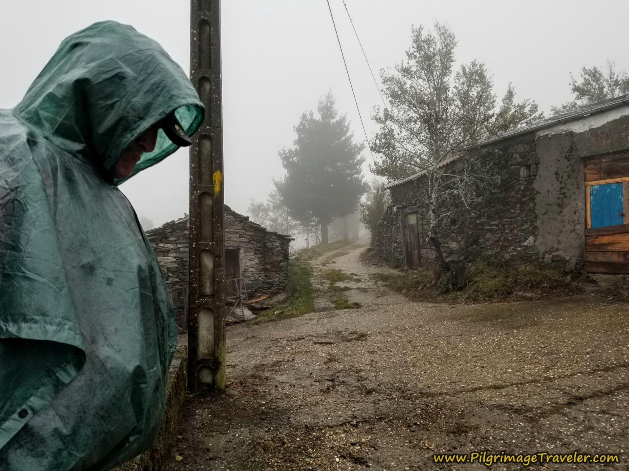 Rich Looking Unhappy
Norm declared that walking in this kind of weather was ridiculous. I believe these were his exact words, according to my voice journal. He has quite the grim look on his face, below, as Miguel remained cheerful and Nadine attempted to be so.
In this moment, the group decision was to continue on.
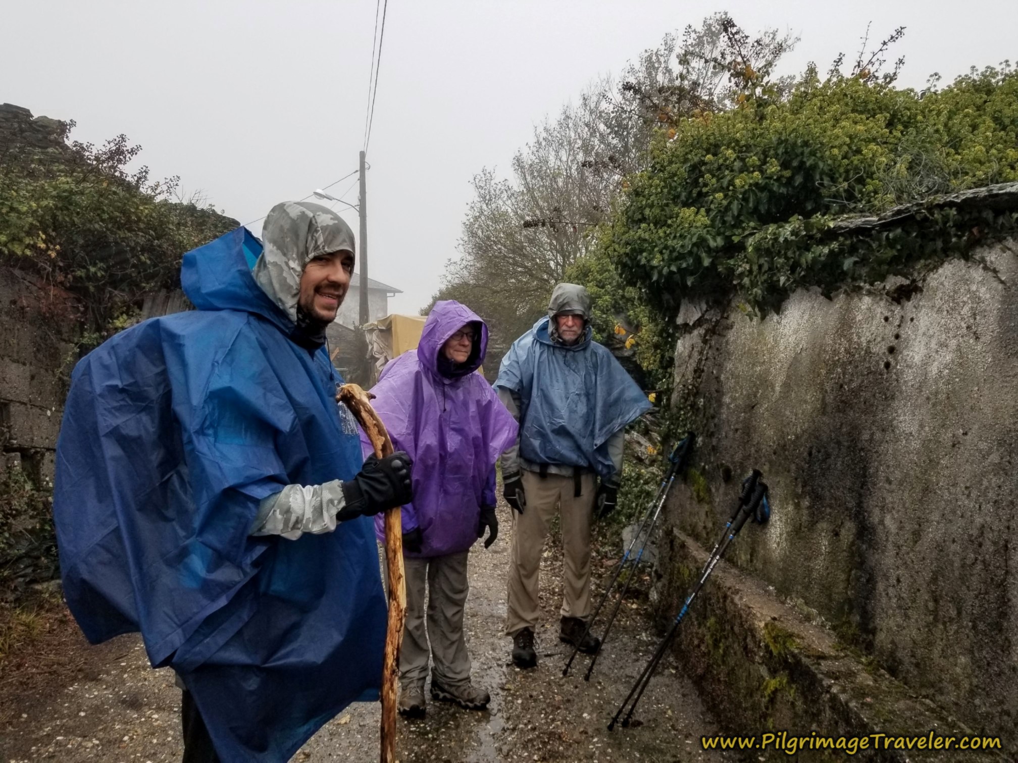 Miguel, Nadine and Norm Attempt to Look Happy
On the official route, after a few meters on the pavement through A Venda da Teresa, you come to this intersection, below, leaving the pavement for the lane to the right. The pavement actually ends in a few meters anyway, and both the old and official routes leave the village on parallel unimproved dirt lanes.
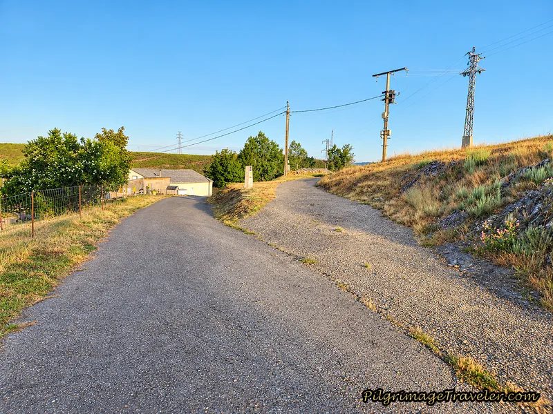 Right Turn, Leaving Pavement in A Venda da Teresa
As we left A Venda da Teresa, the road turned into this somewhat soppy and very exposed lane, below. In the photo you can see Rich, pushing way ahead, walking alone at the front of the pack, trying to get the walk over with as quickly as possible. The rest of us slogged behind.
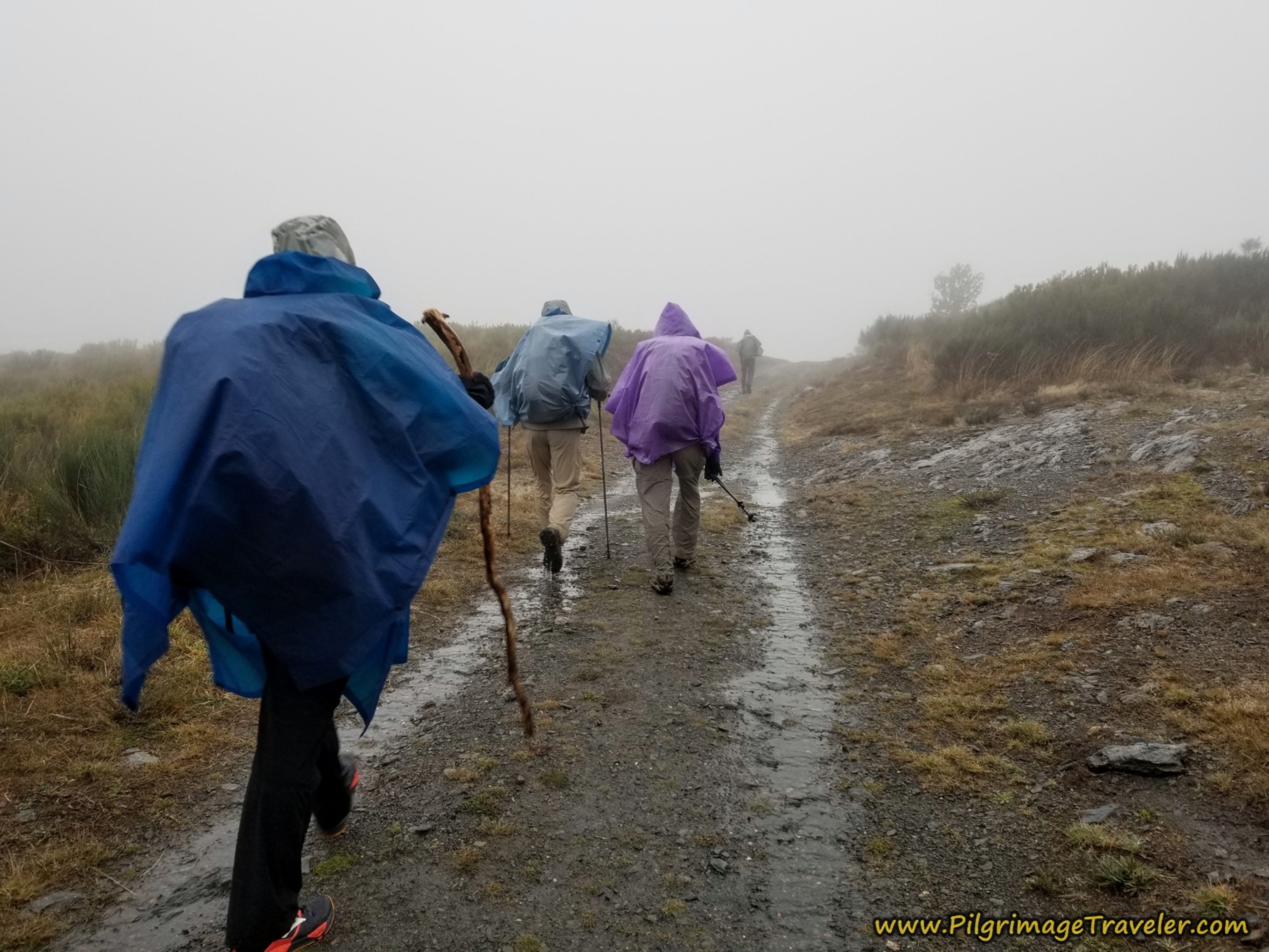
After 300 meters of walking on the lane on the official route, you reach the second summit of the day at 8.2 kilometers and an altitude of 1068.
Both photos, above and below are taken in this summit area, and you can see in the sunny day photo, where the two routes actually converge by what appears to be a fenceline ahead, that there are some nice improvements that Galicia is investing in. The “fenceline” posts are actually poles supporting rows of young trees that were planted.
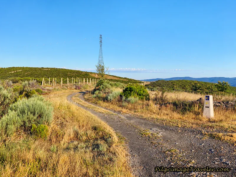 Top of Second Climb
After reaching this top, you will now be on a descent over the next 1.8 kms towards the next town of A Venda da Capela, with amazing views all around.
And just around a big bend, the reservoir, the Embalse de As Portas can be seen. Unbeknownst to us on our stormy day walk, these incredible views were all around us!
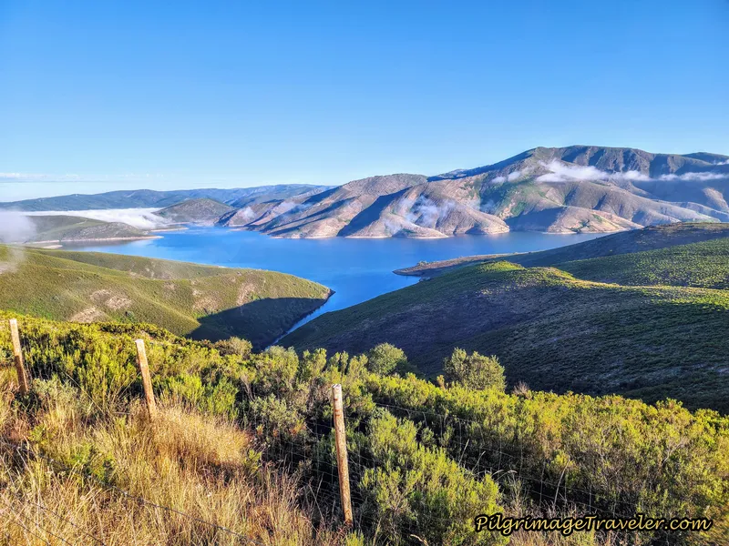
As you walk along this high ridge, hopefully your views will be fantastic. We did have some lingering fog in the valley below as we walked.
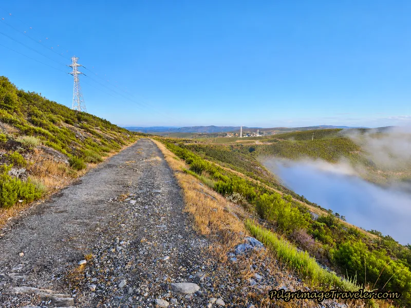 High Ridge Road and Fog After Summit
Jump to Camino Sanabrés Stages
The exposure up here is real, as we learned on our rainy day pilgrimage, when the wind and rain refused to let up!
After approximately 8.9 kilometers, there is a Y-intersection in the lanes, below. Here you have another choice, as the official route stays high and to the left, as the waymark in the photo shows. We could easily see the lane to the right joins the main road again in a few meters.
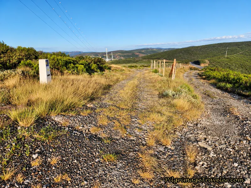 Choice in Routes Toward A Capela
However, the official route takes a giant loop, then another smaller loop, before joining up again with the main road, farther along. This small diversion is to keep the pilgrim off the pavement of the highway a bit longer, when the walk on the road itself is half that amount! Almost no one takes this official diversion!
Walking past the Y-intersection on the rainy day, at the juncture of the lane and main road, the exposure continued to be severe as the wind and the rain did not abate, below.
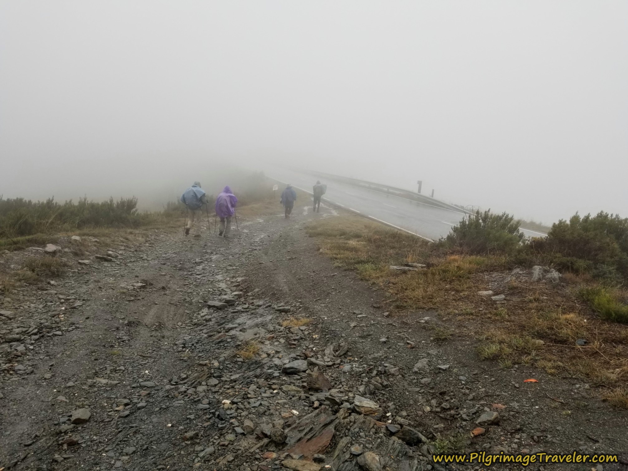 Downhill and Rejoining the Pavement
And this is the same juncture, pictured next, on the sunny day, with the additional trail improvements. You can see the official route below, coming from its wider loop.
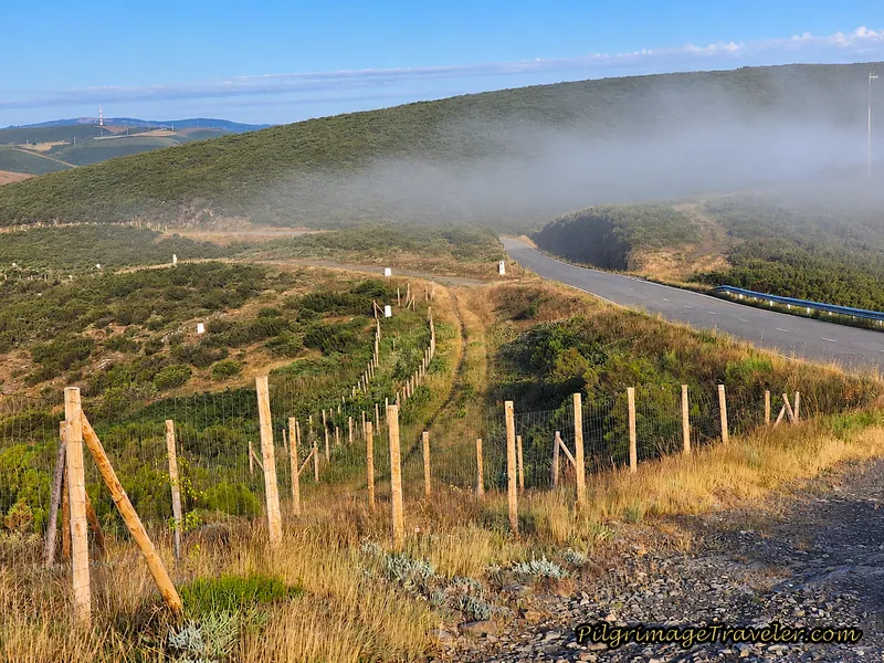 Joining the Highway Route on a Sunny Day
After joining the combined routes along the highway, we pushed on for the next kilometer, crossing a railway bridge, towards A Venda da Capela.
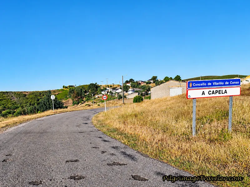 Final Stretch of Pavement Towards A Venda da Capela
On the rainy day story, we never made it very far through town, and saw nothing of it.
Jump to Camino Sanabrés Stages
We Throw in the Towel
After arriving in A Venda da Capela after around 10 kilometers, Norm finally spoke up, in protection of Nadine. He was worried that she could not continue and would get hypothermia. He stated that it is just when people keep pushing so hard that they do get into trouble. He had had enough. Nadine said nothing. She didn't need to ~ her expression told the story.
As soon as I heard the word "hypothermia," I knew that both of their spirits had been broken, and indeed if we carried on, most likely it would not be a favorable outcome. Even though I disagreed with his assessment, there was no arguing the matter. Their spirits were gone.
I could tell that Rich did not want to give up just yet, but was willing to go along with the group decision. I could have gone on as well, but as the leader of the group, I needed to make the best decision for the entire group.
Miguel, however, decided that he was going to walk on alone. But before he did, he called the taxi for us, coming from A Gudiña, to take us down the mountain to Campobecerros. He graciously waited for us, for what seemed like an eternity, for the taxi to arrive about 20 minutes later, before he went on his way. What a gracious Spanish host, and what a trooper!!
We all huddled by a farm building in A Venda da Capela, waiting for the taxi to arrive. Standing around only served to make us colder and colder.
While we were waiting, along came another peregrino, Colin, from Ireland, whom we had just met. He stopped to have a chat. We told him that we were throwing in the towel, and waiting for a taxi to arrive. The big fellow, decked out in black rain gear from head to foot and a wide-brimmed hat, just smirked and said, "This is just one of those days when you accept that you are going to get wet!" Ha ha! Talk about the British understatement!!
What a shining star Colin was in that moment! His light truly was not extinguished in the abysmal weather. He brought me cheer with his humor and I wished I could walk on with him, Miguel and Rich. However, I stayed with the group, as the taxi arrived, and Miguel and Colin walked on into the rain and fog.
I must say, it was lovely being in the warm taxi, as we all had gotten quite cold standing around waiting for it to arrive.
Jump to Camino Sanabrés Stages
Campobecceros
We arrived into town via the taxi, quite early, after having only walked 10 kilometers. The owner of O Albergue da Rosario (+34 650 53 05 47) was notified by the taxi driver and he was waiting for us to arrive. He signed us in and soon we were luxuriating in a hot shower and relaxing while we washed and dried our clothes.
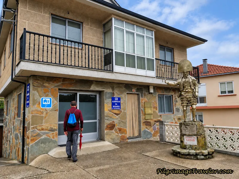
O Albergue da Rosario is a charming place, with a statue out front of the famed A Laza carnival costume of the Peliqueiro. This medieval carnival occurs every year in February. Click on the link provided to learn about this interesting custom.
The albergue has 14 beds that are a bit tight on the lower floor. We were given disposable sheets. There is a funky kitchen in a separate building, round and down the back in a garage with a big horno oven. The kitchen has adequate utensils and a refrigerator. We did not spend a lot of time there because it had no heat unless we lit the oven. It was really cold and damp, and after spending the day freezing we had no desire to freeze more. Also in the garage is a washer and dryer.
We hung out at the Bar Casa Núñez, up the street for a lot of the afternoon, sipping café con leche and debriefing the events of the day. The Casa Núñez also has rooms to rent, (+34 988 07 76 24) if you prefer to end your day here.
We were looking for a meal, but needed to wait for when the kitchen opened for the midday comida. As we waited to be served, a drenched Colin walked in! He had walked down the mountain and had made it in time for lunch. Miguel had already joined us. The walk from where we had stopped, into Campobecerros was only another 10 kilometers, and both men were strong walkers, easily arriving by lunchtime.
Colin took his time over the lengthy lunch, as we all did. The full course meal including copious amounts of wine was delicious and inexpensive. Then after drying out, Colin announced he was going to walk on another 14.5 kilometers to A Laza, to complete the full 34.5 kilometer stage! The weather had not miffed him a bit. I was impressed! It was still raining, although the exposure at this lower altitude was significantly less than on top of the mountain.
Miguel made the decision to stay in the albergue with us, and wait to continue on until the morning. The steep decline into Campobecerros was rocky and slippery, as you shall see below, and he said he actually fell down once. His family instructed him to stay with the Americans, and stay safe. He was an expectant father, after all and had a responsibility to them.
The Continuation from A Venda da Capela to Campobecerros Via the Mountain Alternative
After our group's lengthy discussion over lunch, Rich and I decided to go back up the mountain the next day to A Venda da Capela, via a taxi, and complete the walk where we left off.
Not only did I want to document my journey for this website, but I also felt in my heart that this day's stage was perhaps one of the most beautiful walks, and I wanted to see it. The day was after all, along one of three high mountain passes on the Sanabrés. As it turned out, I was right and the walk through this section was fabulous.
Norm and Nadine decided not to join us, but to do a short day of 14 kilometers to A Laza from Campobecerros on day nine. We would all join up in A Laza at the end of the day. Miguel, to our surprise, was going to walk with Norm and Nadine to be their guide and stay with us in A Laza. He was taking his family's mandate seriously.
We hired the hospitalero from O Albergue da Rosario to drive us back up the mountain to A Venda da Capela, precisely where we left off the day before.
After breakfast, we had said goodbye for the day, to Miguel, Nadine and Norm who were walking onward from Campobecerros to A Laza, where we would all meet up at the Pensión Casa Blanco Conde that afternoon.
We could not get a very early start, because of the hospitalero's schedule, but since our reservation was secure in Laza, and it was only 24 kilometers, we were not at all concerned, nor in a hurry. We began our walk around 09:15. Our timing was actually perfect, as the skies were only beginning to clear after the deluge!
At the exit to town is this row of small cottages, shown below, that were once used by workers in the construction of the railway. They are now being renovated, which is wonderful because they are quite quaint. Remember the word "venda" means country inn in Galician, and these accommodations may have also housed agricultural workers at one time.
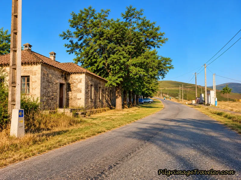 Pilgrim's Rest Stop and "Vendas" in A Venda da Capela
Across from the cottages is a water fountain and some benches to rest if you need a break. There is a view of the reservoir from these benches, and Rich and I took advantage of it when we had a nice long break here, our second time through.
Down to the right of the ridge road, near the railroad tracks, all of a sudden the sun burst out of the clouds for a brief moment, below. We had to pause and admire the view. We were ecstatic to not only see the sun, but to see the views! We had no idea that it was so beautiful here.
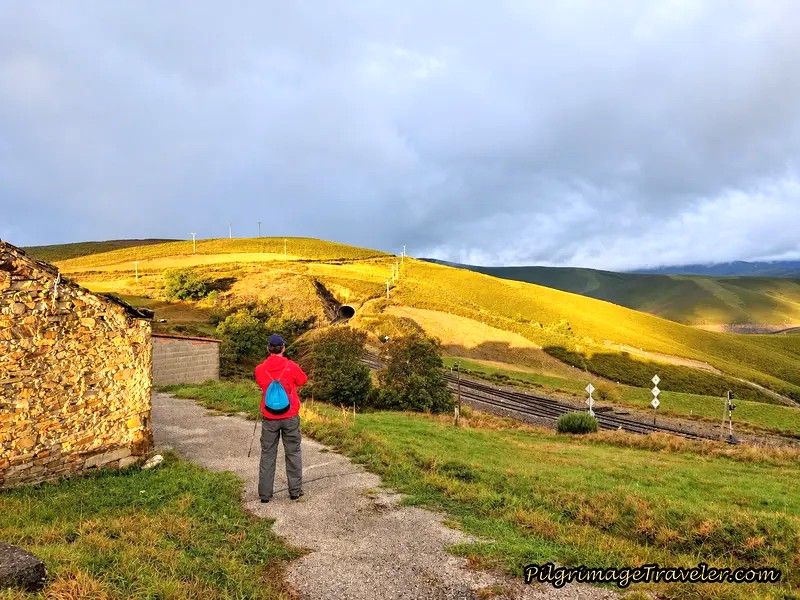 Brilliant Sunlight
You may have noticed that in the above photo, Rich is not wearing a backpack, but a small string bag. The hospitalero allowed us to store our backpacks in the albergue for a few hours, so we could actually enjoy the 10 kilometers without them! Sweet!
This high ridge is a dry and desolate place, known in the area as "La Serra Seca," or dry ridge. It wasn't very dry on our walk, but indeed I could understand it, as very little grows here.
After about 1/2 km from the exit of A Venda da Capela, and a total of about 11 kilometers, you are directed to the left, off-road and onto the lane, pictured next, and to the Mirador O Bambán viewpoint, at the 186.232 kilometer waymark.
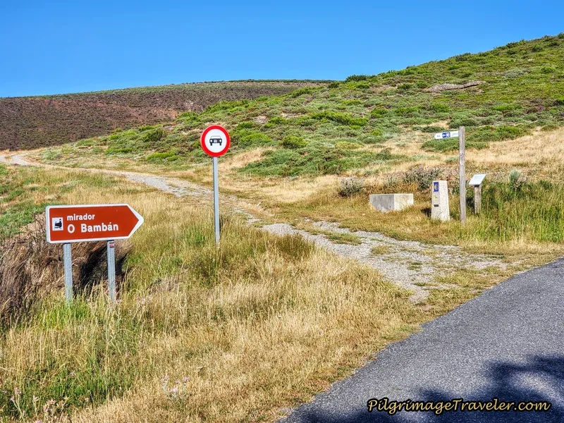 Turn Left Onto Lane
The locals, I learned, call off-road "by way of the mountain" or "de la montaña." I love it! The steep road ahead climbs a small hill, pictured below.
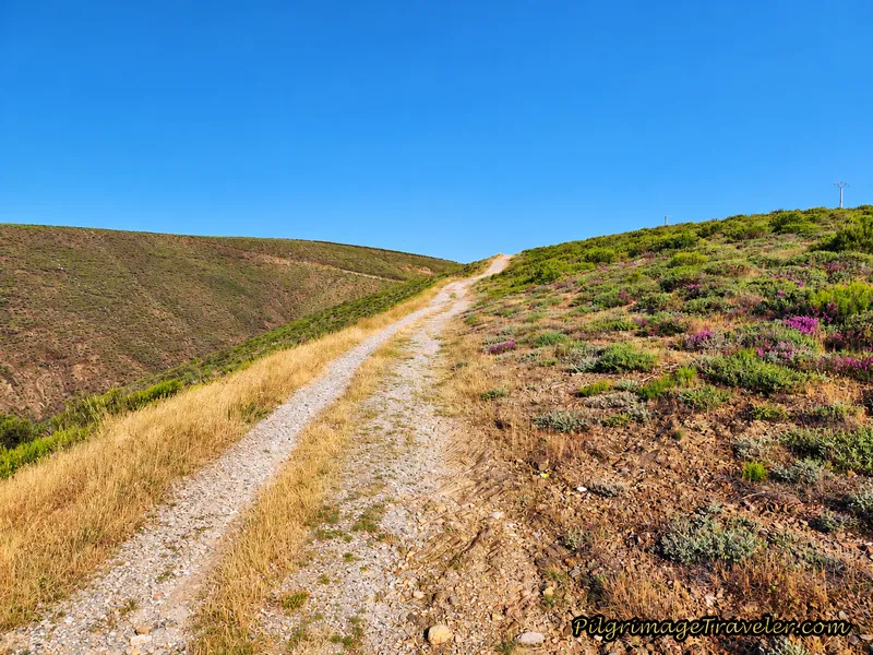 Steep, High Road
And what is that ahead at the top? Really? A Swing? Yes, indeed it is a swing, called the Mirador O Bambán, below. Bambán in Gallego, the language of Galicia, means swing! Therefore this is the Swing Viewpoint! It is located about 500 meters from the turn off at 1075 meters high.
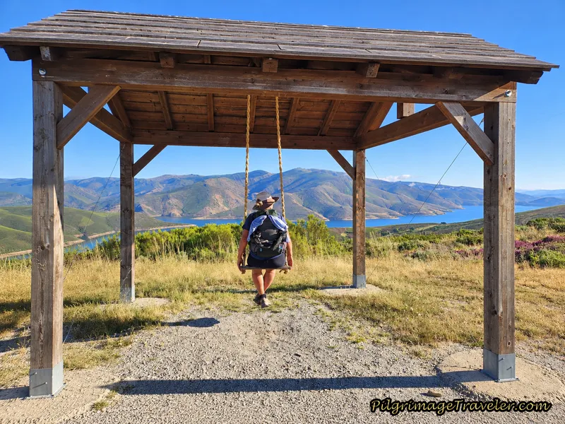 Elle Enjoying the Mirador O Bambán
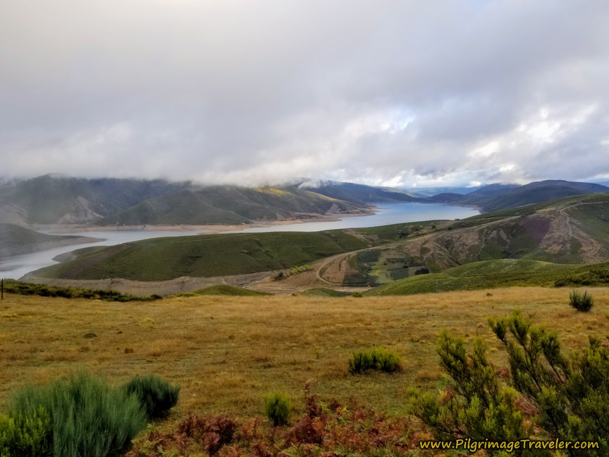
As you swing and face northwards, the view of the reservoir, the Embalse de As Portas, from the ridge heights is fabulous. I was thrilled to have the opportunity to see it, on our return trips here. I felt truly alive and in the moment, as a lover-of-high-altitude. This walk never disappoints me!
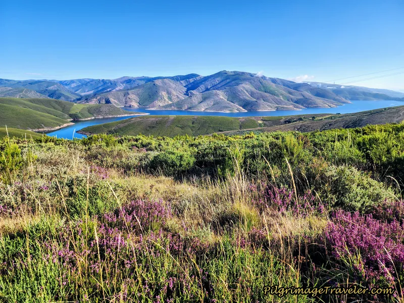 The View of the Embalse de As Portas
It is only about 650 meters total on this ridge lane, and about 150 kilometers after the swing you will come to a T-intersection with the paved road and turn left. Below is the slight descent along the high paved road towards the next town of A Venda Do Bolaño.
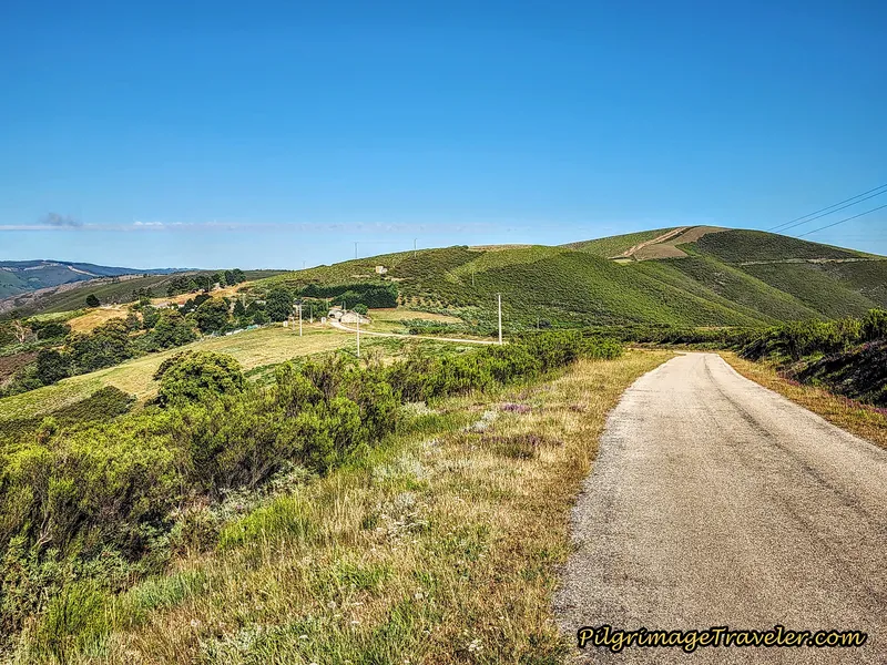 The Road to A Venda do Bolaño
After about 13.2 kilometers, enter A Venda do Bolaño.
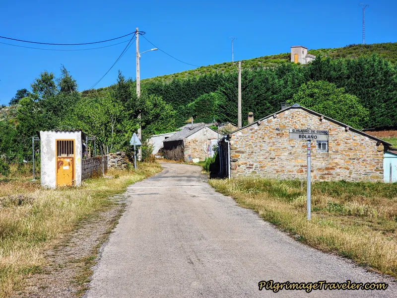 Entering A Venda do Bolaño
There is really not much to this town, and if ever a country inn existed here, it is now long gone. There is, however, a lovely picnic spot in the center of town, on your left, under this large tree, below. So many reasons to linger!
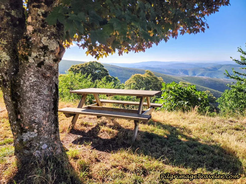 Picnic with a View
After leaving town there is a bit of a climb that you can see ahead and around the bend, below.
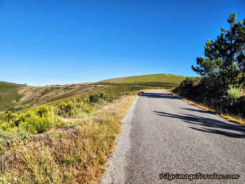 Onward Ridge Road
On the continuation of the ridge road, after cresting the small hill and rounding a bend to the left, you can see the slight descent ahead, below. However, that small hill on the right side of the photo is the final climb for the day, if you choose the mountain route. If you choose the highway route, you will avoid this climb.
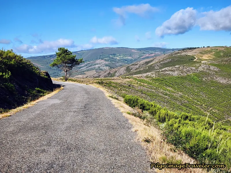 Small Climb Ahead?
After just about 16 kilometers into the day, you will come to this intersection, below, at the 181.174 kilometer waymark.
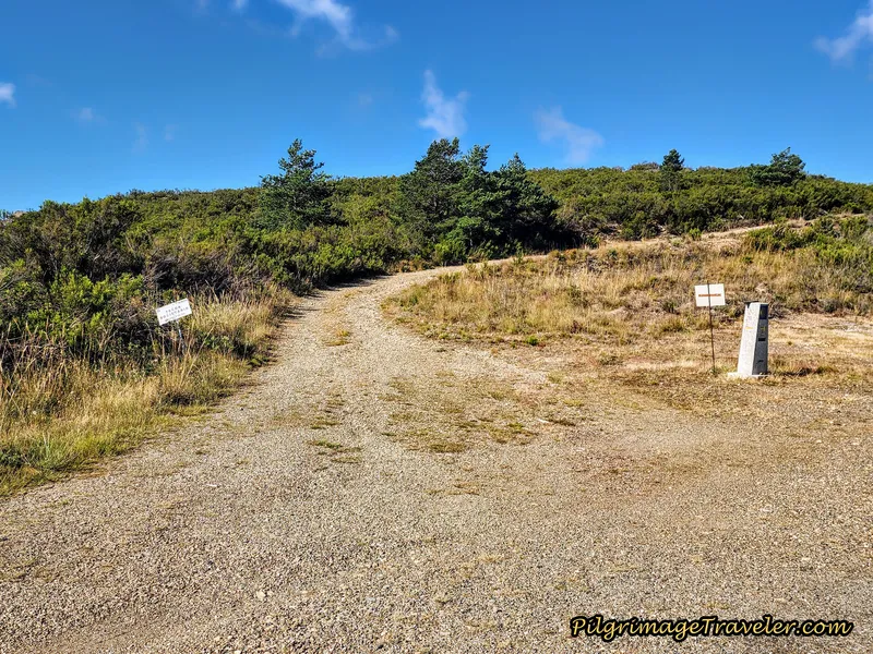 Left Turn Onto Off-Road Lane
The official route is now to stay on the pavement, on a nice downhill cruise, all the way into Campbecerros about 4.2 kilometers later. The smoother and easier route on the pavement is also the recommended route if the weather is bad, which as you now know, often is at this attitude! I do not have photos of this highway route as I have never done it.
If you look closely at the mojón at the intersection, someone painted a yellow arrow on the side, pointing to the mountain route to the left!
It seems like there has been a back and forth over the last several years, over which is the official route. However, it is entirely possible to take the mountain route, “de la montaña,” to the left, off the pavement for a shorter, 3.25 kilometers total into Campobecerros.
I believe that you should be the one to choose! Many pilgrims go this mountain route on a fair weather day because it is almost a full kilometer shorter!
However, be warned that the mountain lane ahead is very, very steep and very slippery when wet, and our young friend Miguel fell down through this section in the rain! Even though it is longer, if it is raining like it was on our day eight, you should take the safer pavement.
Most likely, many a pilgrim has been injured taking the mountain route, which may be the reason for the official change. If you do choose the mountain route there is a short climb up a bit more, a mere 66 meters (216 feet), followed by a sharp descent into town.
Also be aware that there are no arrows or waymarks on this route, except for one old waymark. However, the route is very clear and one-way the entire way, so you will have no fear of getting lost
Long and easy or shorter but harder? Let your skills and the weather be your guide. We have always taken the harder mountain route, with no regrets, though it has been a bit slippery after the hard rain.
After the turn, there is a final small hill before the high point of the day, pictured below. There is nothing dramatic about this climb, over the next kilometer.
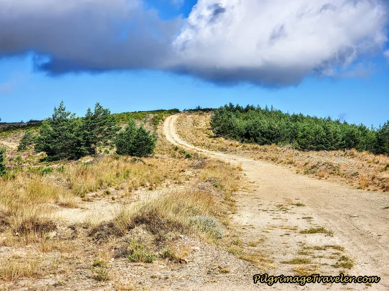 Foot of the Final Hill
The high point is at 1136 meters (3727 feet), about 17.1 kilometers for the day. You can clearly tell you are at the top, with something dramatic now awaiting you on the other side! When you reach the top, shown below, it is actually a long flat road which you walk along for about 1/2 kilometer before the strong descent.
We caught up with several pilgrims at the top.
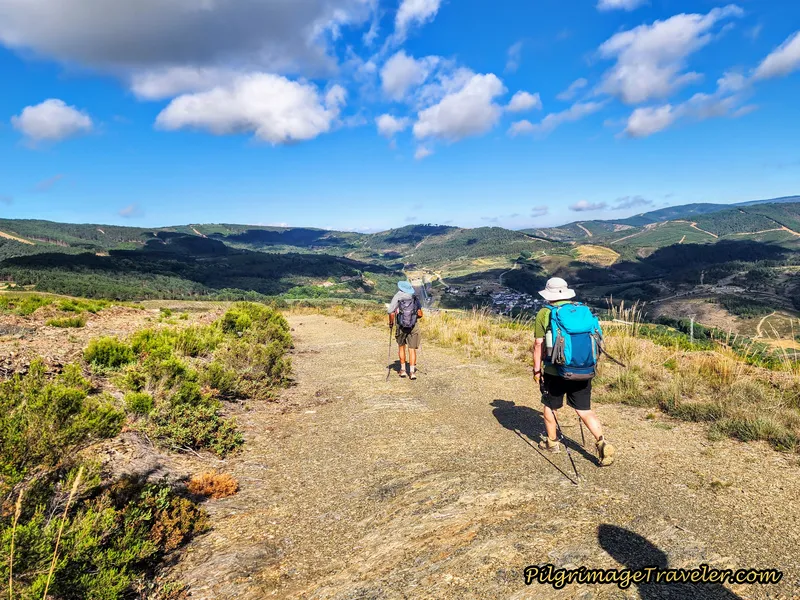 Topping Out
This is a very exposed place and it can be brutal in bad weather. In the photo next, is the single, old waymark that you see on this entire route.
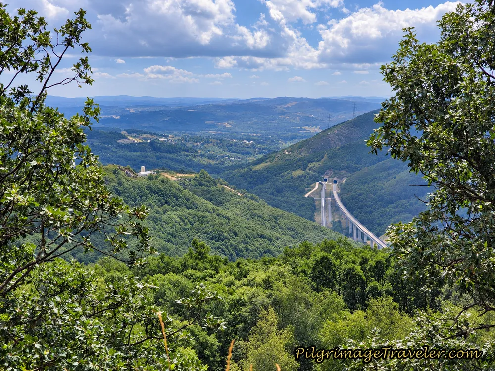
On the other side is the welcome sight of Campobecerros, which is somewhat spoiled with the view of the AVE high speed line to the south. You can also clearly see the old train station. In addition, you can see the road westward and out of Campobecerros that you will be taking on the way to Portocamba.
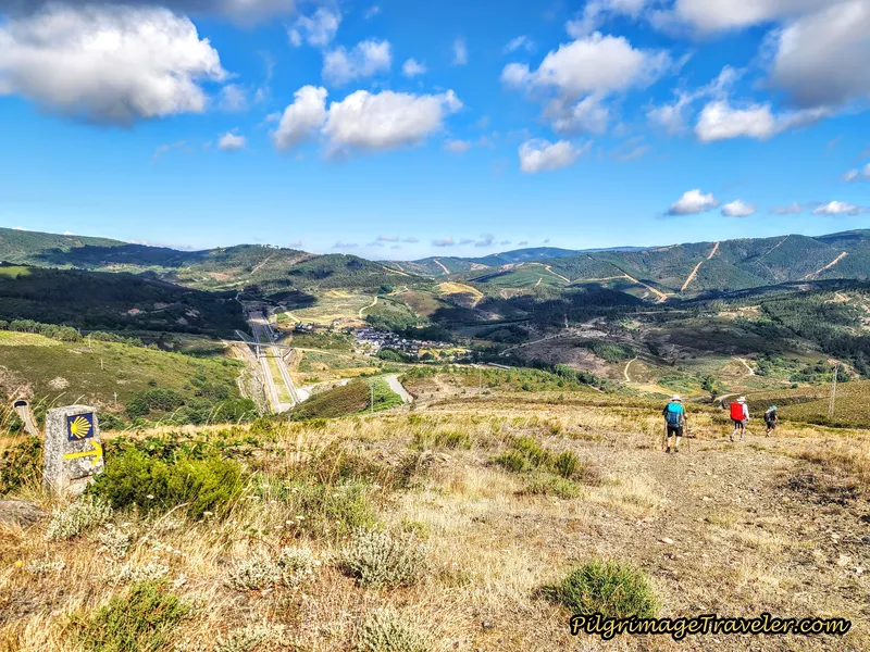 The Descent to Campobecerros
Wow! What a view. And thus begins the serious descent!
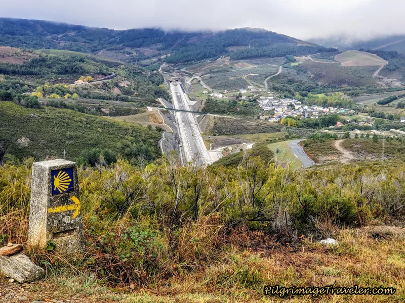 Close-Up of Old Waymark
As I stated, the way down is extremely steep and rocky. This was one of the worst sections, shown below. Negotiating this two-kilometer descent in the pouring rain would not have been fun at all. I leaned heavily on my poles for balance through here, even though it was mostly dry. The views are stunning!
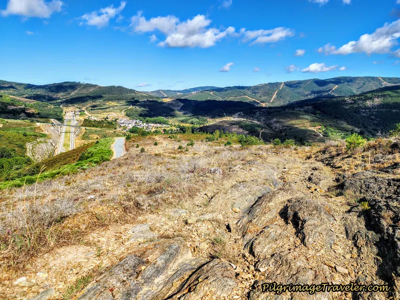 Steep and Rocky Descent
And just when we thought it couldn't get any more beautiful (on our post-rainy day pilgrimage), a rainbow presented itself, below. It was as if it was our personal reward, to choose to come back up the mountain, by ourselves, without encumbrances. It was a day and a view to celebrate!
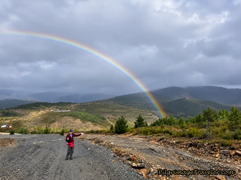 Rainbow Over the Camino
The rough road switchbacks its way down the mountainside, and ends abruptly at this turn, shown below, with a turn left onto the Campobecerros Road. This is the place where the official route along the highway meets the mountain route at the 177.120 kilometer waymark and after 19.3 kilometers total for the day.
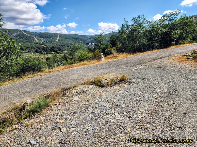 Left Turn Onto the Rúa Campobecerros
And just shy of kilometer 20, we arrived on the edge of town, passing by the town church, the Iglesia de la Asunción. Across from the church, you take a narrow side road to the left, shown below. (Or you could just continue straight along the main road.)
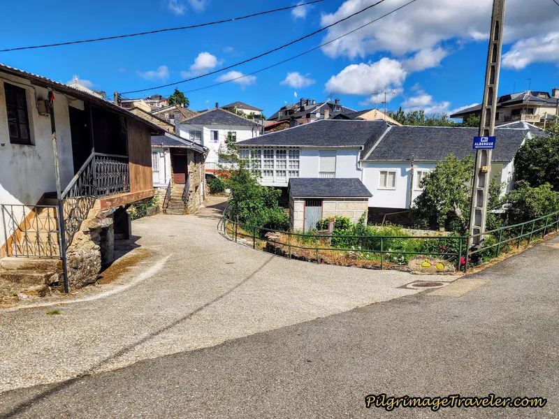 Left Turn Onto Side Lane
This short detour off the main road through town is the usual quaintness, and even has you walking under a home forming a bridge.
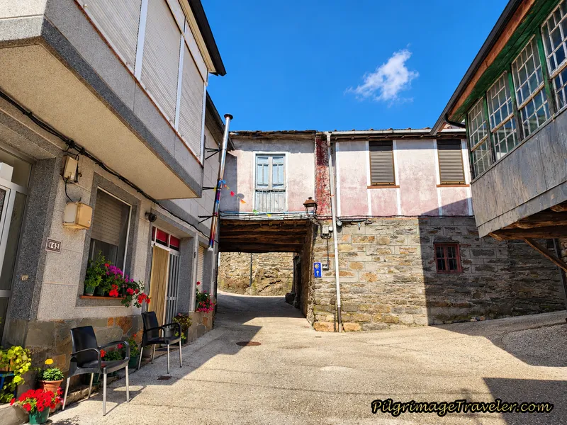 Walk Thru Bridge Home, Campobecerros
To see the Monumento Os Carrilanos, a monument to the area's railway workers, it is a few steps to the left, off-Camino, just before the Bar Casa Núñez, (+34 988 07 76 24), shown next, after about 20.2 kilometers.
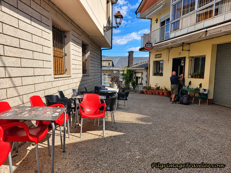 Bar Casa Núñez
The Bar Casa Núñez has rooms and is where we had our fabulous lunch the day before. To find the private O Albergue da Rosario from here, walk past the bar to the main road and turn to the right. Walk a few steps and take the first left turn.
For the onward Camino, at the main road, turn left instead.
We did go to the albergue for a brief stop to get our backpacks once again, when we continued onward. Both the albergue and the Casa Núñez are owned by the same family. There are mixed reviews about both accommodations, and we have experienced mixed reception at the bar. The food was fabulous our first time and only so-so our second.
The accommodations themselves have also received mixed reviews. Our stay at the albergue many years ago was adequate and the proprietor was welcoming. The kitchen was sufficient for our needs. I may only suggest that if you stay here, you may wish to bring your own food if you wish to cook, because there are no grocery stores in town.
Reflections on Day Eight of the Camino Sanabrés, A Gudiña to Campobecerros
On a clear day, this route is superb. This day, without a doubt, for me is one of the most beautiful and rewarding days on the Camino Sanabrés. The mountain splendor rewards your effort to walk through this high place.
However, by this time, after almost two weeks of walking together as a group, it was clear to Rich and I that our level of skill and commitment to this Camino was different from Norm and Nadine's. We were afraid that it would come to this, and it had.
Both Rich and I felt that indeed we could have walked on had we been alone. It would have been difficult, but we could have done it. But I was going to stick with the group. That was my commitment. Rich also admitted that by the time we had waited for the taxi at the top of the mountain, he was too cold to continue. For Miguel to walk on after a lengthy stop in the frigid rain was quite admirable.
We brought up the subject with Norm and Nadine, of whether or not we should continue walking as a group. I wanted to give them the Grace to continue on at their own pace if that was their desire. Nadine was still limping and we did not want to apply any more pressure than was needed. I needed to give them permission to do their own thing. Plus my own feelings were mixed regarding walking on together.
It was immediately clear that they truly did want to follow us and continue on with us. I think mostly it was due to the effort that would be required of them to continue on alone, and perhaps fear of the separation. They had both grown quite dependent on us. Indeed, I had made it too easy for them.
While on this day, I had regretted not walking onward after witnessing Colin and Miguel's shining examples, but as it turned out, it was the best thing that could have possibly happened. On day nine's walk, I absolutely did not regret that I was able to see the top of the mountain in clearer weather and marvel in the beauty of it all.
Salutation
May your own day eight on the Camino Sanabrés from A Gudiña to Campobecerros reflect your inner light, so that your own stained-glass window may sparkle and shine, showing your true beauty regardless of the "weather!" Ultreia!
Camino Fonseca Stages
~ Vía de la Plata Stages from Salamanca
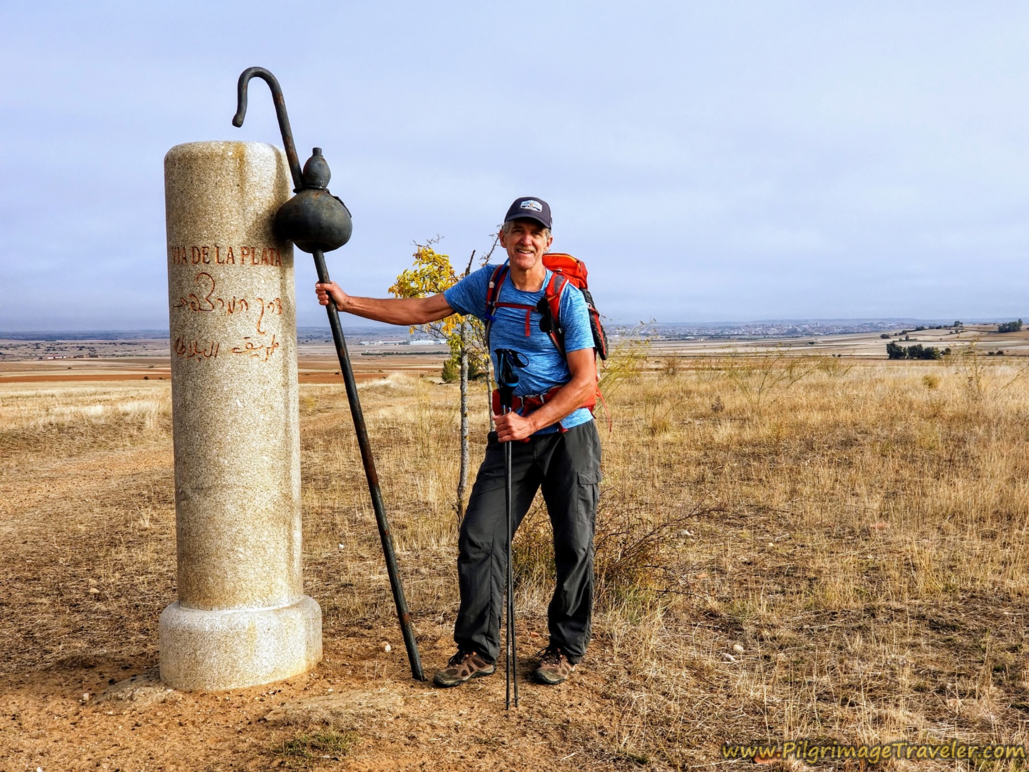


~ Camino Sanabrés Stages
Please Consider Showing Your Support
Many readers contact me, Elle, to thank me for all the time and care that I have spent creating this informative website. If you have been truly blessed by my efforts, have not purchased an eBook, yet wish to contribute, I am exeedingly grateful. Thank you!
Search This Website:
The Pilgrimage Traveler Digital Guides
Our Guides Help You:
~ Know what to expect each day!
~ Locate historic sites along the Way!
~ Know where you are in your journey!
~ Discover a quote from the sages, for your daily reflection on the journey!
Click on a Photo Below to Get Your Copy.
A most popular alternative on the Central Route of the Camino Portugués!👇
The Portuguese Routes are rapidly gaining in popularity, especially the section from Lisbon! Plan to walk this one soon, before it is no longer a quiet experience!👇
Our most popular Portuguese guide! 👇
The most historic of the Portuguese Caminos ~ not to be missed!👇
The spiritual adventure of a lifetime, following in the footsteps of St. Teresa of Ávila!👇
The amazing mountain route alternative, the Camino Sanabrés, from Granja de Moreruela on the Vía de la Plata!👇
The most incredible mountain scenery on this camino from Leon to Oviedo!👇
The shortest of the caminos, but not easy!👇
The very first, Original Way from Oviedo to Santiago!👇
The pilgrimage to the "End of the World" ~ The perfect add-on to your camino!👇
All Banners, Amazon, Roamless and Booking.com links on this website are affiliate links. As an associate of these companies, the Pilgrimage Traveler website will earn from qualifying purchases when you click on these links. We have used and love all of our product recommendations and believe you will too! We sincerely thank you!

🙋♀️ Why Trust Us at the Pilgrimage Traveler?
We’re not a travel agency ~ we’re fellow pilgrims! (See About Us)
We've trekked Pilgrimage Routes Across Europe since 2014!
💬 We’ve:
- Gotten lost so you don’t have to. 😉
- Followed waymarks in the glowing sunlight, the pouring rain and by moonlight. ☀️🌧️🌙
- Slept in albergues, hostels & casa rurals. Ate and drank in cafés along the way. 🛌 😴
- Created comprehensive and downloadable GPS maps and eBook Guides, full of must-have information based on real pilgrimage travels. 🧭 🗺️
- Shared our complete journeys, step by step to help YOU plan your ultimate pilgrimage and walk with your own Heart and Soul. 💙✨
Every detail is from our own experiences. Just fellow pilgrims sharing the Way. We have added a touch of spirituality, heartfelt insights and practical guidance from the road ~ offering a genuine connection to the spirit of pilgrimage. Tap into the wisdom of seasoned pilgrims!
Ultreia and Safe Pilgrimage Travels, Caminante! 💫 💚 🤍
Follow Me on Pinterest:
Find the Pilgrimage Traveler on Facebook:

Shroud Yourself in Mystery, along the Via de Francesco!
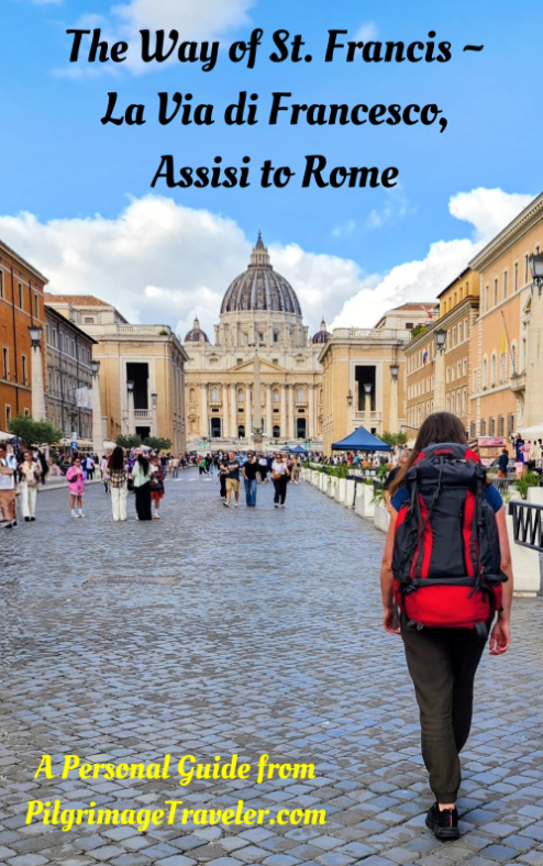
Walk in the Footsteps of St. Francis, and Connect Deeply with the Saint and to Nature in the Marvelous Italian Countryside!
Need suggestions on what to pack for your next pilgrimage? Click Here or on the photo below!


.)

Carbon Trekking Poles ~ My Favorites!
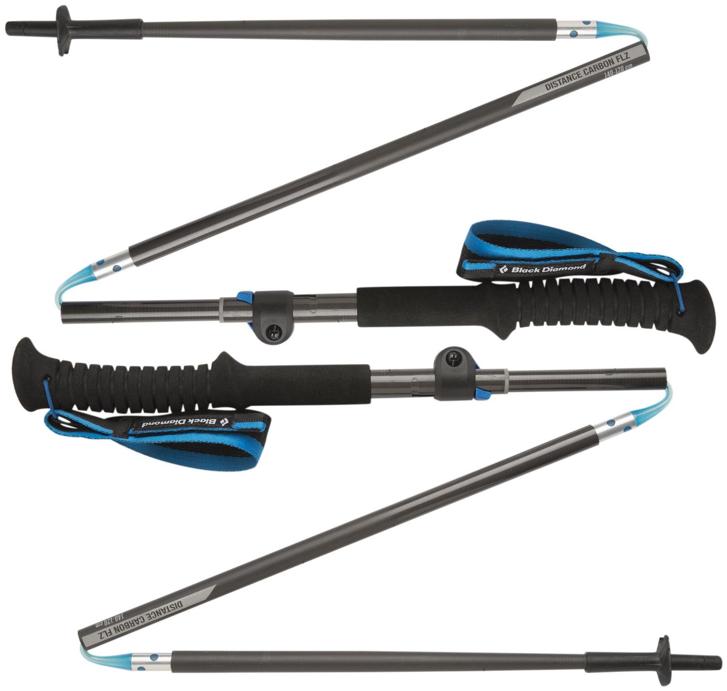
Carbon fiber construction (not aluminum) in a trekking pole makes them ultra lightweight. We like the Z-Pole style from Black Diamond so we can hide our poles in our pack from potential thieves before getting to our albergue! There are many to choose from! (See more of our gear recommendations! )
Gregory BackPack ~ My Favorite Brand
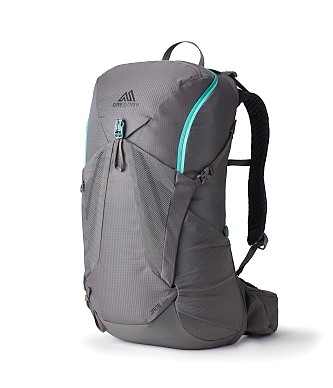

Do not forget your quick-dry microfiber towel!